Polar bear dens aren’t being accurately tracked, new study says
The surveying technology used by oil and gas exploration isn’t accounting for all the polar bear dens in the Artic, which is putting the animals at further risk
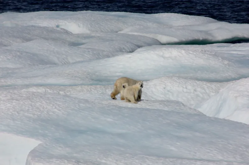
Polar bears have become symbolic of the heartbreaking impacts of climate change -- they are logos for some of the most influential companies in the world and are often the face of entire Arctic ecosystems. Thinning ice sheets are shrinking the size of their habitats and are hindering their ability to hunt for food, but energy companies are viewing these environmental changes as an opportunity to explore the vast offshore oil reserves that were previously trapped beneath the ice.
Oil and gas exploration in the Arctic has been shown to have detrimental effects on polar bears in these regions, some of which were previously undisturbed and had nearly zero human interference. In addition to the stressors that polar bears are already facing, a new study finds that the technology used to detect polar bear dens misses more than half of the dens that are known to be within the surveyed areas.
SEE ALSO - 'Their fur isn't white': 5 facts about polar bears
Unlike other bears, polar bears do not hibernate and are active throughout the entire year. This behaviour changes when female bears become pregnant and start the process of denning, which is when the pregnant female digs a large hole where she will give birth in and will then emerge three months later. Pregnant females typically consume significant amounts of food from August to September, give birth to cubs midwinter, and then abandon the dens by mid-April when it is time to resume seal hunting.
Oil and gas exploration involves surveying sites to understand how developments could impact the ecosystem and use a variety of equipment to collect data. Infrared imagery (FLIR) is a technology that can help identify denning polar bears, since they are often located on the sides of mountains and invisible under the snow, but the study finds that aerial FLIR surveys missed more than half of the known dens in the surveyed areas.
Of the 33 known dens between 2004 and 2016, only 15 (45 per cent) were detected while the other 18 (55 per cent) were missed. The researchers say that there are several reasons why the dens were not detected, such as the physical characteristics of the dens and increasingly unsuitable weather patterns that are related to the changing climate and prevent FLIR to effectively detect the den.
The Alaskan Beaufort Sea coastal region is becoming increasingly desirable to energy companies and is also home to the Arctic National Wildlife Refuge (ANWR), which is the largest national wildlife refuge in the United States. The ANWR was founded in 1903 and has become a primary denning area for the Southern Beaufort Sea polar bear population, which has decreased 40 per cent between 2000 and 2010.
Polar bear cubs that are born in the den cannot leave the shelter until they are three months old, which puts them at risk of industry-related den disturbances that are an additional stressor on this population’s ability to survive. The researchers say that it is clear that maximizing cub survival potential is essential for polar bears to continue living in this region, especially in light of the increased interest for oil and gas development.
Protecting maternal dens begins with knowing where they are and the study recommends that aerial FLIR surveys closely follow protocols that have been developed from previous studies. Conducting FLIR surveys in early winter when snow accumulation over dens is at a minimum will also maximize den detection rates in the future.


