Recent surge in Atlantic hurricanes: Factors at play
In addition to technological advances, hurricane experts say that there is evidence that changes in hurricane and tropical cyclone activity are related to rising atmospheric temperatures.
Over the years, forecasters have recorded an increasing amount of tropical activity occurring outside of the regular hurricane season. This has prompted the National Hurricane Center (NHC) and other divisions of the National Weather Service to consider changing the start date of the annual hurricane season from June 1 to May 15.
The official hurricane season begins June 1 and ends November 1. It hasn’t always been these dates, however. In 1938, the United States Weather Bureau began issuing advisories beginning on June 15 until November 15. It wasn’t until 1964 that the season was extended to reflect what it is currently.
Whether the National Oceanic and Atmospheric Administration (NOAA) along with the World Meteorological Organization (WMO) decide at their annual meeting in mid-March to change the official start date of the season, this change is certain: The NHC will start issuing advisories as of May 15, as stated in a Public Information Statement released on March 2.
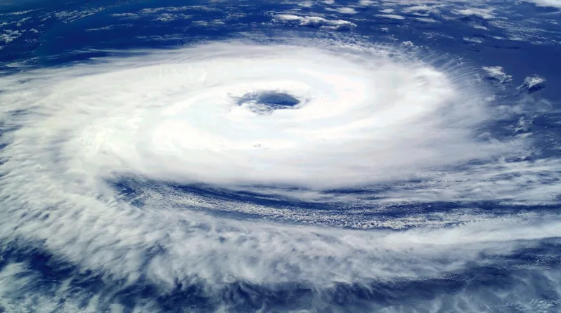
Hurricane Catarina (2004). Credit: Pixabay
The NHC states that in recent years there have been more named storms forming before June 1. Some of those early developers include Tropical Storm Beryl in the 2020 season, which was the most active season on record with 30 named storms. However, tropical storms can develop before May and throughout history there have been many named and unnamed storms that have developed year-round.
Experts say many factors play a role in why these storms are happening more frequently outside of the official hurricane season.
"Named storms have formed prior to the official start of the hurricane season in about half of the past 10-15 years, including each of the past six years," NHC spokesperson and meteorologist Dennis Feltgen said in an interview with The Weather Channel.
"Many of the May systems are short-lived, hybrid (subtropical) systems that are now being identified because of better monitoring and policy changes that now name subtropical storms."
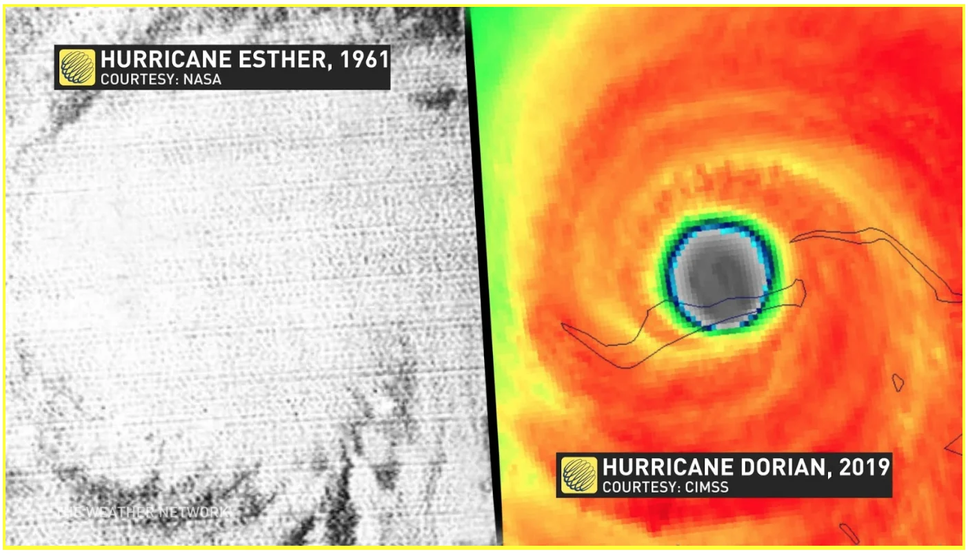
Hurricane Esther was the first hurricane discovered via satellite imagery in 1961 and by 2019, the NHC was tracking every 30-second eyewall wobble on satellite imagery from catastrophic Hurricane Dorian as it lumbered across the Bahamas.
In addition to technological advances, NOAA says that there is evidence that changes in hurricane and tropical cyclone activity are related to rising atmospheric temperatures. For example, a review of existing studies that investigated the effect greenhouse gases have on Atlantic hurricanes lead NOAA to conclude that “it is likely that greenhouse warming will cause hurricanes in the coming century to be more intense globally and have higher rainfall rates than present-day hurricanes.”
WATCH BELOW: WHY HURRICANE NAMES DON'T ALWAYS GET RETIRED
RECENT UPTICK IN ATLANTIC HURRICANES GIVES RISE TO NEW TRENDS
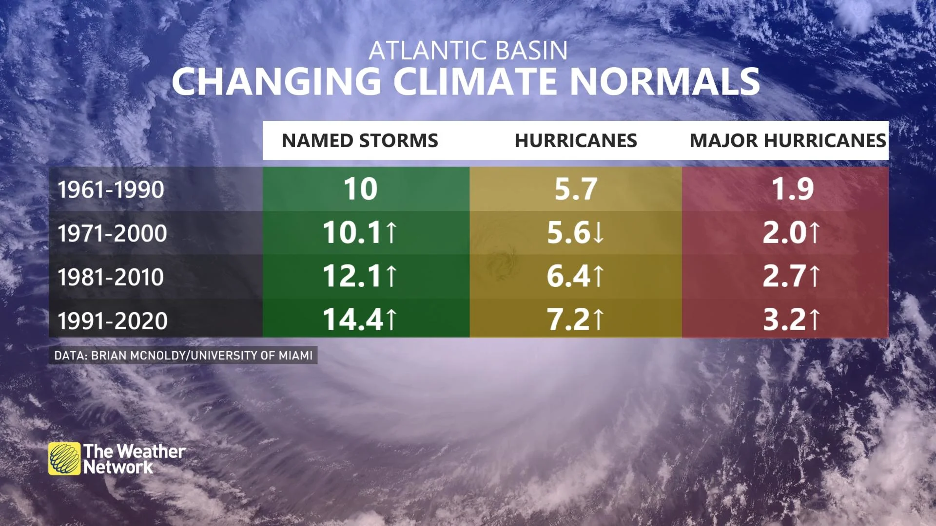
The Atlantic Basin experienced five consecutive above-average hurricane seasons when 2020 came to an end. These tropical cyclones released the 10th greatest amount of energy on record for the Atlantic Basin, so it comes as no surprise that there will be some changes coming to the hurricane climatological record.
Since a single hurricane season is not enough to define a climatological period for hurricane activity, time is aggregated into 30-year brackets or climate normals periods. Before the official release of some climatological data from the NHC in May, Brain McNoldy, a Senior Research Associate from the University of Miami, crunched the latest numbers.
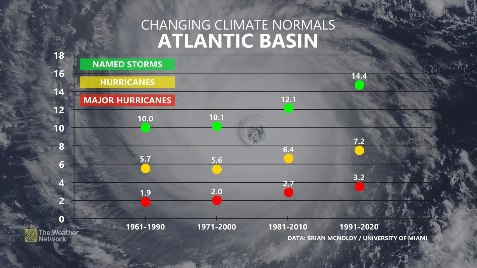
“I would not be too alarmed at the dramatic increase between the 1981-2010 averages and the 1991-2020 averages. Keep in mind that both sets have 1991-2010 in common, so we’re really comparing 1981-1990 to 2011-2020,” McNoldfy said in a statement to The Weather Network.
“Simply, the 1981-1990 period included several very inactive seasons, while the 2011-2020 period included several very active seasons. When one inactive decade drops out of the average and an active one takes its place, of course the average will go up.”
Many factors are at play when we look at the increase of named storms across the Atlantic Basin. A significant factor in season-to-season hurricane variability is the El Niño-Southern Oscillation, a climate signal associated with changing sea surface temperatures in the Pacific Ocean.
Larger scale climate oscillations involving the Atlantic Ocean water temperatures have also been theorized to influence the Atlantic hurricane season. The Atlantic Multidecadal Oscillation (AMO) has been correlated with an increased frequency of storms during the warmer phases, but this oscillation index is not without potential flaws for its apparent influence on hurricane activity.
However, some climate scientists disagree and say that the amplitude of the current AMO warm phase has been overinflated and theorize that human-caused climate change across the Northern Hemisphere has falsely been attributed to the AMO.
Stay tuned to The Weather Network for the latest on what the 2021 hurricane season will bring.
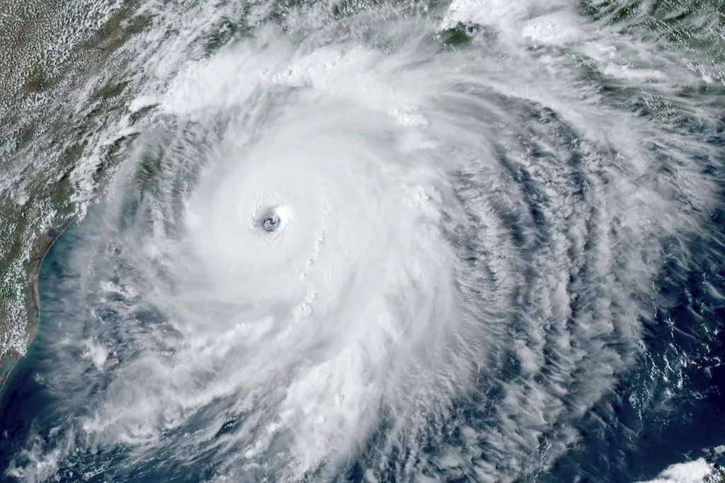
Thumbnail courtesy: Hurricane Laura GOES-16 GeoColor satellite/NOAA


