Hurricane Fiona’s storm surge data will help warn of future impacts
UPEI’s School of Climate Change and Adaptation hopes storm surge data collected during Fiona will help computer models predict future events.
The coastal erosion caused by Fiona is now visible from space. On the ground level, however, it was an equally dramatic picture.
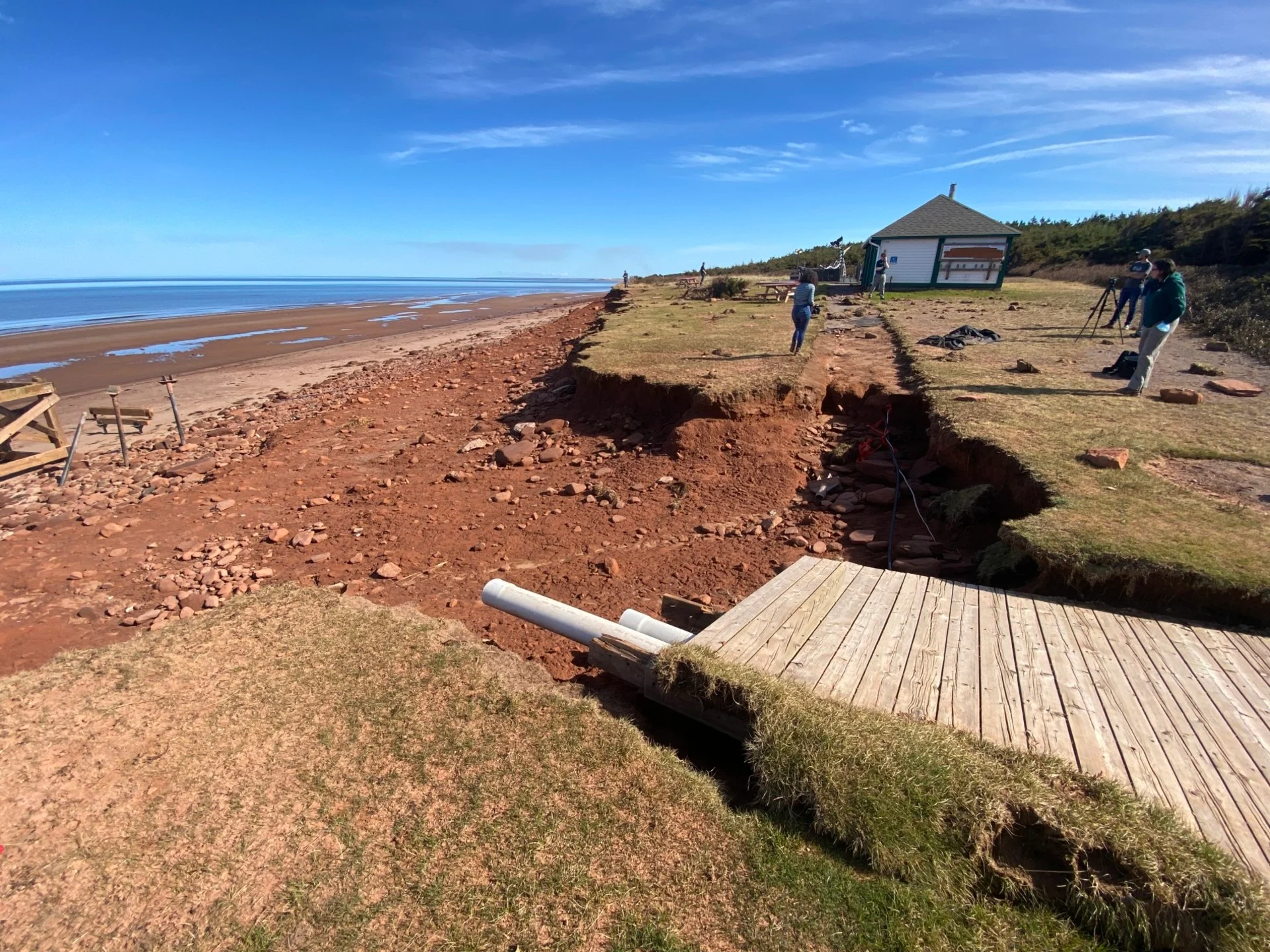
Recently, media were given a tour of the damage to P.E.I.’s National Park, where we saw how the height of the storm surge on the north shore flushed away coastal dunes that acted as a protection layer for the small island province. Sections of road were ripped up near Stanhope Park along with pieces of boardwalk that led to their once pristine beach. Now, pieces of debris and unstable cliffs make the area unsafe for the public.

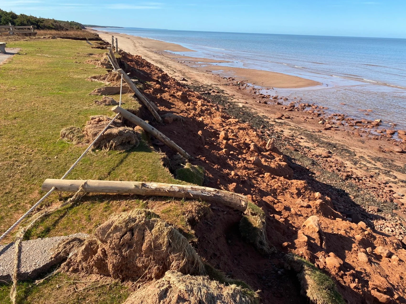
Parks Canada estimates parts of Dalvay Beach, PEI experienced 10 metres of shoreline erosion during Fiona. (Nathan Coleman)
The massive storm is something Dr. Xander Wang was monitoring closely at the University of P.E.I.'s School of Climate Change and Adaptation.
He helped create a storm surge early warning system that’s been actively collecting data for three years in the lead up to Fiona’s arrival. At stations he set up around the province, there were record jumps in water levels that rose up over wharves during the height of the storm on the Northern shore.
Studying storm surge
Dr. Wang left his research in Louisiana to move to the small Canadian province of Prince Edward Island, which is already seeing impacts and damage from climate change. He’s been using the island as a testing platform for his methodologies and Hurricane Fiona was a real test for his storm surge monitoring system.
For example, back in 2019, there was a big one-metre jump on the day Dorian hit, but for Fiona, that level doubled to two metres and up at some stations.
“[Tropical storms] will typically go through the South United States, then they move up,” Wang told The Weather Network. “But this time, for Hurricane Fiona, it moved to us directly over the ocean which means it didn't lose any strength.”

Storm surge during Fiona tore apart this bicycle lane in Covehead Beach, PEI. (Nathan Coleman)
At Dalvay Beach along P.E.I.’s Northern Coast, Parks Canada estimates 10 metres of shoreline erosion caused by the single event.
“This is more significant erosion than we've ever seen before in this area. Peak water height 2.69 metres above its normal baseline so quite a lot more water and quite a lot more wind,” Parks Canada’s James Eastham explained to The Weather Network during a media tour of the damaged beach.
Future impacts
Anyone can access Dr. Wang’s data and users who sign up will get an email if the water gets 50 centimetres from the top of their wharf. For him, the data collected of the wave heights will be an aid for helping predict future water levels.
“Generally, globally, we know that this will become more frequent because under a warming climate, you will have more frequent intensive hydrological cycles, which means you will have a lot of water coming, evaporating to the atmosphere and you have a lot of circulation on the ocean and also because of temperature gradients, you will have more pressure difference and you will have more high wind," said Dr. Wang.
Watch below: How hundreds of wild horses fared as Fiona rocked Sable Island
"Monitoring is a starting point for us to understand what's going on at this moment. But our research is more about the future,” Dr. Wang added. “We need to understand what will happen in the future. Will this become more frequent or more intensive? And what we do is we use a lot of computer models to predict that.”
In order to use those models, he will attempt to validate them using his new monitoring data, but it’s currently still a small sample. His goal is to understand how hurricanes will impact P.E.I. specifically, for the next 50-100 years.
Thumbnail image: A section of boardwalk in Stanhope Park was pulled out into the storm surge. (Nathan Coleman)


