Inside the battle to preserve the underwater ghosts of Ontario's Great Lakes
Archeologists, historians and divers are trying to digitally capture more than 1,000 shipwrecks at the bottom of the Great Lakes before they become unrecognizable after a combination of invasive mussels and climate change have accelerated their deterioration at an alarming rate.
The Great Lakes region is known among diving circles as one of the best places in the world to explore shipwrecks because the cold, fresh water offers ideal conditions for their preservation, even in shallow water.
Now, the deterioration of these underwater relics has not just been accelerated by more frequent and intense storms believed to be driven by climate change, but through the colonization of the lakes by invasive zebra and quagga mussels from Europe, likely introduced in the Great Lakes through ballast water of international cargo ships.
Since their arrival in the 1980s, the thumbnail-sized mollusks have transformed the Great Lakes — driving local mussels to the brink of extinction, turning once-murky turquoise waters crystal clear while at the same time blanketing almost everything — from piers to power plants — in a jagged carpet of densely packed shells.
SEE ALSO: Antarctic sea ice sets another alarming new record for 2023
Shipwrecks reduced to 'piles of lumber'
Durrell Martin has seen been witness to that change first hand. Over his 30-year diving career, Martin, also the president of the non-profit group Save Ontario Shipwrecks, said the invasive mussels have totally transformed the underwater world.
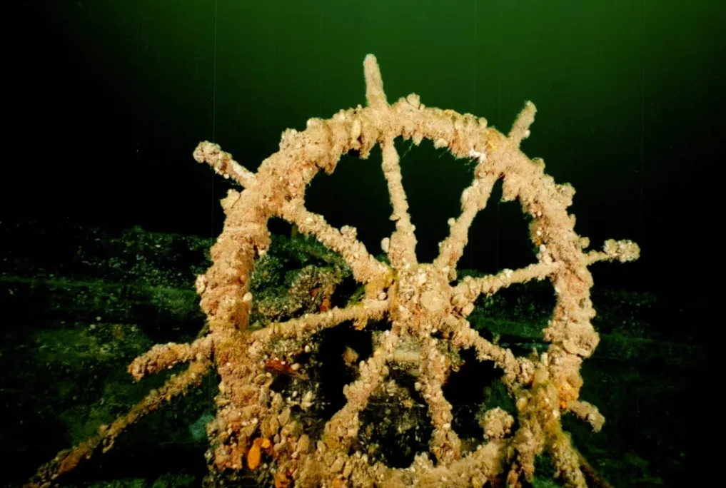
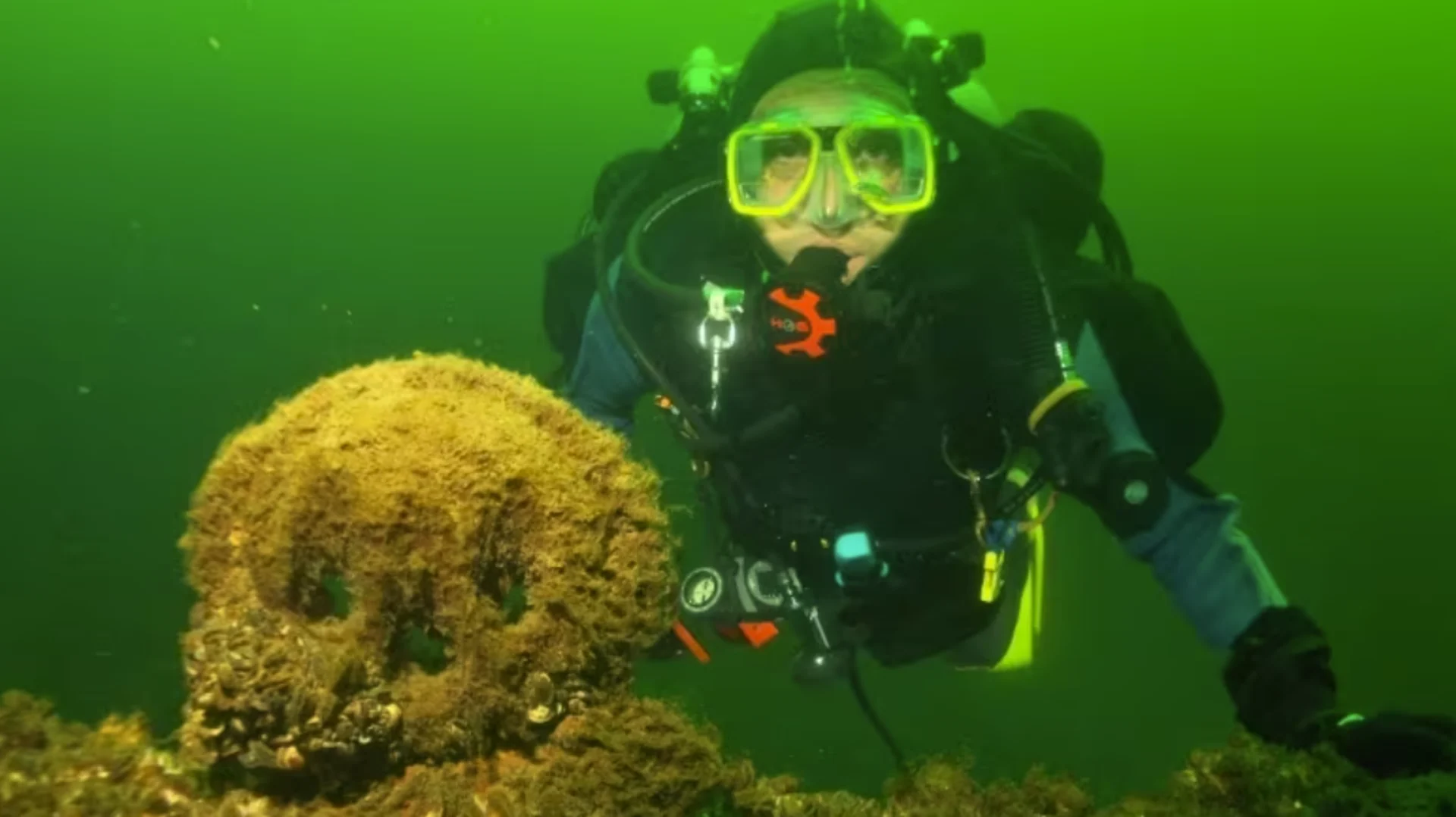
The wheel from the Oliver Mowat wreck can be seen here at the bottom of Lake Ontario and it's encrusted with zebra mussels. The three-masted schooner sunk after a collision with a freighter in 1921, killing three of its five crew. (Kayla Martin)
When he began, lights were needed to penetrate the murky darkness of the lakes. Back then, divers had to get close to see the wrecks, but when they did, they could still see dishes, preserves and even the original wood on 200-year-old ships lying on the bottom.
Today, the water is so clear that lights are often no longer needed, and while divers can now easily see the form of shipwrecks, they're encrusted in living layers of tens of thousands of invasive shellfish.
"Our dilemma is that, yes, the visibility is great for scuba divers, and we now can enjoy and see wrecks more, but they are disintegrating at a faster rate than we have ever seen previously."
Mussels affix themselves to surfaces using a bundle of threads called filaments. On wooden shipwrecks, they use these tendrils to burrow into the wood, giving them a firm hold, but weakening the wood's integrity. On steel and iron, the mussels produce an acid in their feces that corrodes metal.
The hull of a ship is designed to displace water. It is meant to withstand pressure from the bottom, not from the top. Over the years, the filaments and acid weaken the ship materials and the whole ship eventually collapses under the sheer weight of the mussels that are attached to them.
"We can't stop this," Martin said. "Shipwrecks we thought would be here another 200 years from now and we could enjoy, we realized probably within the next 10 to 20 years, they'll all be gone. They'll be piles of lumber on the bottom."
Lack of data on estimated 6,000 shipwrecks
The problem has been documented in a number of studies going back decades, but almost nothing has been done by governments on both sides of the border, according to Ken Meryman, a shipwreck hunter and diver from Duluth, Minn., who has been documenting Great Lakes naval relics for 50 years.
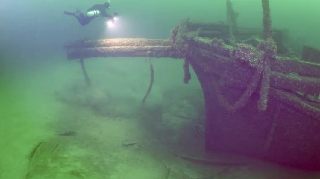
Canadian cave diver Jill Heinerth, shown at the wreck of the Oliver Mowat in Lake Ontario, takes images of the mussel-encrusted bowsprit of the vessel. (Kayla Martin)
"They're collapsing," he said of the 1,400 known shipwrecks in the Great Lakes.
Meryman added that the wrecks are at risk from more than just invasive bivalves — studies suggest bacteria are also being supercharged by climate change.
"On steel wrecks, there's an iron-eating bacteria," Meryman said. "We have that in Lake Superior and on the steel wrecks. It has caused deterioration. I'm not sure what you do about that."
The trouble, according to Meryman, is a lack of data on the estimated 6,000 shipwrecks that are believed to be on the bottom of the Great Lakes. He said both Canadian and American antiquities authorities have yet to document exactly what's out there, its historical significance and the exact rate of decay.
"If you're going to manage shipwrecks, you would like to know, 'Where are the most historically significant features represented and how much of a risk there is to them deteriorating?'"
WATCH: Zebra mussel costing Canada millions
The quest to chart them all
It's why Meryman, a retired computer programmer, has devoted much of his golden years to documenting shipwrecks before they disappear using a 3D scanning technology called photogammetry, which uses a series of images to form a 3D digital model.
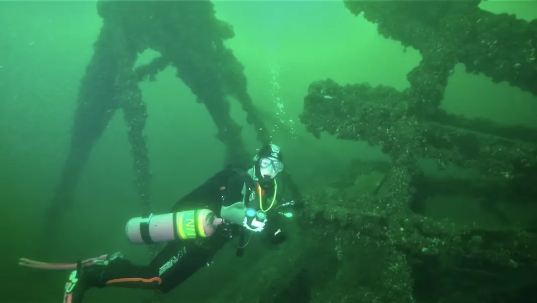
Martin's daughter, Kayla, is seen here exploring the paddle wheel on the wreck of the Comet, a passenger steamer that sank in 1861 after a collision with a schooner near Simcoe Island. The diving site is one of most prized in Lake Ontario. (Durrell Martin)
Divers, historians and archeologists from across the continent have worked with Meryman over the years to help put those models on his 3Dshipwrecks website, where you can browse a catalogue of 160 shipwrecks online to explore wrecks, like the Katie Eccles, which sank in Lake Ontario in 1922, in minute detail.
"You can compare them, get a difference map, and you can tell if the side of the ship is bulging and starting to collapse, if the deck's collapsed; you can tell if somebody took an artifact," said Meryman.
"There's evidence, there's documentation on what's there. It's not the main purpose of the database, but it could be used for that."
DON'T MISS: Miniature sailboat launched in Florida found shipwrecked in Cape Breton
He said the data can also be used to show authorities a wreck is worth saving, especially if it happens to be in a major shipping lane, such as the wreck of the Wilson Thomas near Duluth.
"The ships have been anchoring on it for years ... and they pound the piss out of it, but we can't go to the Corps of Engineers and say, 'Hey we want to we want a shipwreck buoy here,' unless we have hard proof that the thing has changed."
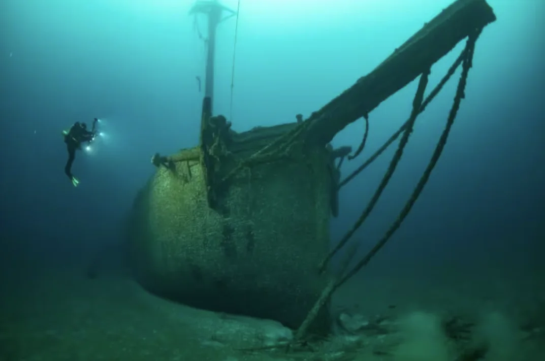
A diver takes a series of images of a sunken vessel in an unknown lake using a technique called photogammetry, which uses many pictures taken at different angles to create an accurate 3D model of shipwrecks. (3Dshipwrecks.org)
Merymen said he plans to increase the number of 3D scans of Great Lakes shipwrecks available on his website to 200 "soon," and hopes to eventually chart the estimated 1,400 shipwrecks that sit at a survivable depth over the next 20 years.
The more we know about our underwater history, he argues, the more power the public has to know what should be saved — or whether it can be saved.
"The database will be valuable to a lot of people," he said, adding he hopes the data might even help researchers to one day find a way to keep invasive mussels off shipwrecks.
"They're colonizing the shipwreck because it's a substrate they can live on, but around them, it's not a substrate that they live on," he said. "I've kind of wondered about that. It might be very effective to use some kind of an abatement process."
Thumbnail image courtesy of Kayla Martin via CBC News.
This article, written by Colin Butler, was originally published for CBC News.


