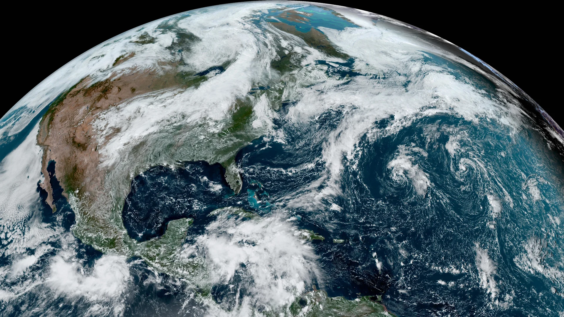
Here’s a gorgeous view of your world on the autumn equinox
Earth glistened with beauty on the first full day of autumn
Our skies are covered by satellites that keep an eye on things from 35,000 km above Earth’s surface. It’s refreshing watch the clouds float by on a calm day. But it’s invigorating to see what’s going on from above.
Taking in the beauty of our planet is a special treat on the autumnal equinox. Sunday morning marked the Sun’s direct rays crossing the equator to begin focusing their energy on the southern hemisphere.
That sunshine witnessed everything from a sprawling system over Canada to brewing trouble in the tropics. Here’s a look at our gorgeous planet from above—the ultimate group photo of Canada and our entire hemisphere on the first full day of fall.
DON’T MISS: Autumn can still produce intense hurricanes across the Atlantic
The terminator
Have you ever heard of the terminator?

That’s the term for the line that divides the Earth’s surface between daytime and nighttime. It’s fun to track the terminator’s movement through the seasons, tilting right and left as we whirl around the Sun throughout the year.
The terminator forms a nearly perfect north-south line on the equinoxes. On this satellite image, the dividing line between night and day will appear to tilt toward the left for the next six months as the northern hemisphere experiences longer nights than our counterparts south of the equator.
A sprawling storm over Canada to start autumn
Closer to home is a gorgeous swirl looming overhead.

A broad trough dipping over the Great Lakes will bring a pattern change to Ontario and Quebec, breaking the weeks-long dry streaks seen in Toronto and Montreal.
The low-pressure system associated with this trough sent a cold front crashing from Hudson Bay south toward the Gulf of Mexico, bisecting the continent with a fantastic curtain of clouds—complete with embedded thunderstorms in spots.
A brewing storm for the Gulf of Mexico
Farther south, the tropics are starting to wake up again.

Forecasters are watching a disturbance in the western Caribbean that has a high chance of developing into a tropical storm over the next couple of days as it tracks toward the Gulf of Mexico. If this system develops into a tropical storm, it’ll be named Helene.
Some models have this system developing into a hurricane this week as it heads toward the U.S. Gulf Coast. Folks in the region should keep a very close eye on the storm. Regardless of its development, flooding from prolific rain is likely to follow the storm inland across the southeastern U.S.

Otherwise, the Atlantic basin has been unexpectedly quiet this season. The only other point of interest in the past week was Tropical Storm Gordon, a short-lived storm out in the middle of the ocean. That system’s remnants are still spinning away with little chance of redevelopment and posing no threat to land.
Smoke choking the skies over South America
Intense wildfires have plagued South America in recent weeks, choking the region’s skies with thick smoke for days on end.

Reuters reported last week that South America recently surpassed a grim record when satellites detected 346,112 hotspots in all 13 countries on the continent.
The wide-reaching wildfires have consumed vast swaths of Amazonian rainforest and other wilderness areas farther south. While experts say most of the fires were started by humans, relentless wintertime heat waves and the effects of climate change have exacerbated the blazes.


