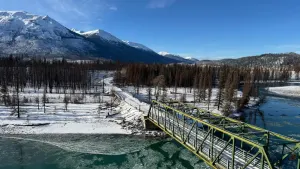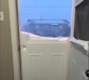
It's like a fire hose flailing out of control on the West. What's happening?
Storms currently hammering the west coast of North America have been stronger and more unpredictable than usual because of the 'bomb cyclone.' So, what is that exactly? A meteorologist explains.
Written by Chad Hecht, University of California, San Diego
The West Coast’s rainy season has arrived in force, with an atmospheric river joining a bomb cyclone off the Pacific Northwest coast. Heavy, wet snow began falling in the mountains on Nov. 19, 2024, and rain has been blasting Oregon and Northern California, creating a risk of flooding and landslides in some areas. The atmospheric river was forecast to last for several days, hitting up and down the West Coast. Parts of Washington have seen more than 70 mph winds from the bomb cyclone.
When these two phenomena get together, the weather gets hard to predict, as meteorologist Chad Hecht of the Center for Western Weather and Water Extremes at the University of California, San Diego explains.
What happens when an atmospheric river meets a bomb cyclone?
An atmospheric river is exactly what it sounds like – it’s a long, narrow river of water vapour in the lower atmosphere. These rivers in the sky transport moisture from the subtropics to the mid-latitudes.
When an atmospheric river runs up against North America’s West Coast, the mountains and complex topography force the air to rise, cool, and the moisture to condense and precipitate. That can mean feet of snow at high elevations and rainfall elsewhere.
RELATED: Atmospheric rivers becoming so intense we need to rank them like hurricanes
That’s not always a bad thing. Weaker atmospheric rivers help replenish reservoirs that are essential for supplying water during the dry season. California relies on atmospheric rivers for up to half of its yearly precipitation and streamflow.
This storm, however, is expected to be stronger and more unpredictable than unusual because of the bomb cyclone.
WATCH BELOW: What is an atmospheric river?
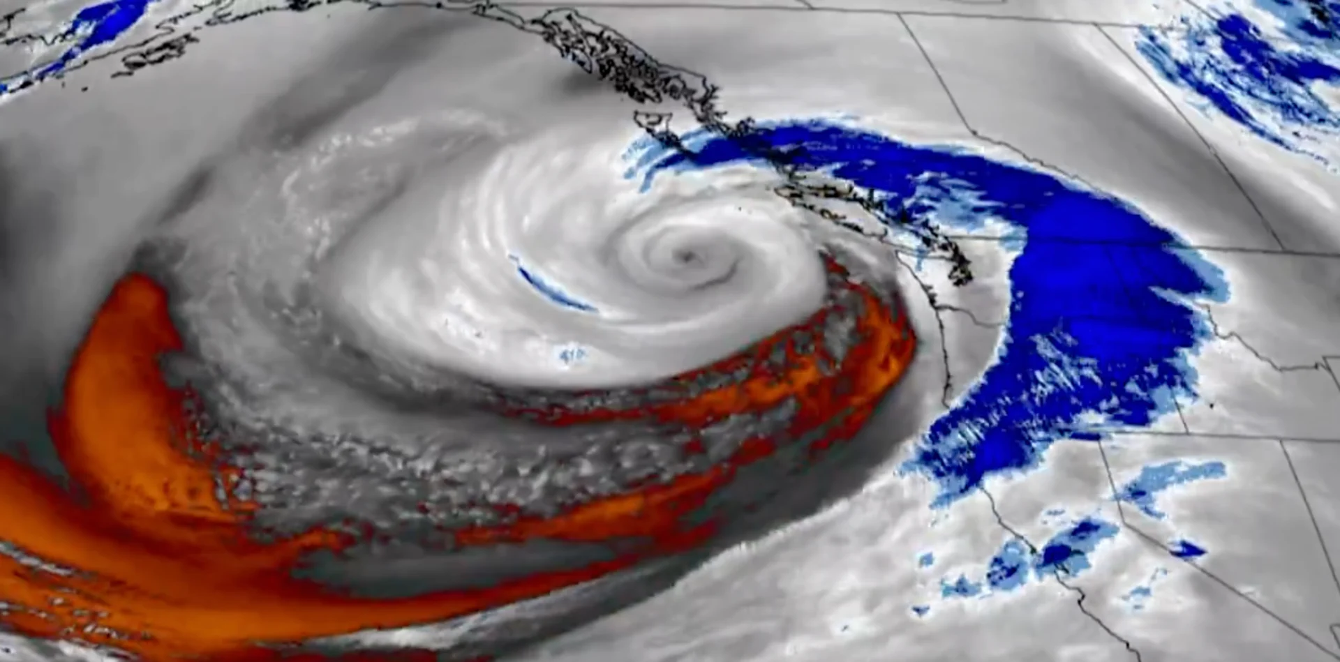
Atmospheric rivers tend to form out ahead of cold fronts that are associated with low-pressure systems known as extratropical cyclones. These are air mass boundaries circulating around the area of low pressure. A bomb cyclone is a rapidly intensifying extratropical cyclone.
These two weather phenomena go hand in hand. A strong atmospheric river will feed moisture into the low-pressure system, providing fuel for the cyclone. The stronger the low-pressure system becomes, the stronger the atmospheric river becomes.
What will this combo mean for the West Coast?
This atmospheric river is impressive for its duration – it is forecast to continue hitting the coast with moisture for several days and spread precipitation into Southern California. Its integrated vapour transport – a measure of how much moisture is moving in the atmosphere – suggests that we’ll see a lot of rain and snowfall, with over a foot of precipitation expected in some areas.
On top of that, the bomb cyclone – one of the strongest we’ve seen along the coast – is bringing powerful winds.

(Graphic: The Weather Network)
While the atmospheric river is hitting the coast, the bomb cyclone will sit over the ocean off the Pacific Northwest and spin. As it spins, it sends small frontal waves through the atmosphere that push the atmospheric river inland. That creates a lot of uncertainty for forecasts.
If you picture the atmospheric river as a fire hose pointed at the coast, these frontal waves are essentially the fireman taking his hands off the fire hose and letting it go all wavy. It can move northward, and then back southward. The question is how far it will go before pivoting, then how quickly it will pivot back.
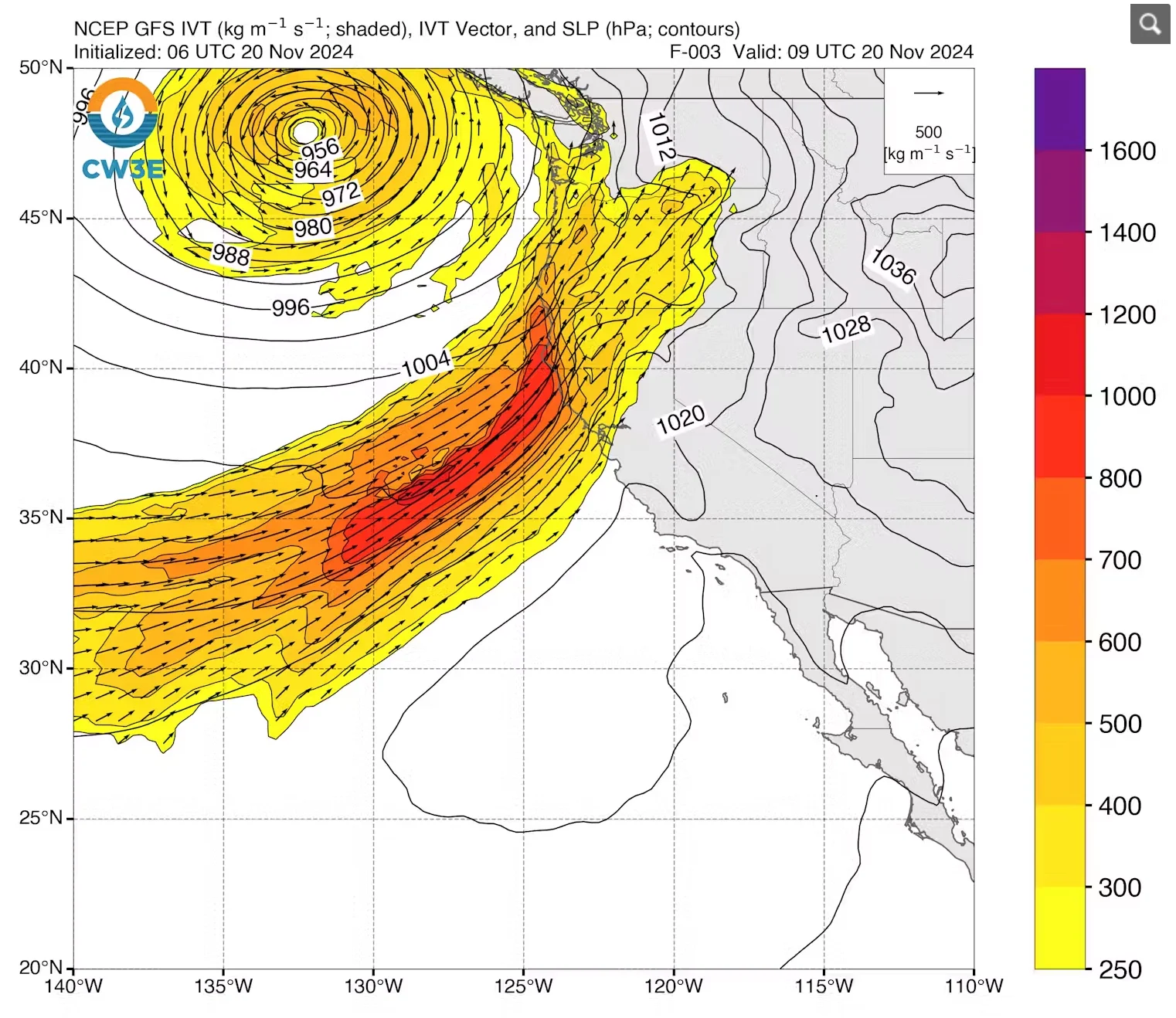
Center for Western Weather and Water Extremes: A forecast for the storm’s vertically integrated vapour transport shows the direction and magnitude of the water flow, measured in kilograms per meter per second. (Center for Western Weather and Water Extremes)
So, how long specific parts of the coast will see rainfall and how intense that rainfall will be are the big questions.
The harder and longer it rains, the more impacts you’re likely to see.
The saving grace with this storm is that it’s early in the season, so the soils are relatively dry. That means they’ll be able to soak up more of the moisture. If a storm like this hit in winter, after the soils were already saturated, more water would run off, causing more widespread flooding than an early-season storm.
Are areas recently burned by wildfires in trouble?
With a storm this intense, the main concern in areas recently burned by wildfires is high-intensity precipitation.
When land burns, the surface can become impervious – almost hydrophobic. So, when that surface gets hit with high-intensity precipitation, the water runs off a lot faster than if vegetation or soil was able to absorb the water. Wildfire burn scars tend to be in hilly places, so that can lead to debris flows.
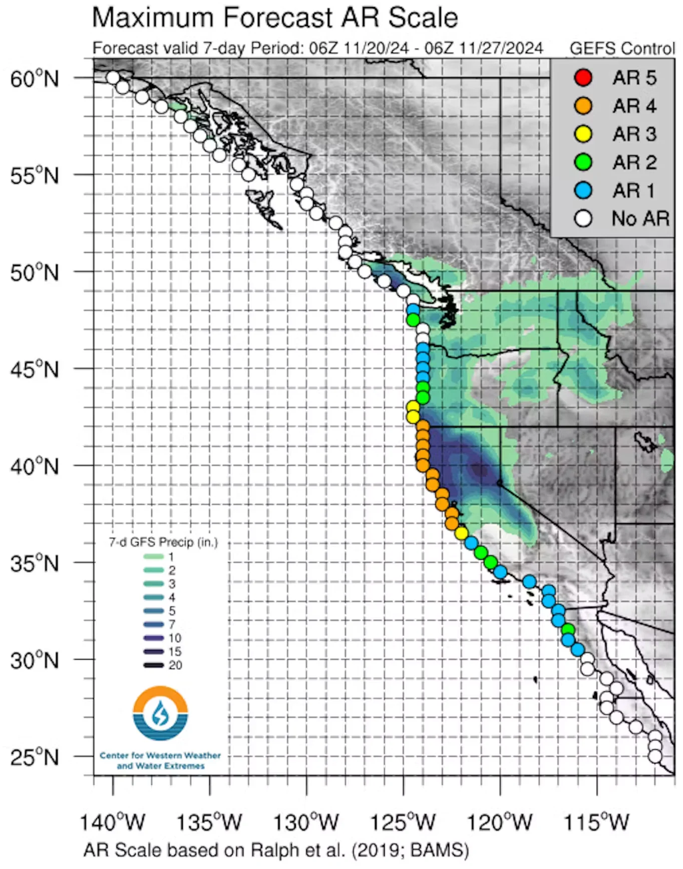
The forecast for the atmospheric river hitting the West Coast, covering Nov. 20-27, 2024, shows a powerful storm. Much of Northern California is expected to experience a Category 4 strength atmospheric river, on a scale of 1 to 5. (Center for Western Weather and Water Extremes)
It’s really a matter of chance whether the burn scars get that intense precipitation. A strong cold front can form narrow cold-frontal rain bands that bring bursts of high-intensity rain. These small but powerful rain bands tend to form in dynamically robust storms. Meteorologists are seeing some signatures suggesting that these features could form.
The best advice if you’re in one of those areas is to pay attention to the National Weather Service’s watches and warnings.
Does this storm suggest a wet winter ahead?
Unfortunately, one really impressive storm doesn’t tell us anything about what’s ahead.
We’ve seen seasons with powerful early-season storms and then not much more. October 2021 is an example: A really strong storm hit that month, with record-breaking, 24-hour precipitation accumulations. But then the tap shut off, and California ended up with below-normal rainfall for the rest of the year.
There are tools that offer some indication of whether the season will be above or below normal, but those aren’t 100% accurate.
For example, the La Niña weather pattern that’s close to forming in the Pacific typically indicates drier than normal conditions across California. But looking at the past 10 years, we’ve had some really wet La Niñas – 2017 being the granddaddy of them all, with record-breaking precipitation in the northern Sierra.
Meteorologists typically have a good sense of what’s coming in the short term, about 10 days out. But what the rest of the season will look like is really an educated guess at this point.
This article was updated Nov. 21, 2024, with risk of flooding and landslides from the storm.

Written by Chad Hecht, Research and Operations Meteorologist, Center for Western Weather and Water Extremes, University of California, San Diego
This article is republished from The Conversation under a Creative Commons license. Read the original article.
(Header image courtesy of CIRA/NOAA)


