Trying to predict the weather? These eight clouds will help
Sometimes, the clues you need to figure out what the skies will bring lie in the skies themselves.
You don't always need computer models or a fancy radar to figure out what to expect from the weather. Sometimes a glance at the skies is enough, at least in the short term.
Here are eight kinds of clouds that you can use to give you an idea of what kind of weather to expect in the next little while.
STRATUS
There's hardly a better symbol for a gloomy day than stratus clouds.
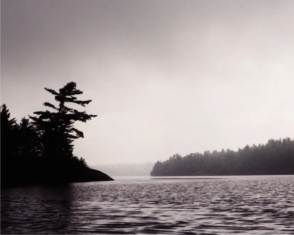
Image: Environment Canada
Low-lying, grey and at times featureless, they can look like high-flying fog banks, though true stratus clouds won't do much in the way of precipitation.
There are several sub-types, though. One, Nimbostratus (with "nimbo" signifying rain), is the most likely to rain on your parade. In fact, sometimes its base can appear even more featureless, due to falling rain.
CUMULUS
Those puffy, scattered white clouds you might see on a warm summer day are cumulus, formed by convection, and aside from the occasional brief shower there's not much to fear from them.
Cumulus does have a couple of offshoots you should watch out for. The least problematic are stratocumulus, which seem a little denser, often appearing joined or with few gaps between them.
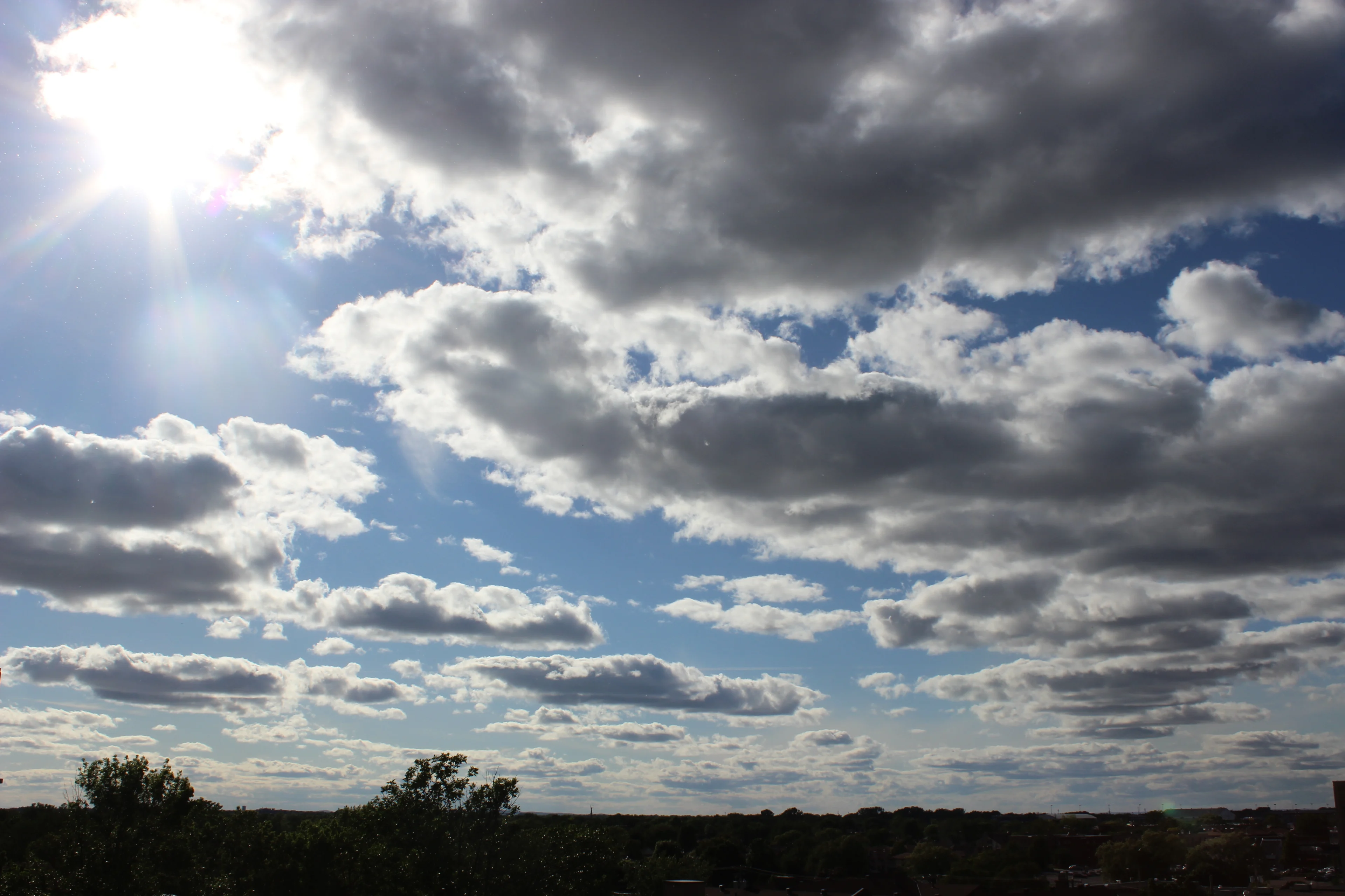
Image: William Mendoza, Dorval, Que.
They form along a cold, warm or occluded front, and can produce light rain or snow.
By far the most dangerous are cumulonimbus.
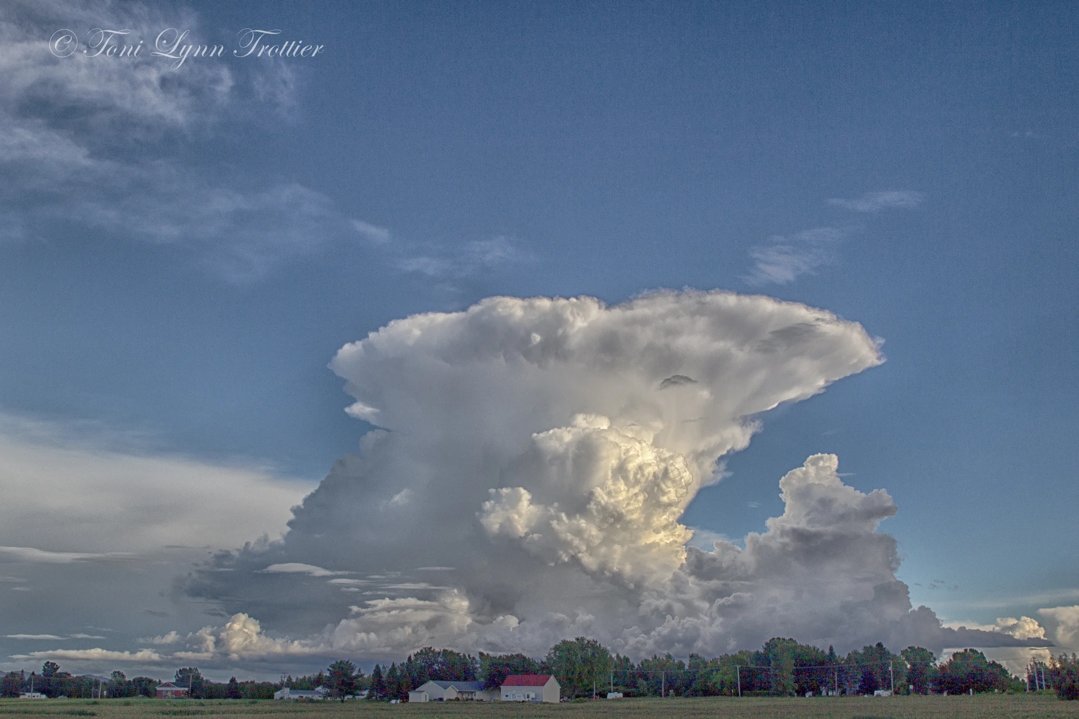
Image: Toni Lynn Trottier, Granby, Que.
There's nothing ambiguous about these low-lying, but towering, pillars. If you see them, you're in for rain and a good chance of thunderstorms, potentially severe, accompanied by torrential rains, hail, lightning and tornadoes.
CIRRUS
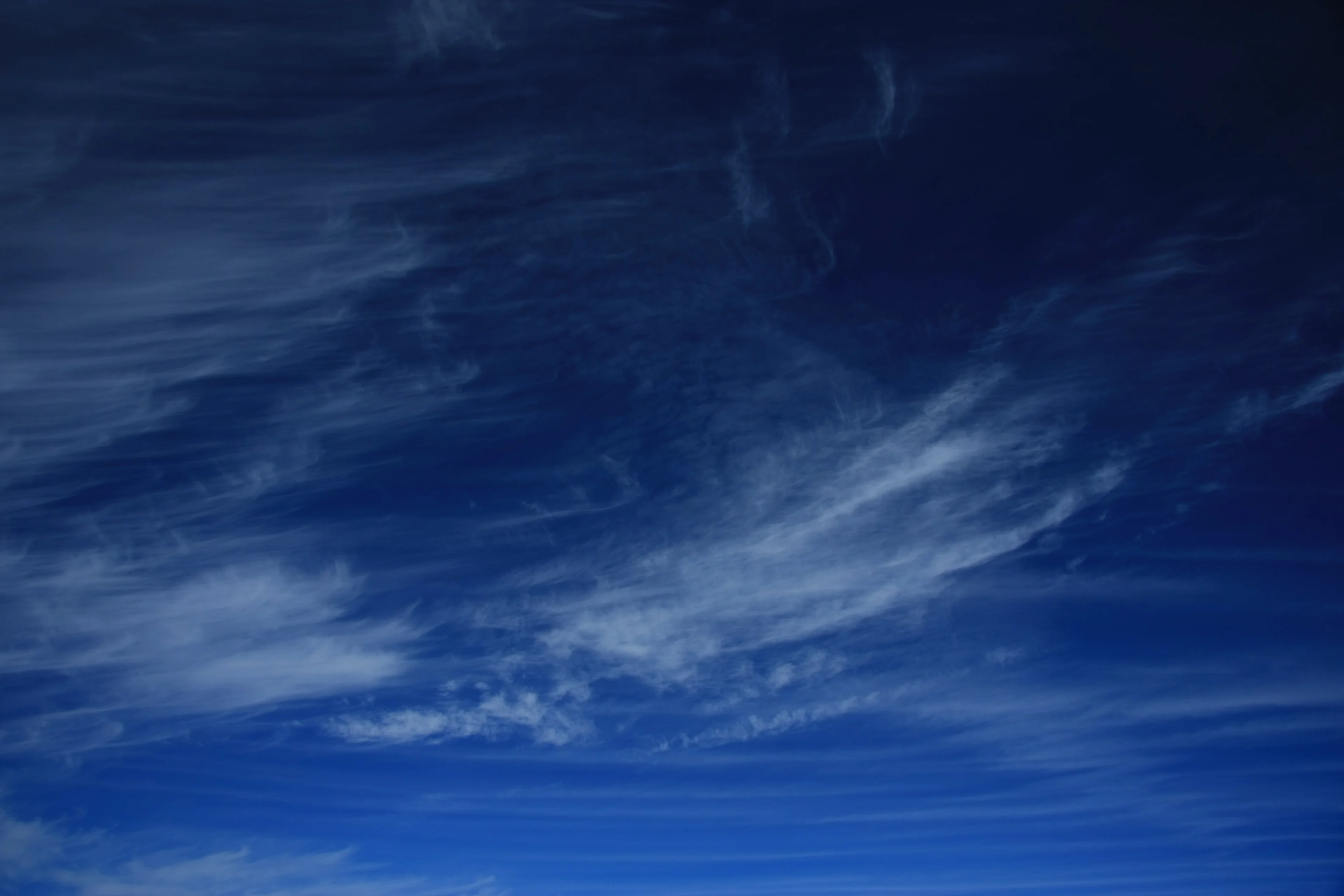
Image: Harley Winborn, Airdrie, Alta.
These wispy tufts of cloud are pretty to look at, that's about all the impact you can expect.
They form very high up and are mostly made up of ice crystals, and their appearance usually portends a coming warm front, which can alter the weather somewhat.
There are some varieties, like cirrostratus, that cover a large chunk of the sky and can produce some nice halo effects, but by themselves they won't bring any precipitation.
WALL CLOUDS
Back to stormy weather, if you see a wall cloud like the one below, get into cover.
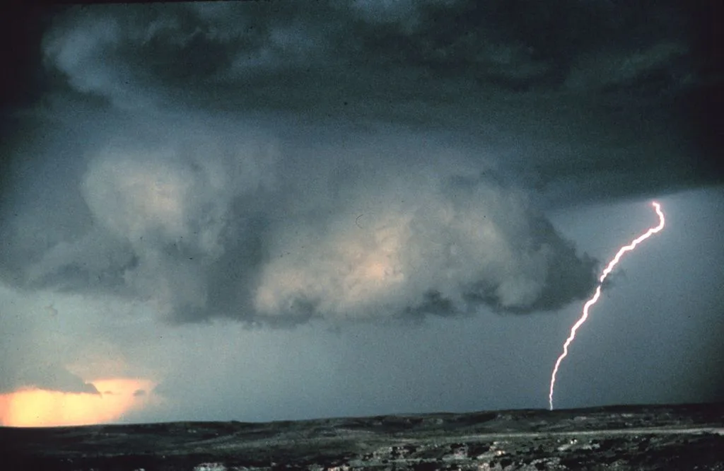
Image: Brad Smull/NOAA/Wikimedia Commons
Associated with thunderstorms, they can lower down from the main base of a thundercloud, often cumulonimbus, and are indicative of an area of strong updraft within a storm.
And if they appear to be rotating, that's when they are most dangerous. That means that part of the storm is most likely to produce tornadoes, and the National Weather service says the "vast majority" of intense tornadoes form this way.
ARCUS CLOUDS
Coming from the Latin word "arch," these low-lying clouds are usually distinguished by their better known sub-types: Shelf clouds and roll clouds.
Shelf clouds, like the one below, are so-called because they appear stacked to the observer.
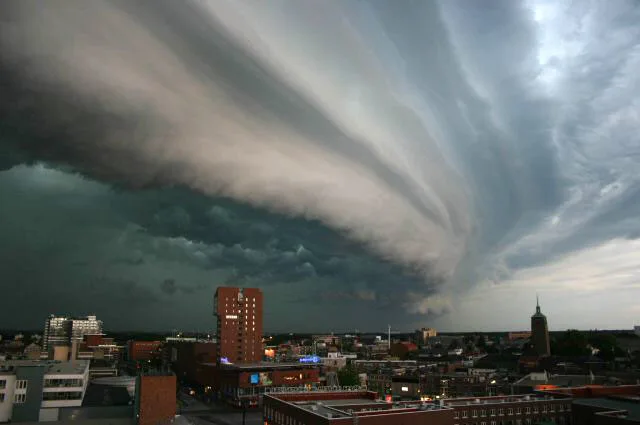
They're usually at the leading edge of a thunderstorm or a line of storms, and as they pass above you, you'll likely feel strong winds before being pelted with heavy rain and/or hail.
They're connected to the underside of the storm, unlike their rarer cousin the roll cloud.
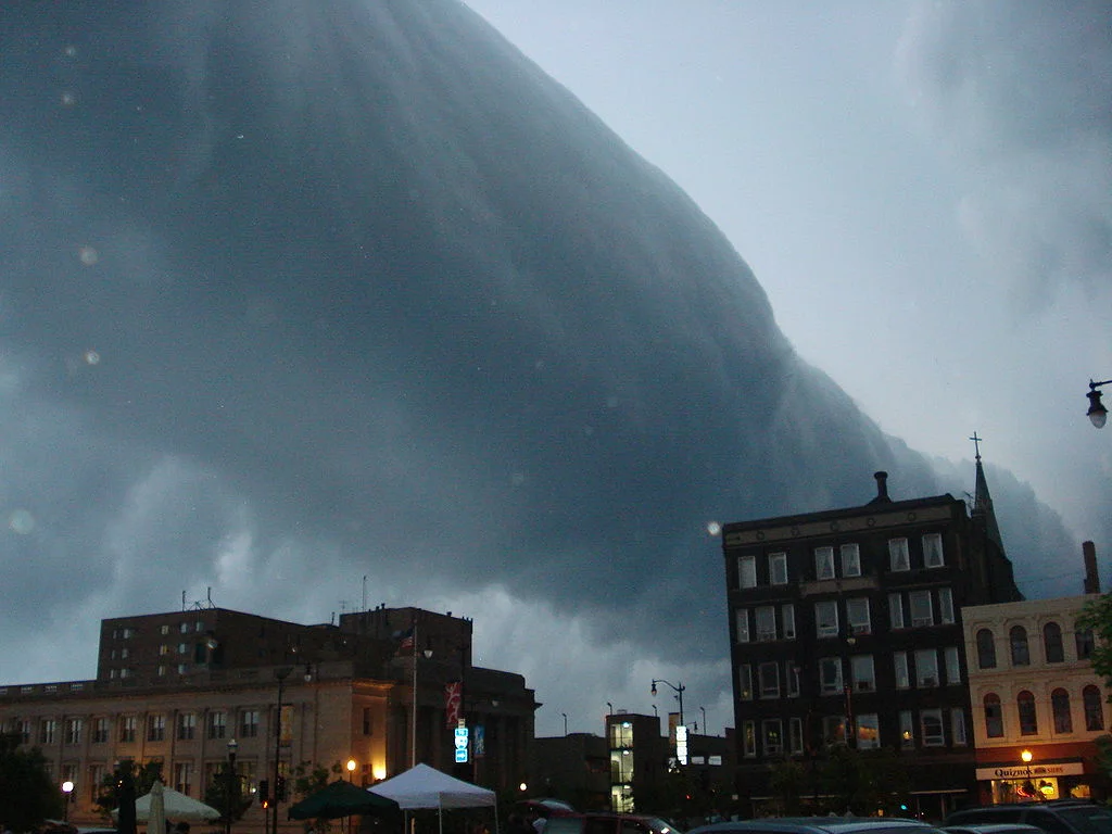
Image: Wikimedia Commons
The totally detached roll clouds can form along thunderstorms, although they typically don't portend as much active weather (they look like horizontal tornadoes, but aren't formed in the same way and don't produce tornadoes themselves). In fact, they can form in relatively calm weather due to action by sea breezes.
FUNNEL CLOUDS
There mere sight of one of these is sometimes enough to spark a tornado warning in some parts of Canada, and Environment Canada has been known on occasion to issue special weather statements just for funnel clouds alone.
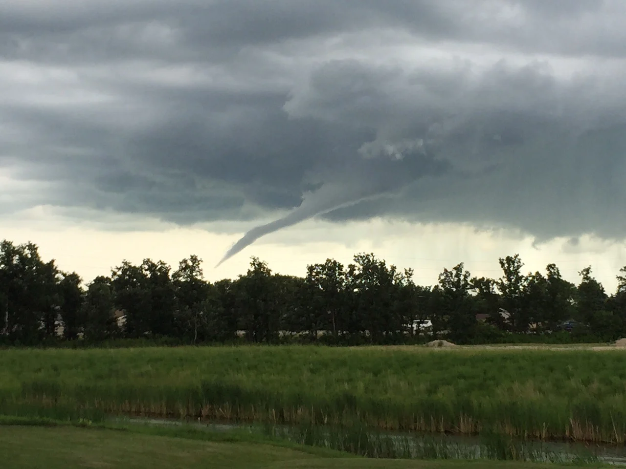
Image: Courtesy of Mike Peters
On their own, they're not dangerous, simply rotating columns attached to the underside of a storm cloud, fueled by wind shear. But if they keep their cohesion long enough to touch the ground, they can become full-fledged tornadoes. Even their weaker cousins, cold-core funnel clouds, which do not form from severe storm clouds, can become tornadoes at landfall.
Forecasters usually warn people to get to cover if they spot one. In fact, some clouds which appear to be funnels may actually be tornadoes whose bases are not visible, and may only be identified as such by the base kicking up dust and debris.
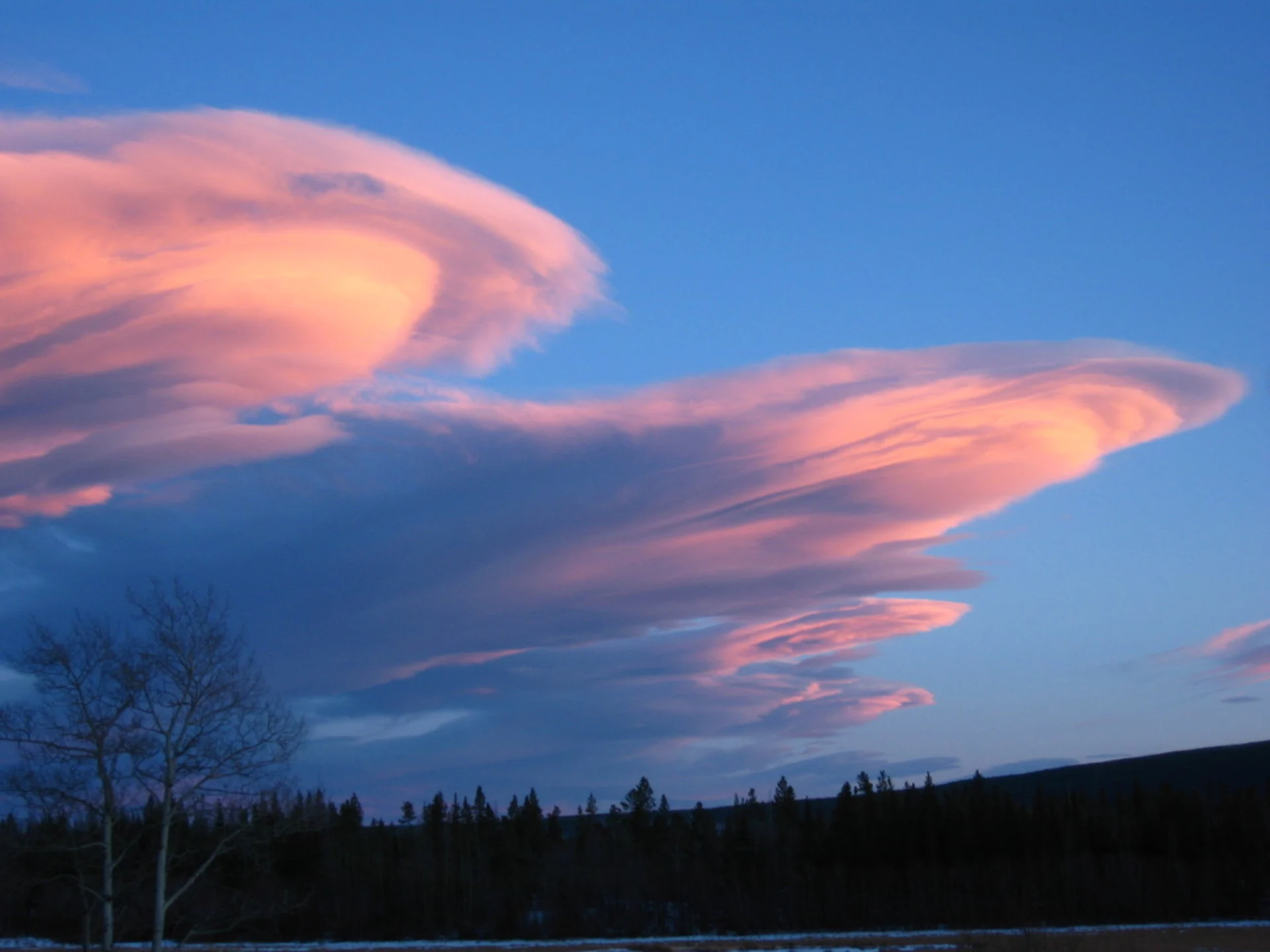
LENTICULAR CLOUDS

Image: Mike Yates, Tatlayoko Lake, B.C.
These weird spectacles are more likely to be mistaken for UFOs than hit you with any kind of severe weather.
You're most likely to see them in mountainous and hilly areas. When stable, moist air flows over the raised land, and if the temperature is right, clouds can appear in that lense configuration.
When the setting sun catches them just right they look amazing, but stormy weather is not their bag.
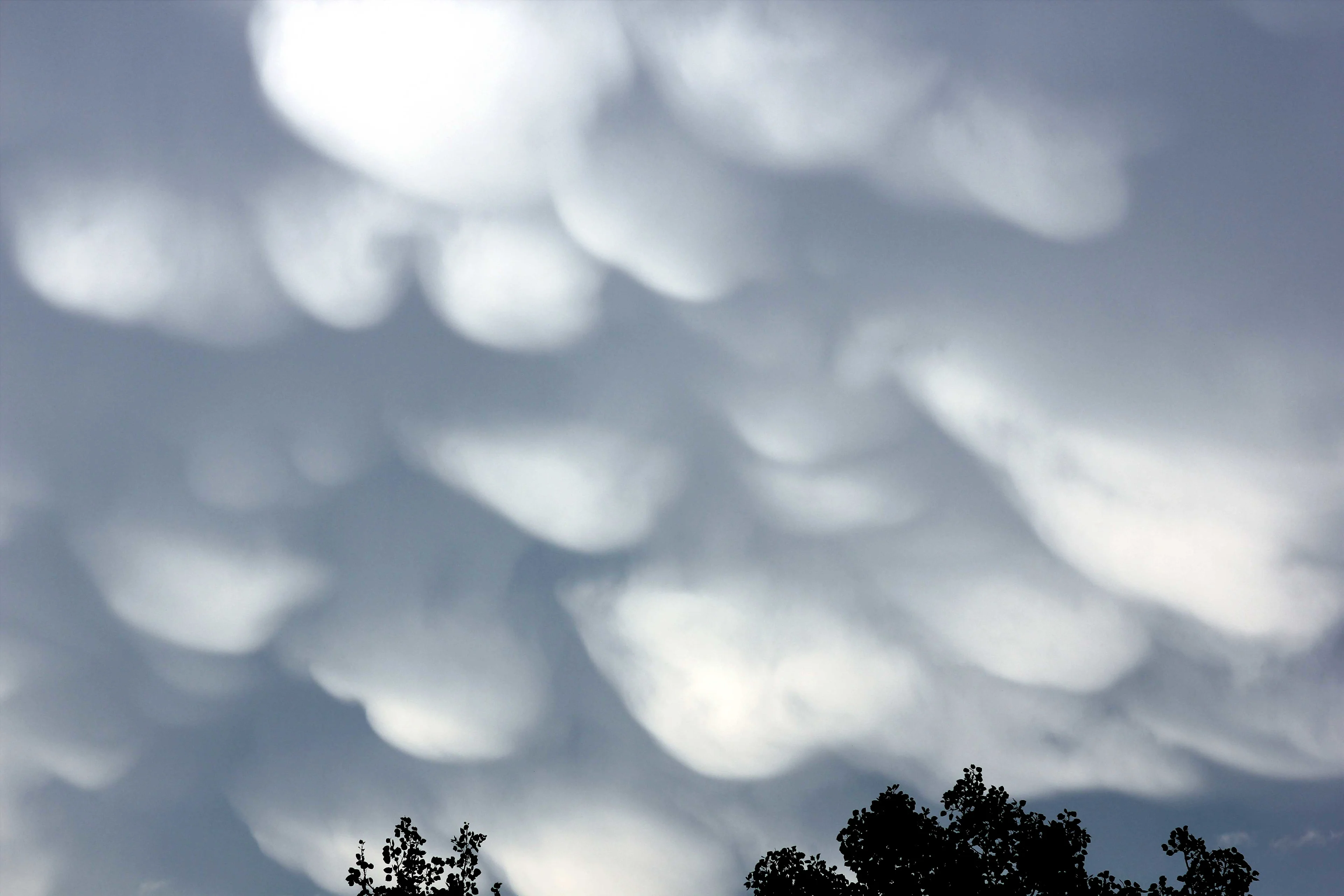
Image: Kellie Witzke, Shellmouth, Man.
These weird clouds aren't themselves stormy, but they do typically form beneath cumulonimbus clouds that are producing thunderstorms. Those bulges are due to turbulence within the cloud itself.
Their appearance is the reason for the "mammatus" monicker, which comes from the Latin root word for udder or breast.
WATCH BELOW: SCIENCE BEHIND THE WEATHER: DIFFERENT TYPES OF THUNDERSTORMS
SOURCES: Environment Canada | University of Illinois | UK Met Office | Weather Online UK | National Weather Service | Weather.com | Live Science | Weather Underground


