How supercells grow to produce giant hail and intense tornadoes

The rotation that drives a supercell can make these thunderstorms exceptionally dangerous when you’re in their path
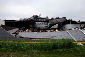
Supercells loom large in Canada's skies during the summer months. These intense thunderstorms are responsible for some of the worst severe weather you can experience, capable of producing significant tornadoes and hail larger than golf balls.
Here’s a look at how a supercell thunderstorm differs from an ‘everyday’ storm to produce dangerous severe weather.
DON’T MISS: The frightening reason violent EF-5 tornadoes are so rare
Normal thunderstorms follow a familiar pattern
A common thunderstorm develops as an updraft of unstable air rises through the atmosphere. Moisture in that updraft condenses as it cools down, creating puffy clouds that gradually billow through the sky. Those clouds continue to grow as long as the updraft has easy access to unstable air.
CHECK IT OUT: How an explosive thunderstorm can burst into the stratosphere

Eventually, though, the weight of the water in the cloud will become too great for the updraft to support. That water starts to fall to the ground as rain, dragging cooler air to the surface along with it.
A downdraft of cold air hits the surface with a chilly whoosh of wind, stabilizing the atmosphere near the surface and choking off the storm’s energy supply. This forces the thunderstorm to weaken and eventually dissipate.
All told, this common process lasts about an hour from beginning to end. Add in wind shear, though, and a completely different story emerges.
Supercells can achieve frightening intensity and longevity
Supercells are thunderstorms with rotating updrafts. They gain this rotation due to wind shear, or winds changing speed and direction with height.
Wind shear that's just right can cause a horizontal rolling motion in the atmosphere. A thunderstorm that develops in this environment can force horizontal rotation to tilt vertically, allowing the entire updraft to begin rotating.
MUST SEE: Tornadoes can happen anywhere—and cities aren't immune

A diagram of a supercell. (Courtesy of Kelvinsong/Wikimedia Commons CC BY-SA 3.0)
Rotation is important because it makes an updraft more resilient, allowing the newborn supercell to grow stronger and last longer than your average thunderstorm. Strong winds high in the atmosphere push on the updraft and force it to tip over a bit, sort of resembling the Leaning Tower of Pisa within the thunderstorm itself.
Now that the updraft is rotating and tilted a tad, the storm survives and thrives by venting its rain-cooled air far away from the unstable air it’s ingesting. This separation is the key to a supercell’s longevity—the strongest such storms can last for hours and travel for hundreds of kilometres before finally fizzling out.
WATCH: How thunderstorms use potent fuel for explosive growth
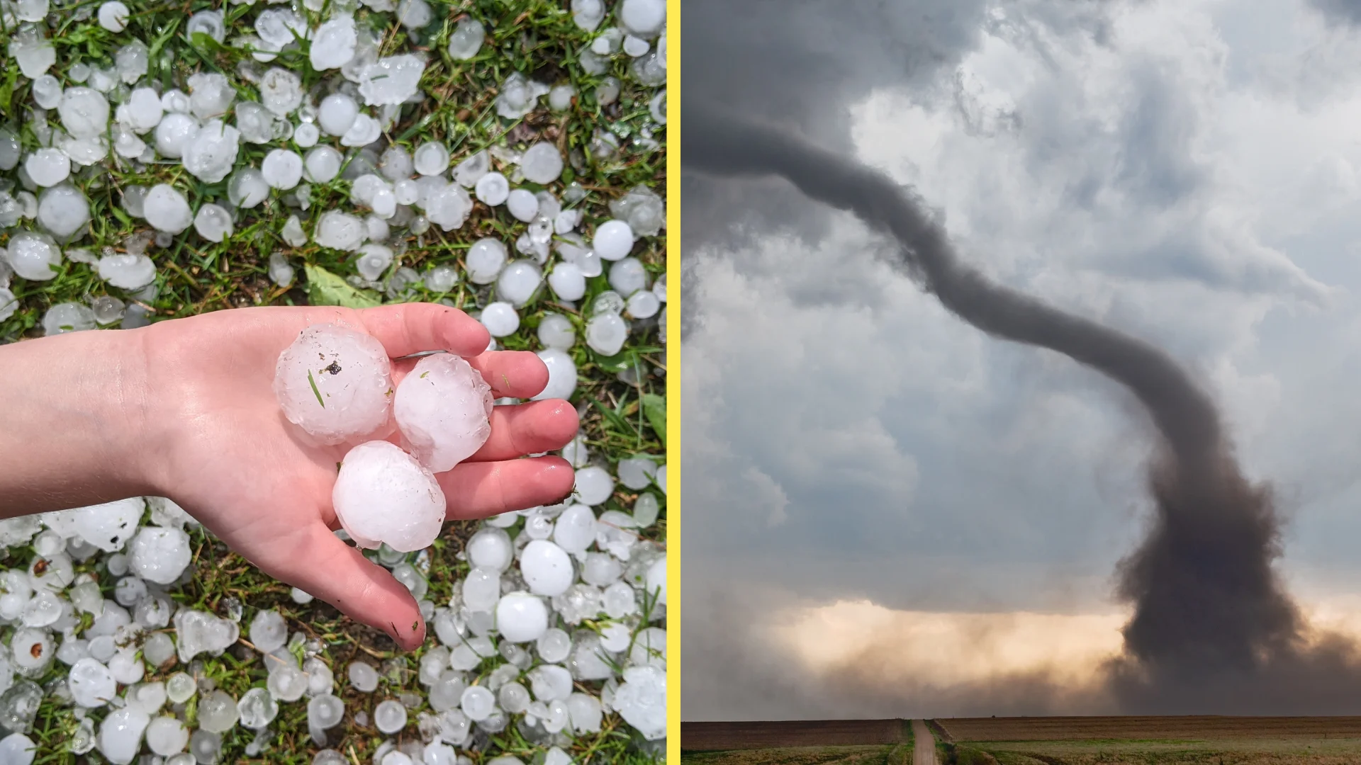
Very large hail is common in supercells
The strength of that updraft doesn’t just make the storm itself more resilient. It also helps create very large hail.
Hail is heavy. An average hailstone can weigh a few dozen grams. That’s not much, but it takes strong winds to keep a solid chunk of ice suspended in thin air.

RELATED: Peas, walnuts and golf balls: here’s what hailstone size means for damage
Most hail-producing thunderstorms are only able to produce tiny stones because their updrafts aren’t strong enough to support the weight of a big chunk of ice. It takes a supercell’s powerful updraft—sometimes with winds blowing skyward at 120+ km/h—to support the weight of hailstones the size of golf balls, baseballs, and even softballs.
These huge balls of ice can weigh as much as half a kilogram before they grow too heavy and finally fall to the ground—or they simply fall out the side of the updraft before they have a chance to reach their potential size.
Most intense tornadoes are found in supercells
The same rotation responsible for the supercell’s structure and the creation of giant hail also plays into the formation of intense tornadoes.
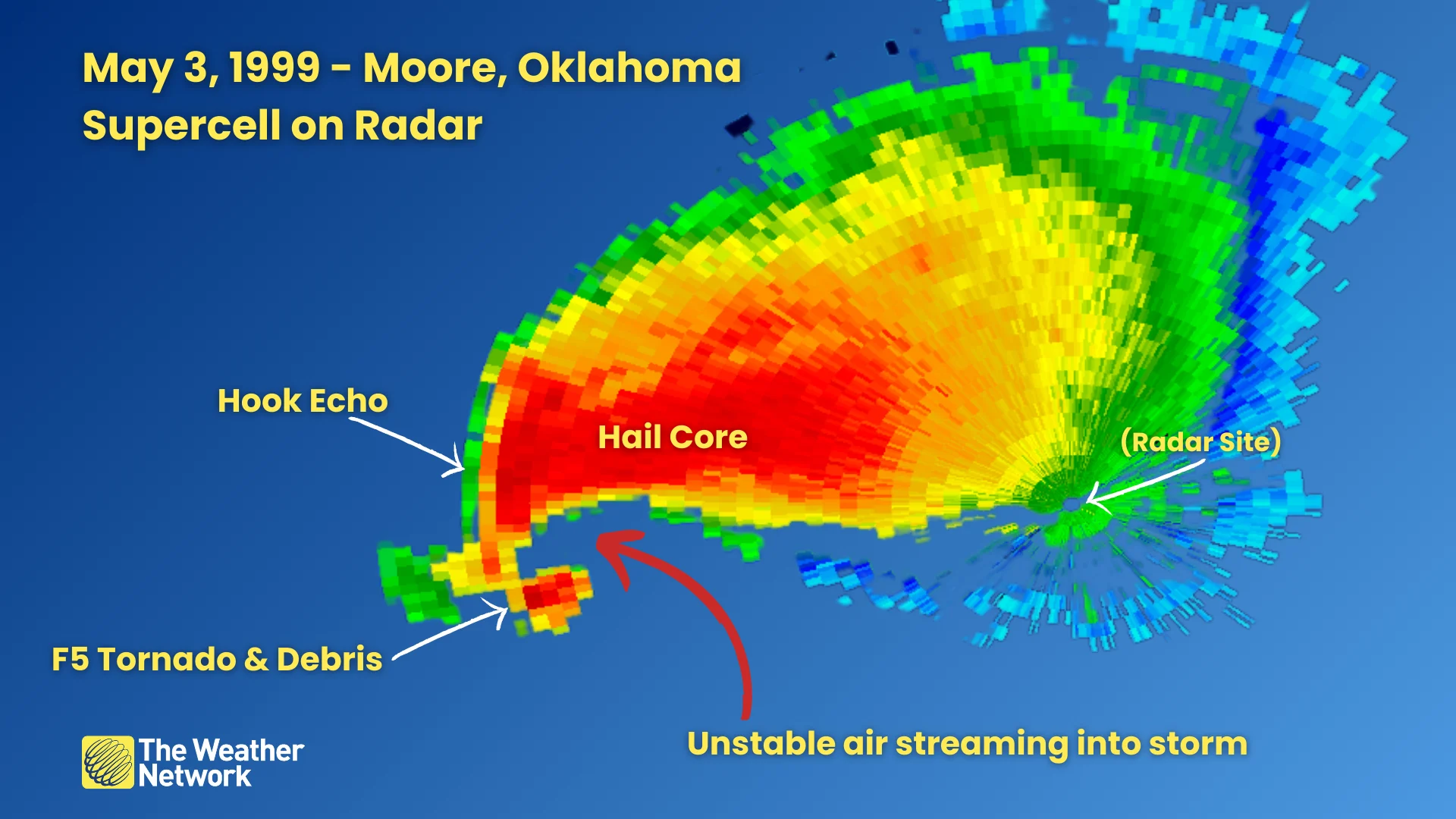
A hook echo on radar is bad news for communities in the path of the storm. This hook-shaped appendage acts like the centre of the rotating storm, forming near the intersection of the warm air surging into the updraft and cold air descending out of the downdraft.
SEE ALSO: The technology that can spot hidden tornadoes lurking in storms
If conditions are just right, a tornado can form off this hook echo. Powerful dynamics within some supercells can support the formation of strong, long-lived tornadoes that can produce EF-5 damage and stay on the ground for an hour or longer.
Most supercells never produce a tornado. Scientists are still studying exactly why some supercells generate significant tornadoes while other identical storms don’t develop tornadoes at all. But an environment capable of supporting supercells can also be capable of supporting tornadoes.
Header image: Hail image submitted by Andrea in Quebec, tornado image via Canva.