The curse of storm nine: Why so many “I” hurricanes are monsters
What is it about names starting with the letter “I” that signals a potentially ferocious hurricane in the making? It’s all about timing.
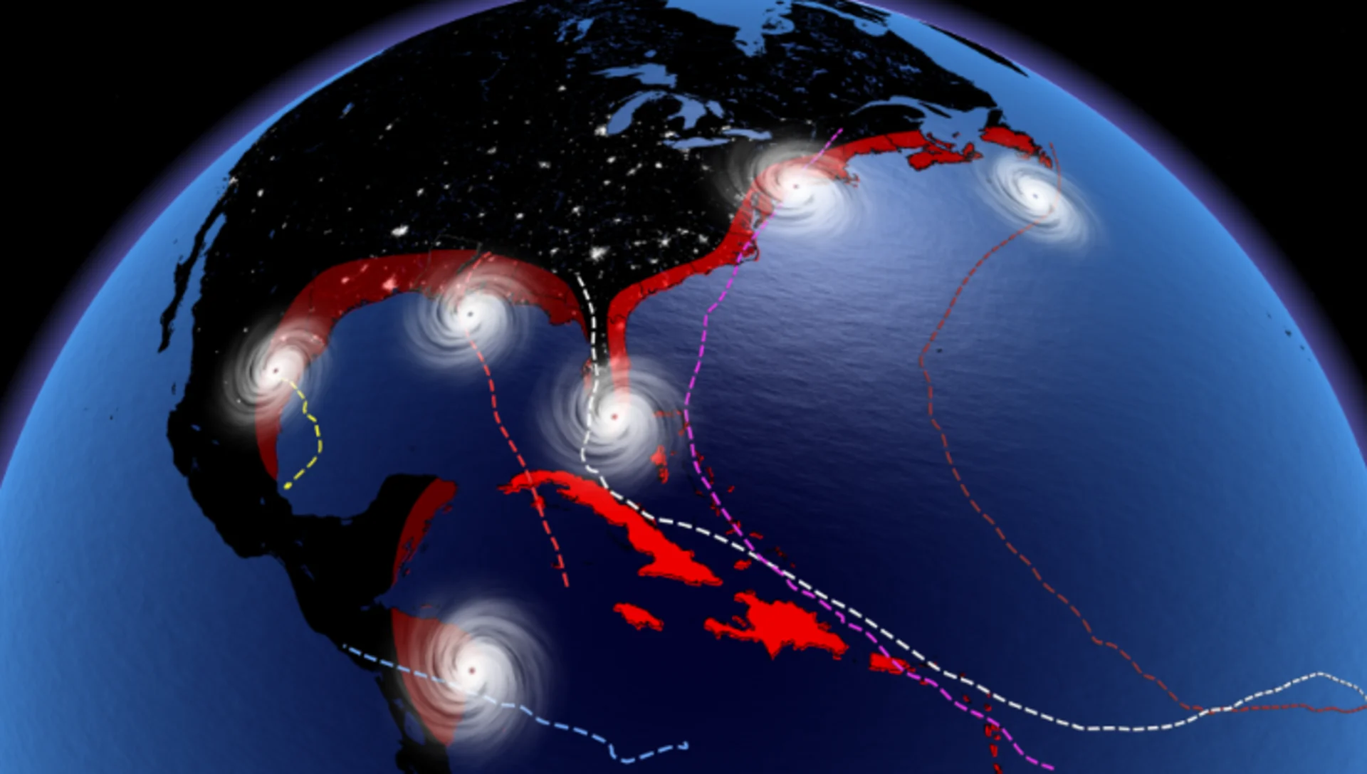
Ian smashed into Florida as one of the strongest hurricanes to ever hit the United States. Irma devastated the Caribbean as a monstrous Category 5 storm. Igor brought widespread destruction to Newfoundland’s Avalon Peninsula. Now Idalia, with a landfall strength and storm surge that could reach "once-in-a-lifetime" levels along Florida's Big Bend region.
History is littered with the wreckage of destructive hurricanes all around the Atlantic Ocean. But if you study the history of devastating storms, one trend begins to pop out: lots of them bear names starting with the letter “I.”
MUST SEE: How do we know when weird weather is caused by global warming?
What is it about “I” storms that makes them noticeably deadlier and more destructive than their alphabetical counterparts? Is there a curse of storm number nine? Is it a coincidence?
A look into this curious pattern starts with a short dive into the history of naming hurricanes.
Tropical storms and hurricanes in the Atlantic Ocean are named from six alphabetical lists consisting of 21 names each. One list is used every year, so 2022’s list of names was last used in 2016, and it’ll be used again during the 2028 hurricane season.
We only use 21 of the 26 letters because it’s difficult to find enough common names starting with the letters Q, U, X, Y, and Z.
Finding plenty of names for storms becomes important when there’s a particularly devastating hurricane. If a storm causes widespread death or destruction, forecasters will retire that name and never use it again out of sensitivity and respect.
WATCH: Hurricanes are growing more intense, and climate change is probably to blame
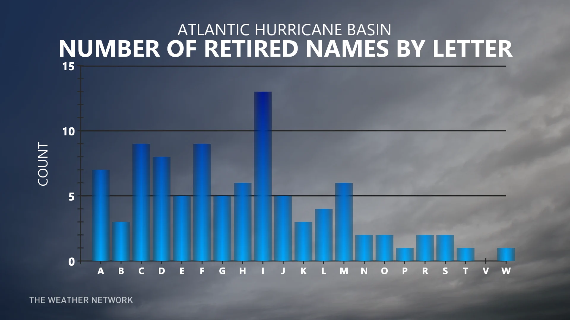
94 names have been retired since the current system came into use back in the mid-1950s. Out of all those names, “I” registers as the most commonly retired letter with 13 storm names forever living in infamy.
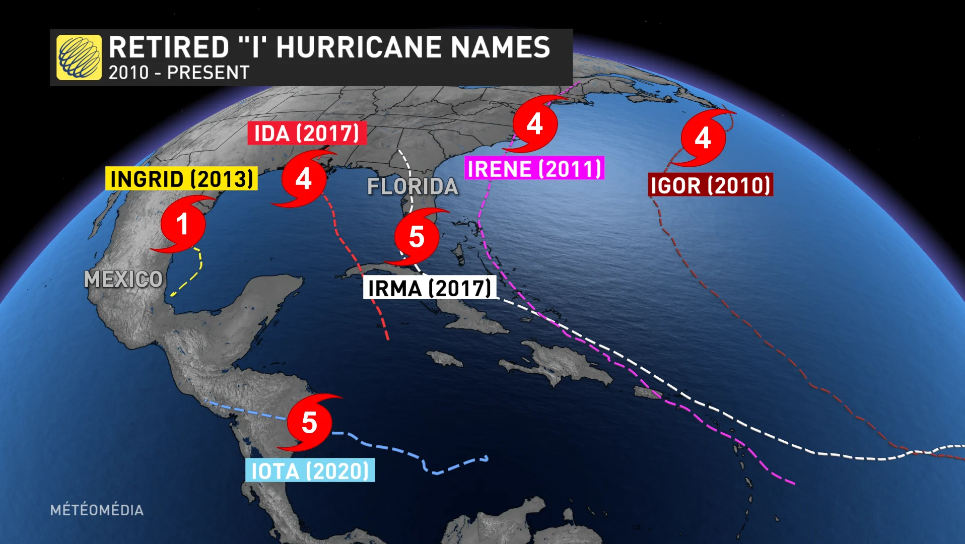
The 13 retired “I” storms are: Ida (2021); Iota (2020); Irma (2017); Ingrid (2013); Irene (2011); Igor (2010); Ike (2008); Ivan (2004); Isabel (2003); Isidore (2002); Iris (2001); Inez (1966); and Ione (1955).
2022’s Hurricane Ian is likely to join the list after the widespread destruction it caused in Cuba and the United States at the end of September.
PODCAST: Hurricane Igor is the worst storm to hit Newfoundland, brought 28 m-high waves
The explanation for this odd grouping of tragic storms comes down to timing.
The official Atlantic hurricane season begins on June 1st and runs through November 30th, with the peak of the season occurring in the second week of September. Historically, we see a handful of storms early in the summer, followed by a burst of activity around the peak of the season.
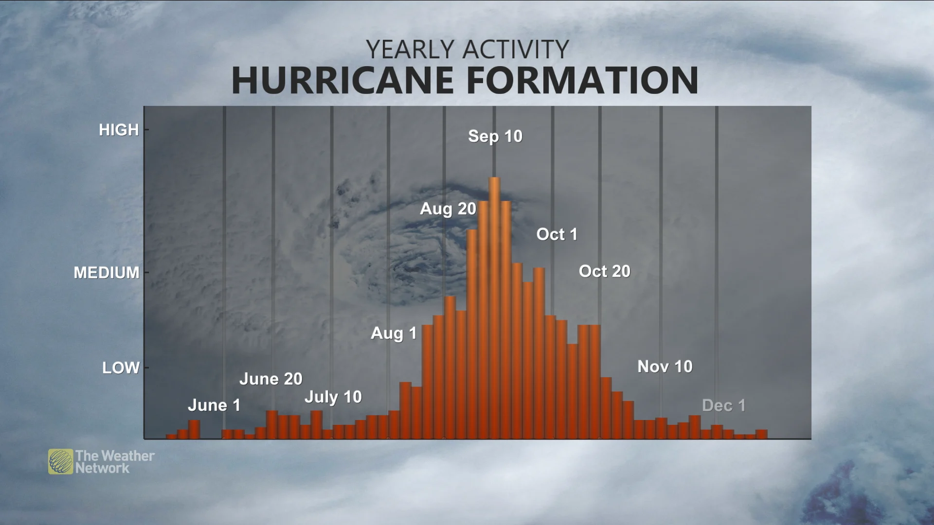
During a normal year, we’ve already seen a smattering of weaker storms early in the season, using up the first handful of letters in the alphabet on systems that usually come and go without much notice.
This trend leaves the season’s strongest storms to draw from the middle of the name list, with the letter “I” coming up most often during the peak of the season when the strongest storms churn through the tropics.
DON'T MISS: How hot water fuels the world’s most powerful hurricanes
That’s not to say there aren’t any flukes involved in the naming of these highly destructive “I” storms.
Hurricane Ian almost wasn’t named Ian at all.
The Atlantic basin saw two systems swirling on either end of the ocean as the sun set on September 23, 2022. Both tropical depressions were on the verge of growing into named tropical storms—it was just a matter of which one would make it there first.
A system near the coast of Africa won the race, becoming Tropical Storm Hermine at 5:00 p.m. that evening.
The other depression in the Caribbean became Tropical Storm Ian just six hours later.
Hermine dissipated over the open ocean after two days.
Ian did not.


