
'Training' thunderstorms cause flash floods in Ontario, but what are they?
Training storms are known to cause severe flash flooding in a short period of time
Pop-up thunderstorms in the middle of summer don’t always last for very long, but sometimes they can last for hours, turning an average storm into a flash flood. This is what happened in London, Ont., on Monday, July 15.
Heavy rains began at around 9 a.m. (EDT), falling for about two hours, leading to flash flooding in the Wortley, Southcrest, and Westmount neighbourhoods. Radar estimated 90 mm of rainfall over a couple hours.
London wasn't the only Ontario city that experienced flooding on Monday. There were localized flooding reports in Burlington and Oakville, as well, with some radar estimates of up to 60 mm of rainfall in a short period of time.
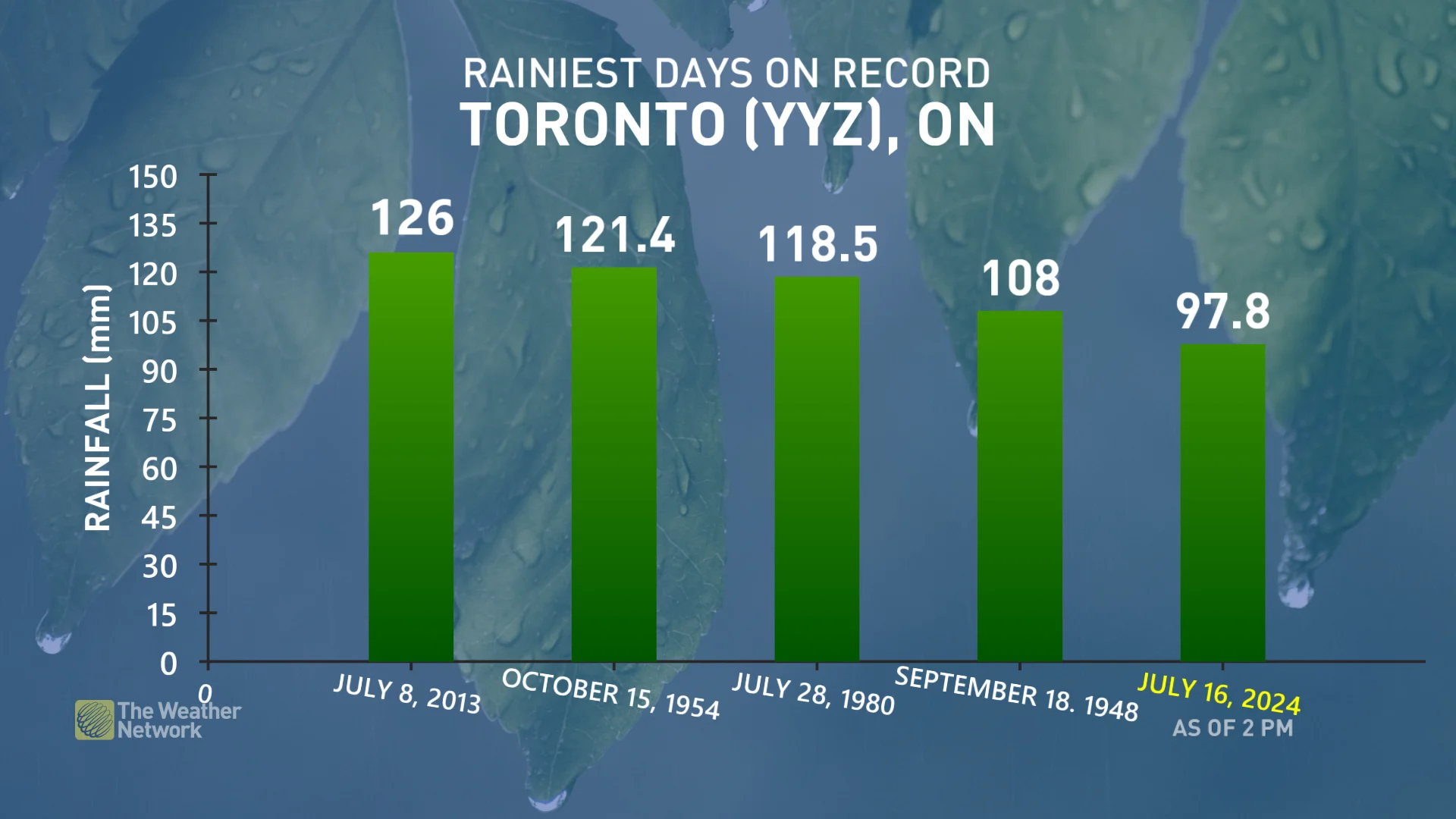
The following day, similar conditions were reported with flash floods once again battering parts of southern Ontario. In just a little over 3 hours (8:43 a.m. to 12:00 p.m.), Toronto Pearson Airport had reported a whopping 96 mm of rain.
"96 mm of rain has fallen at Toronto Airport since 8:43 am.," said Matthew Grinter, a meteorologist at The Weather Network. "This is (so far) the 5th wettest day [for any month], and 3rd wettest July day on record. The wettest day on record brought 126 mm on July 8, 2013, when there was also major flooding in Toronto."
By the time the storms let up at Toronto Pearson, a total of 97.8 mm was officially recorded.
So the question is: what is causing these bouts of heavy rain?
Cause of heavy rain in a short period of time
A boundary is a trigger point for summer thunderstorm development and can be the dividing line between cold and warm air. Ontario gets interesting boundaries in the form of lake breeze fronts. So even on those hot, humid summer days that make you want to either hide inside or go swimming all day, we can get thunderstorms.
The problem with these storms is that because they fire-up on lake breezes, the warm, humid air that the storms feed on isn’t swept out of the area by a moving cold front. Instead, the boundary stays in one place and the storms can continually fire on it. These are known as training or back building storms.
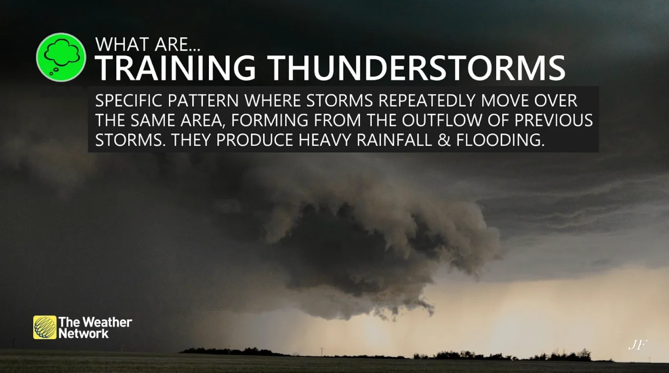
How training storms develop
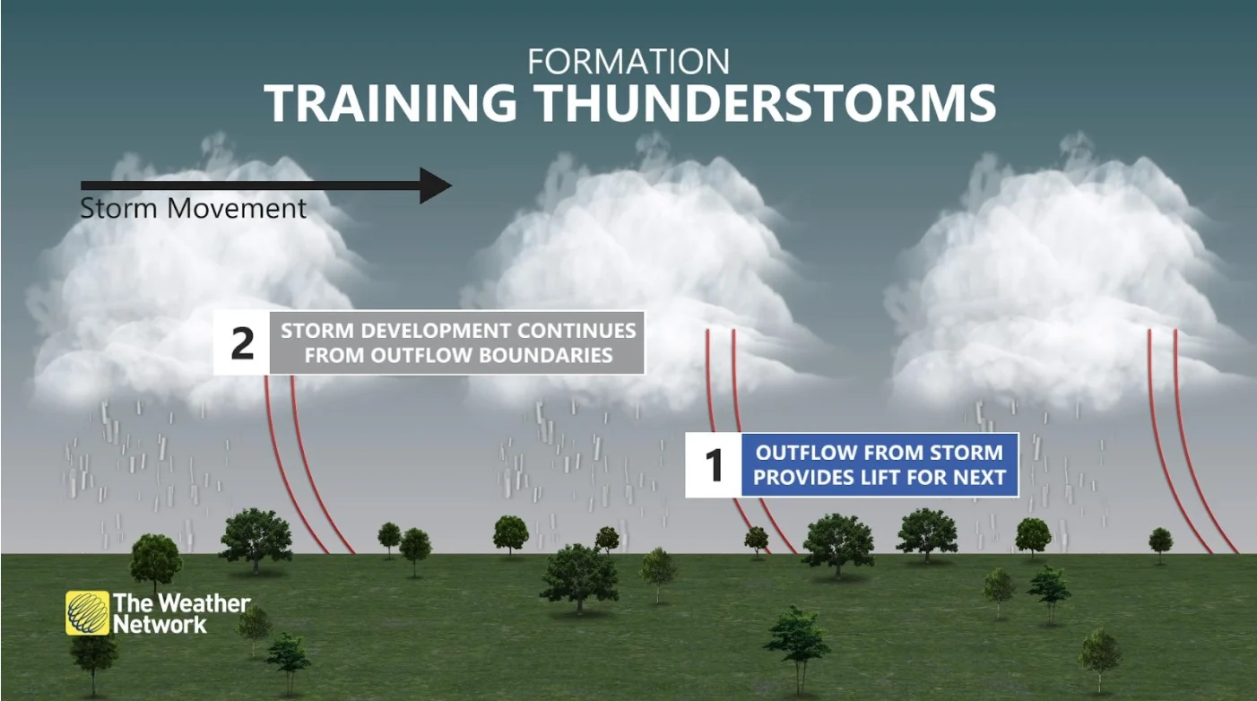
Every thunderstorm creates an ‘outflow boundary’. This is when cold air sinks from a thunderstorm's downdraft, spreading out as it hits the ground.
As the leading storm cell moves on and dissipates, its outflow boundary collides with warmer air behind it, triggering another cell to form …and then another, and another…
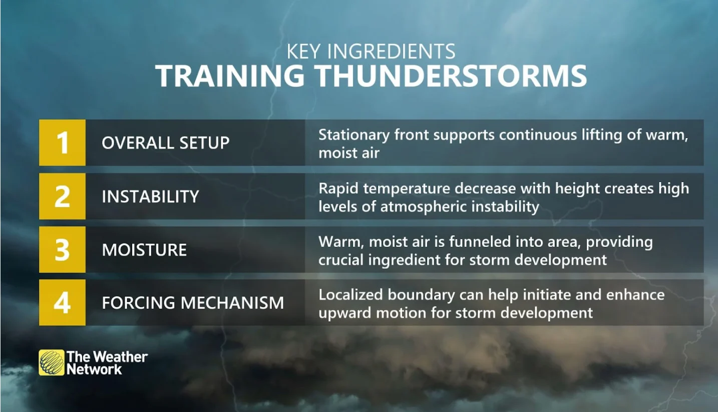
This is where the term "training" comes from—storms line up over the same area one after another like train cars on a track.
The humid summer air holds a lot of moisture, helping these storms produce tremendous amounts of rain.
If the storms are moving slowly and winds are coming from the same direction, one location can see months of rainfall in only a few hours.
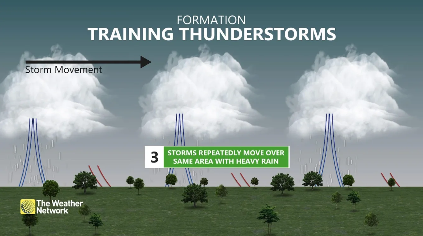
Watch the video that leads this article to learn more about how training storms develop.
WATCH BELOW: Here's why you need specific insurance coverage for flooding in Canada
This article contains files from The Weather Network meteorologists, Mark Robinson and Melinda Singh, and News and Video Optimization Specialist, April Walker. Header image of flash flooding in London, Ontario, courtesy of Scott Kean.


