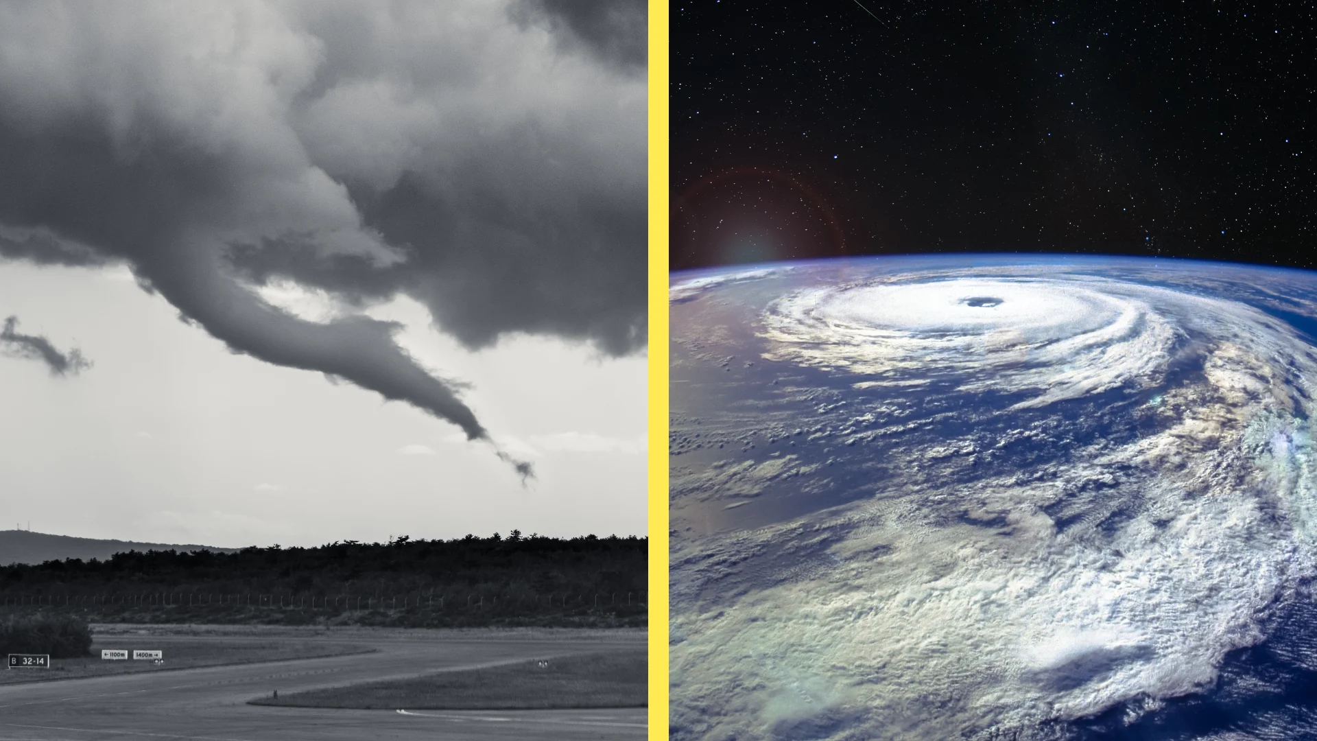
Tropical tornadoes are a hidden danger in landfalling storms

Ontario and Quebec aren’t immune from the dangers of storms that hit south of the provinces
The dangers of a hurricane don’t stop where the eye crosses the coastline.
A landfalling storm’s life-threatening hazards can continue for days after landfall, sending a slug of flooding rains, high winds, and even tornadoes hundreds of kilometres inland from where the cyclone roared ashore.
Tropical tornadoes are an underrated but extremely dangerous threat in any landfalling storm, whether it’s a weak depression or a sprawling hurricane. This tornado threat can stretch all the way into Canada if the storm takes the right track.
Here’s an inside look at how a hurricane can generate its own tornado outbreak.
DON’T MISS: Tornadoes can happen anywhere—and cities aren't immune
Ingredients abound for tornadic thunderstorms
Thunderstorms require the right balance of moisture, instability, and ample wind shear in order to produce tornadoes. There’s no shortage of all three ingredients when a tropical system makes landfall.
Most tropical cyclones feature prominent rain bands, or lines of intense rain and thunderstorms that swirl around the outer edges of the system like teeth on a buzzsaw. We can also see intense thunderstorms throughout the inner core of the storm as it pushes inland.
MUST SEE: Don’t fall victim to these seven dangerous tornado myths
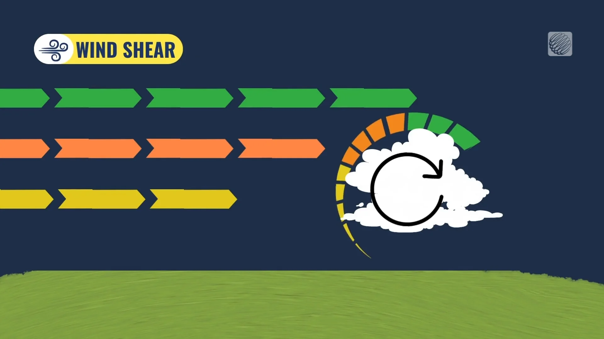
The winds within a hurricane travel at relatively the same rate as they blow over the smooth surface of the ocean.
When the storm makes landfall, however, winds near the surface dramatically slow down as a result of friction. The difference between slower winds near the surface and stronger winds aloft leads to wind shear.
This wind shear creates a horizontal rolling motion in the atmosphere. Updrafts feeding into a thunderstorm can tilt this horizontal rotation vertically, lending a storm the rotation it needs to produce a tornado.
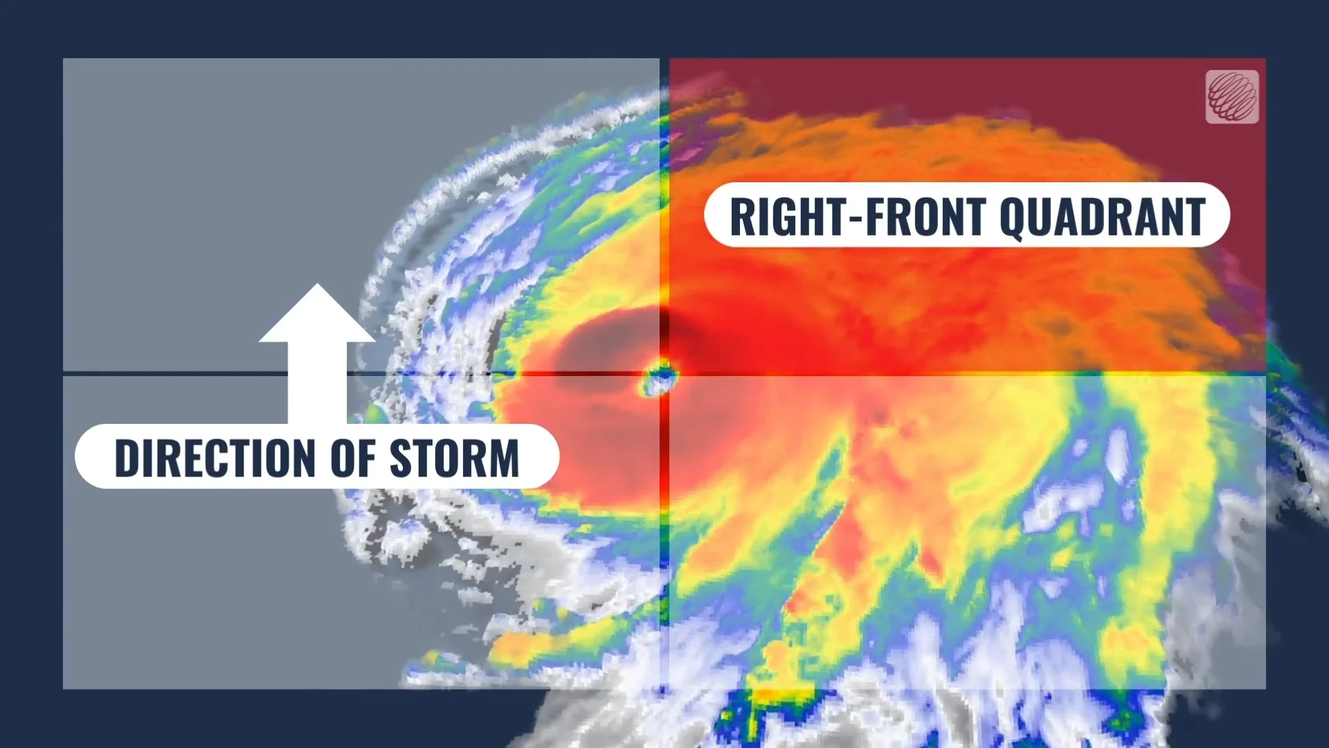
The most favourable wind shear within a tropical cyclone occurs in the right-front quadrant of the storm, which is ahead of and to the right of the eye.
If a hurricane is moving due north, for instance, the right-front quadrant is the northeastern side of the storm.
Hurricanes have a history of intense tornado outbreaks
It’s common for tropical depressions, tropical storms, and hurricanes to produce at least a couple of tornadoes whenever they make landfall. However, some storms are able to produce full-fledged tornado outbreaks when conditions are favourable for individual thunderstorms to develop into supercells.
Hurricane Ivan produced a record-breaking number of tornadoes over the span of four days after making landfall in mid-September 2004.

RELATED: The curse of storm nine: Why so many “I” hurricanes are monsters
The system produced more than 120 tornadoes from Florida to Pennsylvania. The event turned into Virginia’s largest tornado outbreak ever recorded, with more than a dozen tornadoes hitting the Washington, D.C., suburbs alone.
Hurricane Beryl produced a similar tornado outbreak after it crashed into the Texas coast in July 2024. The storm led to a record number of tornado warnings in Louisiana, and produced multiple tornadoes very close to the Canadian border throughout the northeastern U.S.
Beryl’s outbreak was a reminder that tornadoes are possible all the way into Canada when storms make landfall along the Gulf Coast or the U.S. East Coast. If the track of a storm takes it over the Great Lakes or St. Lawrence Valley, conditions ripe for tornadoes could follow the system into Ontario, Quebec, or the Atlantic provinces.
Header image created using imagery from Canva.