Canada's space agency wants to become firefighters' eye in the sky
Canada's fire forecasters will be getting a new tool in their battle against out-of-control blazes.
In this year's record-scorching fire season, provincial and federal wildfire agencies had to rely on a mix of European and NASA satellite instruments to help monitor and predict fire behaviour.
Now, however, the Canadian Space Agency is preparing to launch what it describes as the world's first dedicated public fire-monitoring satellite into orbit.
DON'T MISS: Canada's summer defined by record wildfires, damaging floods and storms
"Since we don't have our own wildfire satellite, we really rely on our collaboration with the European Space Agency," said Daniel DeLisle, senior programs officer at the Canadian Space Agency, in an interview with CBC's Daybreak North.
"They are asked … whenever we have a disaster, to be able to provide us almost near-real-time information."
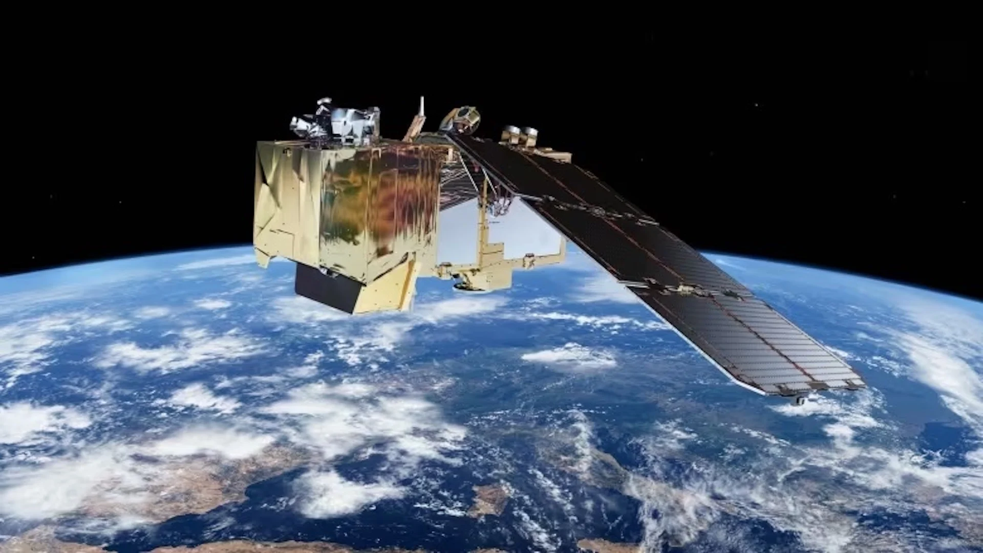
Canada currently relies on several satellites for its fire data. Several key instruments are aboard the European Space Agency's Sentinel satellites.
Additionally, heat data from infrared sensors on several satellites launched by the U.S. National Oceanic and Atmospheric Administration, as well as high-resolution photographs from Moderate Resolution Imaging Spectroradiometers (MODIS) on NASA's Aqua and Terra satellites, are currently being used.
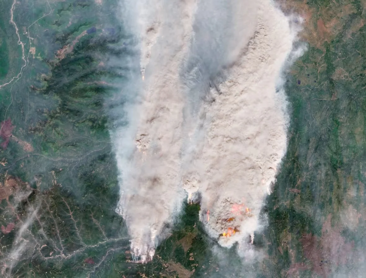
The record-shattering Donnie Creek wildfire is seen in northeastern B.C. from the European Space Agency's Copernicus Sentinel-2 satellite on May 18, 2023 (Submitted by ESA)
Once Canada's own $170-million WildFireSat launches into orbit — planned for 2029 — it will leave Canadian emergency officials less reliant on our friends on the final fire frontier.
"It's important … to have our own system to be able to to track all these wildfires," DeLisle said, "to provide this information as soon as possible when catastrophe strikes."
But the vital emergency data won't just be for Canadian eyes. Once in operation, WildFireSat will help many countries get better information quickly, according to Joshua Johnston, principal investigator of the project.
The forest fire research scientist at the Canadian Forest Service said what data we currently get from space is helpful, and does arrive quickly from allies' Earth-observing science satellites.
"But none are focused just on fires," Johnston told CBC's The Current. "They're just not built for this explicit purpose.
"This type of fire season — I hate to be the one to say it — but it's going to become more and more common as we move towards 2029.
B.C. has seen 2,207 wildfires this year, forcing entire communities to evacuate and burning nearly 25,000 square kilometres of land, according to the B.C. Wildfire Service.
That is roughly six times more than the 4,100 square kilometres that burned annually on average of the last 10 years.
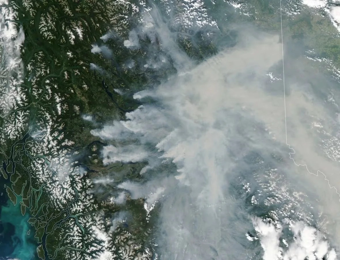
Wildfire smoke is seen spewing from numerous wildfires across northern B.C. in this NASA image captured by a Moderate Resolution Imaging Spectroradiometer (MODIS) aboard the agency's Aqua satellite on July 12, 2023. (Submitted by NASA)
According to the federal government, once launched the satellite will "improve our ability to defend Canadian communities," both to better predict fire behaviour and make decisions about evacuations, but also for things like unhealthy levels of smoke pollution and air quality.
WildFireSat is designed to meet "the needs of fire managers in Canada," Natural Resources Canada announced on Aug. 11 in a statement. "It will support smoke and air quality monitoring and forecasting and downstream carbon emission monitoring."
Meanwhile, on Thursday, the private company Rogers Communications announced its own plans to detect and prevent wildfires with the help of satellites.
In a release, the telecommunications giant announced it will install artificial intelligence-powered cameras linked via billionaire Elon Musk's SpaceX satellites and Rogers' 5G phone network to detect smoke near the B.C. communities of Fort St. James, Smithers and Chetwynd.
The initiative could form "the foundation for an early warning system for wildfires and improve public safety," according to Mathieu Bourbonnais, an assistant professor of earth, environmental and geographic sciences at the University of British Columbia Okanagan, who is involved in the project.
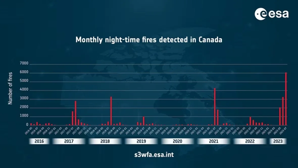
A chart shows night-time wildfire monitoring data for Canada from 2016-2023, based on data from European Space Agency satellite instruments, revealing a significant increase in fires observed. (Submitted by ESA)
But DeLisle warns our own WildFireSat won't be ready for at least six more years. The expected time to prepare for its launch is not unusual for a new research satellite, he noted.
That may seem a long way off given the urgency of tackling worsening fire seasons, and he warned that the current, roughly 7,000 wildfires Canada monitors a year will likely increase in number.
"With climate change and droughts, it could double by 2050," DeLisle said. "So it's important for us to be sovereign — to have our own system to be able to to track all these wildfires."
He said having one satellite devoted to combining observations on fire perimeters, smoke, wind patterns, changes in fire direction, and human infrastructure will help Canada's fire personnel become faster and more effective.
"It's really there to to help decision-making for wildfires," DeLisle said, "to be able to track and try to understand where the fire is going, and how they can actually control it."
WATCH: Canadian technology made this 3D map of Bennu possible
Thumbnail courtesy of ESA via CBC.
The story was originally written by David P. Ball and published for CBC News. It contains files from Daybreak North and The Current.


