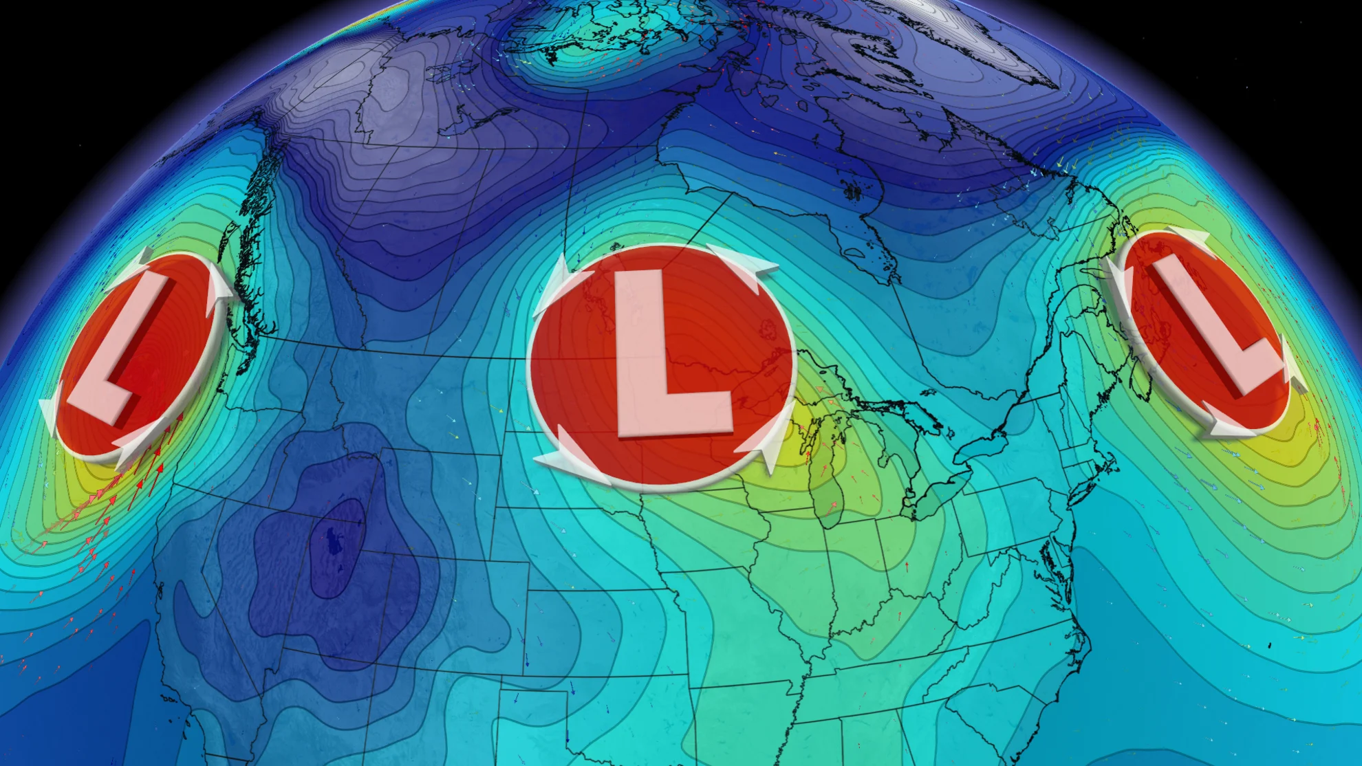
3 major lows bring wet, wicked or wintry weather to most of Canada
An active pattern sets up over the country this week bringing three storms from coast to coast. Impacts range from strong wind gusts, to blizzard-like conditions, as well as days of dreary and never ending rain
Just about every bit of the country will see some sort of stormy weather this week, as three major low pressure systems hit from west to east. Everything from wicked winds and massive waves, to heavy rain and dangerous blizzard conditions are on the table.

While nothing is completely unheard of for this time of year, it'll certainly be a rude wake-up call for many Canadians thanks to a rather sluggish, and above seasonal trend so far this fall season.
Here's how it looks.
Weather bomb for coastal British Columbia

A rapidly developing, and powerful storm will bring intense impacts to B.C.'s coast through Wednesday.
DON'T MISS: B.C. bomb cyclone to create the world’s largest wave pool
Heavy rain, and heavy alpine snow will certainly impact travel, while damaging winds threaten power outages along coastal areas, as well as ferry delays. Vancouver and the Lower Mainland can expect wind gusts between 50-70 km/h, with peak winds expected Tuesday night before easing through the day on Wednesday.

Tides will also be elevated, so there's even a risk of some minor storm surge associated with this low.
Prairie winter storm with dangerous blizzard-like conditions
After a quick blast of winter, and all of its associated travel issues in southern Alberta on Monday, another low has prompted widespread winter storm and snowfall warnings across Saskatchewan and Manitoba.

This potent Texas low is the first of its kind of the season, so drivers are urged to plan accordingly and avoid any non-essential travel until conditions improve.
Between 5-15 cm of snow is expected in major cities including Regina, Sask., and Winnipeg, Man., with abnormally heavy November rain also hitting the Winnipeg area before the colder air sets in.
The heavier snowfall amounts of 15-30+ cm will fall in areas along the provincial border.

Gusty winds will pick up through Tuesday, resulting in whiteout conditions with near impossible travel on some highway routes. Road closures and power outages are certainly main threats.
SEE ALSO: Late-week snow, strong winds, and rain; Ontario will see it all this week
Yet another stalled low over top of Atlantic Canada
The atmospheric gridlock keeps Atlantic Canada under the influence of more unsettled weather through this week.

High pressure over the north Atlantic Ocean is to blame for the wet and crummy conditions, and while no real impacts are involved for the East Coast, the continuous soggy weather can certainly be miserable to deal with for days on end.
More storms to end the month of November
An active pattern looks to lock in across Canada for the rest of November, with slow moving systems and unusual storm tracks that will continue to bring impactful weather and bigger storms to parts of the country.
Temperatures will also trend colder, and the Arctic air will become more widespread as we progress through the second half of November, especially as the cooler weather attempts to spread eastwards. Next week could become quite cold for western Canada, and that could result in some more wintry conditions. Be sure to check back for all of the latest weather updates in your area.


