3000 km Arctic front to plunge millions in Canada, U.S. into deep freeze
A powerful surge of Arctic air diving south will bring some communities their coldest air in years.
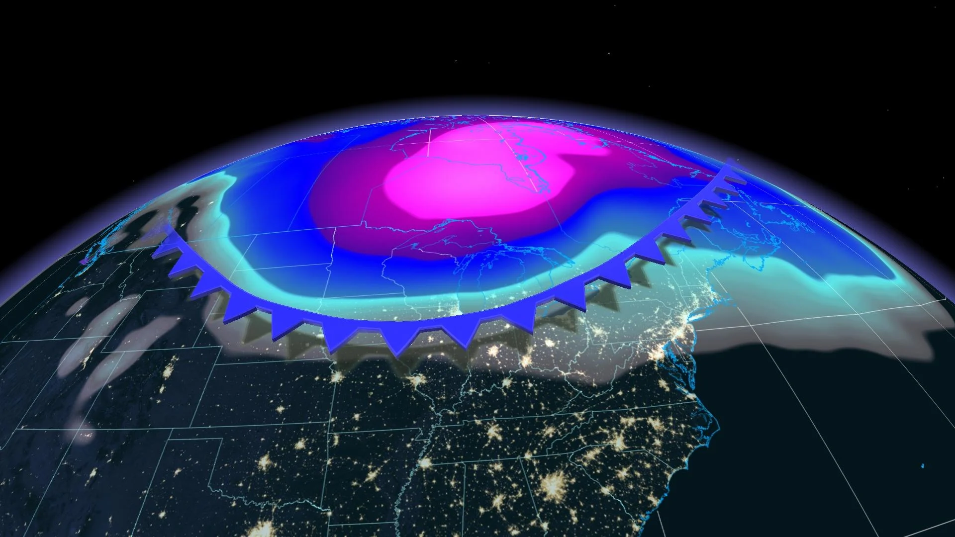
Some of the coldest air on Earth will fall over the eastern half of Canada in the coming days, courtesy of a powerful Arctic front that stretches more than 3000 km from the Maritimes to the heart of the United States.
Bitterly cold temperatures and downright dangerous wind chill values will sweep over Ontario, Quebec, and Atlantic Canada by the end of the week.
The extreme cold will filter south into the U.S., as well, where some communities could see their coldest wind chill readings in more than 30 years.
MUST SEE: Fickle February: Hit and run winter continues to lack commitment
A piece of the polar vortex will send this surge of Arctic air flooding south over the next couple of days. Temperatures associated with this quick-hitting burst of frigidity will dip well into the double-digits below zero, with feels-like values falling to -40 or lower in spots.

This front will plunge into northern Ontario and northern Quebec on Thursday, reaching the southern sections of these provinces by early Friday morning. The front will sweep into Atlantic Canada through Friday.
Saturday morning will see some of the coldest readings across the eastern half of the country. The Greater Toronto Area (GTA) could wake up to morning lows colder than -20°C on Saturday morning, with even colder conditions expected into eastern Ontario and southern Quebec.
Dangerously cold wind chill values expected
Forecasters predict that the vast majority of areas expecting extreme cold will see high-to-severe frostbite risk through this weekend. Exposed skin could freeze in as little as two or three minutes in the coldest conditions.
DON’T MISS: Understanding the warning signs of frostbite
It’s not just the raw air temperatures that’ll pose a threat to the health and safety of those outdoors—it’s also the wind chill.
The combination of bitterly cold air and blustery conditions will lead to parts of Eastern Canada and New England recording their coldest wind chill values in years.
According to the U.S. National Weather Service, folks in Caribou, Maine, located near the New Brunswick border in the northern portion of the state, could see a feels-like of -55 this weekend, the community’s coldest such reading since the late 1980s. Wind chills parked solidly in the -30s will reach as far south as Boston.
Frigid temperatures give rise to feisty snow squalls
Parts of southern Ontario are in line for more than just the intense cold after the Arctic front passes through the region.
The lack of ice on the lakes means that this latest round of frigid temperatures and gusty winds will give rise to potent snow squalls blowing off the lakes.

An extreme temperature gradient between the relatively warm surface of the lakes and the cold air above will lead to convection, very similar to the process that feeds a thunderstorm on a warm and humid afternoon.
Warmer air over the lake will rapidly rise and create heavy snow squalls, which will blow ashore on the gusty winds. Heavy snow combined with gusty winds could lead to whiteout conditions in some areas, especially across the traditional snow belt areas.
Temperatures will soon rebound across the affected areas just as quickly as they fell, jumping to near- or above-seasonal levels by early next week.
Stay tuned to The Weather Network for the latest on conditions across Canada.


