A Canadian town in complete darkness pulled off the unthinkable
For Paulatuk, N.W.T. to reach 3°C on Dec. 3, hundreds of kilometres north of the Arctic Circle, a lot had to happen in the atmosphere.
A Canadian hamlet in complete darkness pulled off the unthinkable – a temperature above freezing.
This time of year, the sun doesn't rise in Paulatuk, N.W.T., and hasn't since Nov. 27.
To get Paulatuk to 3°C on Dec. 3, hundreds of kilometres north of the Arctic Circle, a lot had to happen in the atmosphere.
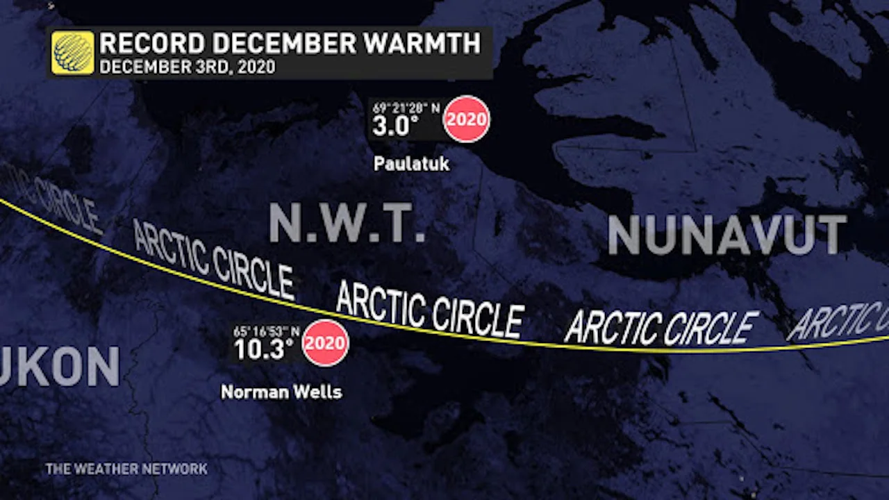
For double-digit warmth to surge towards the Arctic Circle, as experienced by Norman Wells, we look to the upper atmosphere as a probable culprit. The weak solar energy this time of year doesn't allow any appreciable solar energy to warm the surface. Therefore, it's necessary to advect warm air in from lower latitudes to have a shot at above freezing in the absence of sunlight.
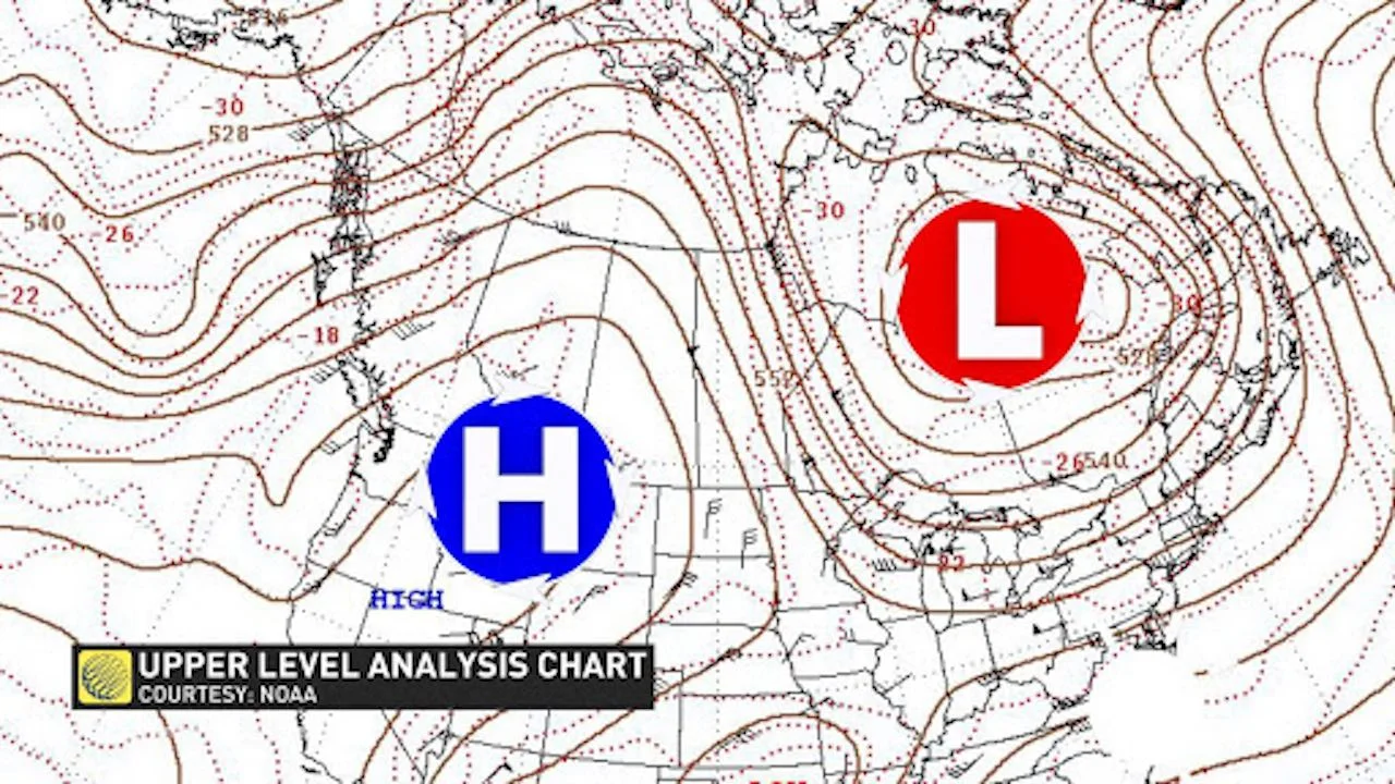
The Pacific jet stream, a region of strong winds aloft, carved a unique path towards the Arctic Ocean, bringing milder Pacific air towards the Canadian Archipelago.
Mild air deflected to the North because of a strong blocking ridge anchored across the Prairies, bulging north towards the Arctic Circle. Here's a sample of the unusually anomalous upper-level weather pattern:
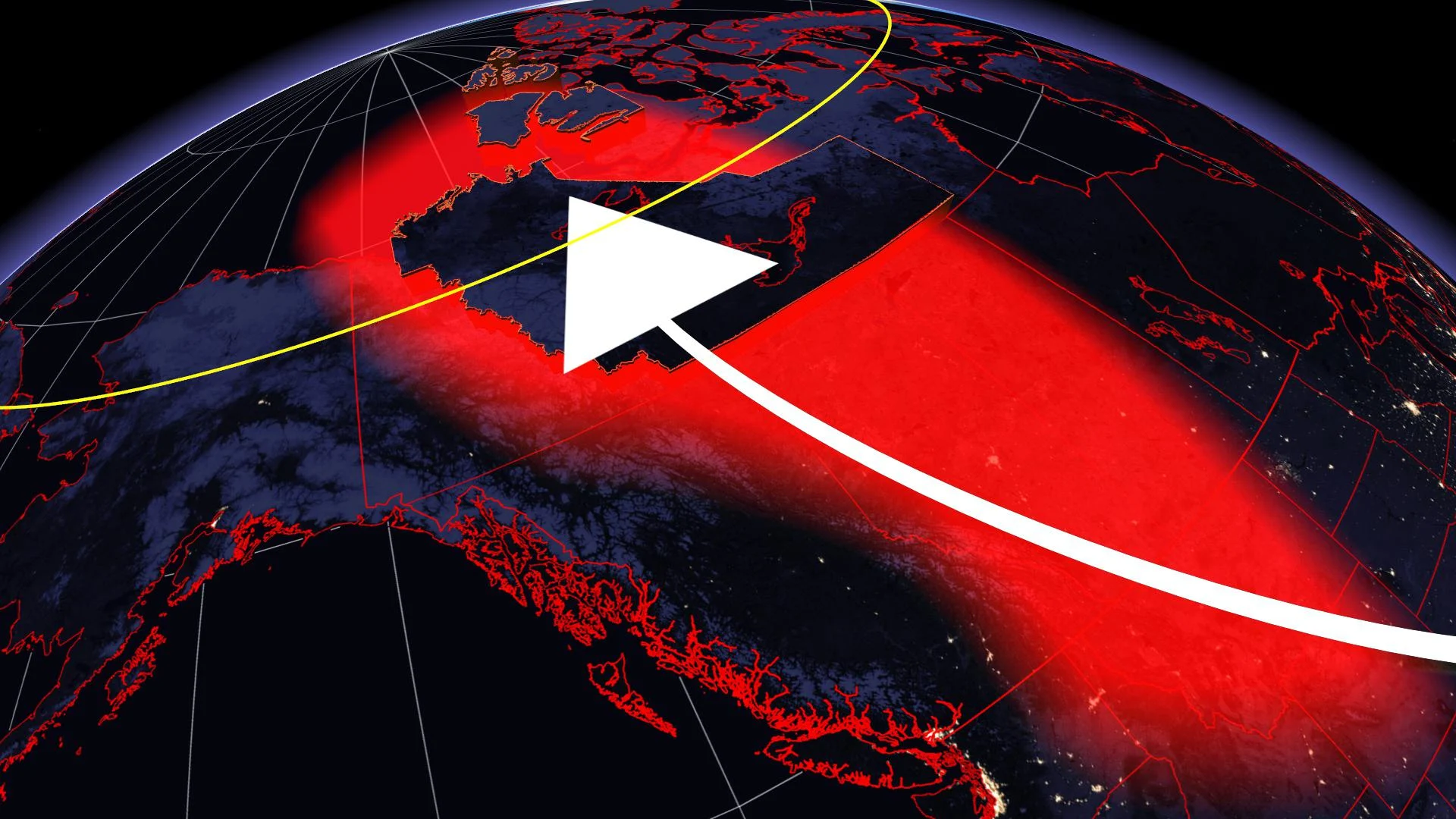
That translates to warm temperatures above the surface. Take a look at the temperature anomaly just above sea level. The bright red is the definition of off the charts, or in this case, outside the given climate record.
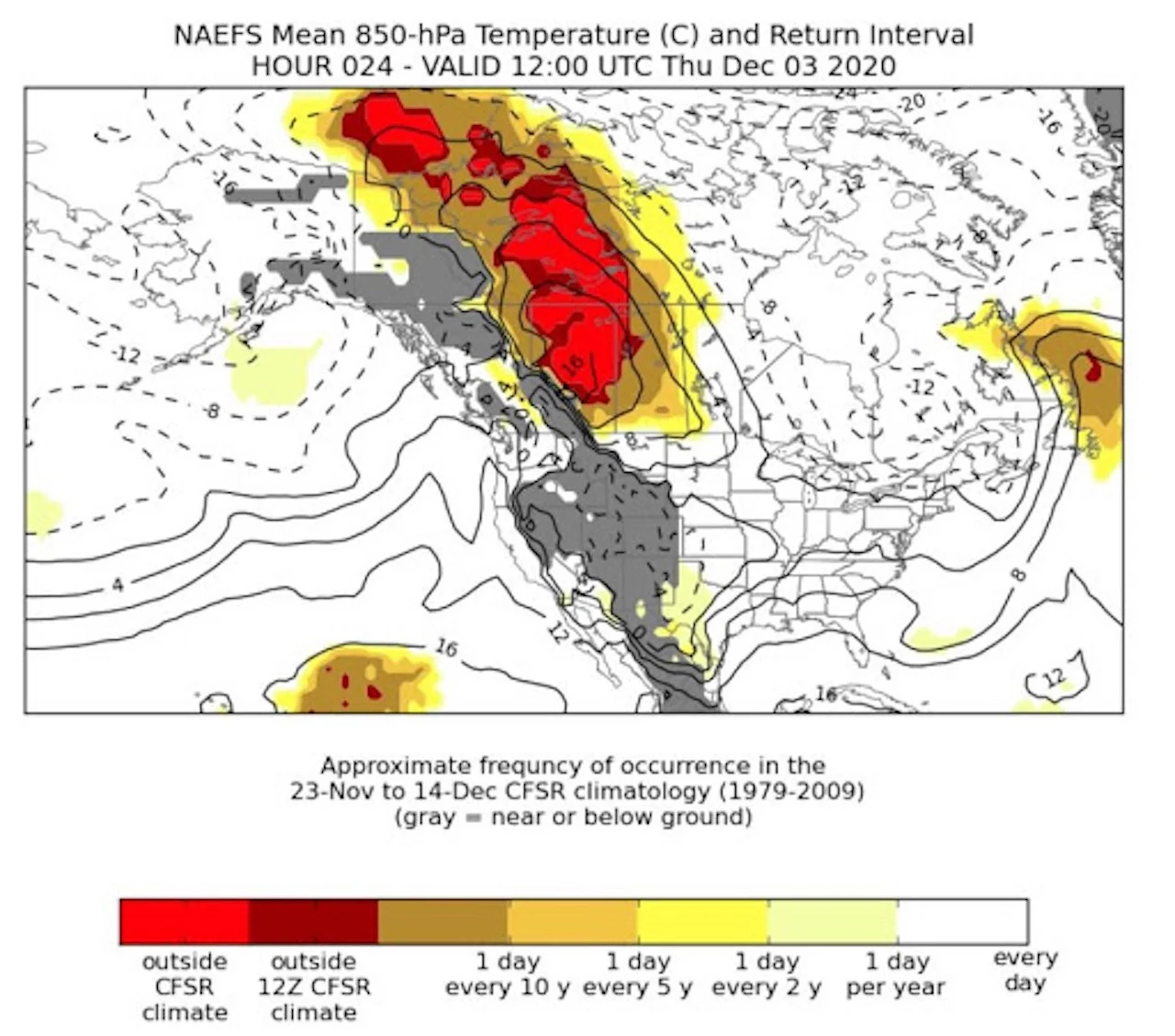
At the surface, a low-pressure system developed along the boundary of warm and cold temperatures. Consequently, this was the final key to the record warmth puzzle.
The higher terrain north of Great Bear Lake slopes towards the Amundsen Gulf, similar to the periodic warmth experienced across Alberta with distinct downsloping winds – home of the famous chinook. The parcels of air warm and compress on the descent.
The true extent of the anomaly is on full display, as experienced by the remote community of Norman Wells. For the first time in December, the mercury soared to over 10°C, obliterating the previous warmest December day by a longshot.

Of the more than 2,300 December days in the climate record for the area, only 13 have crested the freezing mark – that is until this month. Dec. 2, 3 and 4 all featured days above freezing, a truly unprecedented feat.
Temperatures as of late have fallen back into the typical range of climatology for Northern Canada, with bitterly cold, below seasonal temperatures building in over the next 10 days.


