A May to remember: Relive Canada's wildest weather moments
From a rapid-fire tropical storm, to the first tornado of the season forming on placid Vancouver Island, this past May has been one for the books.
In just 31 days in May, Canada's weather veered from the somewhat absurd to the unbelievable. Relive these exceptional May weather moments that kept meteorologists busy, and yes, sometimes a little perplexed.
May 6th-12th: Yukon vs. Ontario
We won't soon forget this weather duel, where anomalous warmth spread north of the Arctic Circle, making the shores of the Arctic Ocean balmier than along the edge of Lake Ontario.
May 8th-9th: Coldest temperature anomaly on the planet, polar vortex pays Canada a rare May visit
Sudbury and North Bay recorded their coldest maximum high temperatures for May, nearly 20°C below normal.
Toronto recorded it's second coldest all-time May temperature at -4.7°C.
Toronto Island recorded five days with below-freezing temperatures. The island avoided a May freeze the previous 62 years, but that streak ground to a halt.

May 11th-12th: May snow, including rare thundersnow, tracked across southern Ontario
The cold airmass drifted through eastern Ontario with some pretty epic fanfare. The extremely cold air aloft and cold temperatures at the surface came together to produce thundersnow
On May 11th the City of Toronto recorded 2.8 cm of snowfall, the largest May daily snowfall event on record

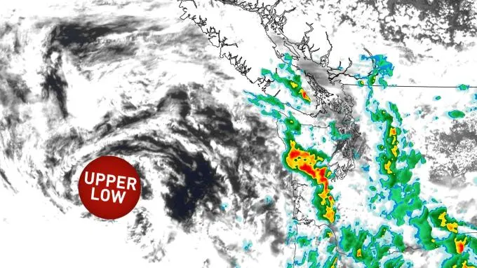
May 12th: Fascinating funnel cloud spins up in Vancouver
One of the most unsuspecting places to see such a cloud formation delivered the unexpected goods: a funnel cloud spun up near Vancouver
Non-supercell tornadoes can occasionally develop in the region, but it still caught many onlookers by surprise
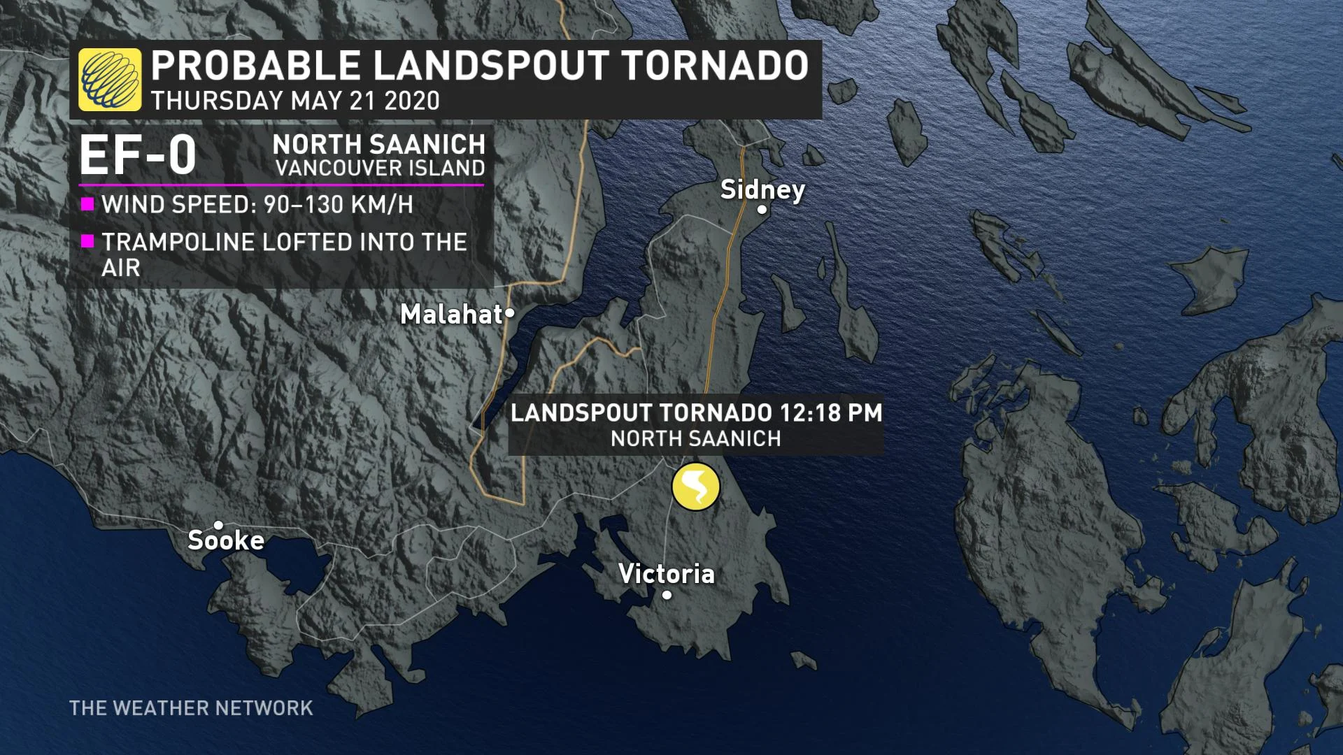
May 21st Canada's first tornado report ... on Vancouver Island?
Certainly, a rare sight, Canada's first confirmed tornado of the year touched down briefly in North Saanich, north of Victoria
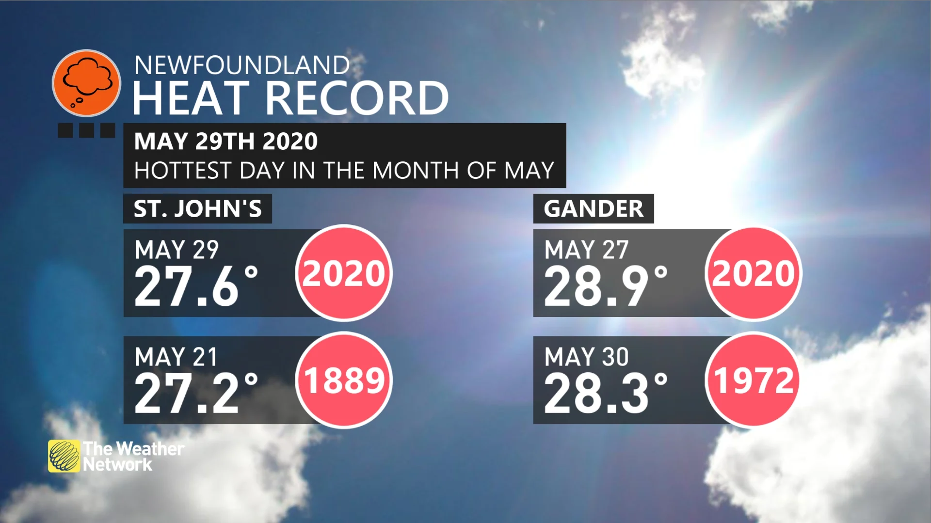
May 26th-May 29th: Extreme heat shatters impressive records across eastern Canada
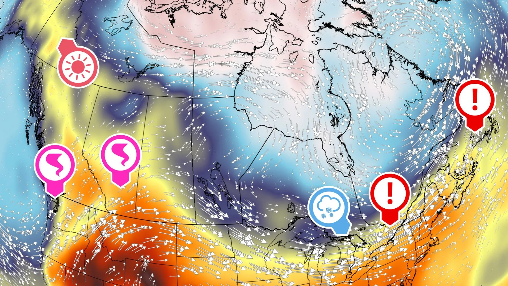
Coined the 'upside-down' weather pattern, this atmospheric configuration caused temperatures to surge to new heights in Ontario, Quebec, and Atlantic Canada
Ottawa and Montreal both recorded their second warmest May temperatures on record, both over 35°C
Bathurst, New Brunswick had two consecutive days of all-time May warmth, reaching 33.7°C by May 29th
St. John's and Gander also both broke all-time maximum temperatures for the month of May
May 27th & May 31st: Alberta nabs Canada's second and third confirmed tornadoes in the country
On May 27th, Alberta's first confirmed tornado of 2020 season occurred, near Mossleigh Alberta under a weak towering cumulus cloud. May 31st, another tornado was spotted southeast of Irricana, causing minor damage.
May 31st: Alberta barraged with numerous cloud-to-ground lightning strikes
An absolutely mesmerizing display of lightning through the pre-dawn hours of May 31st.
Storm cells west of the City illuminated the town of Cochrane.
thunderstorm cells tracked right across downtown Calgary, striking the Calgary Tower, jolting many people awake.
May 2020: Heavy rains heightening flood threats
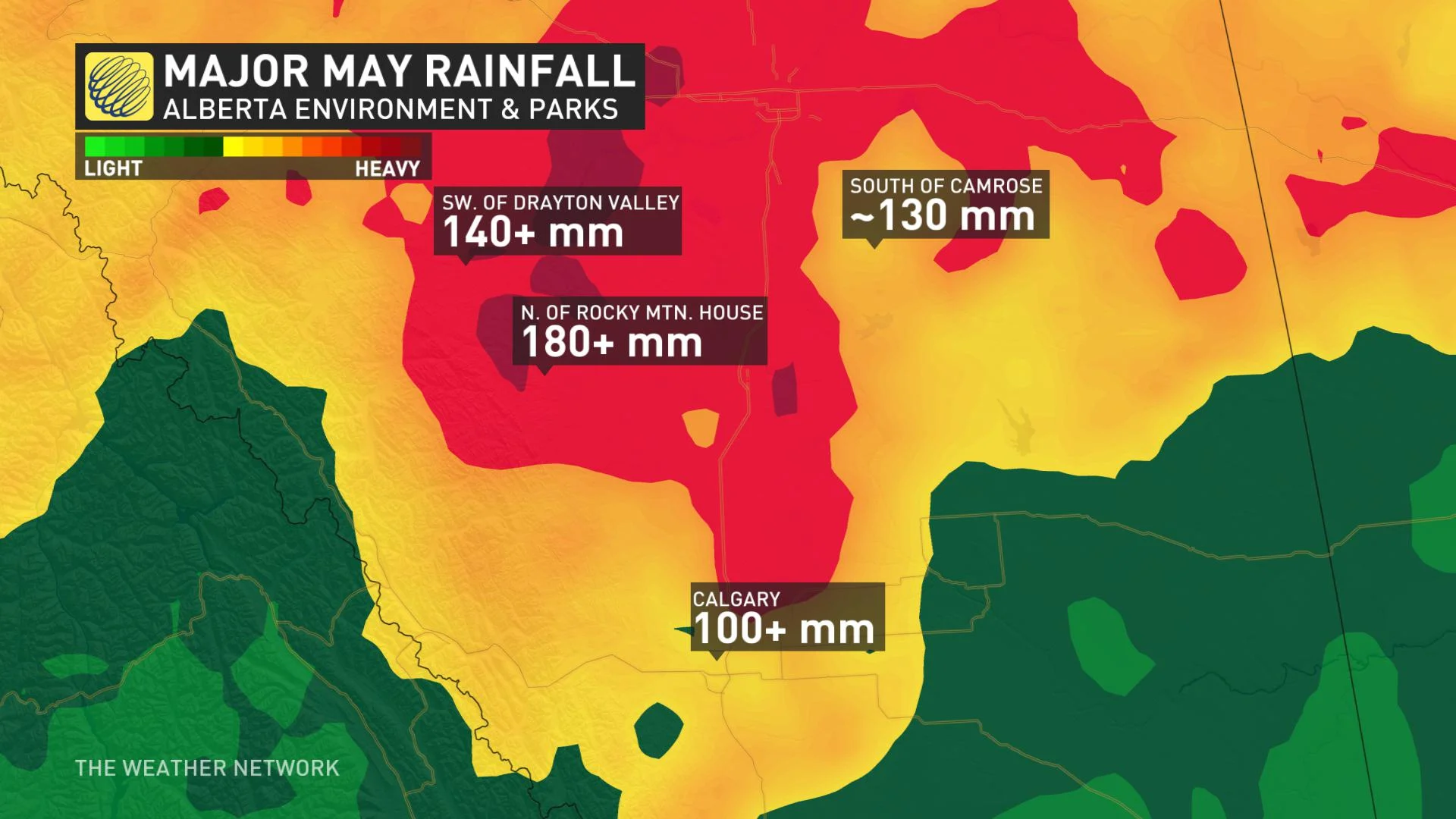
After the disastrous flooding events in Fort McMurray in late-April, Rainfall totals finished well above average for May, in some cases over 200 per cent of normal across parts of the province.
Stalling areas of low pressure near the Alberta and Saskatchewan border and several heavy bouts of stationary thunderstorms have pushed rainfall totals close to 200 mm in pockets of the province.
Long-range forecasts continue to hint at the active weather pattern continuing, heightening the June flood potential.
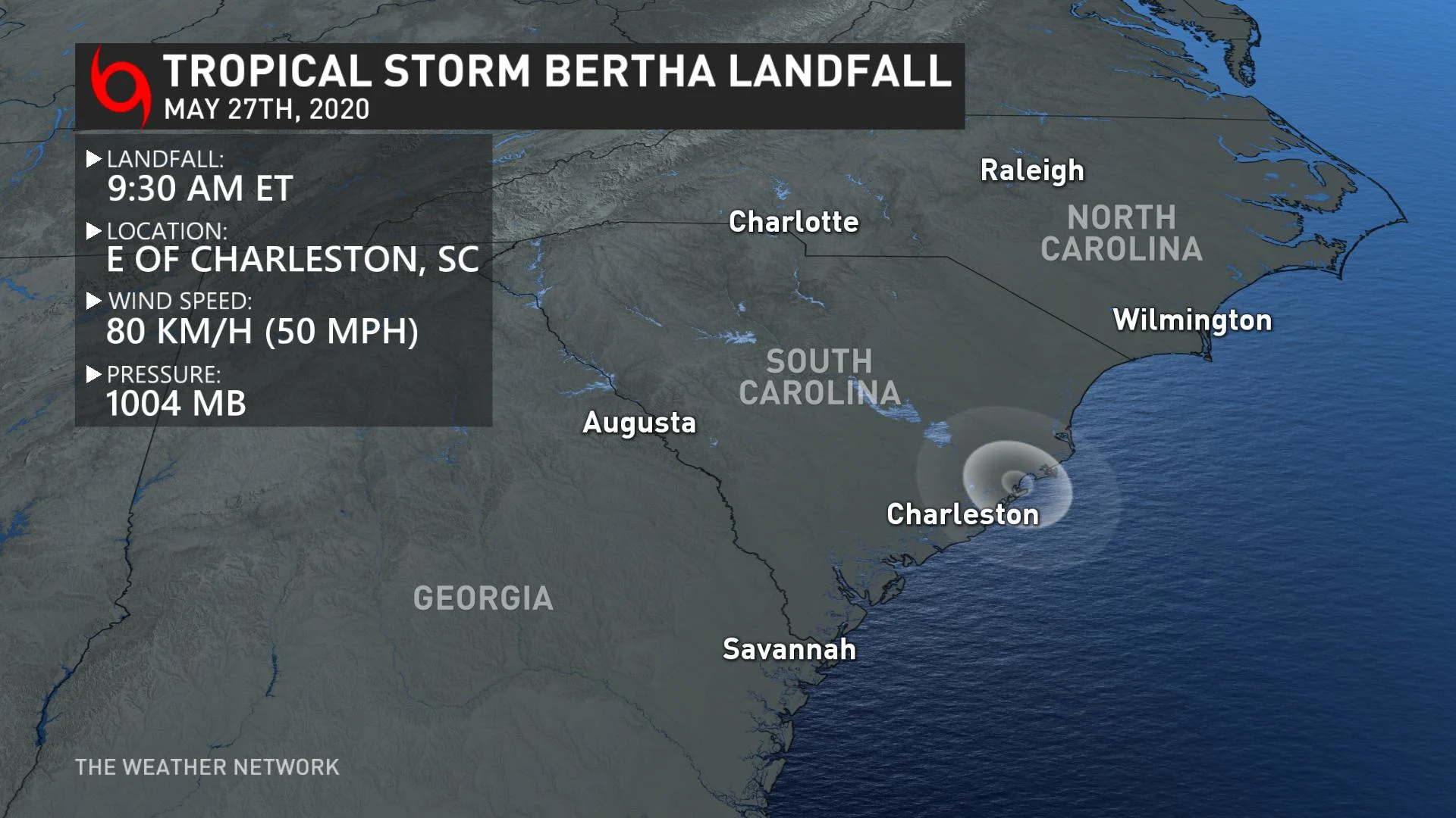
May 2020: The troubling tropical trend in May
The last time two named storms formed in May was 2012
Heightened tropical activity in May doesn't correlate well with the remainder of the season; nevertheless, the hurricane season is still anticipated to be quite an active one
Early June faces an increased threat of tropical activity in the Gulf of Mexico, as the remains of Tropical Storm Amanda from the Pacific swirled around a large scale atmospheric circulation pattern, coined the Central American Gyre
