Abnormal December heat may break records in Canada this week
By Wednesday, millions of Canadians will be feeling the warmth, with some locales in the country expected to be more than 20 degrees above normal
Some Canadians may be breaking out the T-shirts and shorts as temperatures soar, quite literally off the charts above normal. We're talking about a more than 20-degree temperature anomaly, which will have some feeling fall-like during the middle of December.
December has already been one for the record books in parts of Nunavut, so it's no surprise it could be for many other centres in Canada on Wednesday.
DON'T MISS: From blizzards to record warmth: Nunavut experiencing weather turmoil
A ridge, Pacific air mass and strong southerly flow will be the catalyst for an unusual, countrywide temperature swing that will unfold later this week. It will begin Wednesday in Canada's northwestern section, where record-breaking December heat may transpire.

For perspective, have a look at what is normal for this region of the country. For most, daytime highs on Dec. 13 are typically closer to the minus teens, if not into the minus 20s. But, instead, Wednesday's forecast projects 2°C to 6°C daytime highs. That is an absurd 20-23 degrees above-seasonal temperatures in Northwest Territories and parts of northern Alberta, too.
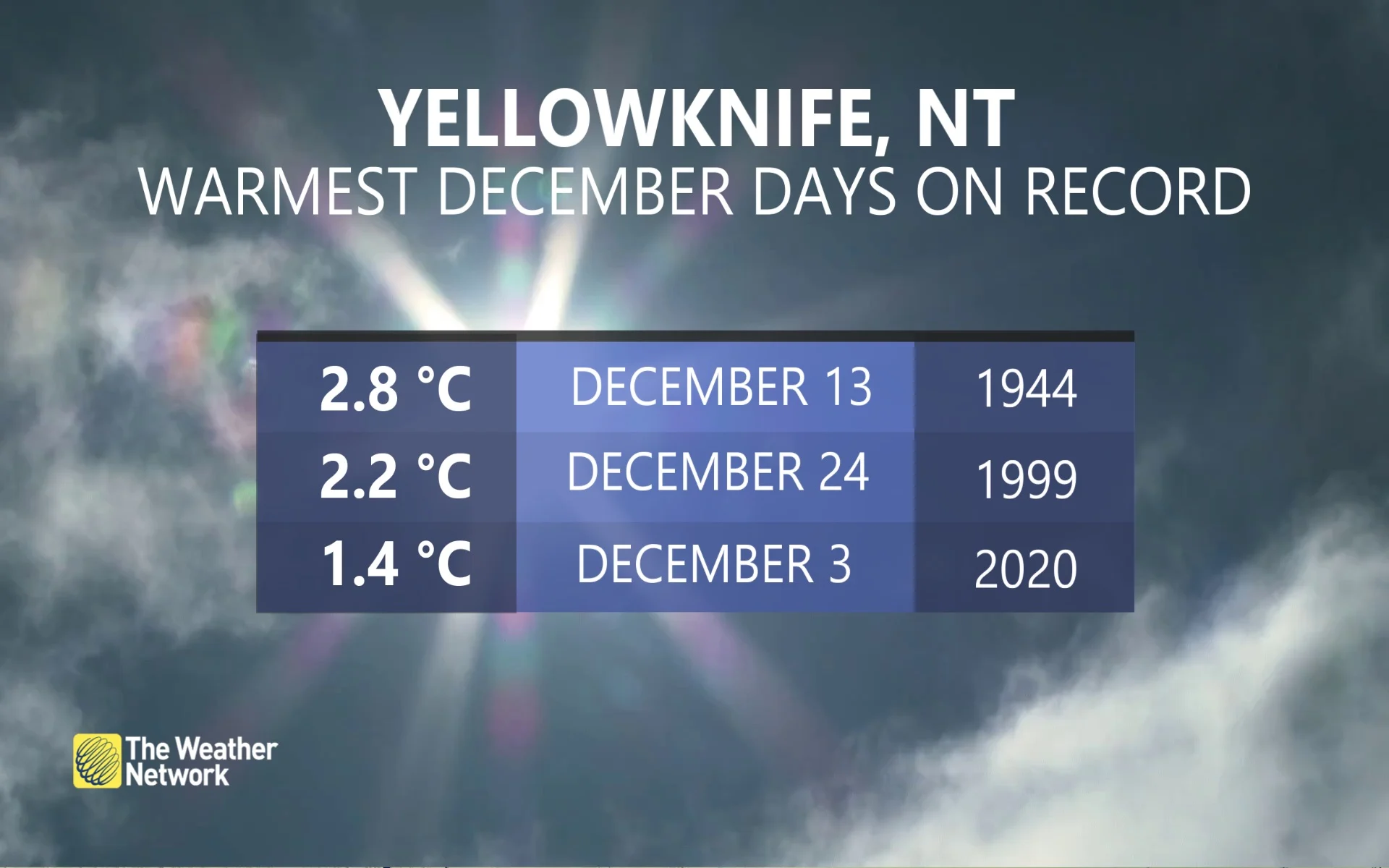
If it wasn't already clear, this is highly abnormal for December standards. Yellowknife, in particular, has only recorded five days above 0°C in December, with records dating back to 1942. We will likely add a sixth on Wednesday. The forecast for the city is 2°C.

The potential to crack the warmest December day is there, if temperatures can beat 1944's 2.8°C, which was also on Dec. 13.
Forecasters are closely watching for the December heat to spread east later in the week. It will lose steam, but will make for a seasonably warm and pleasant weekend in Ontario and Quebec come Friday.
With files from Rachel Modestino, a meteorologist at The Weather Network.
Thumbnail credit: Jaime Reimer/Pexels


