Sneaky "golf ball-size" snow catches Alberta off guard
Sneaky swath of snow catches drivers (and forecasters) off guard in southern Alberta
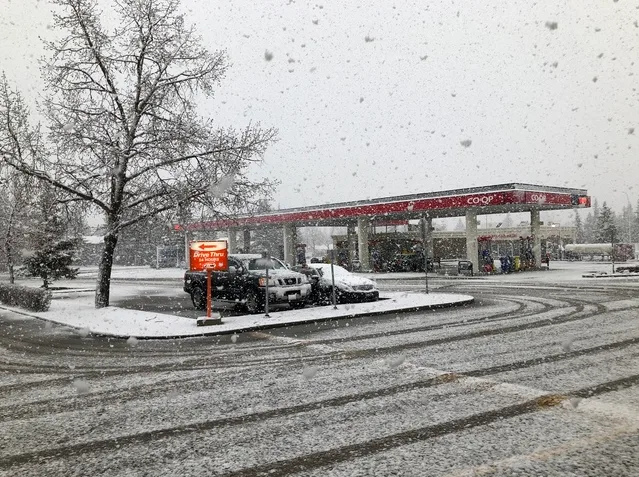
Just as much of western Canada earned bragging rights for more ideal spring conditions, especially in comparison to the recent wintry wallop in the east, a swath of sneaky snow blasted Calgary's metro area on Thursday. That's as a slow-moving, but potent disturbance lifted north through the region.
"We also saw some convective showers and thunderstorms southeast of Calgary on Thursday, changing over to snow as the precipitation moved upslope," says The Weather Network's Kyle Brittain who was caught in the thick of the fickle spring weather. According to Brittain, there were even "golf ball-sized snowflakes in Balzac," which he referred to as the "biggest clumps" he's ever seen.
DON'T MISS: Our country is warming two times faster than the rest of the planet. The Weather Network and Canada's leading experts on climate bring you 2xFaster, an exclusive series premiering Tuesday, April 16.
Conditions continued to deteriorate through the evening and overnight hours with Calgary police reporting multiple collisions and even a temporary road closure.
A stretch of a northwest Calgary road was closed for about three hours, due to an eight-car accident amid the snowy conditions.
HOW DID THIS SNOW CREEP UP ON US?
While Calgary Airport ended up only seeing 2 cm of snow, areas like Cochrane and Airdrie saw between 10-15 cm through the night.
"This kind of sneaky snow typically happens in Alberta because it's so elevation dependent," says Weather Network meteorologist Jaclyn Whittal. "The foothills can make a big difference in terms of getting 10-15 cm of snow or maybe just a dusting as a hill or a mountain can help sustain a snowflake all the way down to the surface."
A trough moving eastward could bring some additional snow to the foothills through Friday before a bigger system with a lot of Pacific moisture pushes through later this weekend.
"We'll see pleasant weather across the Prairies to start this weekend with sunshine and near to above seasonal temperatures," adds Dr. Doug Gillham, another meteorologist at The Weather Network. "However, a system will develop on Sunday and into Monday with some unsettled weather returning."
Stay with us here at The Weather Network for your latest forecast updates as we track these systems.


