Atlantic Canada next in line for a soaking, flood risk from Beryl remnants
Remnant moisture from Beryl continues to move eastward and will hit the East Coast with heavier rain on Thursday, raising the threat for flooding in some locales.
Remnant moisture associated with the once powerful, and deadly Hurricane Beryl has made its way through Ontario and Quebec, bringing torrential, flooding rains.
Now, as the remains from the powerful system continue to track eastward, its sights are set on Atlantic Canada before making its final exit.
Special weather statements and rainfall warnings are in place across the Maritime provinces.
"Heavy downpours can cause flash floods and water pooling on roads. Localized flooding in low-lying areas is possible," Environment and Climate Change Canada (ECCC) says. "If visibility is reduced while driving, slow down, watch for tail lights ahead and be prepared to stop."
SEE ALSO: Get ahead of disaster: Six tips to manage flooding
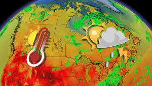
Beryl remnants track through to the Maritimes
Rain and embedded thunderstorms began across the Maritime provinces Wednesday night. By Thursday morning, the rain fully spread through New Brunswick and into Prince Edward Island, as well as Cape Breton in Nova Scotia.

Rainfall amounts are likely to be highly variable, but with some of the harder hit areas, such as central New Brunswick could see 50-100 mm of rainfall by the time all is said and done. Elsewhere in New Brunswick and PEI, folks can see 30-50 mm.
The dry spot in the Maritimes on Thursday and Friday will be the majority of Nova Scotia, where major locales such as Halifax will see no significant rainfall. This probably comes as a sigh of relief for residents as the city has already been subject to several major rainfall events.
DON'T MISS: Colorado State University increases forecast for number of hurricanes in 2024
Newfoundland and Labrador will also be getting a healthy amount of rain, which will greatly help out the province's wildfire danger rating.

The intense rainfall rates could impact travel, with drivers being urged to leave plenty of extra time for commuting. Avoid driving through flooded roads, especially underpasses.
The heavy rains could also lead to high river levels and possible overland flooding.
Stay with The Weather Network for more forecast information and updates on your weather across Atlantic Canada.