Atlantic: November kicks off with rain, damaging winds
Heavy rain and powerful winds will make a mark on much of Atlantic Canada by Friday
After a soggy Halloween, the month of November is set to roar into the East Coast, with lingering downpours and damaging winds up to 100 km/h for some areas. More on the timing of this far-reaching and potent storm, plus a look at the fierce winds that close out the month of October, below.
WEATHER HIGHLIGHTS:
Widespread rain and gusty winds for Friday
Some lingering showers in Newfoundland Saturday morning as the Maritimes clear
Stay up-to-date on the ALERTS in your area
As a potent upper-level trough digs south over the south-central U.S., a stream of southwesterly flow up the Eastern Seaboard will pump significant moisture into Atlantic Canada through Friday.
The beginning of an elongated boundary arrived early Thursday morning, and by Friday morning, the rain will still be falling over much of the Maritimes.
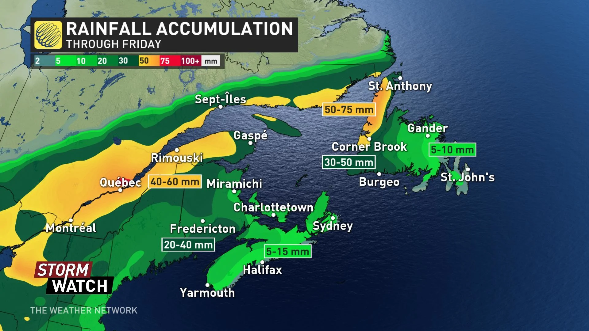
"The heavier periods of rain are expected Thursday overnight into early Friday morning as the system's centre tracks over the area with upwards of 50 mm possible in the hardest-hit areas," Sonnenburg says.
In Newfoundland, the heaviest downpours will be on the Northern Peninsula.

Breaks in the rain are expected through the day on Friday, as well as rising temperatures into the upper teens.
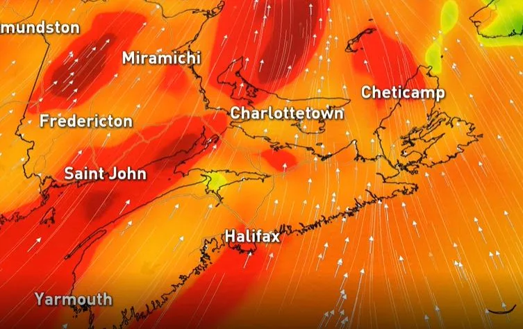
Winds will remain powerful, however, with gusts between 60-80+ km/h, especially along the Fundy Shores and southern shores of Nova Scotia, where gusts could exceed 100 km/h.
By late Friday night, the bulk of the system will depart the region with just some lingering rain showers Saturday morning in Newfoundland. Winter storm watches have been issued for parts of Labrador, however, as heavy snow pushes into the region and threatens 20+ cm through Saturday morning.
Colder than seasonal temperatures will then spread across the region by early next week, although with a period of milder weather ahead of the weekend.


