Atypical warmth, gusty winds and rain seeps into Ontario and Quebec
Impressive warmth will filter into southern Ontario and Quebec Tuesday, potentially setting November records as daytime highs soar into the teens and low 20s for some. However, the bonus warmth will come with rain and strong wind gusts
A wet, windy and mild start to the week is expected in Central Canada, as a Texas low makes its way through the region.
While Tuesday and Wednesday will be gusty, with some periods of rain, at least the temperatures will be mild, potentially reaching historic values in parts of southern Ontario as a result of the strong, southerly winds surging in with the Texas low.
DON’T MISS: What if Ontario's looming November warmth was cold instead? Imagining 30 C flip
That kind of warmth doesn’t happen on its own this time of year. Exceptionally warm air has to be imported from down south, so it’ll be very windy at times as the Texas low pushes through the region.

This week:
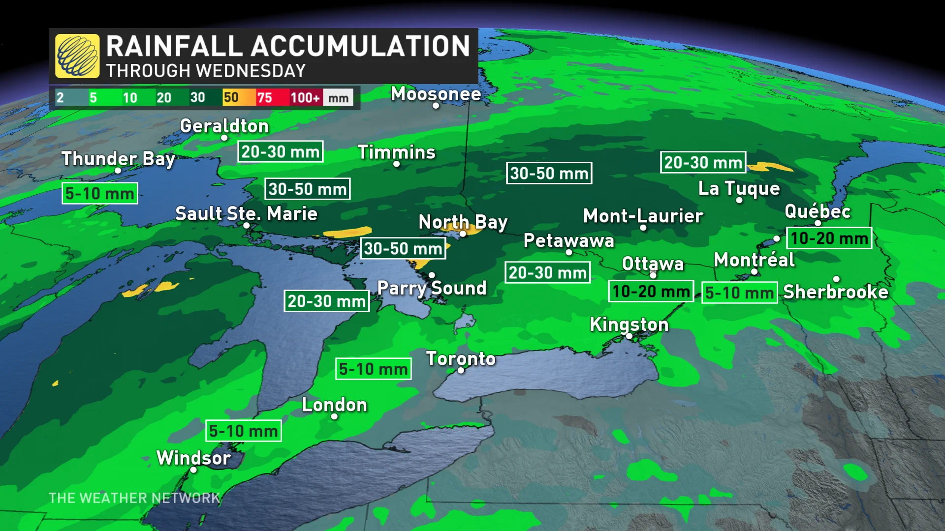
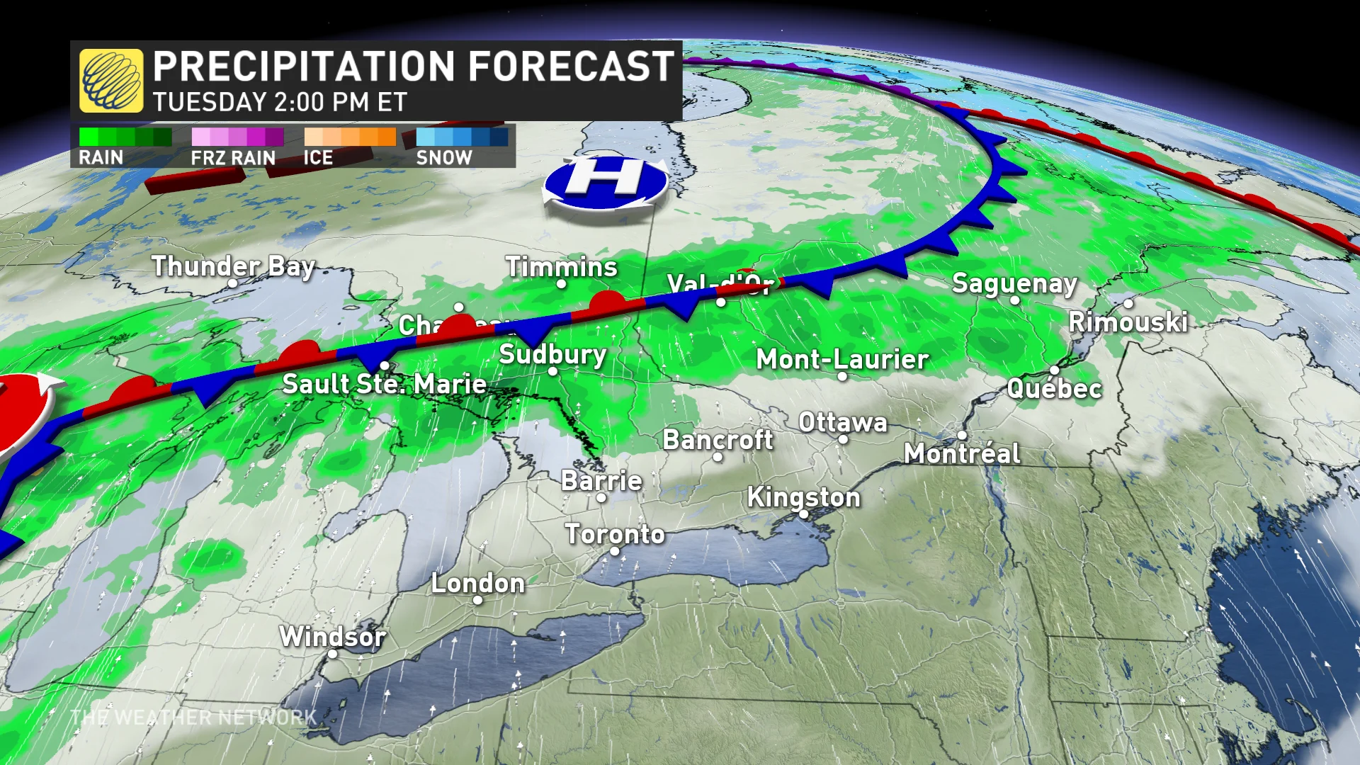
Another round of rain moves into central and northeastern Ontario, as well as western Quebec, on Tuesday. It will be short-lived, with rain ending in the overnight hours and Wednesday morning, respectively.

The heaviest swath of rain will be 30-50 mm, so drivers should be mindful of possible ponding on roads.
Gusty, but mild winds across the south
With the system to the north, this will allow mild temperatures into southern Ontario and Quebec once again, with daytime values stretching into the 20s.
Gusty, but mild, winds will develop through the day on Tuesday for southern Ontario, reaching speeds of up to 50-60 km/h, with some areas reaching upwards to 70 km/h. Gusty conditions can lead to localized power outages.

For southern Quebec, wind gusts will reach the same speeds, but will pick up Tuesday night and peak Wednesday morning.
A cold front will eventually pass through southern Ontario Tuesday overnight into Wednesday morning, bringing broken patches of rain and accompanied with gusty winds. It will bring rain to southern Quebec, too, ending Wednesday afternoon.

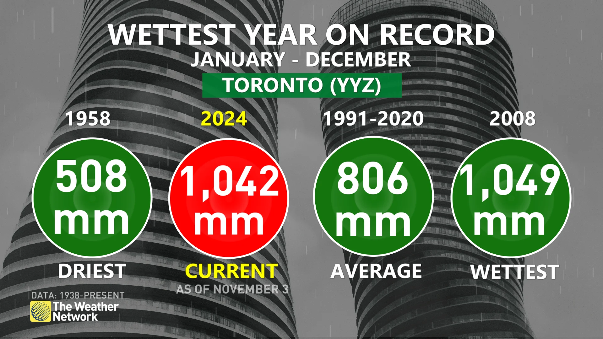
As Toronto crawls to the finish line on the wettest year on record, not much rain is forecast for the Greater Toronto Area (GTA), with just a few millimetres at most.

The next system to watch will be yet another Texas low, which is expected to track to near Lake Superior on Sunday. That should bring an increasing threat for rain into Sunday night and into Monday morning. Above-seasonal temperatures will dominate through mid-November, but an active pattern is expected to return during mid-month.
Stay with The Weather Network for all the latest forecast updates for Ontario.
Thumbnail courtesy of Unsplash.


