Summer’s muggy heat surges and wanes across Canada this August
August is a bittersweet month for summer-lovers and autumn-adorers alike. We’re still in the heart of summertime weather, but the eve of back-to-school season and proximity to September starts to ruffle feathers for colourful foliage and cozy sweaters.
The month ahead will bring a mixed bag for the country, with some areas enduring persistent heat while others get a well-deserved reprieve, even if it’s on borrowed time.
While fall is around the corner, we’ve still got a bit of road to go before this summer’s off-ramp comes into view. Read on for a taste of what August weather has in store for you across Canada.
DON’T MISS: July 2023 set to be world's hottest month on record
Western Canada
It’s been a hot summer for much of North America so far this season, and the heat hasn’t spared the western half of Canada. Persistent ridges building over the west have allowed temperatures to climb to record territory at times while an unprecedented wildfire season rages in British Columbia.
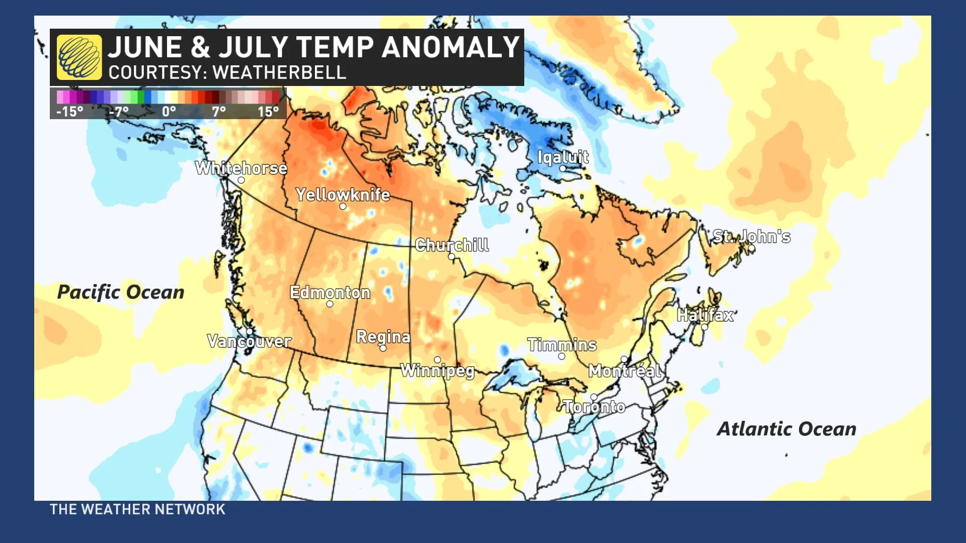
Fort Good Hope in the Northwest Territories saw a searing afternoon high of 37.4°C on July 8, going down in history as the hottest temperature ever recorded in Canada’s Far North. The town sits just a few kilometres south of the Arctic Circle.
Making matters worse in July was a tremendous heat dome over the western United States that occasionally slid north of the border, allowing highs in the upper 30s to seep into Western Canada at times.
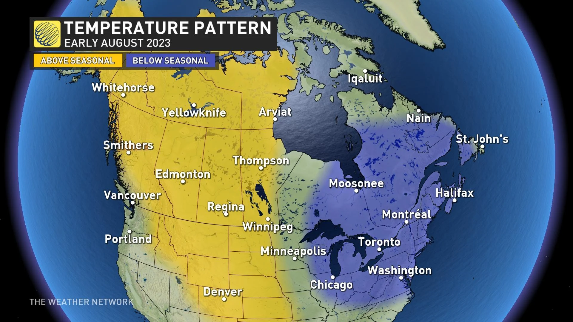
This pattern is likely to continue through the first half of August, with additional ridging over western North America bringing stretches of above-seasonal temperatures to B.C., the western Prairies, and the territories.
Eastern Canada
August will start on a very different note from what we saw through most of July across the eastern half of the country.
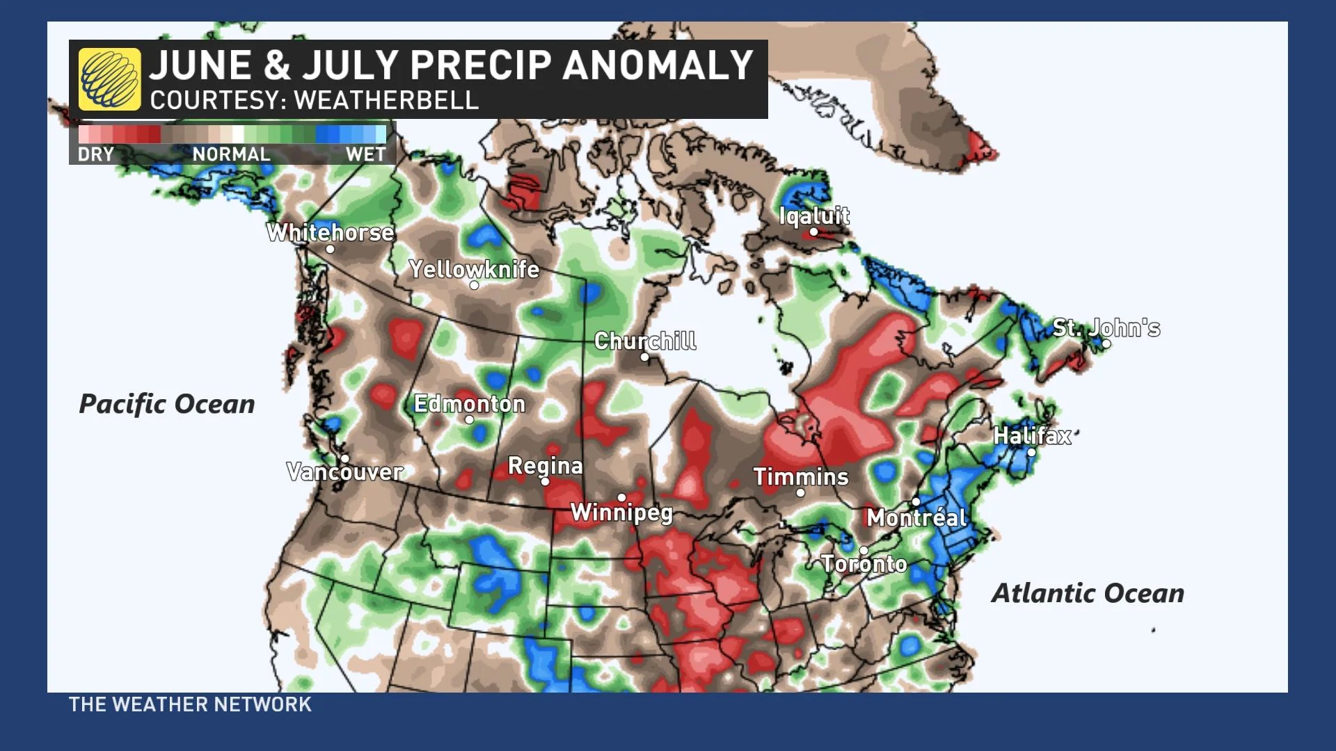
A glut of tropical moisture flowing into Eastern Canada through July brought unforgiving humidity that led to warm nights and remarkable deluges. The surge of moisture fuelled prolific rains that broke monthly and all-time records from Quebec to Nova Scotia, the latter of which saw catastrophic flooding when thunderstorms produced an entire summer’s worth of rain in just a few hours.
MUST SEE: Nova Scotia flood catastrophe — what went wrong?
Stepping outside will feel like entering a different season for much of Eastern Canada as we start August. A hefty trough dipping over the region will bring temperatures far enough below seasonal that some may need to break out their jackets.
But fear not, summer lovers—this premature taste of fall won’t stick around forever.
While the beginning of the month will start off with an unseasonable cooldown, feverish sea surface temperatures across the Atlantic Ocean should help a ridge of high pressure build over the region, shoving that trough back toward the west and pushing temperatures above seasonal again by mid- to late-August.
The strength of this ridge over the Atlantic will determine just how far west the trough and its cooler weather moves. A stronger ridge would push warmer and wetter conditions closer to Montreal.
The return of warmer, muggier air will likely mark the return of above-seasonal rainfall along the East Coast, bringing additional soakings to communities already desperate for a chance to dry out from the past month’s deluges.
Central Canada
With above-seasonal temperatures likely in the cards for both coasts this month, what will August have to offer for Central Canada?
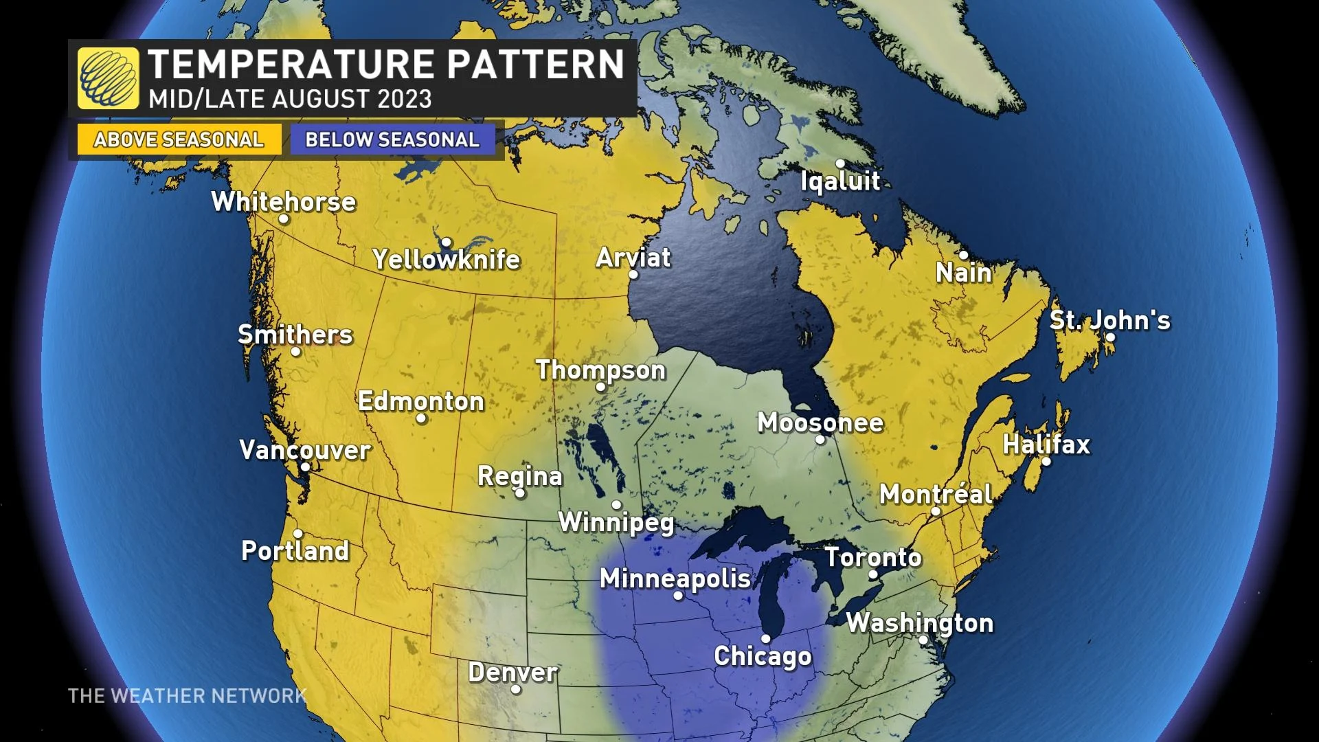
Ontario and Quebec endured waves of severe weather through July as one trough after another moved through the region. This pattern should will take a bit of a breather during early August. While we will continue to see occasional showers and thunderstorms, these hard-hit regions will get a much-needed break from the frequent rounds of severe weather and torrential rain.
August will start with below-seasonal temperatures for much of Central Canada as a trough settles into place to begin the month. But this does not mean that we are finished with muggy weather for the summer.
That ridge over the East Coast will force the trough to retreat toward the western Great Lakes by the middle of the month, allowing near-normal temperatures (even above normal at times) and an active storm track to return to much of Ontario and Quebec during the second half of August.
WATCH: Why the Nova Scotia floods were so catastrophic
(Header image courtesy of Catherine McLeod/Submitted)


