A turbulent July promises smoke, storms, heat, and drought across Canada
Will excessive heat be a concern again as we enter the heart of summer? Here's a first look at your forecast across Canada this July
The heart of the summer season is finally here!
Across most of Canada, July is typically the warmest month of the year. However, for a few coastal locations—such as St. John’s, Newfoundland; Sydney, Nova Scotia; and Tofino, British Columbia—August is typically slightly warmer.
While the warmer weather provides many opportunities to get outside to do a wide range of activities and to enjoy the beauty of our great country, we also know that too much heat causes great hardship as well.
Will excessive heat be a concern again during the upcoming month? To find out, please read on for a look at our July forecast.
Visit The Weather Network's wildfire hub to keep up with the latest on the active start to wildfire season across Canada.
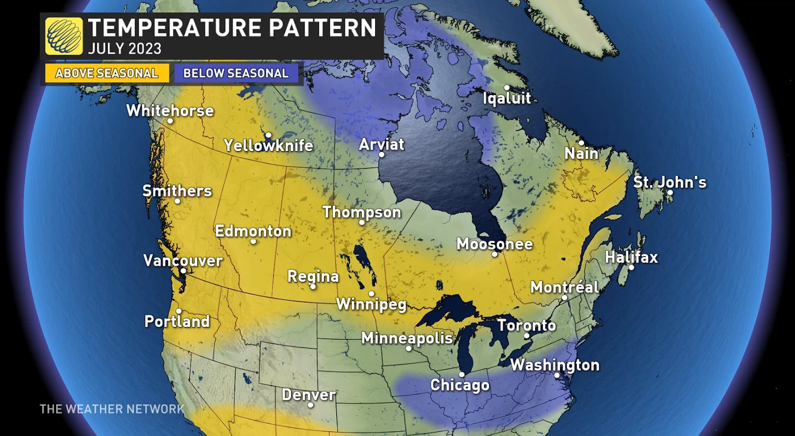
Across most of Canada we expect near-normal or warmer-than-normal temperatures for the month of July. However, we expect less extreme and less persistent heat than what we have endured during many recent summers.
Here is a look at our temperature forecast for the month of July.

For most areas where we expect warmer-than-normal temperatures, we still expect breaks from the heat with shots of cooler weather at times and minimal extreme heat.
DON'T MISS: Best practices to keep yourself safe from wildfire smoke
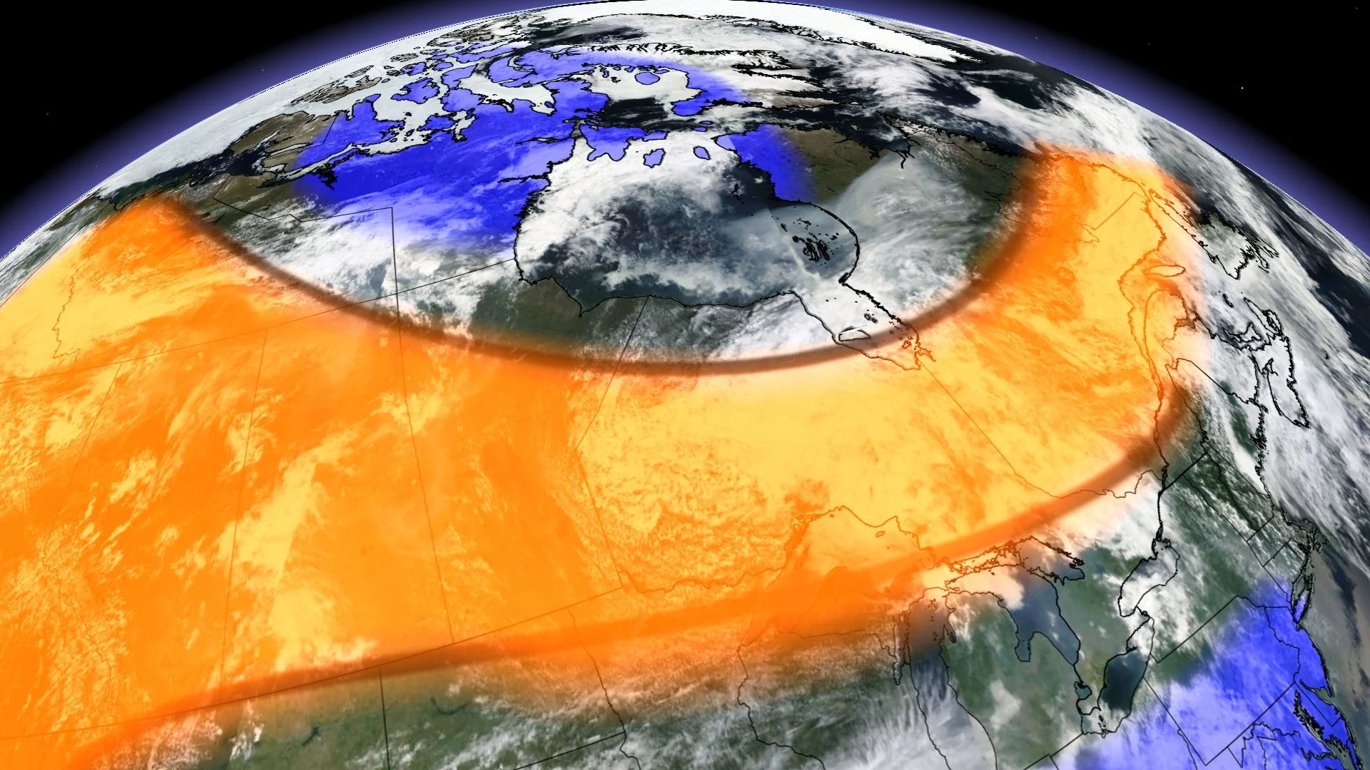
The region with the highest risk of seeing more persistent heat, and even some extreme heat at times, looks to be across parts of Western Canada, especially southern B.C.
From the Great Lakes to Atlantic Canada we expect periods of warm and very humid weather during the first half of the month, but an active and stormy pattern should keep daytime temperatures from being consistently hot across much of the region.
However, as we get deeper into July, we are watching the potential for a more consistent dip in the jet stream to set up over Ontario and Quebec with shots of cooler weather at times.

STAY SAFE: Don’t fall victim to these seven dangerous tornado myths
However, confidence is still low as to how quickly this pattern will develop. Most models show warmer-than-normal temperatures dominating through the end of July. However, we are seeing indications that the cooler pattern could develop during mid-July.
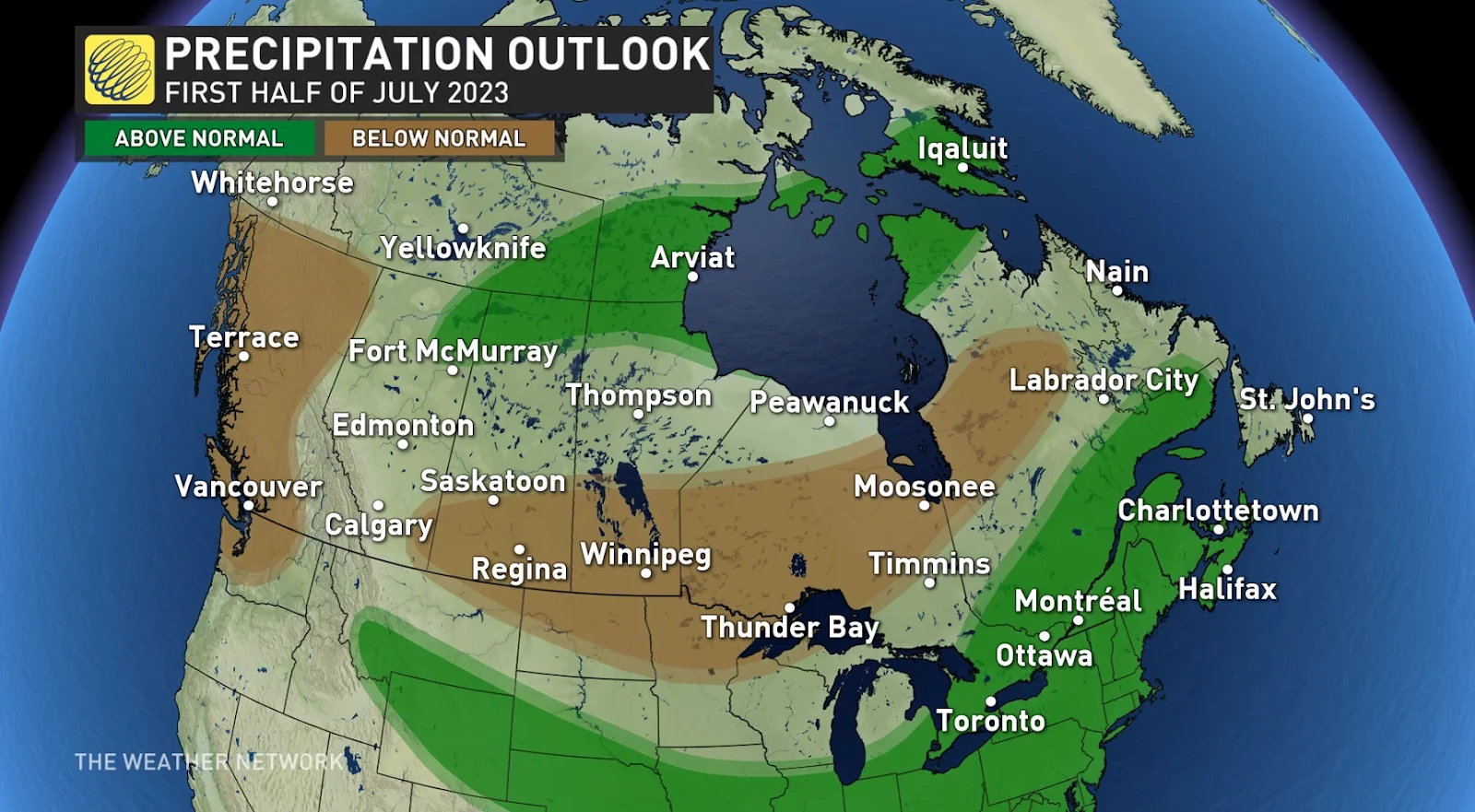
During at least the first half of July we expect an active and stormy pattern across southern Ontario, southern Quebec and into parts of Atlantic Canada. This should bring near-normal or above-normal precipitation to most of that region.

MUST SEE: Canadian wildfire emissions reach record high in 2023
Meanwhile, a drier pattern is expected across most of Western Canada, but this region should still see some rain at times from thunderstorms. This pattern is expected to persist through most of July.
Unfortunately, many of the areas where wildfires continue to burn will not see enough rain to extinguish the fires. Therefore, smoke and poor air quality will continue to be a major concern at times through July.
Stay with The Weather Network as you make your summer plans all across Canada.


