Canada’s thaw continues: When will winter stage a comeback?
From cold to snow, here are the major weather highlights for the month of January.
Winter has hit the pause button. During the final week of December, our weather pattern flipped from wild to mild with warmer-than-normal temperatures spreading across most of Canada.
The various shades of orange, red and brown on the temperature anomaly map below highlight that most of North America has been warmer than normal for the past week.

This is a dramatic pattern change from what we saw during most of the month of December.
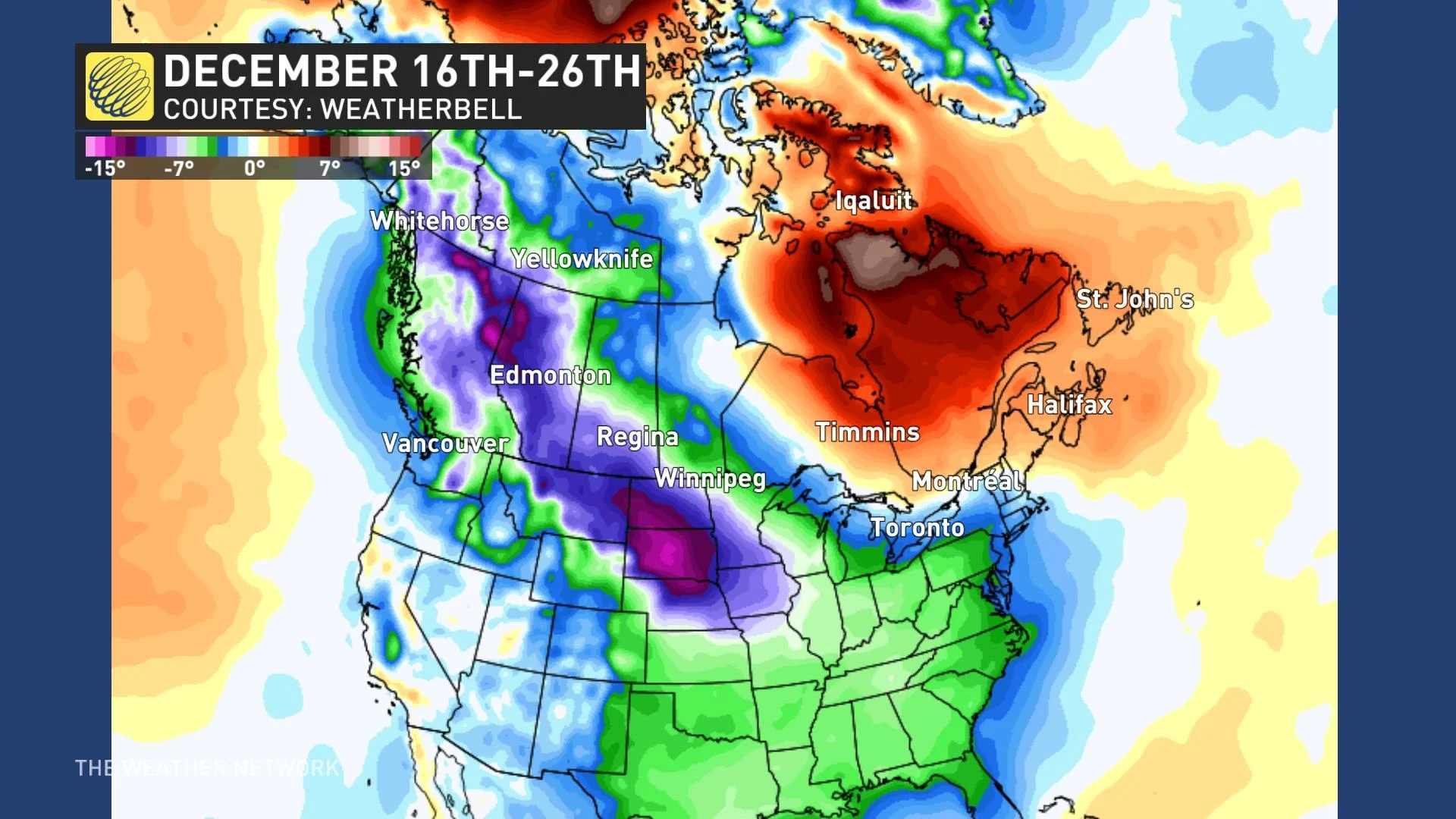
Winter started quickly across Western and Central Canada with colder-than-normal temperatures west of the Great Lakes during most of December. The cold weather was especially severe during the 10 days leading up to and through Christmas.
The various shades of blue, green, and purple on the temperature anomaly map below show that much of North America (except for the area from northern Ontario to Atlantic Canada) was much colder than normal between December 16 and December 26.

While the cold weather allowed most Canadians outside of Atlantic Canada to have a white Christmas, winter storms severely disrupted Christmas travel plans.
However, while many were enjoying a break from work and school, winter also began an extended break, and it does not appear to be in any hurry to return.
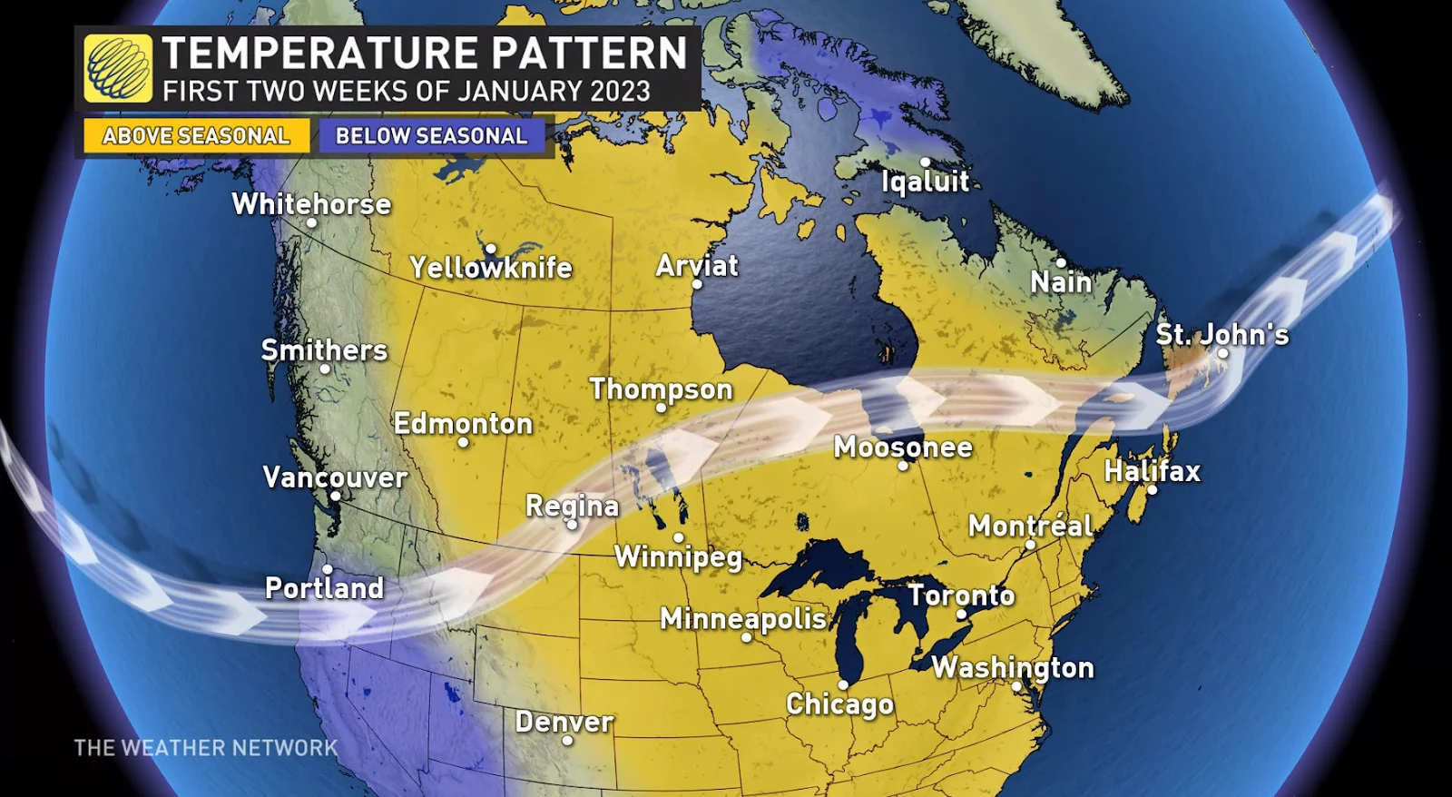
Mild Pacific air will continue to spread across most of Canada during the first two weeks of January with minimal Arctic air available to plunge south. Therefore, we expect that above-seasonal temperatures will continue to dominate across most of Canada during the first half of January.

However, keep in mind that for most of Canada, January is the coldest month of the year, so high-impact winter weather can still occur in a mild pattern, especially for areas that are further to the north and away from coastlines (both Atlantic and Pacific). Across most of Canada, temperatures can be well above normal and still be cold enough for snow and ice.
Mid and late January: Does winter stage a comeback?
During the second half of January, we expect that winter will attempt to stage a comeback. However, the strength of that comeback is still highly uncertain.
There are numerous variables that we analyze around the globe for clues as to how the jet stream pattern will evolve during the weeks ahead. Unfortunately, those variables are currently giving us some strongly opposing scenarios regarding the jet stream pattern for mid- and late January.
One possible scenario is that the very mild early January pattern will continue to dominate most of the month.
However, it is also possible that the jet stream will trend back towards a pattern that resembles what we saw during December with another extended period of colder-than-normal weather.
Often when we are faced with strongly opposing signals regarding the long-range pattern, we end up seeing a more changeable pattern with neither extreme being able to take over the weather pattern for an extended period.
That is the outcome that we currently favour with our forecast for the second half of January shown below. We expect that western and central Canada will be near seasonal during the second half of January as a result of back-and-forth swings in temperature. Meanwhile, we expect that much of eastern Canada will tip to the mild side of seasonal.

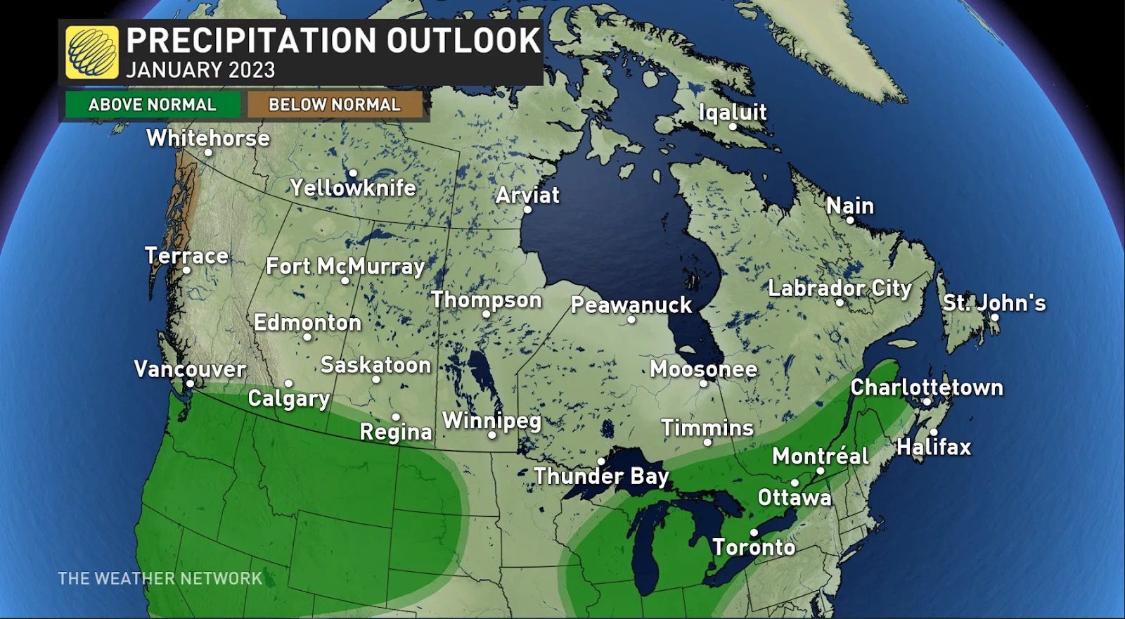
A strong jet stream over the Pacific Ocean is expected to bring an active storm track into the west coast of North America. While storms will track south of the border at times, the jet stream will meander north and south during the month and should deliver enough storms to bring near-normal or slightly above-normal precipitation totals to the South Coast region of B.C., including Vancouver and Victoria.

An active storm track is also expected across most of the Great Lakes region, the St. Lawrence Valley and into parts of Atlantic Canada. However, several of these storms will bring rain or a mix of rain, ice and snow, especially across southern parts of the region.


