Canada’s solar eclipse forecast may hinge on cold air in Asia
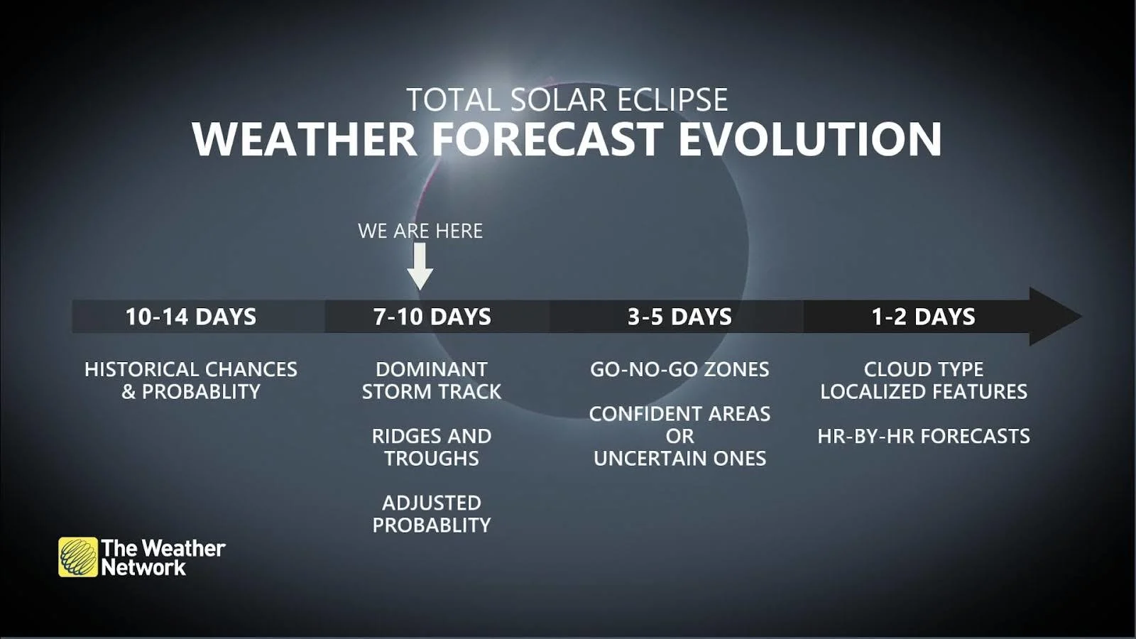
The solar eclipse is less than ten days away and we’re starting to get solid clues about how conditions will shape up along the path of totality on April 8
We’re now less than 10 days out from the total solar eclipse on Monday, April 8. Millions of folks across Canada and the U.S. plan to travel into the path of totality, which cuts across portions of Ontario, Quebec, and the Atlantic provinces.
The big day is close enough that weather models are finally in range to start sorting out the general patterns expected to criss-cross North America that afternoon. Clouds are the all-important factor for viewing this cosmic splendour.
It’s too soon for anyone to accurately or confidently issue a precise cloud forecast. But forecasters can see how conditions across North America that day are likely to hinge on the evolution of an active pattern halfway around the world in Asia.
DON'T MISS: Everything you need to know for April's spectacular and rare solar eclipse
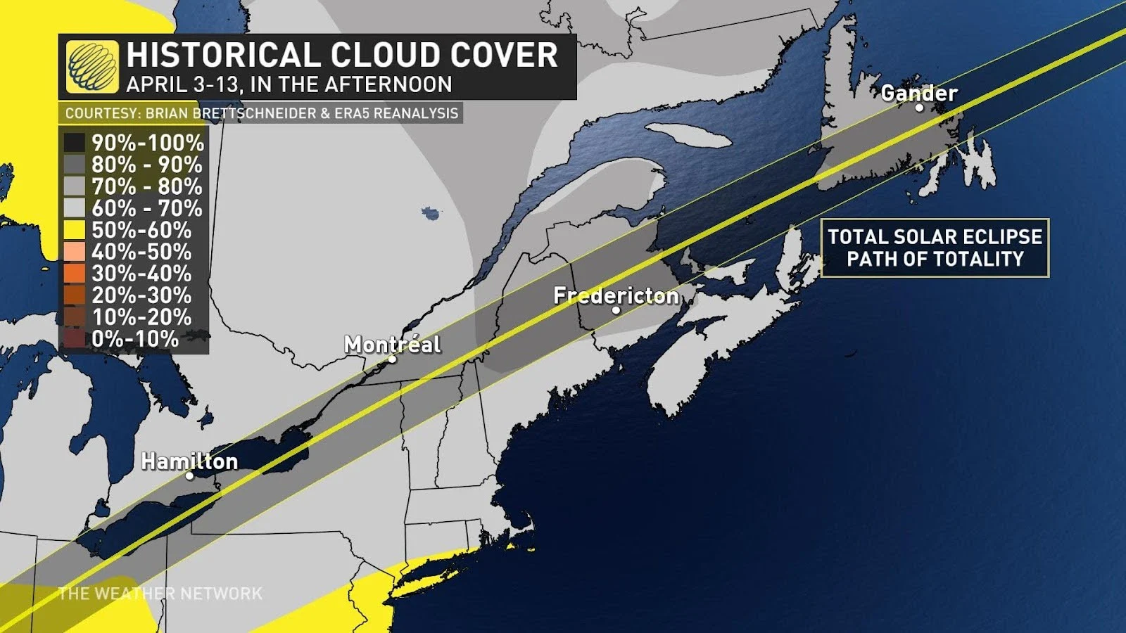
Up until now, we’ve had to rely on historical data to suss out the probability of cloud cover during the eclipse. Early spring is a stormy time of year, and cloud-filled skies are more common than not across most of the Great Lakes and Eastern Canada on that important date.
Asia’s weekend weather to influence Eclipse Day conditions
Right now, though, we can start to see the general position of ridges and troughs in the upper atmosphere. These features can tell us where unsettled weather is possible on the big day, the first clue about where clouds may obscure the total solar eclipse.
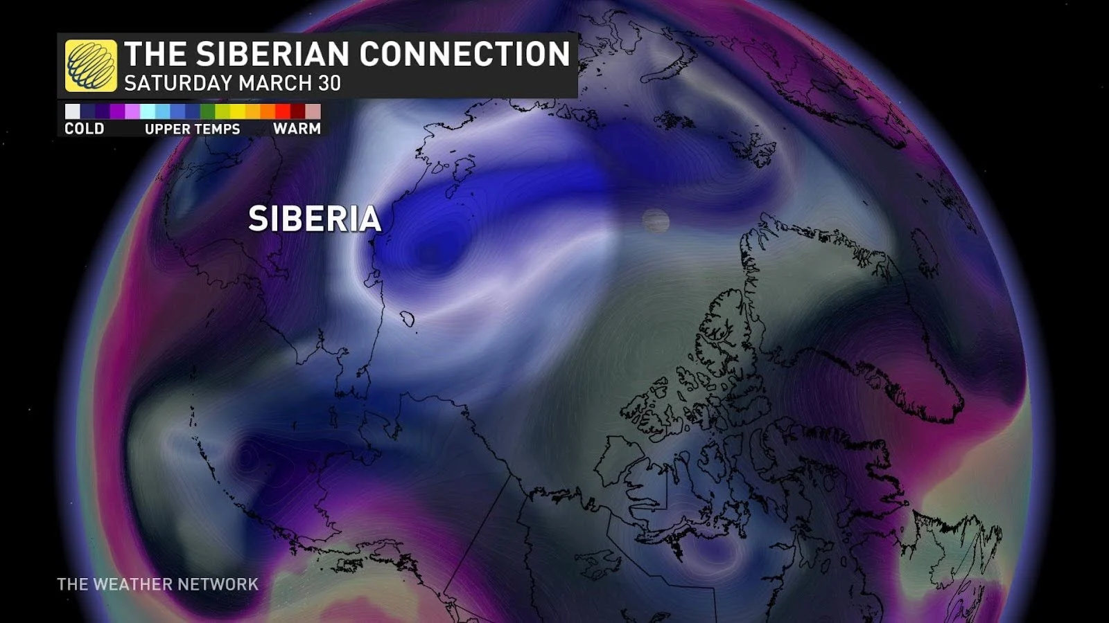
The timeline starts this weekend as a trough filled with frigid air dips over Siberia.
This feature high in the atmosphere over northern Russia will gradually migrate toward lower latitudes in the days ahead, eventually dipping over Alaska before swooping into British Columbia by the middle of the week.
RELATED: How to safely watch the April 8 total solar eclipse
This would put the trough—and its associated cold air—around the western United States by next weekend. Cold air tends to amplify the jet stream, which can lead to more widespread unsettled weather near robust troughs and calmer conditions beneath sprawling ridges.
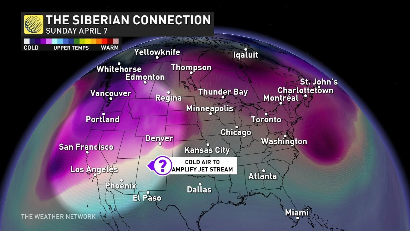
A sharp trough over the western U.S. will likely force a ridge to build over eastern North America around the time of the eclipse.
Lots of things can and likely will change over the next week, but this kind of setup is the first positive sign you’d want to see if you’re hoping for calmer conditions and a chance for clearer skies along the path of the total eclipse here in Canada.
Potential storms are still a wildcard
It’s becoming increasingly unlikely that we’ll contend with any Alberta clippers or systems affecting the path of totality from the northwest. Forecasters will closely watch the development of Texas or Colorado lows next weekend, as these would be the likely drivers for make-or-break cloudiness during the eclipse.
MUST SEE: Canada’s next solar eclipse could change the weather
Between this potential pattern and historical cloud data, conditions for southern Ontario may be a coin toss. Different cloud layers and the depth of moisture in the atmosphere would play a role in conditions on April 8. Quebec and the Maritimes may get lucky with this setup, which may favour a lower risk for clouds.
Forecasters will have a clearer picture of the upper-level pattern across Canada and the U.S. by Easter Monday, ultimately picking out the location of cloud-producing low-pressure systems across the continent.
Stay with The Weather Network for all the latest news and information on the upcoming total solar eclipse, including updated forecasts and fascinating information about this once-in-a-lifetime experience.


