Canada’s widespread drought may fuel the upcoming wildfire season
This winter ended with widespread drought across Canada, a worse position than we saw ahead of last year’s unprecedented wildfire season
The dry and historically warm winter we just experienced across Canada puts the country in a bad spot heading into wildfire season over the weeks and months ahead.
Canada’s lengthy fire season heavily depends on patterns we see across the country during the winter and spring.
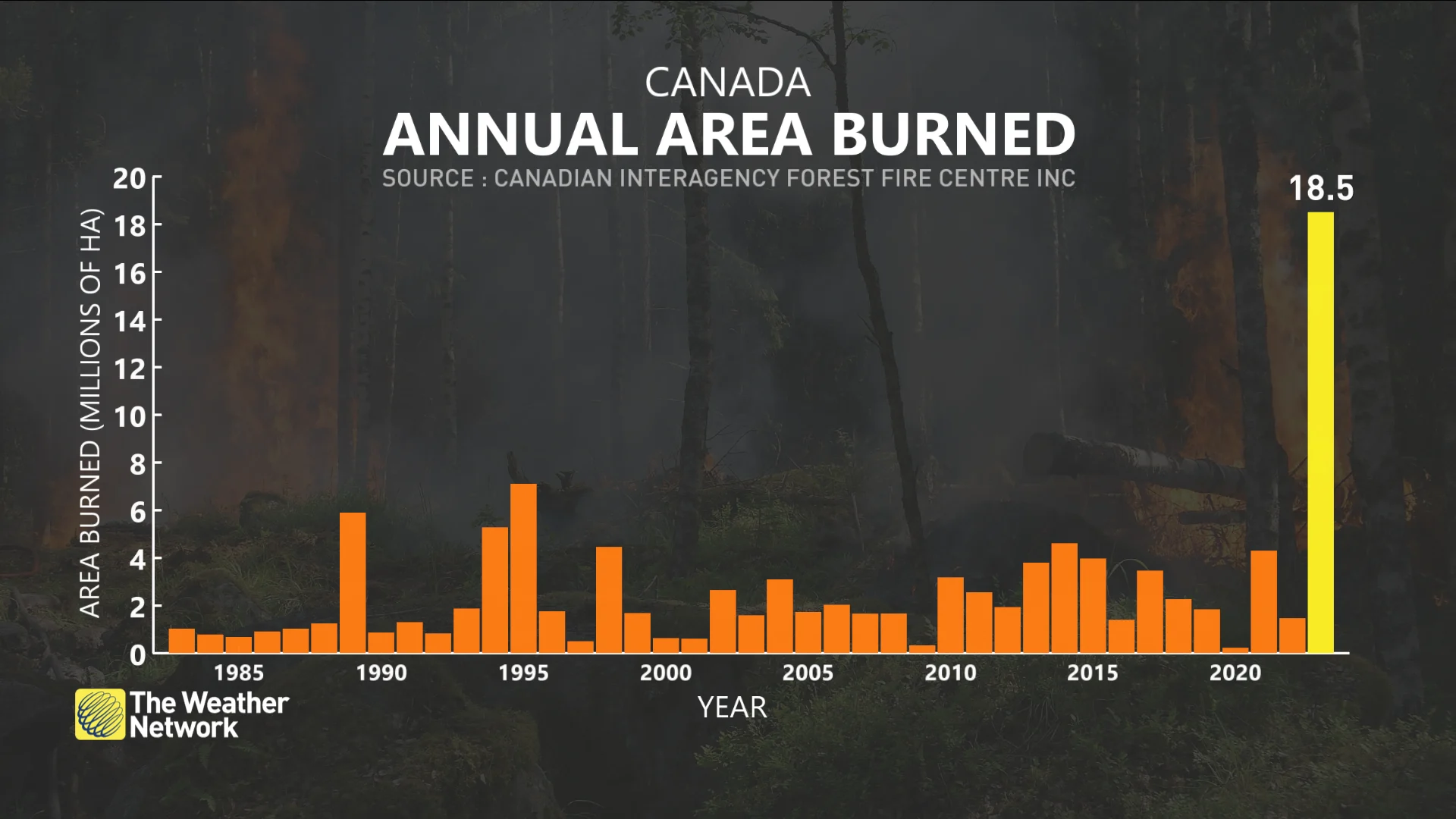
Widespread drought blanketed the country from British Columbia to Labrador as February drew to a close—even worse than we saw ahead of the unprecedented blazes that raged in 2023, which consumed 18.5 million hectares of land across the country.
Conditions through the remainder of spring will dictate just how favourable the environment will be to support the spark and spread of wildfires heading into the warm season.
Visit The Weather Network's wildfire hub to keep up with the latest on the wildfire season across Canada.
This winter was drier, hotter than last winter
When we’re looking for clues about this year’s upcoming wildfire season, it’s helpful to compare this past winter to the winter of 2022-23 to pick out similarities and differences.
RELATED: What we can learn from Canada's record wildfire season as a new one approaches
Below-normal precipitation has been the norm across Western Canada for the past couple of years. Last winter saw less rain and snow than average across much of British Columbia, Alberta, and Saskatchewan. Northern sections of these provinces were hardest-hit by the lack of winter precipitation.
As a result of those warmer and drier patterns, we entered the spring of 2023 with widespread drought across the western half of the country. Moderate to severe drought covered much of the West Coast and the western Prairies, even stretching deep into the heart of the Northwest Territories.
How does that compare to this past winter?
DON'T MISS: Warmest winter ever: Canada's record season reaches new heights
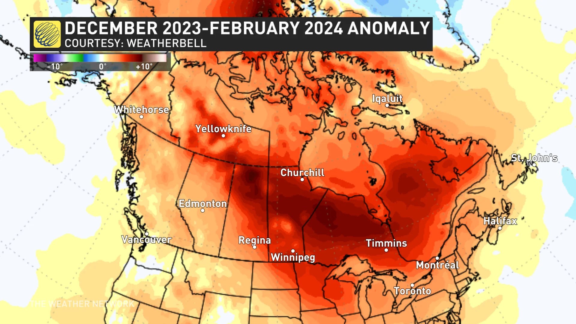
We just endured our warmest winter on record across Canada. Seasonal temperatures were far above average for nearly every square kilometre of the country, with the most unseasonable warmth targeting the northern and eastern Prairies, as well as northern sections of Ontario and Quebec.
That warmth had a significant impact on precipitation throughout the season.
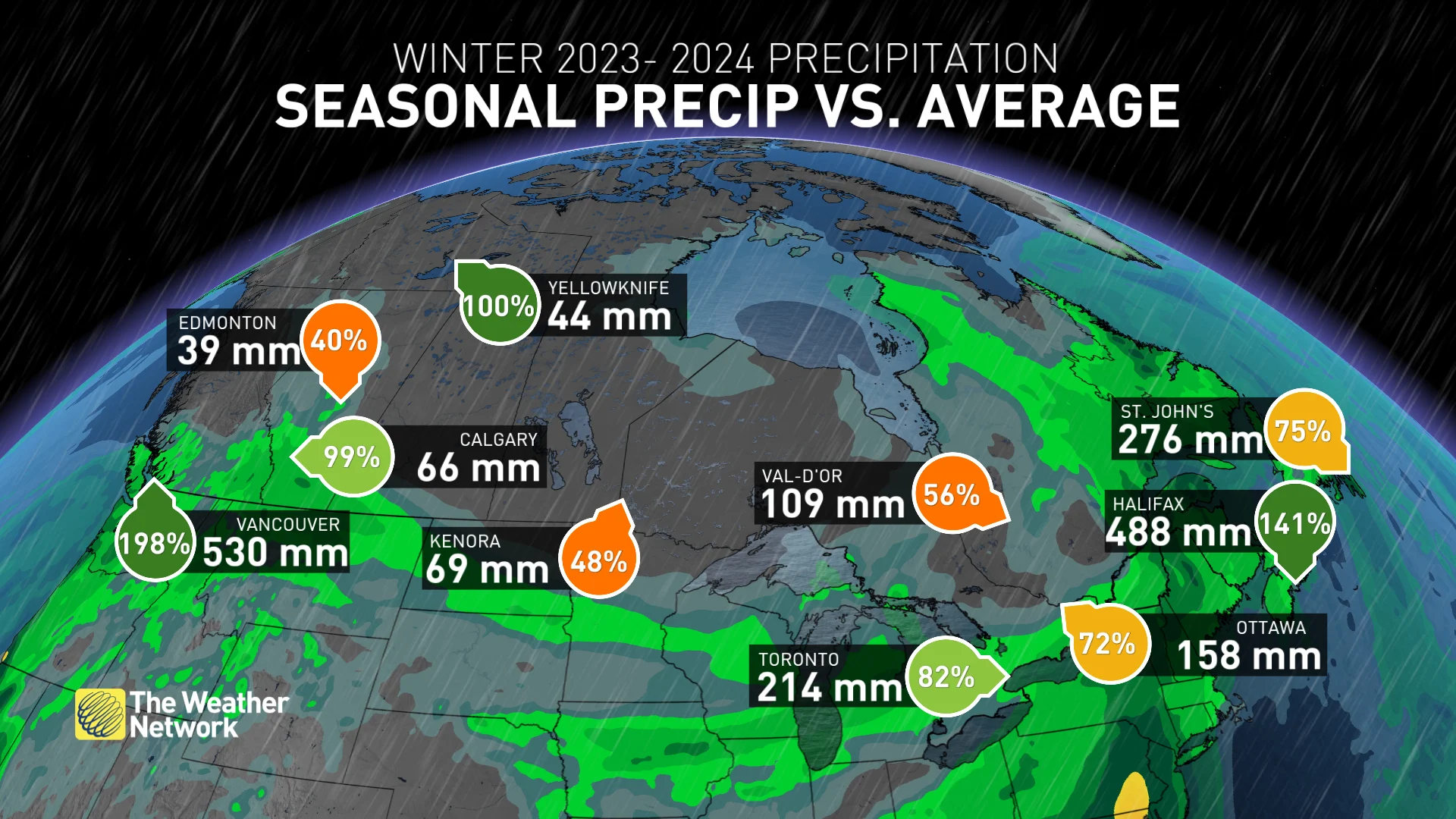
Many communities across the country saw significantly below-seasonal precipitation totals this past winter. A significant factor was a relative lack of meaningful snows across much of the country.
Only a few spots managed to exceed their usual snowfall numbers through this point in the season, including Vancouver, Calgary, and Halifax. A healthy snowpack is important for keeping soils and vegetation saturated before spring’s rains arrive.
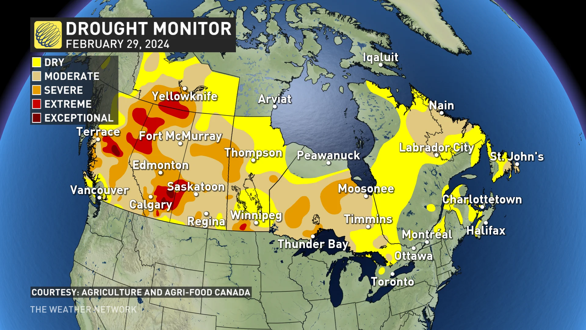
Subpar precipitation and persistently warm temperatures have done a number on the ground across the country. We ended this winter with much worse and more widespread drought than we saw at the same time last year.
MUST SEE: Historic El Niño has weakened, but its impacts hang on
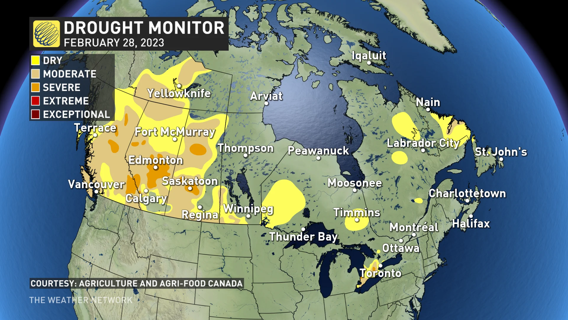
Drought conditions are entrenched from coast to coast, with nearly three-fourths of the country enduring abnormally dry conditions or full-blown drought.
The sheer nationwide extent and severity of the drought is concerning. Wide swaths of B.C., the Prairies, and northern Ontario have fallen into severe drought, with pockets of ‘extreme’ and ‘exceptional’—the two worst categories on the Canadian Drought Monitor’s monthly analysis—found throughout B.C., Alberta, and the Northwest Territories.
Spring could turn things around—or make conditions worse
Patterns are changing with the seasons, and there’s an opportunity for springtime rain and snow to help reverse some of the thirst the ground incurred this past winter.
The Weather Network’s spring forecast holds tough news for the hardest-hit areas across Western Canada.
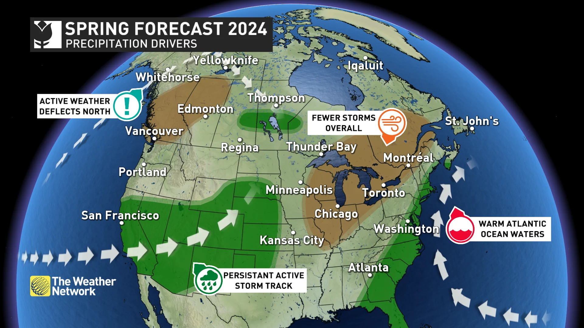
We’re likely to see an active storm track deflected far to the north for much of the season, bringing below-seasonal precipitation to B.C. and Alberta as storms bypass the region.
A similar situation may play out for Ontario and Quebec as prevailing patterns suggest that storms with beneficial rains will largely miss the region to the west and to the east, leaving below-seasonal precipitation for a significant swath of the two provinces.
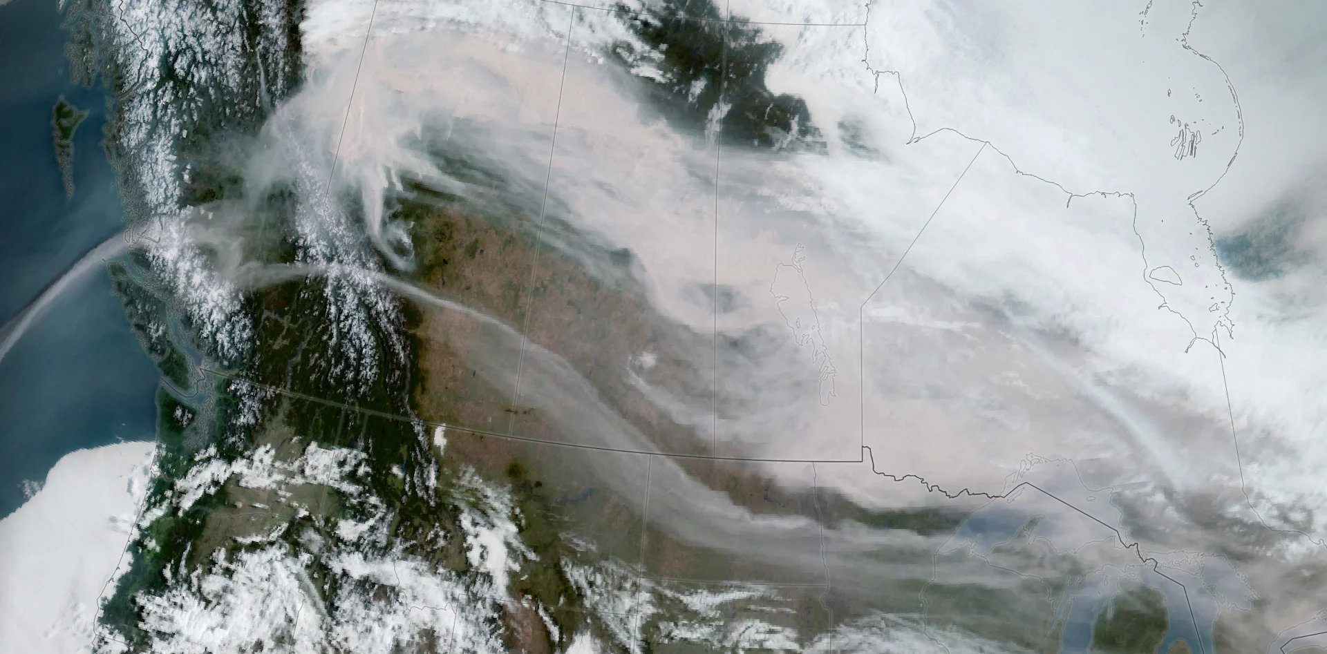
Header image courtesy of NASA, showing wildfire smoke on May 15, 2023.


