Chinook Arch captivates Albertans, but its warm signal won't last
A Chinook Arch can appear like an arch as you are looking out from under the cloud into clear blue skies.
Albertans were treated to a spectacular Chinook Arch cloud on Tuesday -- something you can both see and feel.
PHOTOS: Snow jelly rolls? See what’s forming from a recent winter wallop
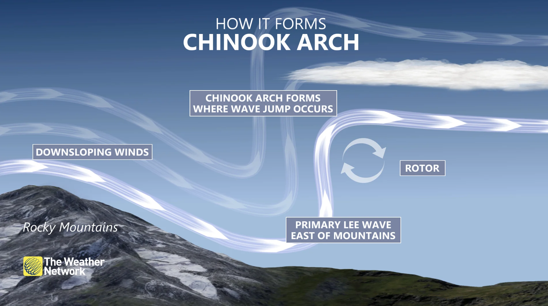
"Also known as mountain-wave clouds, they form on the east side of the Rockies as westerly winds traverse the north-south range," explains Nadine Powell, a meteorologist at The Weather Network. "They tend to have a well-defined western edge and can extend for hundreds of kilometres."

To the viewer looking westward toward the Rockies, as seen in many photos, it can appear like an arch as you are looking out from under the cloud into clear blue skies.
The classic "arch" shape is due to the clouds forming at middle and higher altitudes.
Chinook arches tell of warm weather on the way, as the downsloping "chinook" wind heats up as it descends, leading to temperatures rising at the base of the mountain.
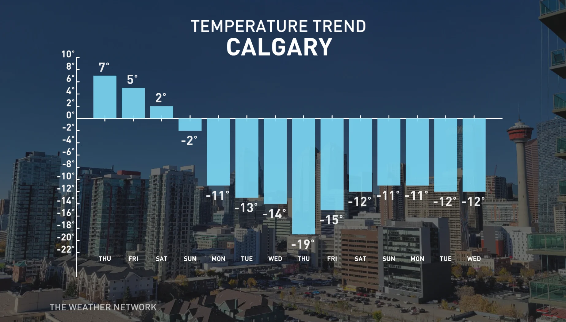
In this particular case, it's definitely the right sign as southern Alberta enjoys some milder November weather this week, with even double digit daytime highs expected across some southern sections by Friday.

It won't last long however, as conditions turn much colder for the weekend as Arctic air plunges south and dominates through most of next week -- including a couple days of "severe cold."
MUST SEE: Don't call it a comeback, Canada: Winter hasn't even started
Some places will see high temperatures that will struggle to reach -20°C and forecasters are also watching a system that could bring significant snow to parts of the region near the Yellowhead Highway, and possibly Edmonton, into Monday.
Here's a closer look at the Chinook Arch cloud captured across southern Alberta Tuesday:
Thumbnail image courtesy: Stuart Milliner/Twitter


