Drivers face first blast of ice and heavy snow across Ontario this week
Ice, heavy snow, and frigid temperatures. The first signs of winter will be bold across much of Ontario this week
A major pattern reversal is bringing the first signs of winter across much of Ontario this week. After one of the warmest falls on record, cross-polar flow has developed, which is sending Arctic air plunging south into western and central Canada, and spreading east. That means the colder weather will become more widespread during these final days of November, bringing the coldest conditions of the season, so far.
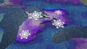
That also sets the scene for some wintry weather throughout the week as freezing rain, blustery winds, and rounds of snow push through. The Great Lakes are finally turning on to bring the first major lake-effect snowfall to the traditional snowbelt regions. It is possible that some local areas see 30+ cm of snow through this multi-day lake-effect event.
RELATED: The 50-cm snowfall lottery: Will an Ontario locale win it before December?
Across eastern Ontario, including the Ottawa area, drivers are challenged with some icy conditions early in the week, with periods of freezing rain slicking up commute times through early Tuesday. Surfaces such as highways, roads, walkways and parking lots may become icy and slippery before the precipitation transitions over to rain.
Here's how the rest of the week plays out.
Wednesday: Multi-day lake-effect snow squall event begins
Temperatures will cool several degrees below seasonal, and this will spark some lake-effect mixing Tuesday night. Snow squalls are expected off of Lake Superior, with colder temperatures settling in the north. Lake-effect snow changes over through Wednesday for Georgian Bay and Lake Huron.

The highest accumulating snow will be off of Lake Superior where it is possible to reach upwards to 15-25 cm of snow through Wednesday. Snow squall watches are in effect for parts of the region.
"Travel may be hazardous due to sudden changes in the weather," says Environment and Climate Change Canada (ECCC) in the snow squall watch. "Surfaces such as highways, roads, walkways and parking lots may become difficult to navigate due to accumulating snow."
Road closures are possible this week, especially over areas that receive multiple snow squall bands.

For areas east of Georgian Bay, between Barrie and Parry Sound, between 10-15 cm of snow is forecast. Snowfall totals will be highly localized due to the nature of snow squalls.
Thursday: Snow chances sneak south
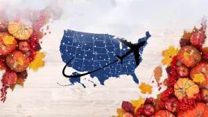
By Thursday, we'll be watching snowfall chances creep in for areas further south, as a low pressure system tracks south of the Great Lakes, and through the northeast states. This will bring travel disruptions for American Thanksgiving.

With the current storm track, up to 3+ cm is possible near for the Niagara region and south, though there is still some uncertainty on the track and impacts of this storm.
The stateside system will disrupt the lake-effect snow squalls, but a stronger multi-day event will return for the weekend and beyond.
SEE ALSO: Coldest air of the season to push into Canada to start December
This weekend and beyond: Lake-effect snow on repeat
Regardless of the track of Thursday's storm, it will certainly draw in another, much colder wave of Arctic air, which will stick around through the weekend.

As a result, all of the Great Lakes will be producing lake-effect snow for multiple days as December arrives, producing heavy amounts in the tradition snowbelt regions.
RELATED: Buried: Why the Great Lakes produce some of the world’s heaviest snow
Some of the stronger squalls might even push into the Greater Toronto Area (GTA) as well, but it is still too soon to know snowfall totals or exact locations that could be impacted.
Lake-effect snow squalls will meander across the snowbelts through the first week of December, with significant snow totals likely. Ski areas will be able to build an impressive base during early December due to natural snow and excellent snow-making conditions.


