Closely watching snow sneak into southern Ontario as temperatures finally cool
Winter is waking up in Ontario, with a much colder pattern and snow on the horizon
There's no question that fall is slowly fading, and some more wintry weather is finally in sight. Any signs of winter will likely catch many Ontarians off guard however, thanks to a November that has felt more like September at times.
Unusual November sunshine and record breaking warm temperatures have taken centre stage for much of the month. In fact, many areas across the province are on track for seeing their warmest fall season on record. That means snow flurries have essentially been non-existent so far, but things are about to change.

DON'T MISS: Ontario's mild weather is quickly fading, so is winter just around the corner?
Snow starts to slowly sneak into the forecast
The final days of November will be looking and feeling a lot more like what we typically see, with signs of snow creeping into the forecast as we round out the month, and look ahead to early December.
We will be closely watching the track of a couple low pressure systems for the final days of November next week.
SEE ALSO: Southern states could get snow before these major Canadian cities
A system forecast for early next week could bring some snow to parts of northern Ontario, with more rain falling with milder temperatures to the south.
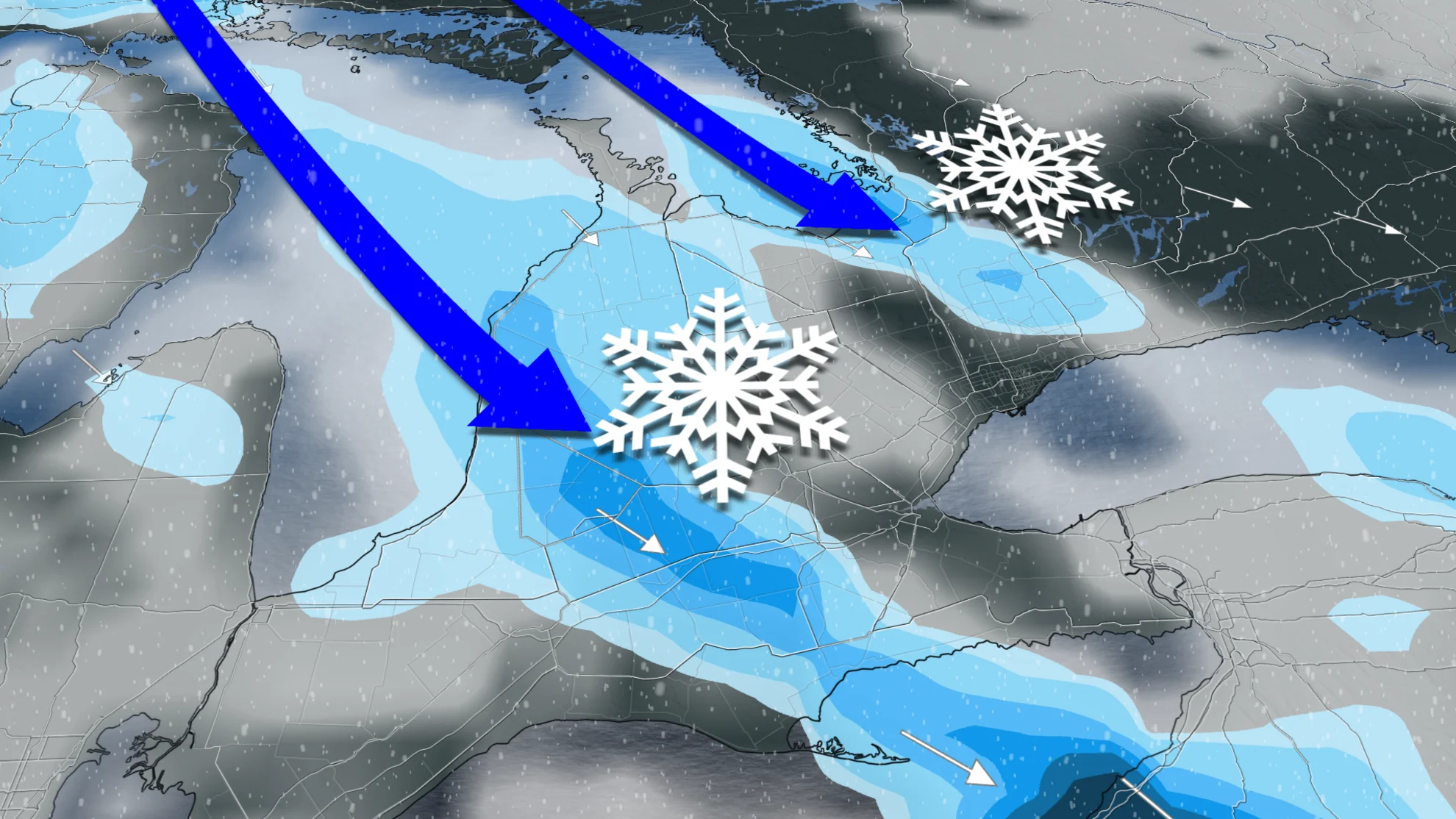
Northwesterly winds behind that system however, will usher in some colder temperatures that will help set up lake-effect snow off of Georgian Bay and Lake Huron. This looks to be a bit of a teaser snow event, as any snow that falls will likely be wet and light.

First shot at a multi-day lake-effect snow event for next weekend
The attention then turns to late next week, with a low pressure system forecast to develop stateside. Confidence is still low on the exact track of that system, but regardless, it will help with a pattern change that allows northwesterly winds set up in time for next weekend.

This is where we're closely watching the chance for the first multi-day lake-effect snow event of the season, and also the chance at accumulating snow for parts of the snowbelts.
This won't be a widespread snow event across the region, but could be the pre-holiday boost ski areas have been desperately waiting for.

Cold start to December could be a major win for ski areas...finally!
With the upcoming pattern conducive for more cold air into the beginning of December, ski areas could take advantage of some snow making, as well.

This will be quite the contrast to recent years, where much milder weather didn't allow for any snow leading into the holiday season.
Will the pattern stay cold? Be sure to continue to check back for the latest forecast updates as we get ready to start December.


