Coldest air on Earth sends temperatures below -50°C in Siberia
A lobe of air that broke off of the polar vortex, which is currently blanketing parts of Siberia, is sending temperatures plummeting across parts of Canada.
Canada is no stranger to temperatures below -30°C, but parts of eastern Russia have plummeted below -40°C since the middle of December, courtesy of the bone-chilling polar vortex lingering over Siberia. One of the more chilling temperatures, in Delyankir, just northeast of the coldest, permanently inhabited places on Earth recorded a -58°C on January 18th, 2021.
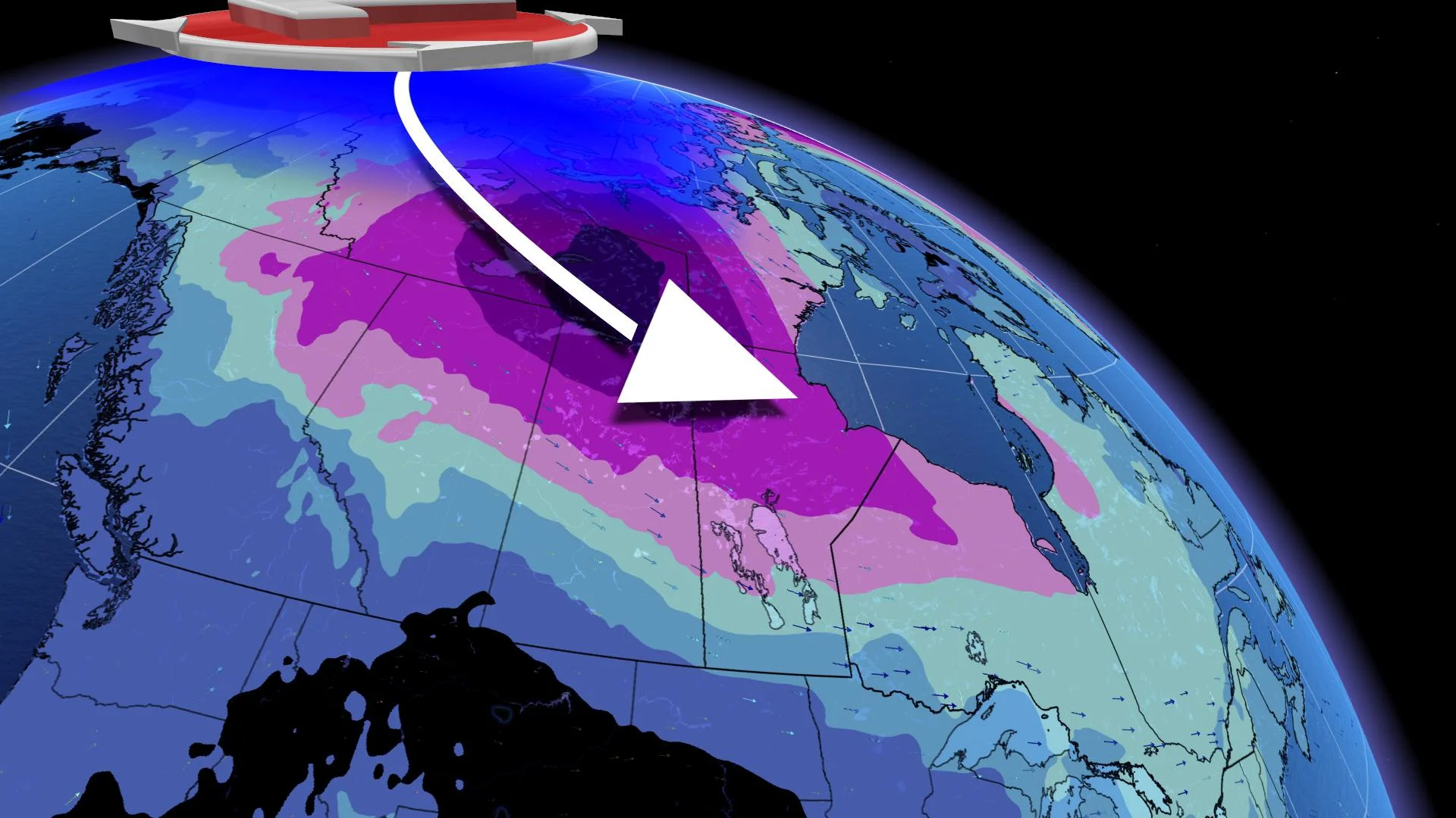
A lobe of frigid air that broke off of the polar vortex meandered its way down across North America and is sending temperatures tumbling across Canada. This raises the question, will the coldest air in the world soon make an appearance in Canada?
First, let’s look at a map that figuratively takes your breath away, or literally, if you're a resident of Yakutsk, Russia.
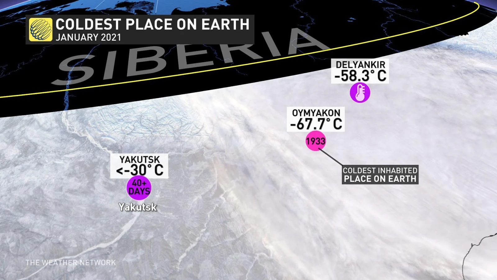
For over 40 days, daytime highs remained below -30°C in the capital city of the Sakha Republic, with just over six hours of meagre daylight contributing next-to-nothing in terms of warmth.
RELATED: Man goes for a swim in the coldest village on Earth
POLAR VORTEX IS IN SHAMBLES
The temperature outlook is bleak for the remainder of January over Siberia – the coldest air in the world will continuously recharge and replenish itself over the region. Although it's been cold even by Siberian standards, we can't soon forget the record warmth anomaly that helped catapult the planet to one of the warmest years on record in 2020.
Keep in mind, back in last May, 'zombie fires' cropped into our lexicon – the forest fires that surprised us by smouldering below the Siberian snowpack. Temperatures soared to 38°C in Verkhoyansk last spring, while this week -57.5°C was recorded. That makes this a 95°C temperature difference!
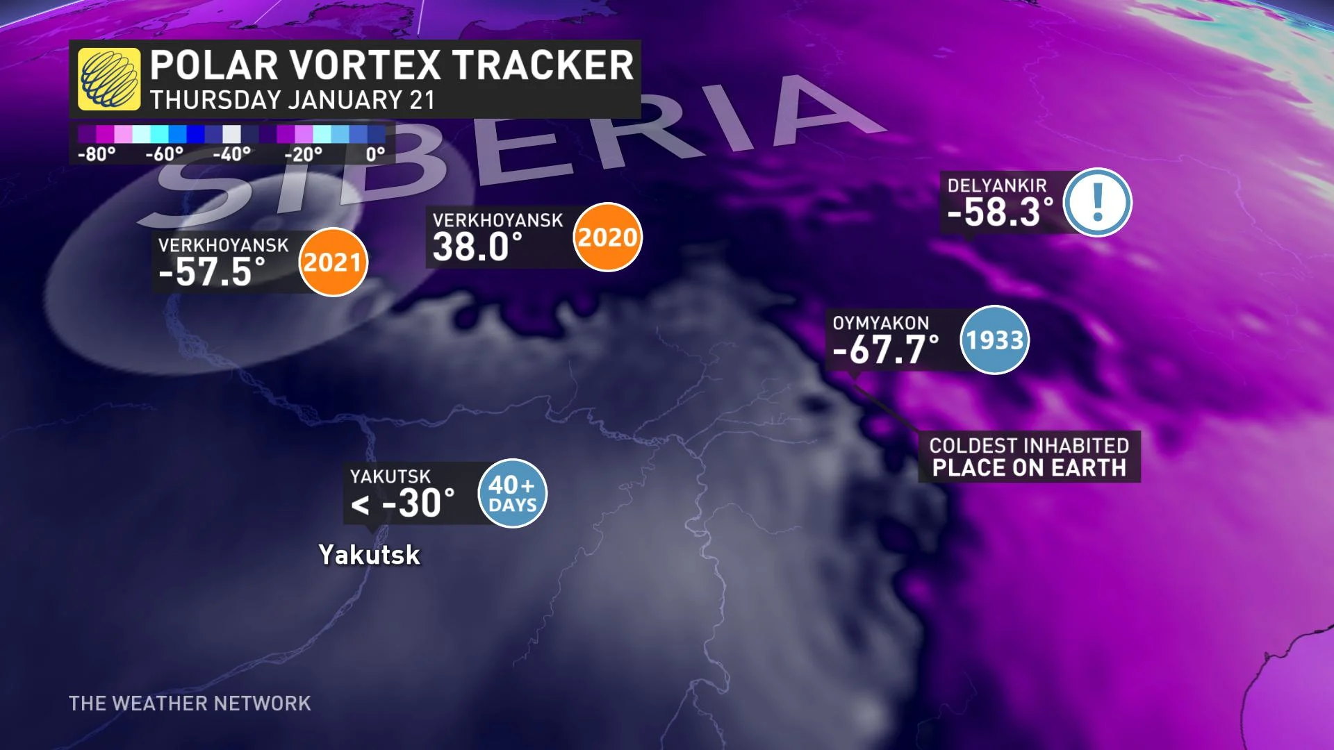
The polar vortex has been temperamental as of late -- it has recently weakened and allowed colder air to drift towards lower latitudes.
A couple of formidable lobes of Arctic air are on tap for this side of the globe, but we are not foreseeing bone-chilling cold in the cards over the next few weeks in Canada. The cold anomalies are a little less extreme than Siberia’s, with the coldest temperatures forecast overnight to be temperatures Siberia struggles to reach during the day. The cold is expected to meander across North America, thanks to a restless Pacific jet stream, refraining from locking into place.
By the middle of next week, colder air oozes across most of Canada, with the core of cold situated towards the western Prairies. At times, highs may struggle to get out of the -20°Cs across the region, an equivalent average low temperature for this time of year. Some cold ultimately breaks off the main lobe and squeezes east across Ontario towards Atlantic Canada, then confidence decreases.
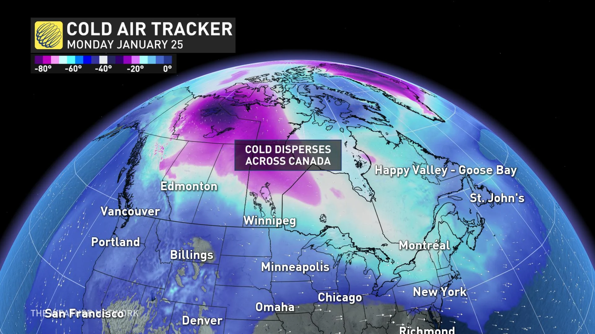
Signs are pointing to the coldest air retreating a bit, up to Alaska and the Yukon, compliments of an unruly Pacific jet stream. Some signs point to warmer temperature anomalies cropping up once again in parts of Ontario, Quebec, and Atlantic Canada – as we turn the page on a new month.
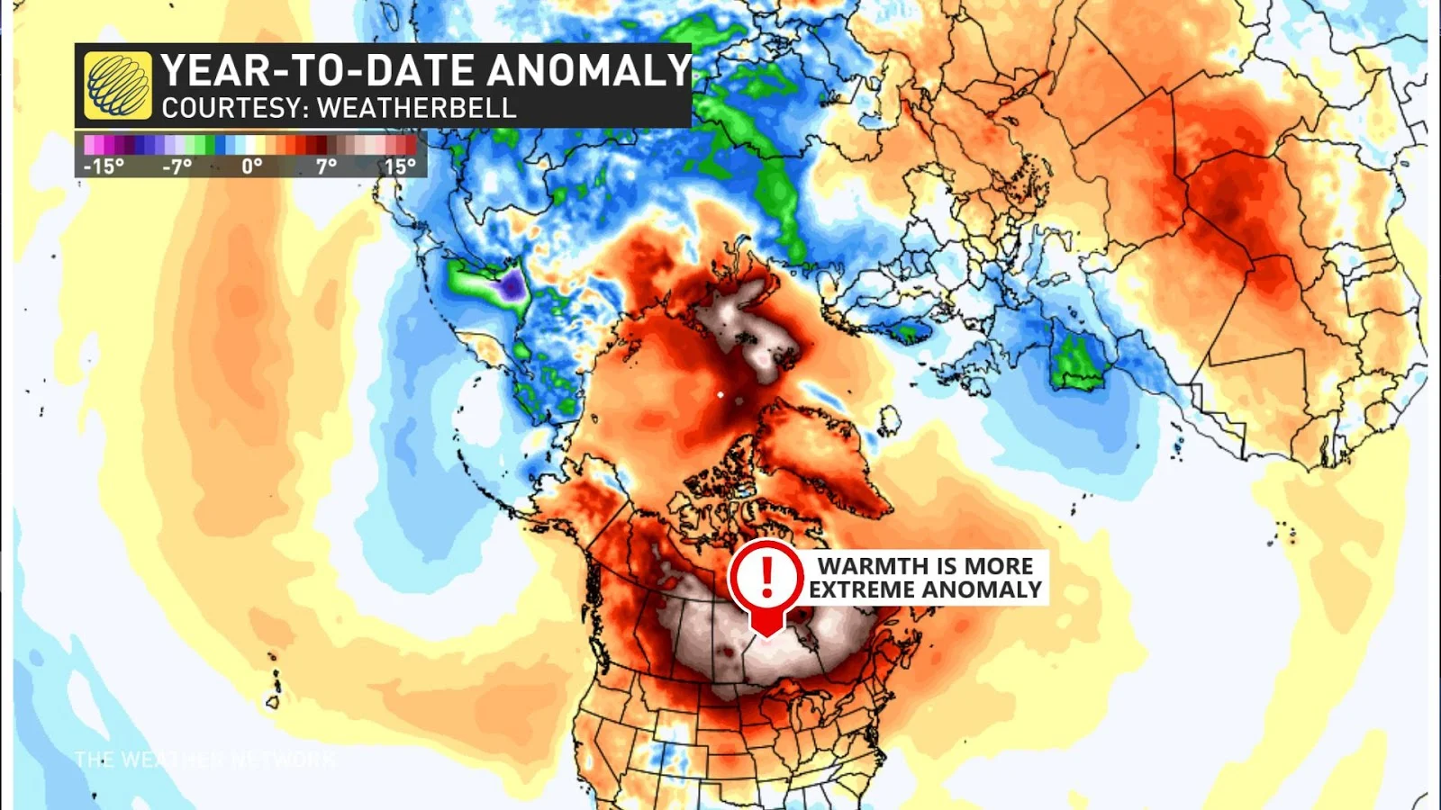
Some perspective. As cold as it's been in Siberia, this warm anomaly enveloping Canada over the past several weeks has unequivocally been drastically more extreme:
