Wintry pattern stays locked over the Prairies, temperatures only getting colder
The breaks will be few and far between as a wintry pattern with frigid temperatures take hold across much of the Prairies
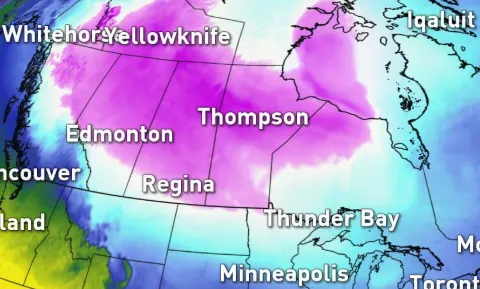
The frigid pattern will relax slightly to end the work week across the Prairies, but don't get too comfortable as the wintry weather remains locked over the region well into next week. That means bursts of snow and plummeting temperatures will be making things feel more like December than the start of November. More on the nicely timed warm-up for Halloween, plus a look at a strong clipper that could dump snow over the western Prairies through the late weekend, below.
WEATHER HIGHLIGHTS
Brief break in the frigid pattern late week, but several reinforcing shots of arctic air next week
Another mild shot of snow descends late Wednesday/early Thursday.
Potential for stronger clipper Sunday into Monday for southern, western Alberta
Stay up-to-date on the ALERTS in your area
WATCH BELOW: WHEN TO EXPECT THE NEXT BURST OF SNOW
After waking up to frigid wind chills well into the minus double digits, the chilly pattern will slightly loosen its grip, aligning nicely with trick-or-treat times on Thursday.
Extra layers however, will still be needed as daytime highs hover just a few degrees above freezing.
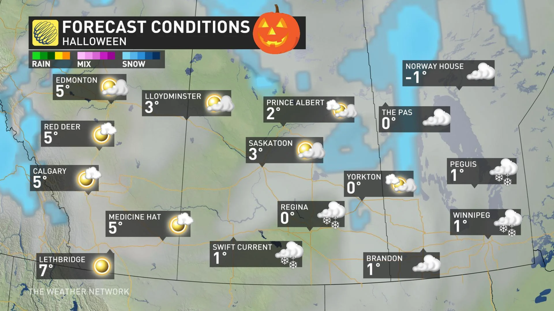
While no major snow accumulations are expected across the southern Prairies, bursts of snow flurries will continue well into the weekend.
SEE ALSO: Canada has some freaky fall frost stats this year

"We're also watching the potential for a stronger clipper system on Sunday and Monday with significant upslope snow possible for parts of southern and western Alberta, including Calgary," says Weather Network meteorologist Dr. Doug Gillham.
SNOWIER OCTOBER THAN NORMAL?
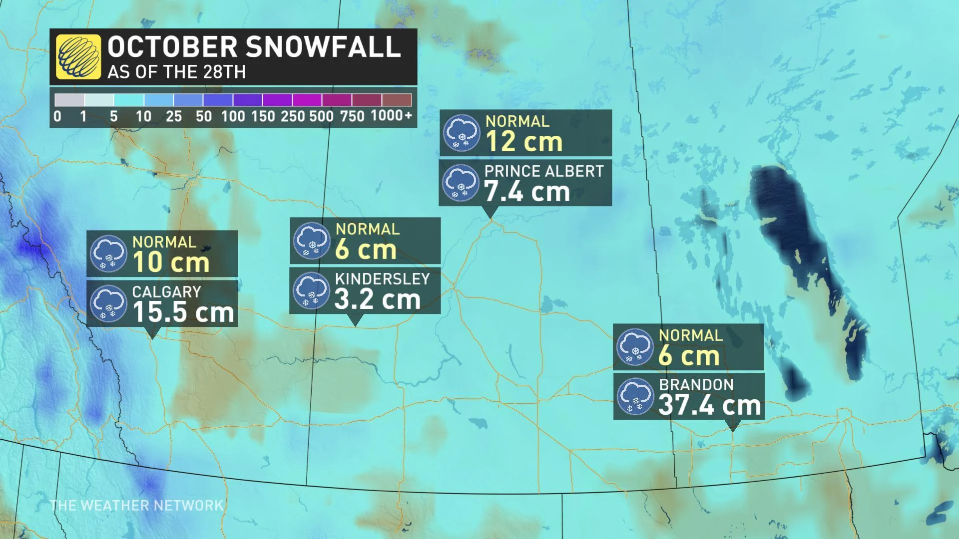
If it feels like it's been a snowier October than normal, you're certainly not wrong.
So far this month, major cities like Calgary have already picked up over 15 cm of snow, while Brandon, Manitoba is sitting closer to 40 cm, courtesy of the Thanksgiving blizzard. That's about 30 cm MORE than what the city typically sees for the entire month.
STAYING FRIGID THROUGH NOVEMBER
Despite this brief break in the December-like temperatures, several reinforcing shots of arctic air will continue into much next week. In fact, the cold air that started this week will just be a taste of what's to come as we kick off November.
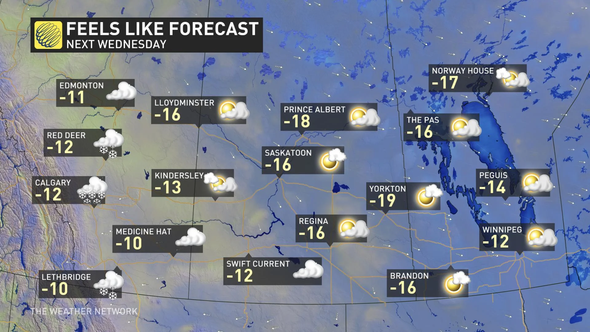
"By Wednesday of next week for example, widespread daytime highs will only be feeling like the mid-teens with the wind chill," says meteorologist Jaclyn Whittal.
