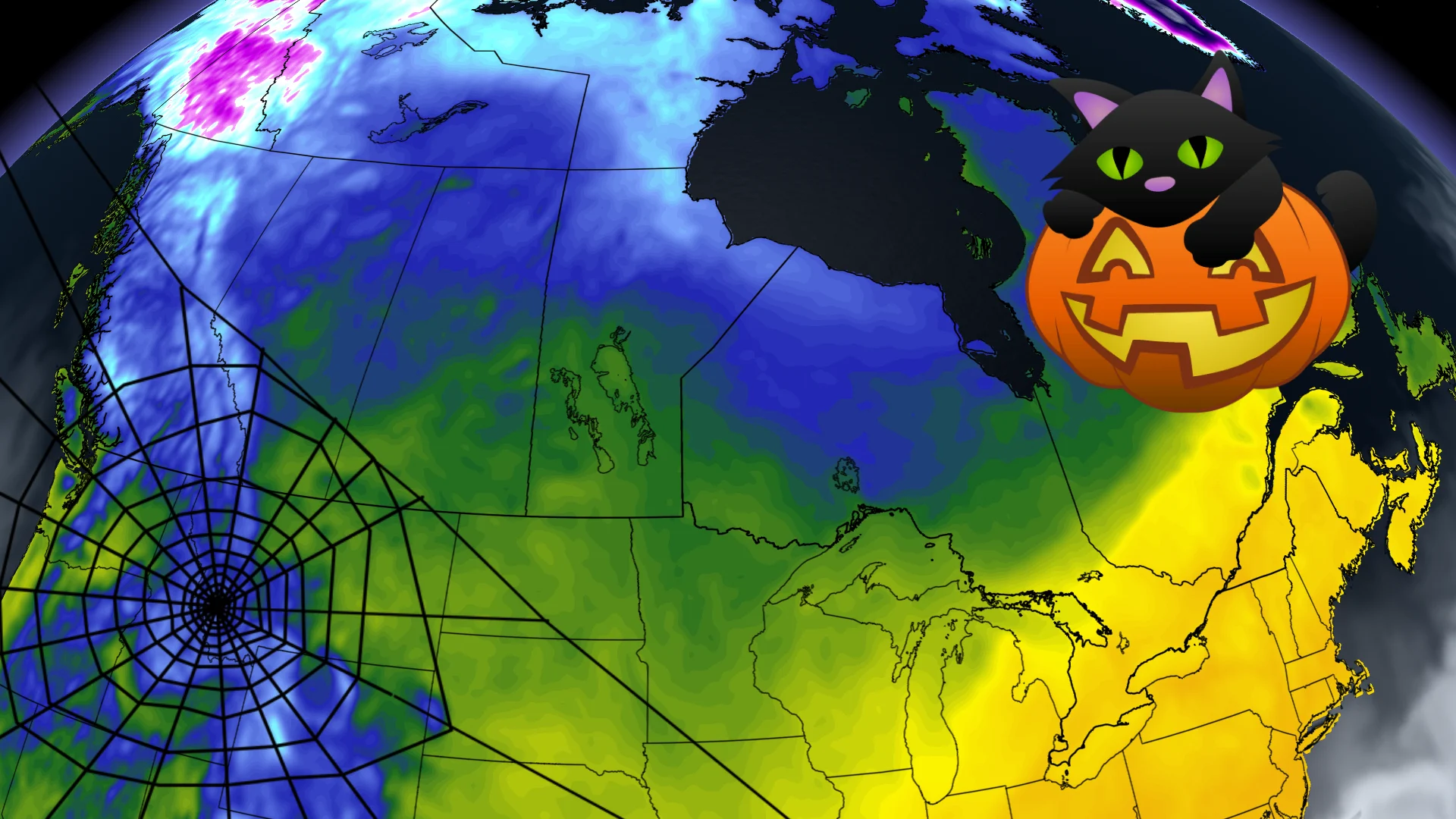
Halloween attempts to cast cold spell across Canada, but half will fight back
Halloween is a week away still, but we have the early details on what to expect weather-wise across the country, with some clear favourites for an ideal Oct. 31.
As usual, there will be some winners and losers for the most ideal Halloween forecast, but because we're still a week out, there is still time for some things to change between now and then.
DON'T MISS: Trick-or-treat safety: Eight tips for keeping kids safe on Halloween night
The West will see some cold and wet weather for some, while much of the East will be comfortably warm in most spots. However, there is some uncertainty surrounding trick-or-treaters as rain could sneak its way into the forecast and put a bit of a spooky damper on outdoor plans.
Below is our preliminary look at what to expect for Halloween, so you can plan accordingly for the spooky-themed, fun night (hopefully with lots of candy).
Western Canada
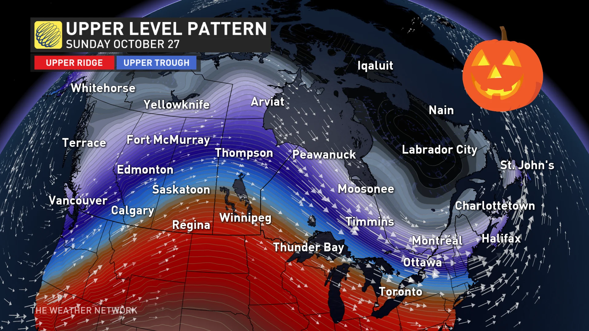
With B.C. on the verge of another rainfall and wind event this weekend, how will it look for next week as we approach and reach Halloween?
Well, not as good as last year's Halloween, we can safely say.
A long-range pattern shows a series of troughs moving across British Columbia and the Prairies, allowing chilly, northerly air to sink south.
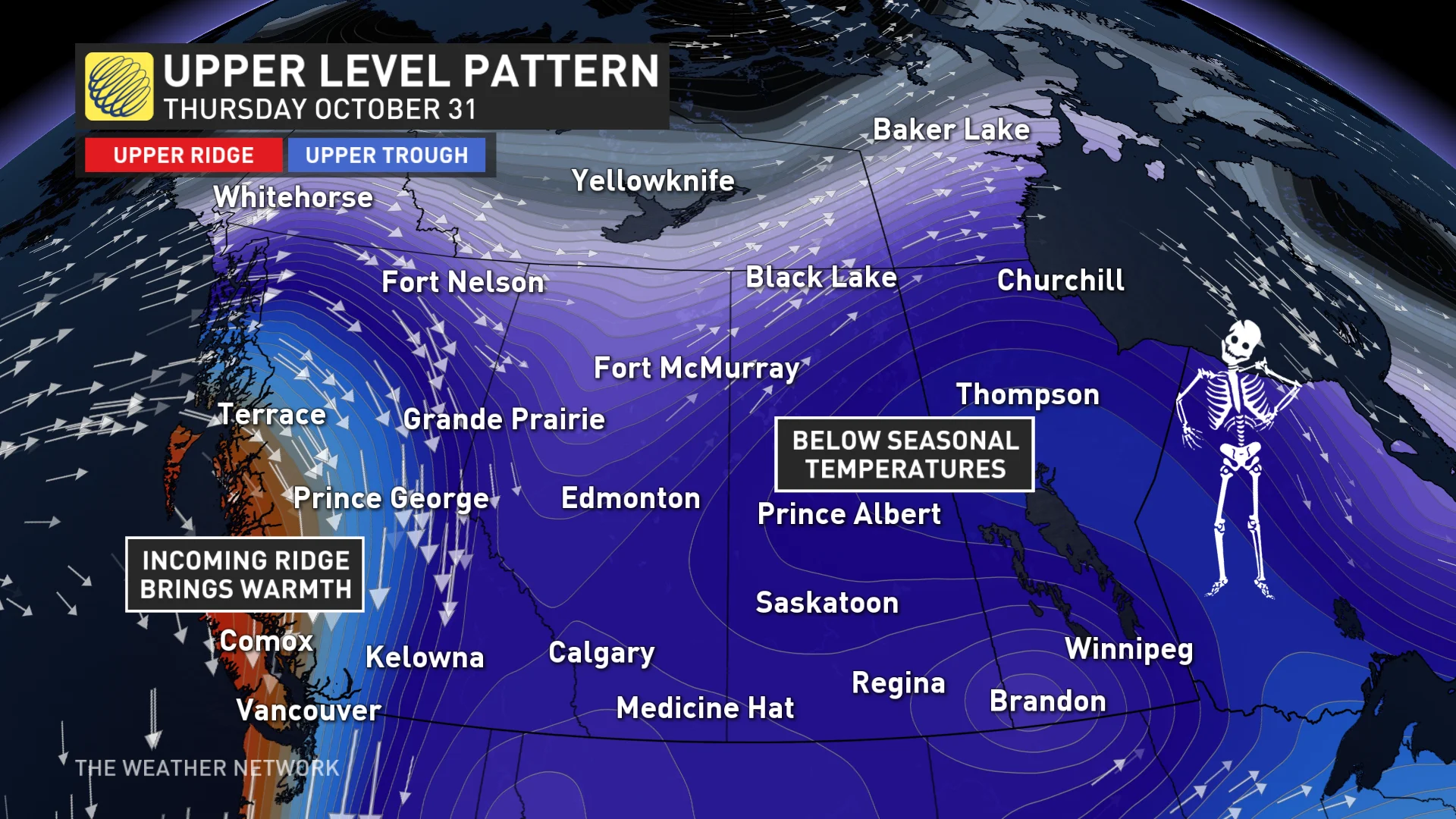
After dealing with its first significant snowfall this week, Alberta will see another shot of colder weather next week, as previously mentioned, alongside Saskatchewan and Manitoba. So, the outlook is trending cold at this point, so for now, be prepared to put on layers if you're taking your little ones trick-or-treating, or participating in any other outdoor activity.
There is a possibility of more showers for parts of southern B.C, too, with some chances for precipitation in parts of the Prairies but too low at this point to make a sound call.
Eastern Canada
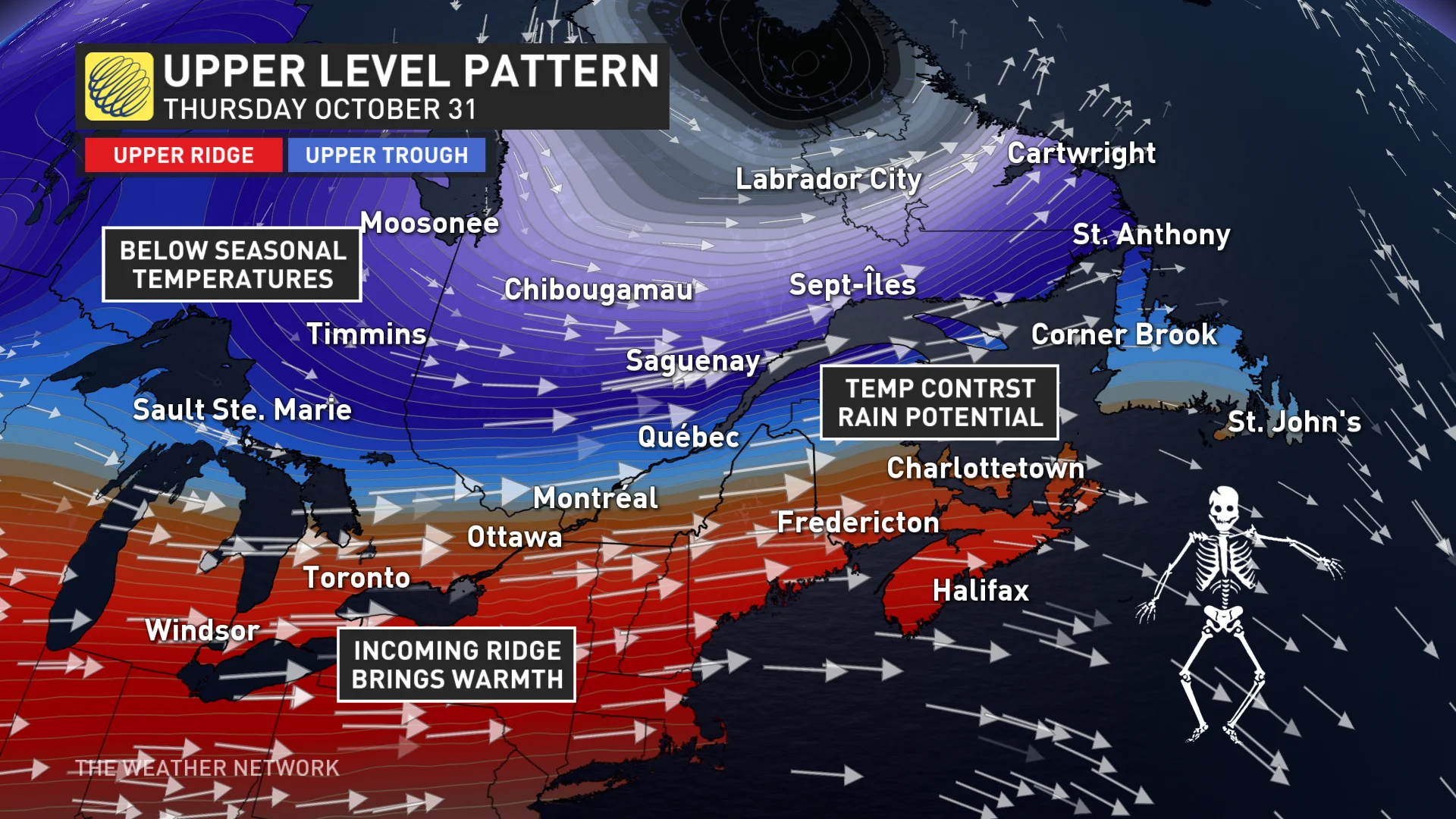
To kick-start the days prior to Halloween, a seasonably warm and dry ridge will reappear during the week for all of Eastern Canada, a nice rebound after what is expected to be a soggy first half of the weekend for the East Coast.
However, along the boundary between the West trough and East ridge, the doors will be open for a fall storm to track through, possibly with some Halloween interruptions for parts of the region.
A chilly cold front moves through Ontario with rain possible for the northern sections of the province.
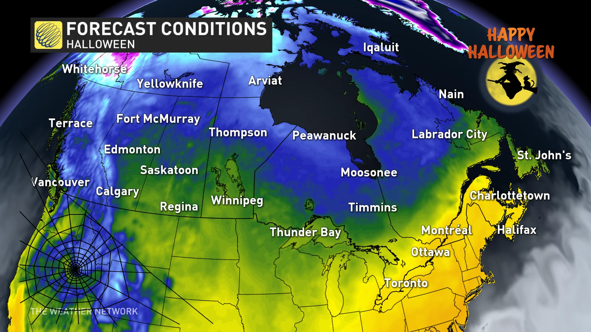
As for southern and eastern Ontario, as well as southern Quebec, the forecast is truly a trick or a treat. The make-or-break forecast between a warm and dry evening versus a chilly and rainy one will depend on the speed of the cold front, and how long can the ridge hold on. Timing is uncertain but we will be watching.
Farther east, there will be a higher likelihood that the Maritimes trend warm for Halloween, with showers possible in Newfoundland.
With files from Melinda Singh, a meteorologist at The Weather Network, and Nathan Howes, a digital reporter at The Weather Network.


