Heavy rain expected as a Texas low aims for Ontario next week
Several days of rain could sweep into Ontario to begin the next work week
A mostly dry couple of weeks will soon come to an end across Ontario as November looks to start on an unsettled note.
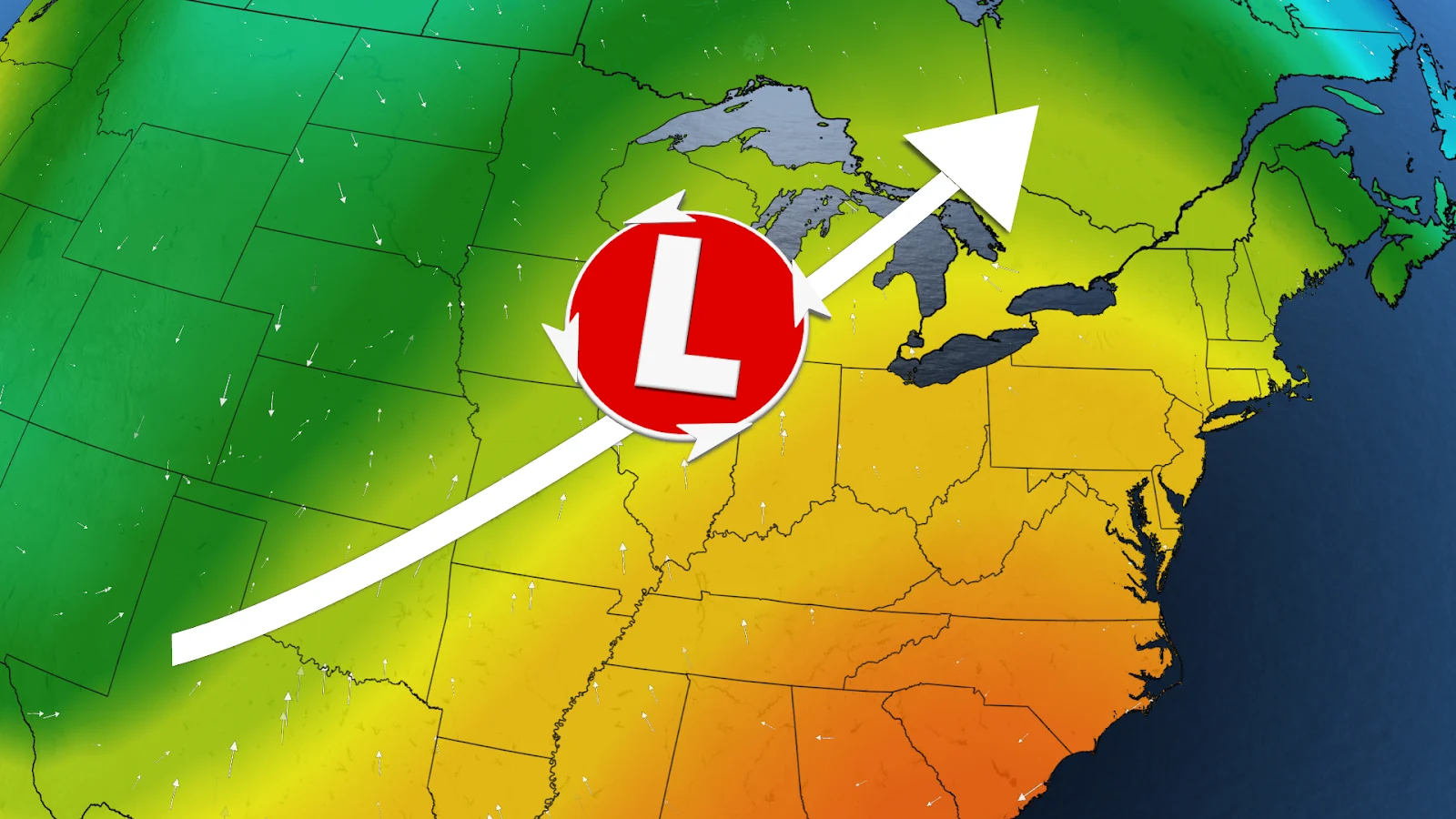
Forecasters are watching a developing Texas low that could bring a slug of heavy rain to the province through early next week.
DON’T MISS: Snowy surprises can blanket Canada during a typical November

Many communities across southern Ontario saw one of their driest Octobers on record this year, an unusual spell of dry weather that arrived amid one of Toronto’s wettest years in history.
Change is on the way as a more active pattern sets up over the Great Lakes region heading into the first full week of November.
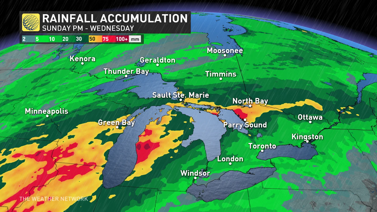
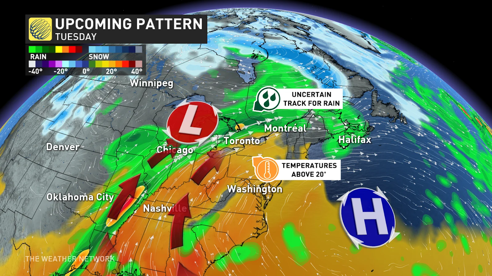
A budding Texas low will push toward Ontario beginning Sunday night and lasting through Wednesday morning. This system will tap into a stream of Gulf moisture aloft to fuel waves of widespread heavy rain across the region.

The heaviest rain is likely through central and northeastern Ontario, which will find itself beneath a boundary that’ll help wring out that enhanced atmospheric moisture for multiple days. Some of these areas could see 40-75+ mm of rain.
We’ll see a touch less rain across southern Ontario, but unsettled conditions are likely Tuesday and into Wednesday. Pearson International Airport is tantalizingly close to measuring its wettest year on record, and this incoming rain could push the station over the top.

It’s not just rain that’ll arrive with this system.
Persistent winds out of the south will help drag milder air across the border. Daytime high temperatures on Tuesday could poke into the lower 20s, which is unseasonably warm but likely not record-setting for early November.
Stay with The Weather Network for all the latest on this active pattern developing for Ontario.


