
Canada's November Outlook: A smooth transition or a free fall into winter?
Are Canadians in for an early taste of winter? Find out what's ahead in The Weather Network's exclusive November weather outlook.
Winter weather has made a rather sudden appearance across parts of Canada, with many of us having already experienced an abrupt transition from record warmth to early winter-like conditions.
Is the cold weather here to stay, or can we expect a return to more autumnal weather before winter sets in? Read on to find out what's ahead from coast-to-coast across Canada this month.
First week of November: colder-than-normal temperatures
As November begins, temperatures are colder than normal in most parts of North America.
The various shades of blue, green, and purple on the temperature anomaly map below highlight the widespread colder-than-normal temperatures that we are seeing on November 1st.
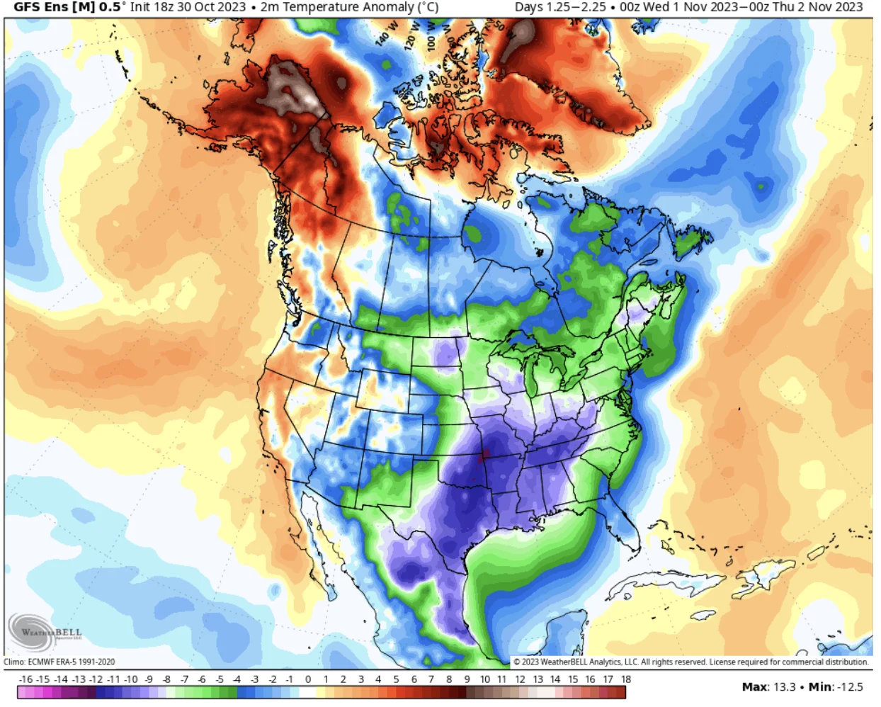
Widespread colder-than-normal temperatures are expected at the start of November. (Graphic: WeatherBell)
This is a sharp contrast to what we saw for most of October, which featured widespread warmer-than-normal temperatures, especially across eastern Canada.
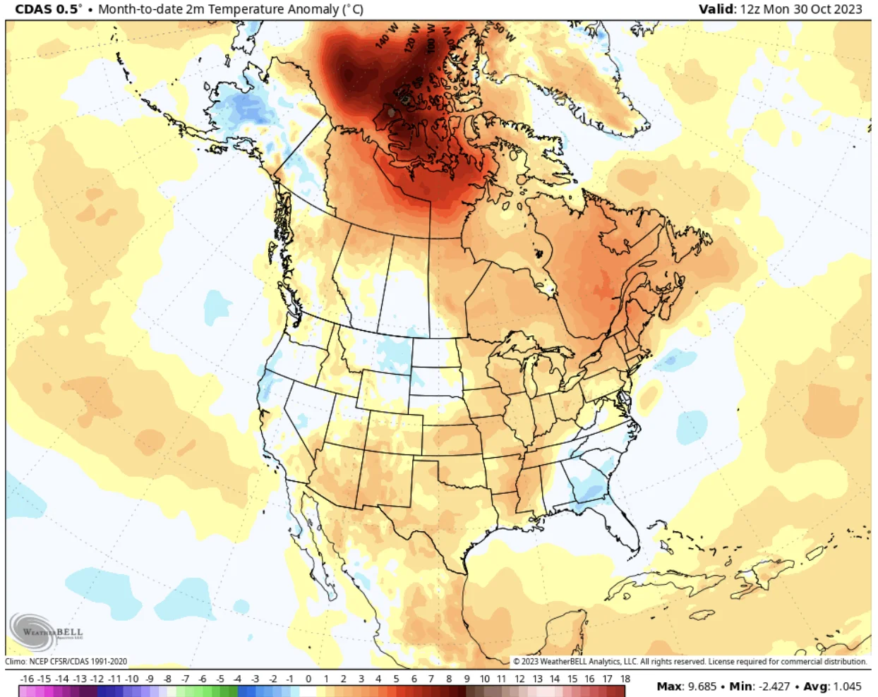
The various shades of orange on the temperature anomaly map above highlight the widespread warmer-than-normal temperatures that we saw during October, especially across eastern Canada. (Graphic: WeatherBell)
While a large section of the Prairies appears to be "near-normal," this region was actually much warmer than normal through October 24th before Arctic air plunged south into the region for the final week of October and wiped out the warm anomaly for the entire month.
Meanwhile, colder-than-normal temperatures will continue to dominate across Central and Eastern Canada through the first week of November, though southern Ontario and southern Quebec will see a few days of milder weather.
The graphic below is a model forecast that highlights widespread colder-than-normal temperatures for the first week of November.
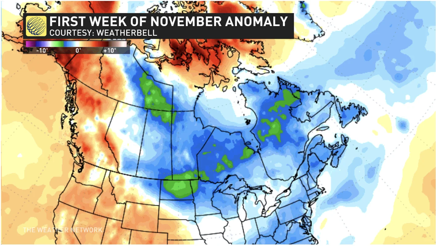
This graphic is a model forecast that highlights the widespread colder-than-normal temperatures for the first week of November. (Courtesy of WeatherBell/The Weather Network)
Parts of Western Canada, including British Columbia and Yukon, on the other hand will be milder than normal. A wet pattern is also likely for B.C.'s South Coast.
Second week of November: Milder West, Cooler East
During the second week of November, the milder weather that B.C. will see at the start of November will slowly spread east across the Prairies.
Meanwhile, a couple of reinforcing shots of chilly weather are expected to keep most of Eastern Canada (from Ontario to Newfoundland and Labrador) near seasonal or on the cold side of seasonal.
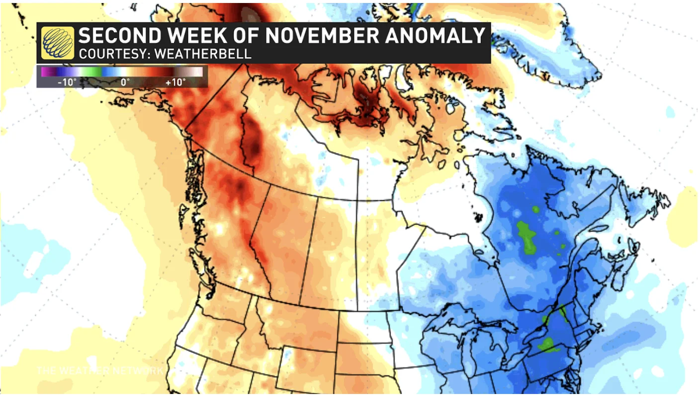
Model forecast for the second week of November. (Courtesy of WeatherBell/The Weather Network)
As for precipitation, a wet pattern is expected to continue on B.C.'s South Coast, but there will be a few days of dry weather.
In addition, a few systems are expected to track from the Great Lakes to Atlantic Canada during the second week of November. At least one of these systems will include the potential for significant winter weather for parts of the region, especially across northern Ontario and into Quebec.
Second half of November: Mild air spreads east
During the second half of November, we expect milder weather to spread east from the Prairies into Ontario and Quebec. In addition, Atlantic Canada should trend closer to seasonal.
This should mean that most of Canada will be milder-than-normal or near-normal for the final two weeks of November.
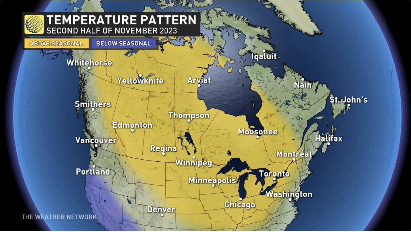
Temperature pattern for the second half of November. (The Weather Network)
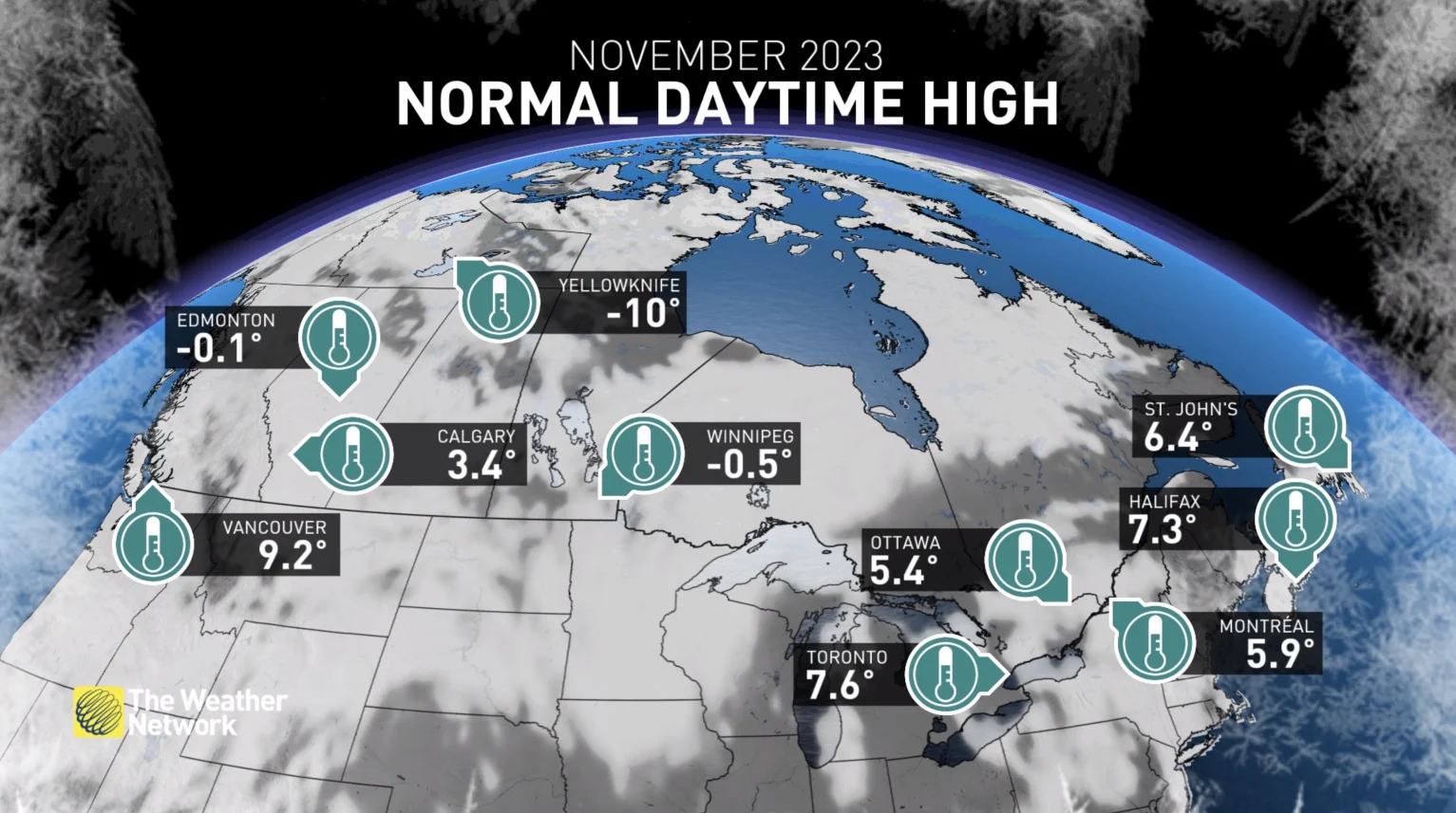
While reading this, it is important to remember that 'normal' (or 'seasonal') temperatures steadily drop during November, so 'mild' temperatures during late-November will not be anywhere near as warm as what many Canadians saw in October.
El Niño Impact
El Niño conditions continue to strengthen in the tropical Pacific Ocean, and that is one of the key considerations as we look to the second half of November and into winter.
However, the challenge with this forecast is that the jet stream is not consistently reacting to the change in ocean water temperatures, as it typically has done in the past. In fact, the jet stream pattern is currently behaving as if we were still in a La Niña event, despite that pattern ending last spring after three years.
If that tendency continues into the second half of November, then we will continue to have a higher risk for shots of colder weather across Ontario and Quebec.
This will also be a major consideration in our 2023-24 Winter Forecast, which will be released on Wednesday, Nov. 29th.


