Hurricane Ernesto steadily marching toward Canadian waters
The hurricane is lashing Bermuda as it picks up speed and threatens impacts to Newfoundland early next week
Folks across Newfoundland should closely watch the progress of Hurricane Ernesto as it churns through the western Atlantic Ocean this weekend.
The storm, which is currently lashing Bermuda, could bring high winds and heavy rainfall to eastern Newfoundland early next week. This includes St. John’s and surrounding communities.
While the precise timing could change, we’re likely looking at impacts to Atlantic Canada beginning Monday and lasting into Tuesday.
Keep up with all the latest news and information throughout hurricane season at The Weather Network’s hurricanes hub.

The latest forecast shows Hurricane Ernesto remaining east of Nova Scotia during the day Monday. “The only expected impact for Nova Scotia will be heavy surf conditions along the Atlantic coast of the province Sunday and Monday,” the Canadian Hurricane Center said in a statement on Friday. Rip currents are a common and deadly hazard for beachgoers.
Models have come into better agreement that Ernesto’s future track will bring some impacts to Newfoundland. Here’s what we know about the forecast so you can prepare for the potential effects of rain and wind on the island.
Eyes on Canadian impacts
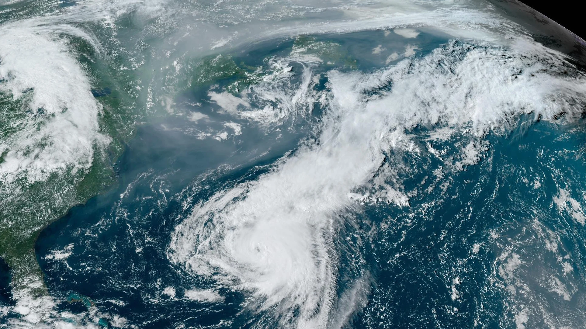
Ernesto remained a large hurricane on Friday as it steadily marched north toward the tiny island of Bermuda, which is located about 1,000 km off the coast of North Carolina.
Folks across Bermuda will experience an extended period of high winds, heavy rainfall, and coastal flooding from high waves and storm surge.
The storm will continue moving north into this weekend before curving in a more northeasterly direction this weekend. Following this projected track, Ernesto will come very close to eastern Newfoundland late Monday and into early Tuesday.
RELATED: Hurricane Ernesto leaves half of Puerto Rican customers without power
It’s likely that Ernesto will begin transitioning from a tropical system to an extratropical low-pressure system by early next week. This transition will spread the storm’s energy over a wider area, expanding the reach of the storm’s winds and rainfall.
If the centre of the storm comes ashore, then strong winds, heavy rain, and coastal flooding could be an issue. Even if Ernesto avoids a direct landfall on Newfoundland, it’s likely that we’ll see some impacts from rain, wind, and waves as the storm passes by to the east.
Based on current projections, wind gusts upwards of 100 km/h are expected across the southeastern Avalon Peninsula, with 70-80 km/h gusts expected for St. John’s.
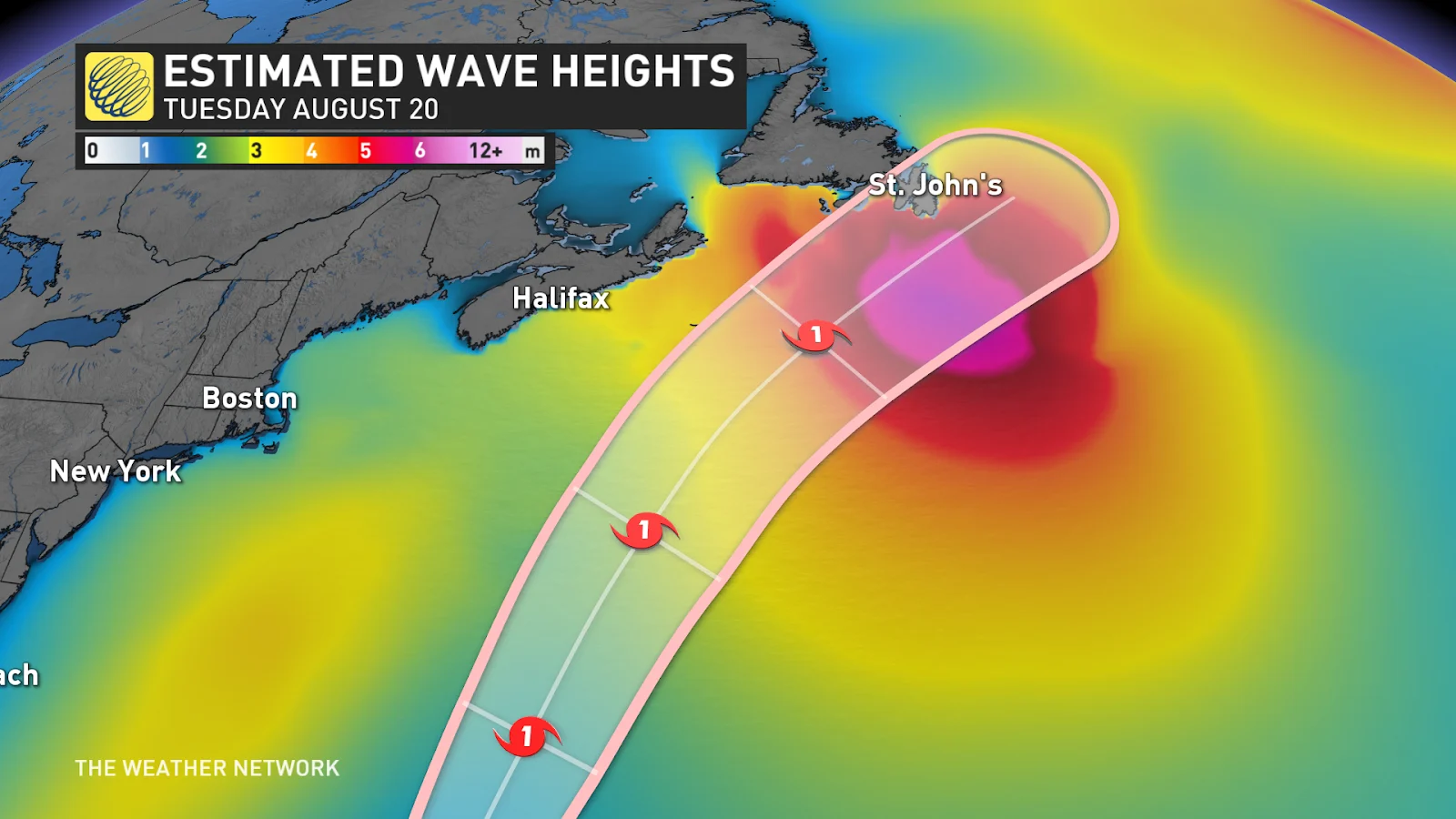
The southern shores of the Burin and Avalon Peninsulas could see the risk for minor coastal flooding from waves pushing ashore from the south. St. John’s should be protected from the worst waves.
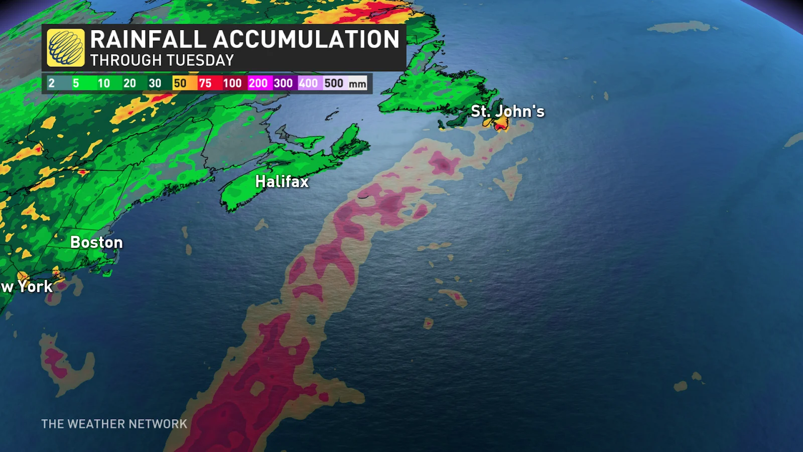
Rainfall won’t be particularly intense with this storm, with model guidance ranging from 30-60 mm depending on the system’s precise track through the region. The storm’s swift forward motion would limit the duration of rainfall to a few hours.
Continue to check back through the weekend as the storm evolves and the details become clearer on this potentially impactful forecast across Newfoundland.
Header image courtesy of NOAA.
Stay tuned to The Weather Network for all the latest on Hurricane Ernesto.