Intense fall storm to hit the East Coast with impactful rain and winds
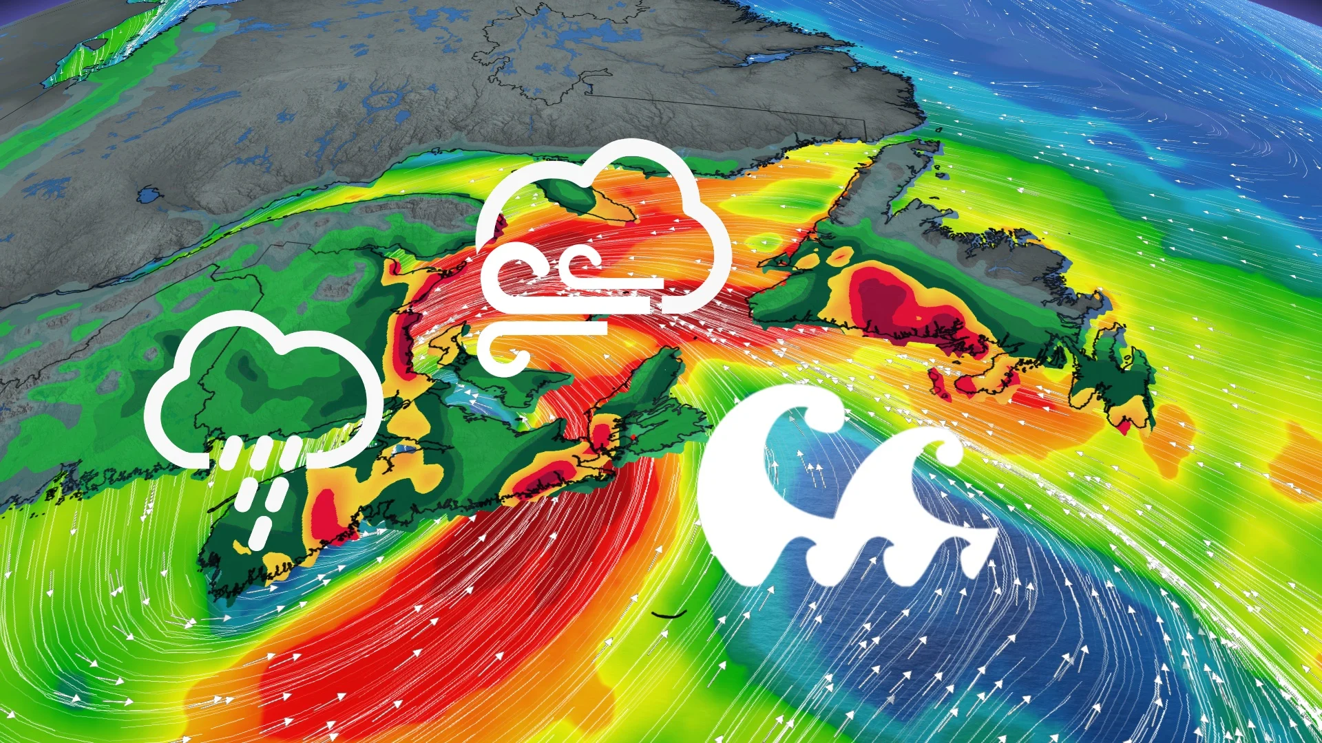
Another Atlantic rain-maker moves in for the weekend, with heavy rain, blustery winds, and even some slushy snow for some, prompting warnings across parts of the East Coast.
A weekend storm will bring plenty of wind and precipitation to Atlantic Canada, helping to relieve pressures on areas facing lower water levels. According to Halifax Water, minimal precipitation this fall has resulted in lower-than-normal water levels in Lake Major.
The unsettled pattern will continue through the weekend, and beyond, keeping much of Atlantic Canada stuck in the stubborn and gloomy cycle.
RELATED: Parts of Atlantic Canada actually in need of the weekend rain
Periods of rain will be widespread across, with 30 to 50+ mm forecast for much of the region. The rain will also mix with wet snow in New Brunswick, and some slushy accumulations aren't out of the question, especially for higher terrain and northern areas.

As well, winds will be quite blustery at times, with a significant risk of damaging gusts. High winds may toss loose objects or cause tree branches to break, and there is a good chance of power outages, especially in the warned regions.
This weekend:
Wet, cloudy, and unsettled conditions have been the story this week in Atlantic Canada this week. Another low is set to bring more widespread rain and strong wind gusts through the weekend.
So far this month, Halifax, N.S., has only recorded nine per cent of the normal rainfall amount for November.

Heavier precipitation will pick up through much of the day on Saturday.
The low will meander across the region before eventually tracking east into Newfoundland, and blasting the region with heavy rain, as well.

DON'T MISS: Transform your broken umbrella with this clever hack
A widespread 30-60 mm of rain is forecast by the time all is said and done on Sunday.

Saturday will be the more impactful day in terms of the wind. Although not overly widespread, a swath of 80 km/h gusts will sweep through the eastern half of Nova Scotia and eastern New Brunswick while P.E.I. and shoreline areas will see gusts exceeding 100 km/h.
Ensure devices are charged as power outages are likely.

An active pattern will continue through at least the end of November. Another large, low-pressure system will track into the Maritimes late Tuesday and linger through Wednesday, bringing widespread wind and wet conditions. Following that, a significant system is possible late next week and weekend. Temperatures will be mostly on the mild side of seasonal for the rest of November, and then trending somewhat colder during the first week of December.
Thumbnail courtesy of Erik Witsoe via Unsplash.
Be sure to check back for the latest weather updates across Atlantic Canada.


