Jamaica and Cayman Islands next in line for Beryl's vigorous wrath
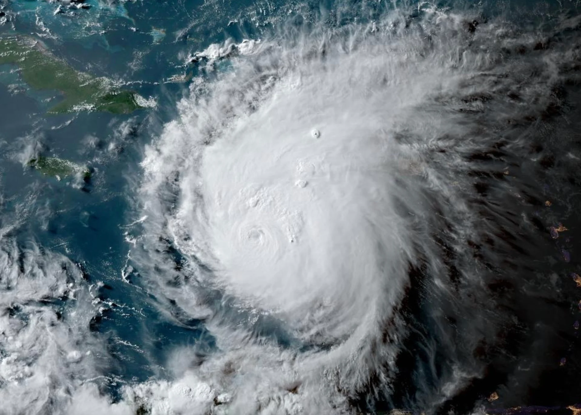
Forceful Hurricane Beryl is now expected to bring life-threatening winds and storm surge to Jamaica and the Cayman Islands this week, continuing its westward trek in the Caribbean Sea and heading towards the Gulf of Mexico
Jamaica is on high alert as it is in the path of the powerful Hurricane Beryl, and will be next in line to see potentially destructive impacts from the storm.
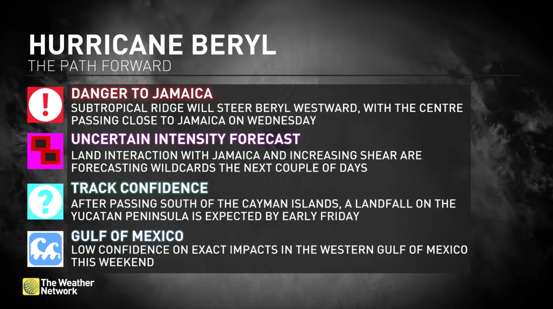
Beryl is churning across the Caribbean Sea as a high-end Category 4 storm, and is forecast to bring "life-threatening" winds and storm surge to Jamaica on Wednesday, according to the U.S. National Hurricane Center (NHC).
Check out The Weather Network’s hurricane hub for all the latest on the active hurricane season ahead
Those who have a flight scheduled for in or out of Jamaica, the Cayman Islands or other destination in the western Caribbean, along with the Yucatan Peninsula of Mexico, on Wednesday, Thursday or Friday should check with their airline about possible delays or cancellations.
Beryl stays the course as destructive storm
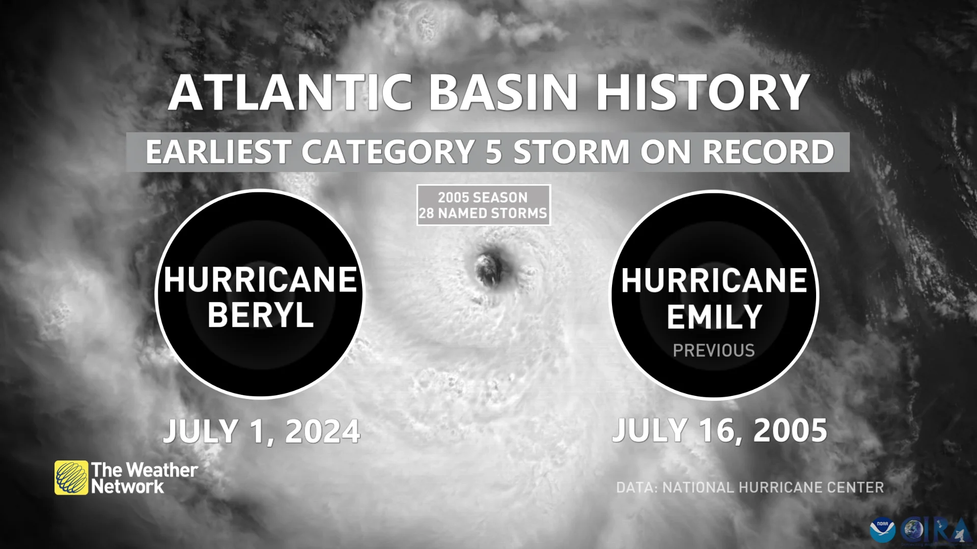
Beryl swirled into history on Sunday when its maximum winds rapidly intensified to Category 4 status, the earliest such storm ever recorded in the Atlantic.
The mighty storm has since then continued to break records, becoming the earliest storm to reach Category 5 status in the Atlantic and being the earliest major storm in the eastern Atlantic basin.
RELATED: Deadly Hurricane Beryl churns toward Jamaica, causes 'immense destruction'
Currently, a hurricane warning is in effect for Jamaica, Grand Cayman, and Little Cayman and Cayman Brac. A hurricane watch is in place for the south coast of Haiti from the border with the Dominican Republic to Anse d'Hainault, and the east coast of the Yucatan Peninsula from Chetumal to Cabo Catoche.
Beryl’s winds have weakened a bit further on Tuesday evening. Destructive winds, life-threatening storm surge, flooding and torrential rains are expected along Beryl’s path.
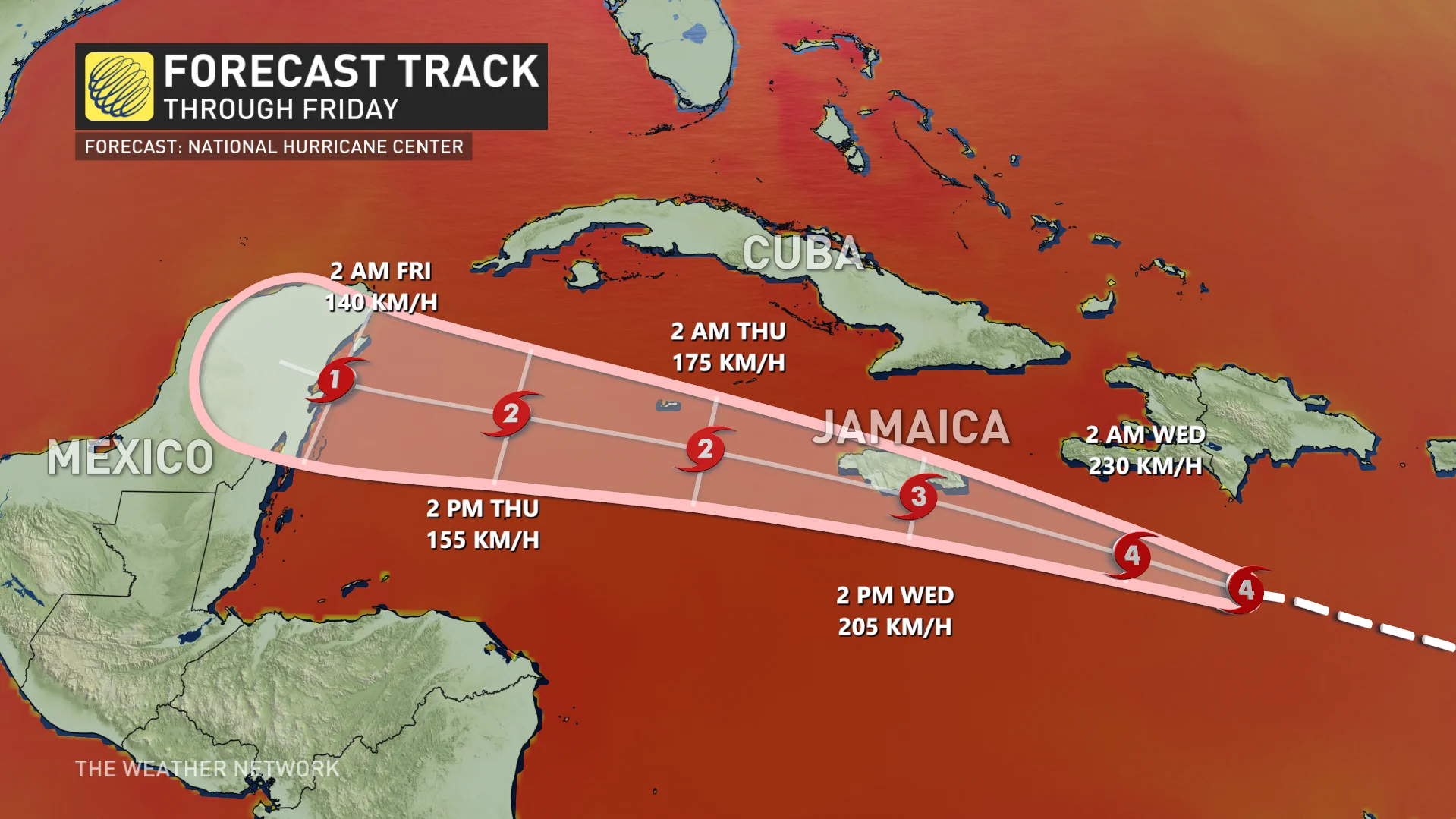
As of 8 p.m. EDT Tuesday, the NHC reported maximum, sustained winds near 240 km/h in its latest update.
SEE ALSO: It's not just your imagination, Atlantic storms are getting stronger faster
Weakening is forecast during the next day or two. However, Beryl is forecast to be at or near major-hurricane intensity while it passes near Jamaica on Wednesday and the Cayman Islands on Wednesday night.
Additional weakening is expected thereafter, though Beryl is forecast to remain a hurricane in the northwestern Caribbean.
After a pass through Jamaica, the centre of Beryl is expected to pass near or over the Cayman Islands Wednesday night or early Thursday, and approach the Yucatan Peninsula of Mexico Thursday night.
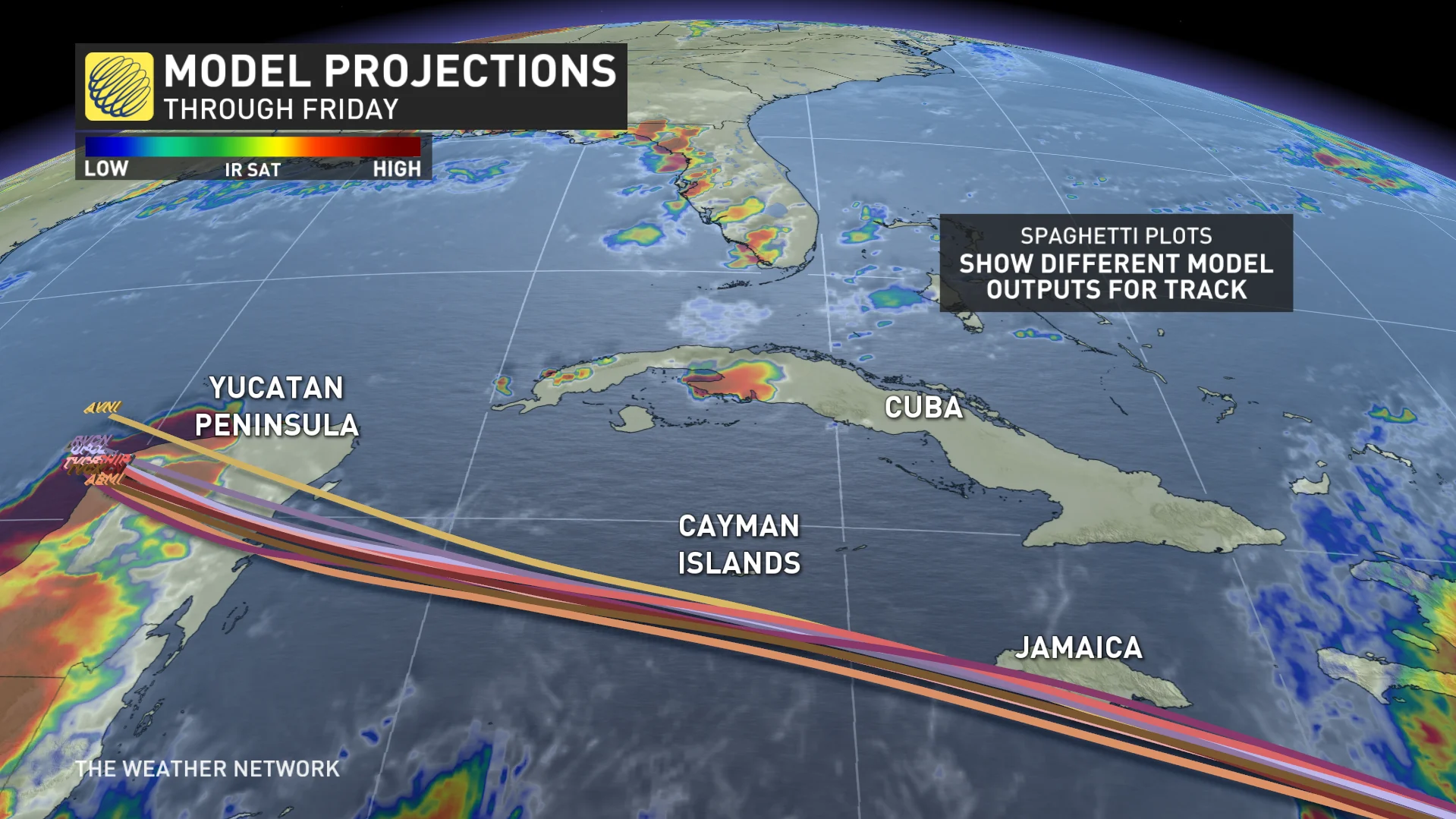
Interests elsewhere in the northwestern Caribbean Sea and the western Gulf of Mexico should closely monitor the progress of Beryl, and heed the advice of local officials.
One of the region’s earliest storms on record
Beryl wouldn’t be out of place as a powerful hurricane in the middle of hurricane season, but it’s unheard of to have such a powerful storm this early in the year.
It was the earliest we’ve ever seen a hurricane form in the tropical Atlantic Ocean.

(Courtesy of Red Cross Canada)
RELATED: Hurricane forecasts are better today than ever before—here’s how
The only other storms that formed this far east this early in the year were Hurricane Elsa in 2021 and an unnamed storm that hit Trinidad and Tobago in 1933. It’s worth noting that both 2021 and 1933 eventually ranked among the most active hurricane seasons on record.

Beryl is also the earliest Category 4 and 5 hurricane ever recorded in the Atlantic Ocean, beating by a week the record set by Hurricane Dennis back in 2005. The historic 2005 season saw Hurricanes Dennis and Emily peak at Category 4 and 5, respectively. Dennis reached major hurricane status on July 7, and Emily did so a week later.
The last time there was a major hurricane before the July 4th holiday was Hurricane Alma on June 8, 1966. Alma was also the earliest hurricane to make landfall in the U.S. since 1825.
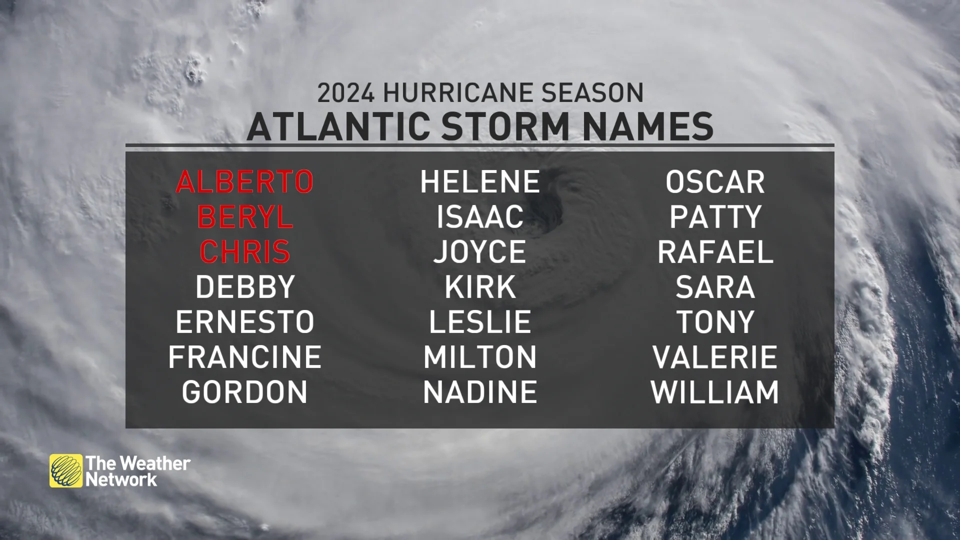
Experts largely agree that we’re in for a very active Atlantic hurricane season in the weeks and months to come. Sea surface temperatures throughout the Atlantic are running several degrees hotter than normal, closer to what you’d expect in September than the end of June.
MUST SEE: El Niño is over—but La Niña may arrive during peak hurricane season
These abnormally hot waters will combine with the lower wind shear brought on by a developing La Niña in the eastern Pacific to foster extremely favourable conditions for tropical cyclone development through the peak of the season this fall.
The latest seasonal outlooks call for as many as two-dozen named storms, which is far more than the 14 tropical storms we’d see during a typical Atlantic hurricane season.
Thumbnail courtesy of the National Oceanic and Atmospheric Administration (NOAA).
Stay with The Weather Network for all the latest throughout hurricane season.


