Messy system to deliver a wintry punch to the East Coast
We're watching for a potential snowstorm that could impact parts of Atlantic Canada by the end of the week, with an uncertain track yielding two possible scenarios
The unsettled pattern will continue across much of Atlantic Canada this week, keeping the region stuck in a stubborn and gloomy cycle.
This comes after parts of the East Coast saw minimal precipitation in much of this fall, resulting in lower-than-normal water levels in Lake Major.
RELATED: Parts of Atlantic Canada actually in need of the weekend rain

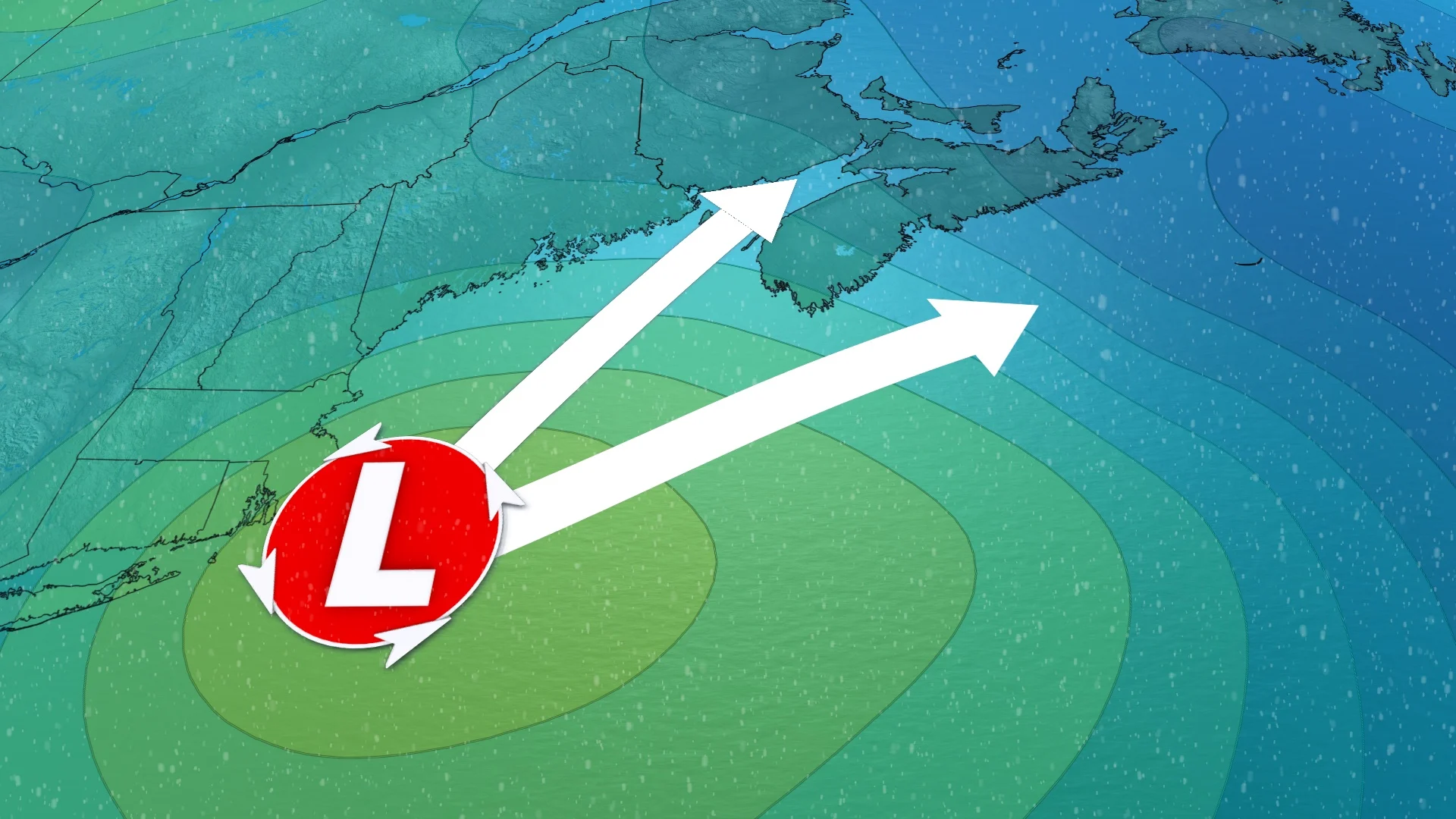
The next scenario will come from a forthcoming Colorado low, which is expected to become a messy storm as it intensifies and tracks into Atlantic Canada late this week. There are two scenarios on the table, one of which would bring significantly more snow to the northern Maritimes, if it comes to fruition.
This week:
A low-pressure system tracking through the U.S. Northeast will move into Atlantic Canada, bringing some accumulating snow to the region. However, there is low confidence on where the heaviest amounts could fall.
DON'T MISS: Transform your broken umbrella with this clever hack

The low will track in late Thursday with some rain initially, but during the overnight hours and into Friday morning, a good chunk of the Maritimes will see transition to snow.
Southwestern Nova Scotia and the southern shores look to just see rain for the system.

There are two scenarios on where the low will track.
The first scenario has the system moving south of Nova Scotia, bringing the heaviest snow into northern areas of the province and southern New Brunswick.

The second would see it track through the Bay of Fundy and brings the heaviest snow into New Brunswick. It still brings snow to Nova Scotia, but wouldn't be as heavy.
These two scenarios can bring some locations from seeing accumulating snow to snowblower amounts, so check back with The Weather Network soon as we continue to monitor the situation.
Stay with The Weather Network for all the latest on conditions across Atlantic Canada.


