LIVE: Florida in the thick of it as dangerous Hurricane Milton nears landfall
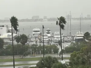
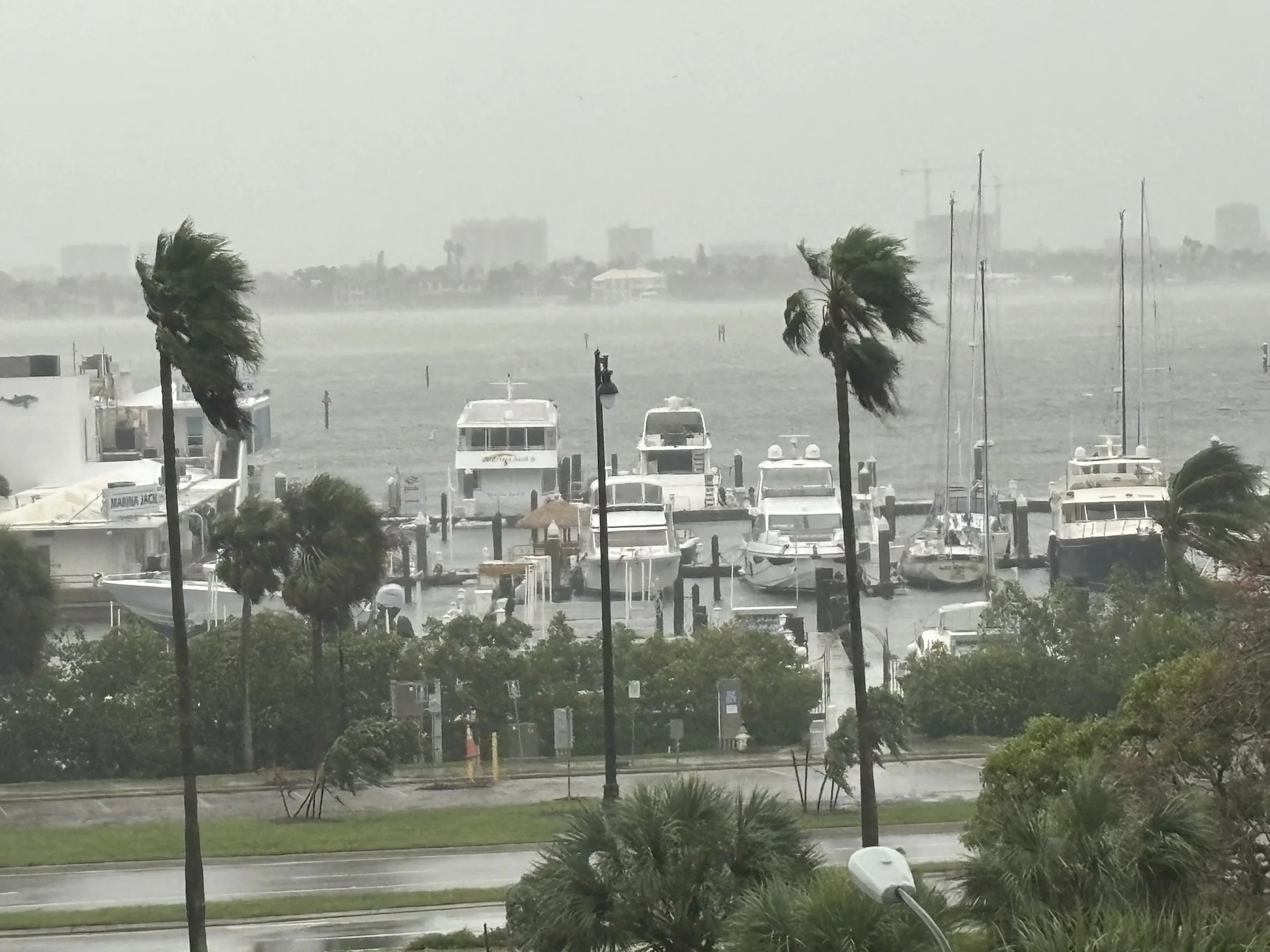
Hurricane Milton has begun to unleash some rainfall, tornado, wind and storm surge impacts on Florida, while speeding up its trajectory toward a Wednesday night landfall
The effects of Hurricane Milton have begun to show up in Florida as the extremely dangerous, Category 3 hurricane picks up speed toward a Wednesday night landfall, within the next few hours.
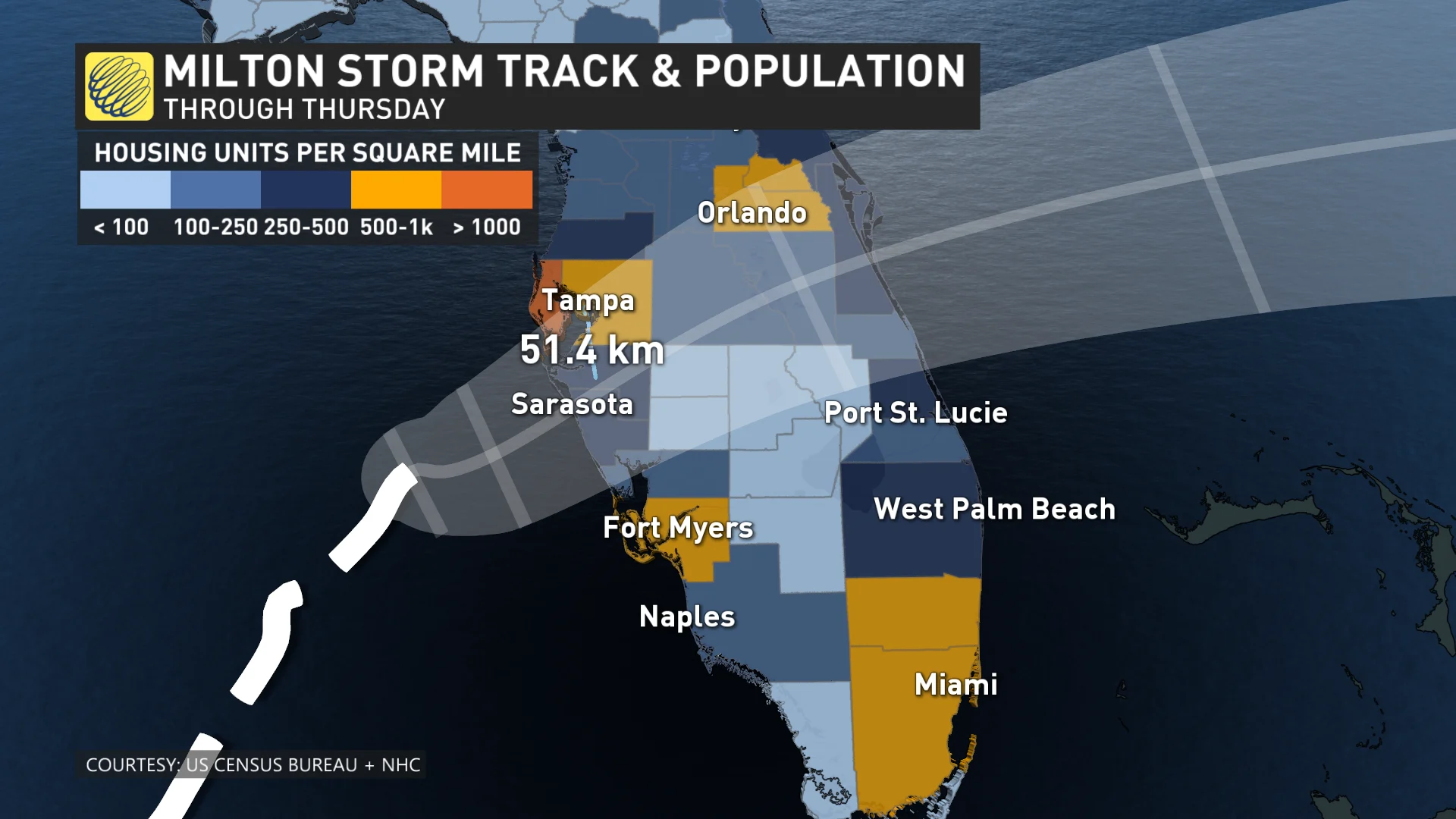
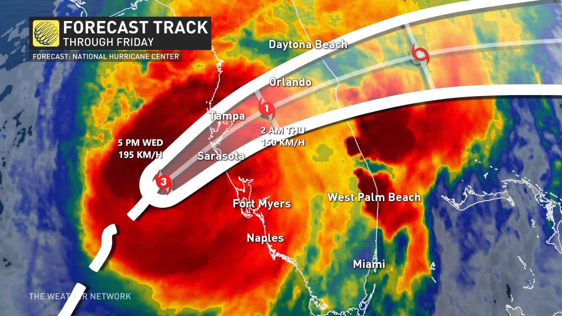
Milton could still be a major hurricane when it reaches the coast of west-central Florida coast, likely making a landfall in or near Sarasota. Ahead of its landfall, there have been numerous supercells and tornadoes spotted as the outer bands made it to land.
"This is a life-threatening situation. Persons located within these areas should take all necessary actions to protect life and property from rising water and the potential for other dangerous conditions. Promptly follow evacuation and other instructions from local officials," NHC said in its Wednesday evening update.
DON'T MISS: Nightmare scenario unfolding for Tampa with Milton's potential hurricane track
More than one million people in coastal areas are under evacuation orders, with the region still reeling from the widespread destruction of Hurricane Helene just two weeks ago. Tampa Mayor Jane Castor warned people in evacuation zones to "get out or risk death."
Keep up-to-date with the latest Hurricane Milton developments by visiting The Weather Network's hurricane hub.
Current strength and track
Milton reclaimed Category 5 hurricane status on Tuesday for a second time, and the storm maintained maximum, sustained winds of 260 km/h as of early Wednesday. After losing some strength, its wind speeds have increased again. It now boasts maximum, sustained winds near 205 km/h. It still remains a dangerous Category 3 hurricane.
Thanks to extremely warm sea surface temperatures, Milton quickly became one of the fastest, intensifying storms on record in the Atlantic Ocean, surging from a tropical depression to a dangerous Category 5 hurricane in just 49 hours. It is also the strongest storm on our planet for 2024 so far, beating out Hurricane Beryl in July.
Milton will remain a hurricane while it moves across central Florida through Thursday. Milton is forecast to weaken over the western Atlantic and become extratropical by Thursday night.
"On the forecast track, the centre of Milton will make landfall near or just south of the Tampa Bay region this evening, move across the central part of the Florida Peninsula overnight, and emerge off the east coast of Florida on Thursday," the NHC says.
WATCH: Hurricane Milton set for landfall as eye moves south
Current alerts in Florida
A storm surge warning is in effect for Florida's west coast from Flamingo northward to the Suwannee River, including Charlotte Harbor and Tampa Bay. It's also in effect for the east coast of Florida, from Port Canaveral northward to the mouth of the St. Mary's River, including the St. Johns River. As well, it has been extended southward to Sebastian Inlet, Florida, and northward to Altamaha Sound, Ga.
The hurricane warning has been issued from Bonita Beach northward to the mouth of the Suwannee River, including Tampa Bay, as well as from the Indian River-St. Lucie County Line northward to Ponte Vedra Beach, and extended southward to the St. Lucie/Martin County Line.
RELATED: Why Florida’s west coast is so vulnerable to storm surge flooding
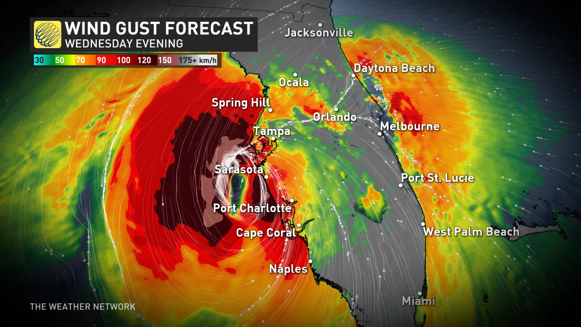
Impacts: Winds, life-threatening flash flooding and storm surge
Powerful winds in the core of the hurricane will cause significant damage near the point of landfall. Damage to homes and businesses is likely, along with long-lasting power outages in the hardest-hit communities. Power outages are expected to last for days in the storm's wake.
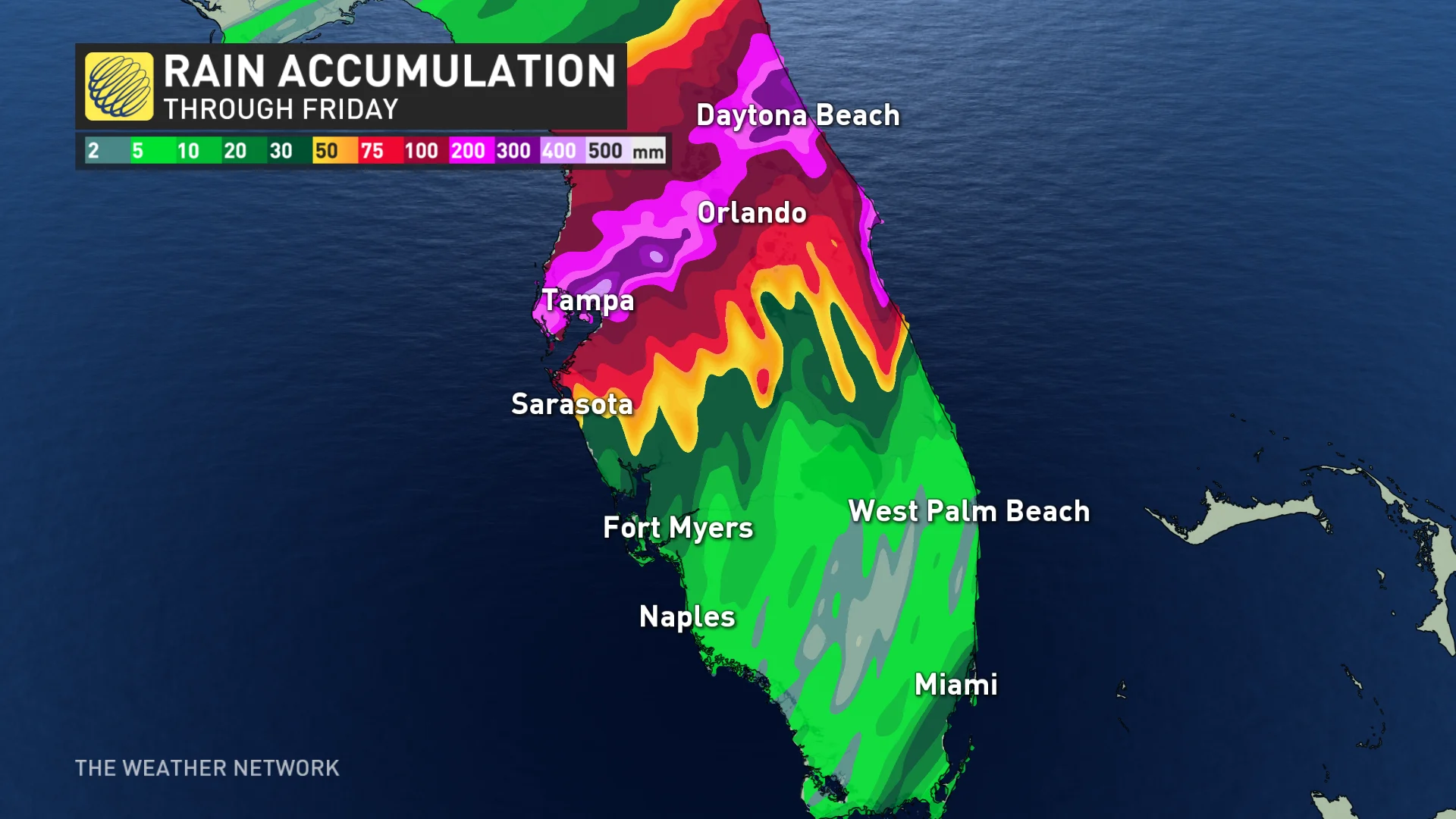
Many communities throughout Florida could see 150-300+ mm of rain during this event. Some localized areas could even see up to 450 mm. Between 200-300 mm is expected for both Tampa and Orlando, while areas south of the track could still pick up 100-150 mm of tropical rain.
"This rainfall brings the risk of catastrophic and life-threatening flash and urban flooding, along with moderate to major river flooding," NHC says.
MUST SEE: Why focusing on a hurricane’s category is downright dangerous
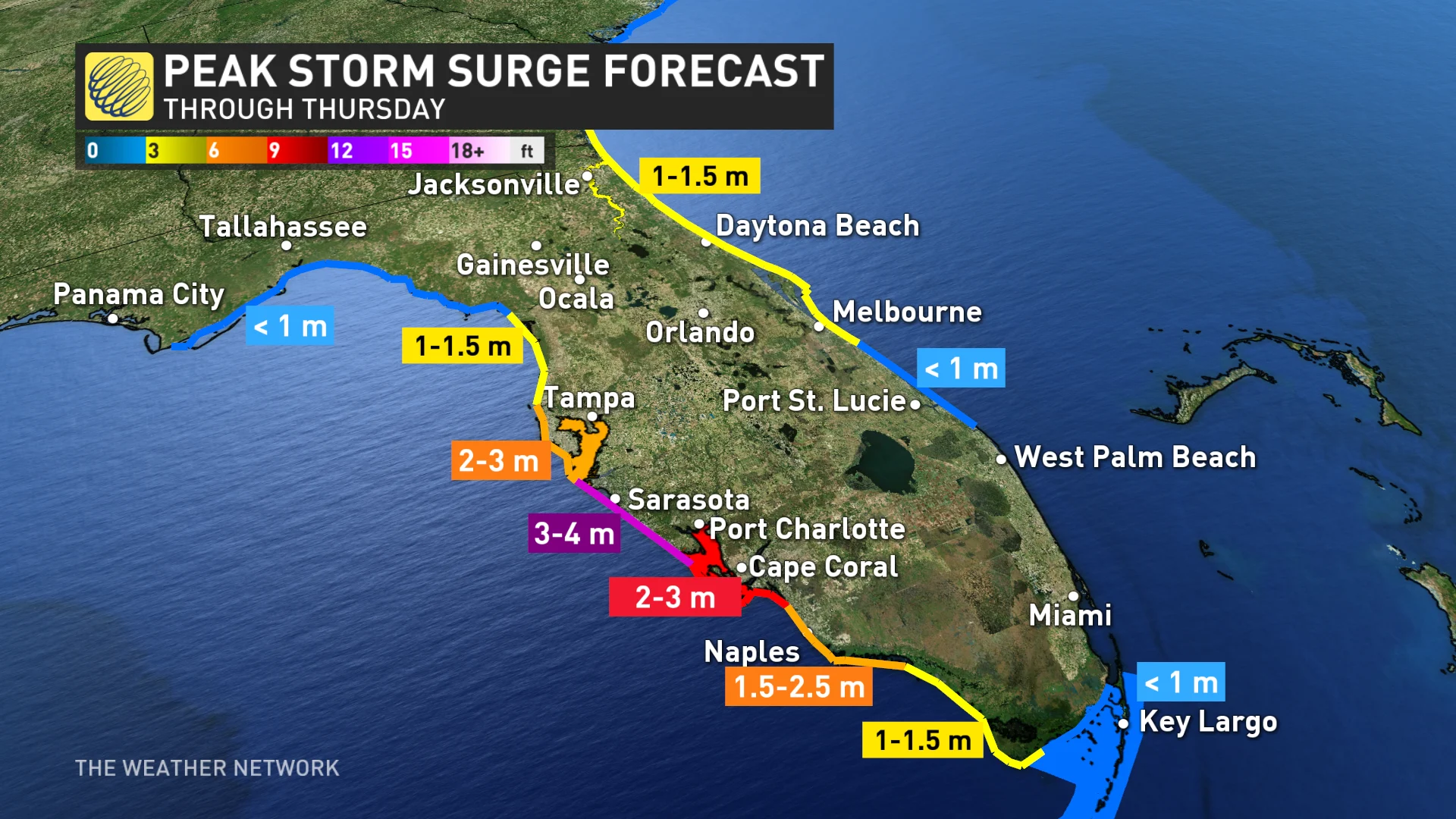
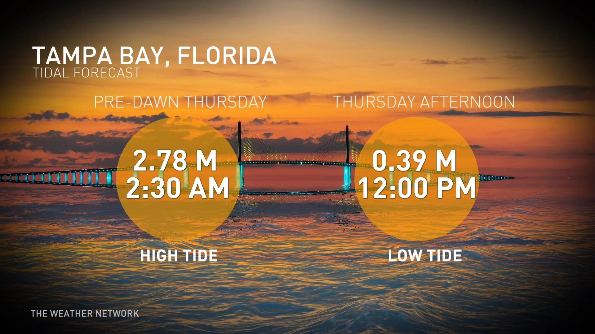
A life-threatening storm surge is likely where the hurricane makes landfall. Florida’s western coast is exceptionally vulnerable to storm surge flooding.
Even if the eye of the storm skirts the Tampa Bay area, Milton's storm surge will still be a very dangerous situation for the region. It will be the most life-threatening part of the storm as high waves funnel into narrow bays.

In Tampa Bay, water heights could reach 1.83-3 metres above ground. That's more than a single-storey home. The deepest water will occur along the immediate coast near and to the south of the landfall location, where the surge will be accompanied by large and dangerous waves.
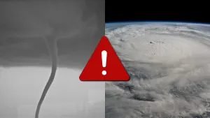
Dangerous, tropical tornadoes
As with any landfalling tropical system, tornadoes have been reported ahead of Milton's landfall.
Tornadic supercells from Milton began to sweep across the southern Florida Peninsula late Wednesday morning, with more spotted as the day wore on, resulting in damage across multiple locales.
Stay alert for tornado alerts throughout the state. Tropical tornadoes can happen quickly with reduced tornado warning lead time.
A major hurricane hasn't directly hit the Tampa Bay area in living memory. The last major hurricane to strike the region occurred back in 1921.
Milton will be an extraordinarily high-impact, life-threatening, if not, a catastrophic event, with a far-reaching power outage potential, that in the hardest-hit areas will take months to clean up, or years to rebuild. According to RBC analysts, Hurricane Milton could cost insurers up to US$100 billion.
WATCH: Gas shortages and empty streets as Florida braces for Milton's impact
With files from Reuters.
Thumbnail courtesy of Nathan Coleman, a reporter at The Weather Network.