Another bomb cyclone heads for B.C. this weekend, but this will be different
As BC Hydro crews work to restore power from the bomb cyclone, another storm steps onto the West Coast stage for this weekend, threatening even more rain, snow and strong winds.
After a destructive bomb cyclone hit on Tuesday and Wednesday, the next impactful B.C. storm is already on deck––just in time for the weekend.
DON'T MISS: Power restorations continue after powerful bomb cyclone batters B.C.
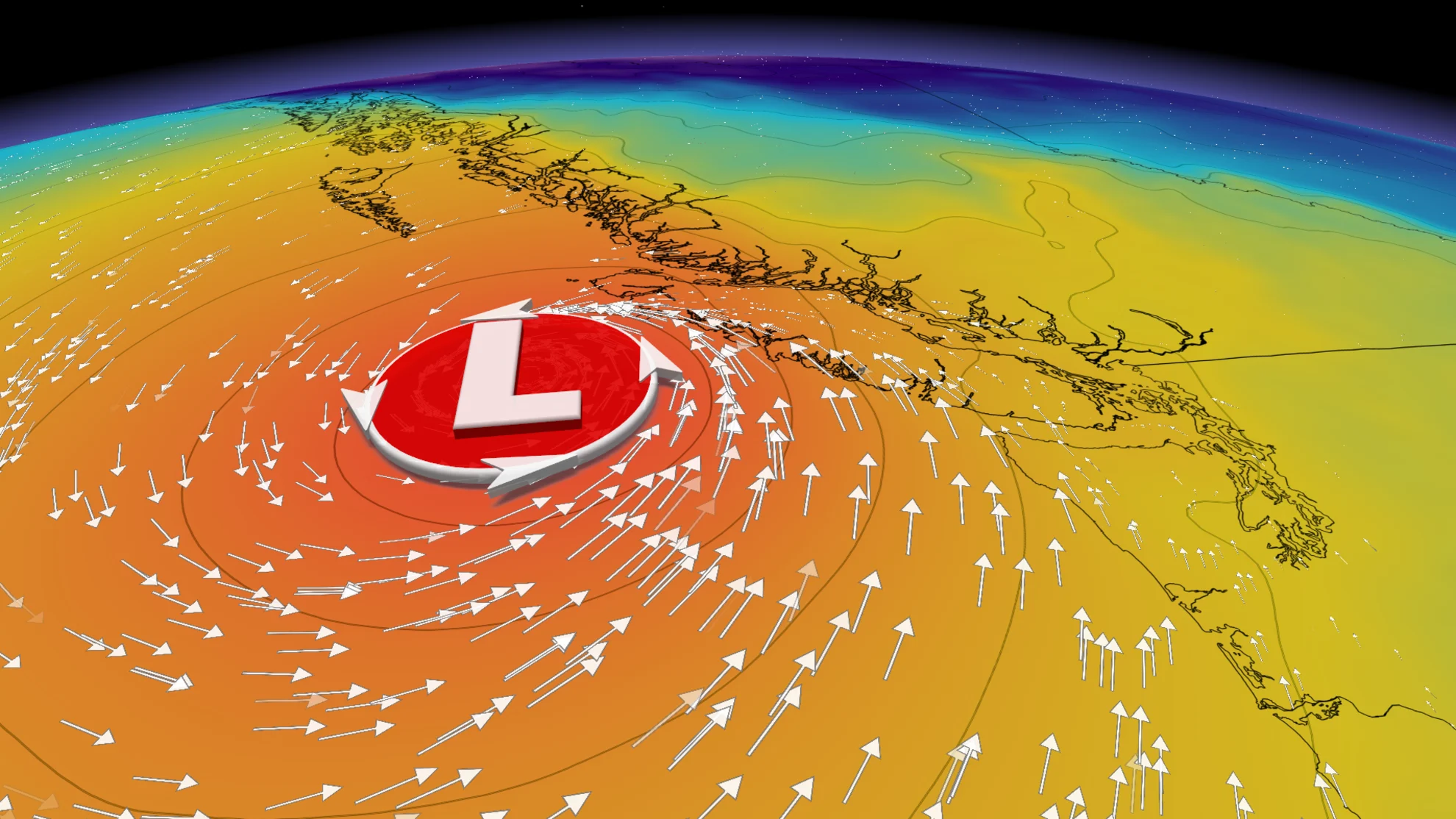
Another low-pressure system gears up to push into B.C.’s South Coast after the mid-week monster bomb cyclone brought wind gusts upwards of 170 km/h along western Vancouver Island, driving power outages and setting new wind records. This weekend system will be classified as another bomb cyclone, as it will undergo rapid intensification, but will remain weaker than the previous storm.

Regardless, there could be more power and travel disruptions on Friday and Saturday due to the wind gusts and rain in the forecast, so it'll be best to be prepared and stay up-to-date on the weather warnings in your area.
Next storm en route for the weekend
As the first weather bomb weakens and retreats offshore, it will draw the next storm toward the Pacific coast, strengthening as it does so.
Enjoy Thursday along the South Coast as conditions will clear for the day in between systems, with sunny breaks even possible.
SEE ALSO: Heavy snowfall in B.C. leads to early opening at Big White Ski Resort
The low is pulling moisture off an atmospheric river aimed at the northwestern U.S., bringing a lobe of it to the South Coast of B.C. by Friday. That will raise the flood threat, particularly for Northern California and southwestern Oregon.

This storm will be weaker than the double bomb cyclone from earlier in the week, but it will still undergo rapid intensification, leading to weather bomb criteria once again. It will be especially impactful due to its track right to the western shore of Vancouver Island.
The storm inches towards the coast by Friday, moving closer to shore than the weather bomb early this week. It will be aimed at the South Coast, but it will drift back out to the Pacific by Sunday, just as its predecessor did. Winds will, however, still come from the southeast, though remaining weaker than the previous storm.

Ferry delays are possible again with this system, but likely not as many.
DON'T MISS: B.C. bomb cyclone to create the world’s largest wave pool
Southeasterly wind gusts will funnel through the Georgia Strait, hitting speeds of 50-70 km/h on Friday afternoon in Vancouver, and between 60-80 km/h for Victoria. Across West Vancouver Island, gusts between 80-100 km/h area forecast. There's a heightened power outage risk associated with these winds, though it's not expected to impact as many customers as it did before.

A difference with this system is that the precipitation will make its way further inland, spreading through all of southern B.C. this time around.
Rain totals won't be impactful however, with 15-30 mm expected for the Lower Mainland, and lesser amounts of 5-10 mm for Victoria.

Freezing levels should hold steady around 1,200 metres, likely bringing 15-20+ cm of snow to the Allison and Coquihalla passes.
Another 50 cm of snow is likely for Whistler, putting the total to more than one metre this week.

Stay with The Weather Network for all the latest on conditions across B.C.


