October outlook: Summer slowly fades, but consistent cold is delayed
Will October see the country fall back into a cooler pattern across Canada as we progress through the autumn? Or, will we see the recent trend of warmer-than-usual temperatures continue? We have the details on what you can expect during the upcoming month.
While there is no doubt that summer is fading, the transition to consistent, autumnal weather has been slower than normal across Canada so far this year. Will that trend continue through the month of October?
Please read on to find out what you can expect during the upcoming month.
Visit our Complete Guide to Fall 2024 for an in depth look at the Fall Forecast, tips to plan for it and much more!
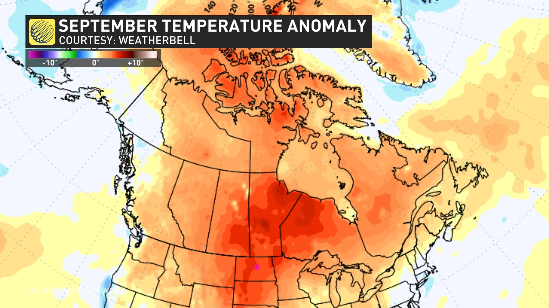
We expect that the national temperature pattern during October will resemble what we we saw during September.
The map below shows the temperature anomalies that we saw across Canada during the past month. The various shades of orange and red highlight the warmer-than-normal temperatures, which dominated across most of Canada.

However, keep in mind that "normal" temperatures quickly fall through the month of October. So, temperatures that feel chilly during early October end up feeling relatively warm before the end of the month.
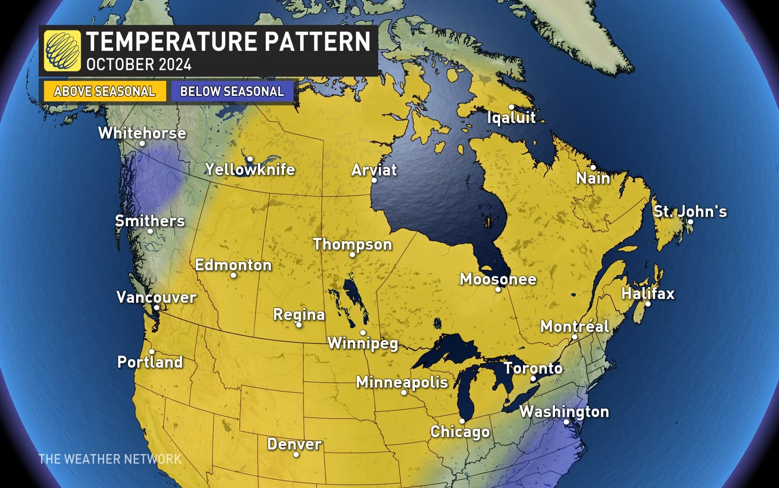
Here is our temperature forecast for the month of October. Much like September, we expect that warmer-than-normal temperatures will dominate across most of Canada.

However, October is always a changeable month and everyone will see significant interruptions to the warmer pattern.
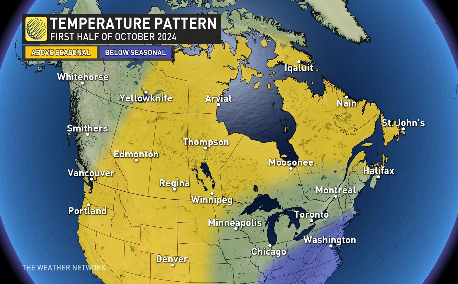
In fact, during the first two weeks of October, a couple strong cold fronts will bring periods of much cooler weather across the Prairies and into Ontario and Quebec. From the Great Lakes to southern Quebec, the back-and-forth temperature swings should result in near-normal temperatures during the first half of the month.

While this will be quite a contrast to September’s summer-like weather, it does not mean that winter is getting ready to storm onto the field.
During the second half of October, we expect that warmer-than-normal temperatures will be more consistent across most of Canada, east of the Rockies.

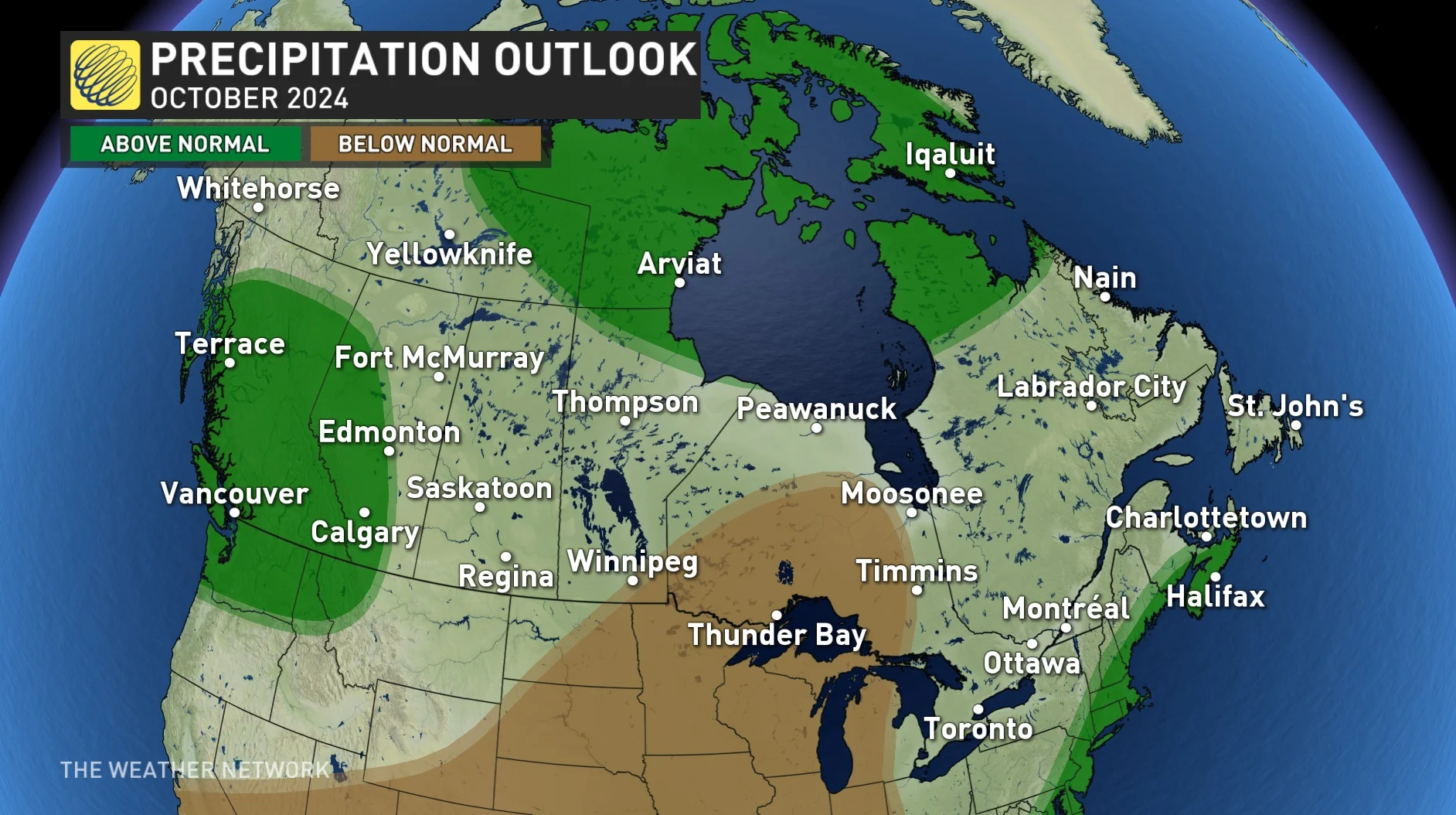
While we are getting into the time of year that is known for its classic fall storms, we expect that October 2024 will feature fewer storms than normal for most of the country, except for B.C and into Alberta.
The active and wet pattern, which has been impacting northern and central B.C., should shift farther south as the month progresses.

Precipitation totals for Eastern Canada will highly depend on whether a tropical storm or hurricane impacts the region. While the heart of the season was unusually quiet, the tropics became very active during late September, and that pattern will continue well into October.
While parts of Central Canada will see below-normal precipitation totals, many places are still forecast to reach near-normal totals despite seeing fewer than the typical number of rainy days. That is due to the risk for a couple of strong and moisture-laden storms, despite the quieter pattern overall.

WATCH: Canada's records its first -20C temperature of the season
Stay tuned to The Weather Network for the latest updates on the forecast for each Canadian region as October progresses.


