Ominous signs for hurricane season as Atlantic swelters, La Niña looms
The latest forecast from NOAA paints a grim picture of the upcoming Atlantic hurricane season
Experts increasingly agree that we’re bound to face a very active hurricane season this year across the Atlantic basin.
NOAA’s annual forecast released on Thursday calls for a constant drumbeat of activity across the Atlantic, which means folks across the East Coast should remain extremely vigilant heading into the summer months.
The potential exists for the Atlantic to produce enough storms to run out of names for only the third time on record.
DON’T MISS: What La Niña could mean for Canada’s upcoming summer
NOAA’s high-end forecast
Hurricane forecasters with NOAA expect 17-25 named tropical storms this year, which is far above the seasonal values for a typical hurricane season in the Atlantic Ocean.

About half of those storms could grow into hurricanes, with the potential for several major hurricanes with winds of Category 3 strength (178 km/h) or higher.
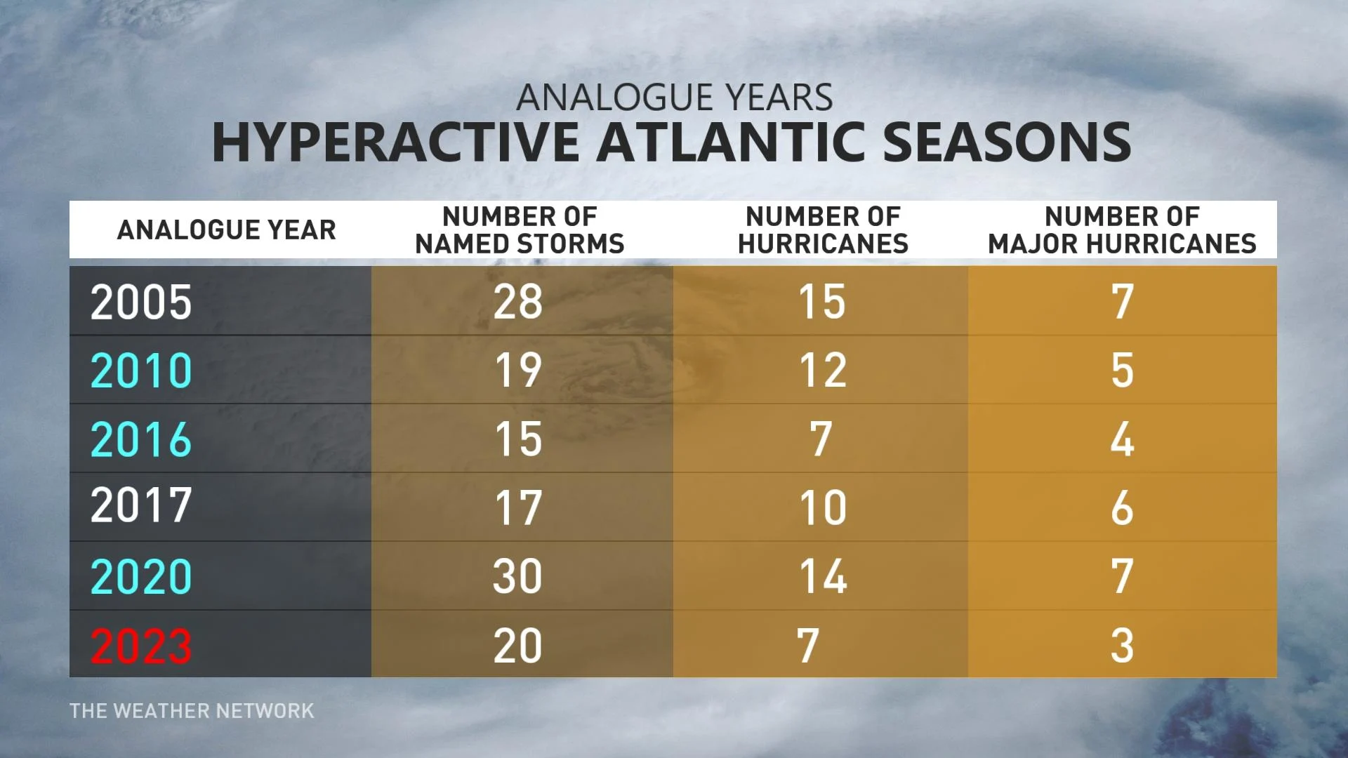
An average Atlantic hurricane season would produce 14 named tropical storms, seven of which would grow into hurricanes, and about three of those hurricanes growing into major hurricanes.
RELATED: Experts predict an extremely active 2024 Atlantic hurricane season
This is in line with Colorado State University’s highly anticipated forecast, which also called for a hyperactive season that could push the envelope with 23 named tropical storms.

If either forecast verifies, the 2024 hurricane season would rank among the most active on record. The current record for the most named storms in a single season was 30, set during the historic 2020 Atlantic hurricane season.
Canadians should remain on guard
According to the Canadian Hurricane Centre, more than 30 percent of all tropical systems in the Atlantic Ocean track through or close to Canadian waters.
Folks across the Atlantic provinces have to pay close attention during every hurricane season, but especially when a very active season is in the cards.
HURRICANE PREPAREDNESS: Here’s what you need in your kit
Landfalling storms aren’t just a coastal hazard. The remnants of storms that hit the United States often sweep into Ontario, Quebec, and the Maritimes. Remnants are sneaky hazards that can produce widespread flooding, wind damage, and even tornadoes.
Make sure your emergency preparedness plans are in place just in case a storm threatens the region. You should know where to go and what to do if your area is evacuated ahead of a storm, as well as what to do if flooding threatens your home during and after a storm.
Check your emergency supplies now and ensure you have everything you need to get through a storm and its aftermath, which could include long-duration power outages.
WATCH: 2024's hurricane outlook released by Canadian Hurricane Centre
La Niña, hot Atlantic are Contributing factors
Several worrying factors are working together to create the potential for a very active hurricane season ahead.
The biggest factor is sweltering sea surface temperatures throughout the tropical Atlantic Ocean. Hot water is the fuel that drives a tropical system.

"The level of heat is pretty much unprecedented," said Bob Robichaud with the Canadian Hurricane Centre on Thursday. "As of now, the temperatures are more what we would see in August than they would be in May."
Very hot water temperatures powered the 2023 Atlantic hurricane season through the typical subduing influence of an El Niño to above-average territory.

MUST SEE: Millions at risk as land sinks beneath major coastal cities, study finds
This year, though, we’re on the way toward a La Niña during the height of hurricane season. This pattern of cold waters in the eastern Pacific Ocean reduces the destructive wind shear that can kill an Atlantic tropical disturbance before it has a chance to form.
The overall pattern of less wind shear and warmer waters could afford more opportunities for any disturbance to take root and strengthen as they roll west across the Atlantic and Caribbean.
21 names may not be enough
This year’s list of Atlantic names begins with Alberto and ends with William. Given that there are only 21 names on each season’s list, there’s a potential that we could run out of storm names for only the third time on record.

If we run out of names this year, we’ll move to a supplementary list of names that forecasters introduced after the hyperactive 2020 season. This auxiliary list of 21 additional names works the same way, beginning with Adria, Braylen, and Caridad.
Check back for The Weather Network’s exclusive summer forecast on May 29, which will include a full tropical update to cover the season ahead.
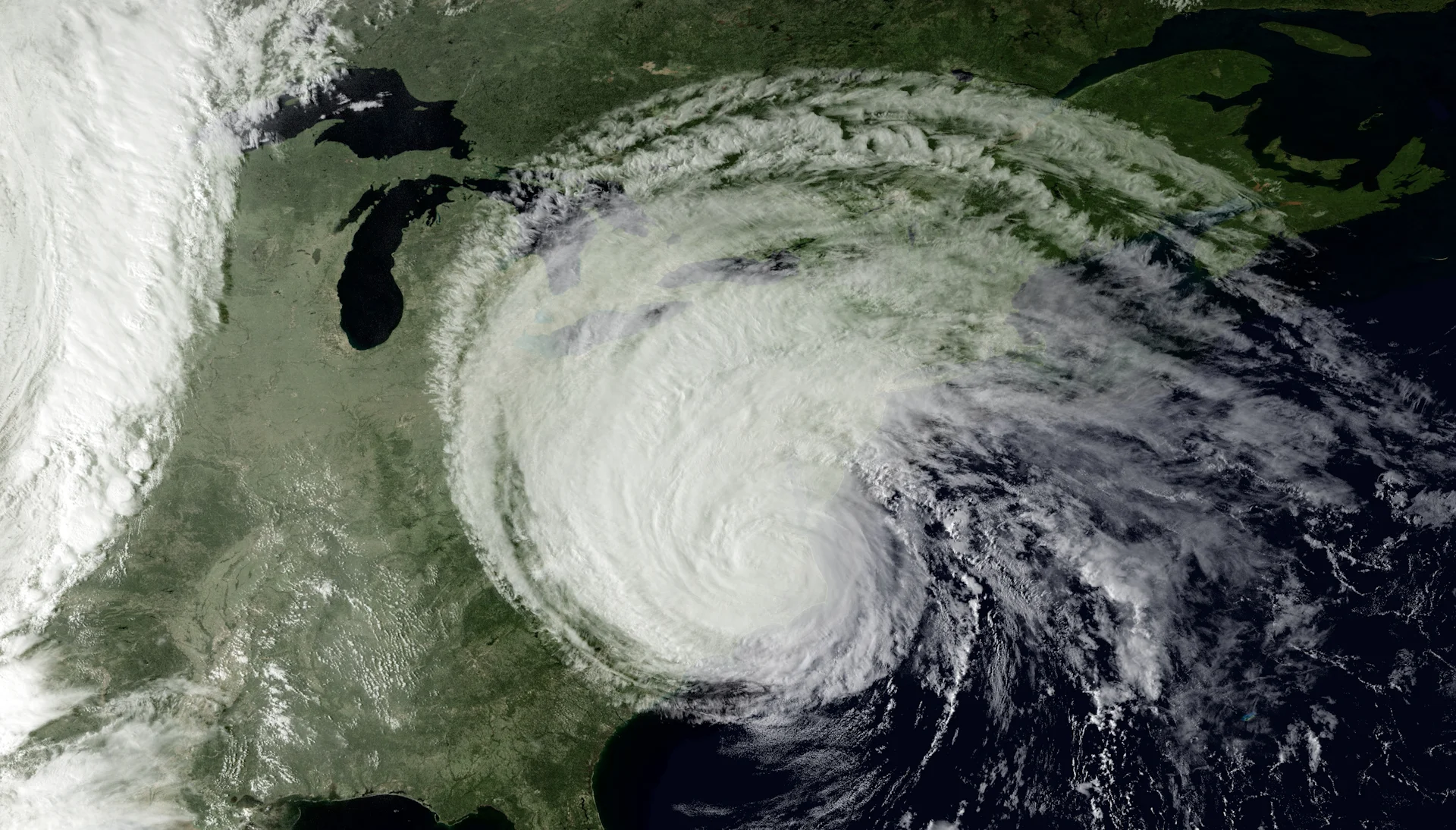
Header image of 2003's Hurricane Isabel courtesy of NOAA.


