Ontario: Severe storms linger, heatwave potential for next week
Conditions are favourable for the development of scattered thunderstorms
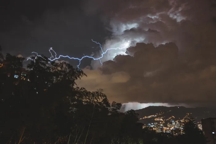
A cold front tracking through southern Ontario will continue to bring some scattered severe thunderstorms before tapering off and allowing for more pleasant conditions to move in for the end of the weekend. Sunday will feature abundant sunshine, low humidity, and near seasonal temperatures. These warming conditions will be the start of a scorching week due to heat moving in from southwestern desert regions in the United States and Pacific moisture streaming eastward. Details on who will soon see humidex values at or near 40, below.
Summer revealed! Visit our Complete Guide to Summer 2019 for an in-depth look at the Summer Forecast, tips to plan for it and much more
WEATHER HIGHLIGHTS:
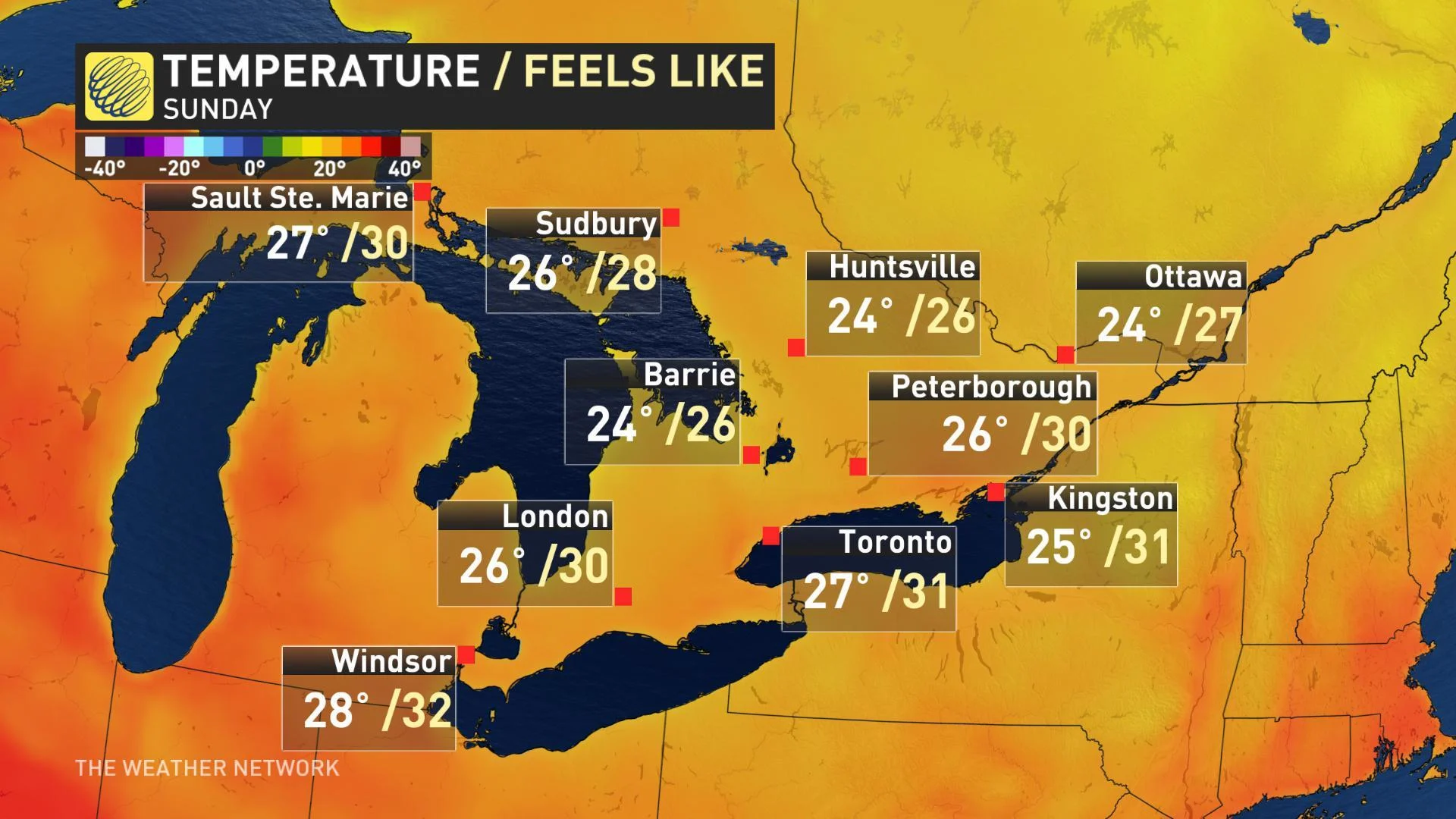
Abundant sunshine and low humidity on Sunday
Potential for heatwave mid-week
Stay up-to-date on the ALERTS in your area
HIGH PRESSURE BRINGS THE SUNSHINE ON SUNDAY
After Saturday's isolated downpours the sunshine will finally move into the majority of the region on Sunday. Temperatures will hit the mid-to upper 20s for much of the southern portion of the province as the high pressure system tracks in.

"Sunday will be a gorgeous summer day with abundant sunshine, near seasonal temperatures and low humidity," said Gillham.
STRETCH OF HIGH HEAT, HUMIDITY (BUT WITH A CATCH) FOR NEXT WEEK
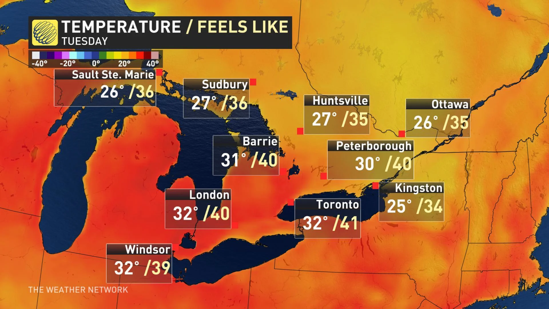
"Tuesday and Wednesday will bring increasing heat and humidity with high temperatures reaching the lower 30s and the humidex soaring into the lower 40s," Gillham says.
Heat tracking in from desert regions of southwestern United States plus low pressure systems moving eastward across Canada will bring converging moisture that will create highly humid conditions.
A number of cities could reach a humidex value of 40 and the City of Toronto could potentially experience the most severe conditions with a potenial humidex value of 41.

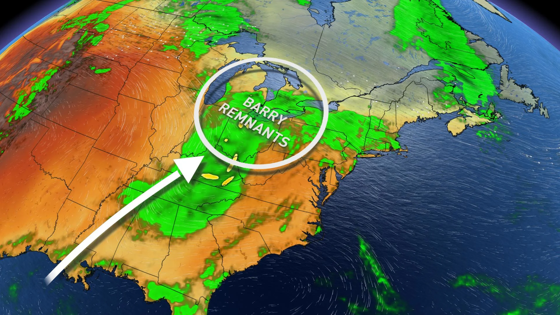
Because of the uncertain track for the remnants of Barry, there could be a slight change in the forecast of this expected heat wave.
"We will be closely watching the remnants of Barry, as this system could track close enough to our region to enhance the threat for thunderstorms during the middle of the week," said Weather Network meteorologist Dr. Doug Gillham.
MONITORING BARRY REMNANTS FOR IMPACTS NEXT WEEK
Forecasters are keeping an eye on the track of Barry, as the remnants from the storm could move close enough to the Great Lakes region, increasing the cloud cover and threat for thunderstorms through the middle of next week.
"If this occurs, the increase in cloud cover will keep us from getting quite as hot for Wednesday and Thursday, but the humidex will remain very high," said Gillham.

"However, at this point, it looks like cooler weather (near seasonal) will arrive for the last seven days of July," Gillham adds.
RELATED: Five horrible things extreme heat does to the human body


