Ontario's first major snow squall event threatens 'overwhelming' totals
The first major snow squall event of the season is setting up across Ontario's snowbelt regions, and while this will be amazing news for ski areas ahead of the holidays, drivers will be tested with dangerous road conditions
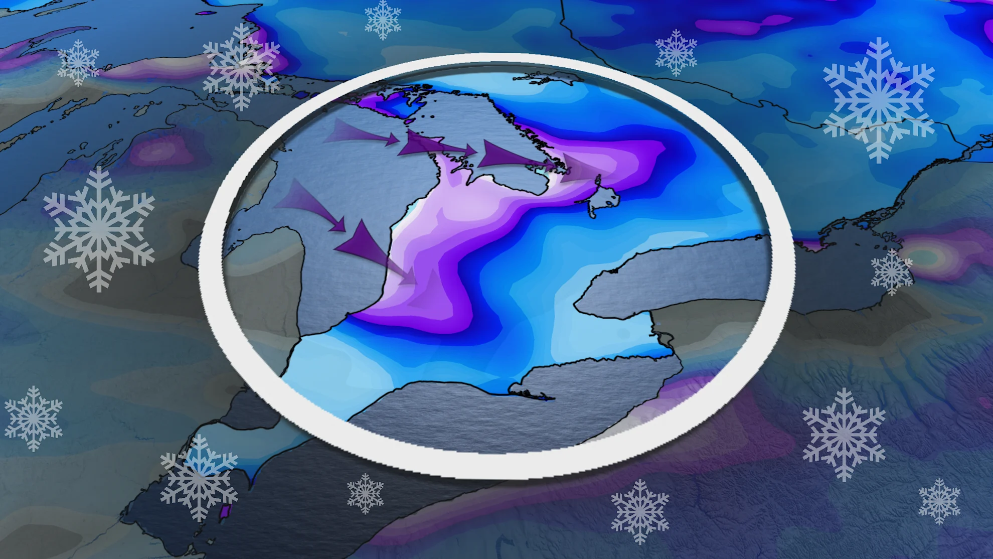
A very long duration and major, lake-effect snow squall event is setting up across Ontario. The snowbelts will certainly live up to their name and reputation during the next few weeks, with impressive, and possibly overwhelming, snow totals expected as we kick off December.
Visit our Complete Guide to Winter for an in-depth look at the Winter Forecast, tips to plan for it and much more!
Road closures are certainly possible, especially over areas that receive multiple snow squall bands. More than 30 cm of snow is likely through the weekend.

Drivers are urged to plan ahead, and be prepared to adjust to the deteriorating conditions. Travel may quickly become hazardous due to sudden changes in the weather. Snow squalls can produce intense accumulating snow or near zero visibilities.
DON'T MISS: The 50-cm snowfall lottery: Will an Ontario locale win it before December?
The powerful multi-day event starts Thursday
After the first blast of squalls off of Lake Superior Wednesday, even colder air, and stronger snow squalls are on the way this weekend. In fact, it will be coldest temperatures we've seen so far this season, helping to stir up the lake-effect snow machine.
Cold air is a key ingredient when it comes to lake-effect snow. The colder the air, the stronger the air and lake water temperature difference is, which leads to longer lasting, and more potent snow squalls.
SEE ALSO: Coldest air of the season to push into Canada to start December
The multi-day lake-effect snow event will kick off late Thursday, and stick around through Sunday and beyond.

Significant snowfall will certainly impact the traditional snowbelt regions, and possibly reach into London, Guelph and parts of the Greater Toronto Area (GTA) at times.
Possible impacts to the GTA at times
Impacts to the GTA will depend on a localized strong squall showing up at the right place, and the right time, which we cannot rule out. There's higher confidence in the snow forecast as you head north of Toronto.
Meanwhile, areas including London, Guelph, Barrie, and sections of the 400, have multiple chances for a snow squall moving in, so it'll be important to remain weather-aware, and be prepared for the changing conditions.
RELATED: Buried: Why the Great Lakes produce some of the world’s heaviest snow
The snowbelts are forecast to see the bulk of the snow, with over 30 cm likely through this weekend.

While there will be some lulls in the lake-effect squalls, the bands will be rather persistent and meander across the snowbelts through the first week of December, and possibly well beyond, with more impressive snow totals likely.
Great for ski areas, but trouble on the roads
This is great news for Ontario's ski resorts, as early December will offer some of the best natural snow and snowmaking conditions we've seen in quite some time.
However, it does also mean trouble for the roads. Heavy localized snow with winds gusting between 40-60 km/h, will lead to whiteouts, slippery conditions, and difficult winter travel through this long duration and major lake-effect event.


