Pineapple express makes final stop in B.C., zones in on flood-hit areas
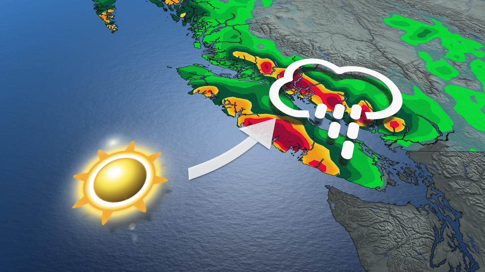
The prolonged pineapple express will be making a final stop in B.C. on Thursday. However, the rain could cause further flooding and avalanches, and potentially landslides, too, as communities remain on high alert
The pineapple express will finally come to its last stop in B.C. on Thursday, leaving behind more rainfall in flood-weary and -plagued communities that are already seeing the impacts or are on high alert.
Special weather statements and a rainfall warning remain in effect, outlining the set of potential hazards with this next system. With the flooding risk enhanced, people need to watch for possible washouts near rivers, creeks and culverts.
RELATED: Animals rescued after flooding hits B.C. shelter, support welcome
Widespread flood watches, warnings and high streamflow advisories from the B.C. River Forecast Centre are in effect across southwestern B.C. The incoming bout of rain will impact the province's South Coast through Thursday.
As a result, more than 50 properties are on evacuation alert in the Squamish-Lillooet Regional District due to flooding. It includes the six Pemberton properties that were on an evacuation order, but was then downgraded to an alert on Wednesday.
As well, B.C.'s first reported avalanche fatality of the season occurred on Saturday.
Thursday and beyond: One more round of rain before conditions begin to improve
Heavy rain with the new round started Wednesday and will continue into Thursday morning. Beyond that, scattered showers will continue into Friday morning. Drier conditions will move in for the weekend.

The coastal mountains of Vancouver Island will once again record the heaviest amount of precipitation, on top of the 480 mm of rain already recorded from Friday to Tuesday at the Effingham station in the mountains east of Tofino.
Combined rainfall and snowmelt has created a flooding risk around the mountains, and an unstable snowpack that has enhances the potential for avalanches in the backcountry, to considerable levels in many areas, along with mudslides.
WATCH: Animal shelter evacuated as B.C. community declares state of emergency due to flooding
DON’T MISS: El Niño is hanging strong—but a big change is on the way

Freezing levels will begin to drop as February kicks off a pattern shift back to winter. Drier conditions will also come in for the weekend, allowing rivers to slowly recede and mountain snow to not melt away. That being said, water will continue to be fast-moving, so people should stay away from watercourses for awhile.
Widespread flood watches, warnings and high streamflow advisories are in effect across southwestern B.C.

With the drier pattern coming, it will be of minimal benefit to ski areas in the South Coast region, other than allowing them to resume snowmaking. However, periods of snow are likely Friday through Tuesday for the southern Rockies and Kootenay mountains with substantial snow totals likely.
Slightly cooler-than-normal temperatures are expected next week across the province, but then a milder pattern is expected towards mid-month with below-normal precipitation.


