Rare October severe storm threat building for Sunday across Ontario

Just because the calendar says October, it doesn’t mean the atmosphere behaves like it. Southern Ontario gets a parting risk of thunderstorms on Sunday before a cooldown arrives
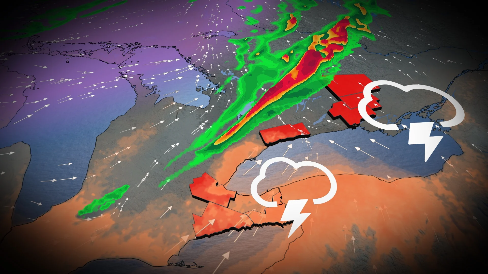
While a pattern change is coming to Ontario on Monday, with snow returning to the forecast for some areas, southern sections of the province will be getting treated to a rare October threat for severe thunderstorms –– likely the final widespread chance of the year.
A strong low that has been touring Canada is finally crossing Ontario, and it’s encountering some warmer-than-normal temperatures across the south.
DON'T MISS: Fall chill soon sweeps Ontario, and the snow chances grow
With the dynamics at play, that means an uncommon, but not unheard of, threat for severe thunderstorms on Sunday, with the usual hazards on the table –– heavy rain, strong wind gusts and large hail.
Sunday:
A cold front is forecast to track across southern Ontario during peak heating Sunday, so the increasing instability will spark thunderstorms ahead of it. Storms are forecast to develop in the mid-afternoon and track towards the east.

Gusty winds are forecast to develop, potentially exceeding 80 km/h locally near thunderstorms and along the shoreline.
Up to 40 mm of precipitation is possible in regions with sustained rainfall and storm activity, with guidance highlighting cottage country, Prince Edward County, Kingston and other eastern Ontario areas as being the targets for heavier amounts.
Showers and embedded thunderstorms begin up around Georgian Bay late Sunday morning, progressing east into the afternoon.

Isolated power outages, heavy rain and frequent lightning are the possible hazards, so anticipate slow travel during bursts of downpours. Travel east of Toronto along the 401 presents a risk of gusty winds, pooling and ponding on roadways.
The uncertainty is higher than average for the late-season, severe storm threat as cloud cover in the warm sector and fontal timing can make or break severe thunderstorm chances. There is marginal surface instability but favourable low dynamics, and those setups have been known to overperform in the past.

The threat will diminish Sunday evening across Niagara Peninsula and eastern Ontario.
A few days of much colder, autumnal weather is likely Monday through the middle of next week. Temperatures will actually be a few degrees cooler than seasonal for a couple of days, a sharp contrast to anything that we have seen so far this fall. That should bring our first widespread frost and/or freeze for many areas, especially across the more rural areas to the north of Toronto, but Toronto will stay above freezing.
Temperatures should rebound back to seasonal and possibly warmer than seasonal late next week and into the start of the long weekend, but another shot of colder weather is expected to arrive during the long weekend. A warmer pattern is expected to return for the final 10 days of October, but keep in mind that "seasonal" is relative and it drops quickly at this time of year.
Thumbnail courtesy of Alexandra Myre, taken in Hawkesbury, Ont.
Stay tuned to The Weather Network for the latest forecast updates for Ontario.