Record Great Lakes temperatures: What they mean for Ontario's snow season
At the end of November, the Great Lakes are sitting in record-breaking territory. Find out what this means for lake-effect snow for the remainder of fall and during the upcoming winter season
As the Great Lakes basin hits record-warm temperatures, it reminds us of what’s coming: Intense, lake-effect snow.
These powerful, natural, snow-making machines will enhance lake-effect snow early in the season. So, if you’re downwind of a lake, read ahead.
RELATED: The 50-cm snowfall lottery: Will an Ontario locale win it before December?
Great Lakes are running a record fever
As of the end of November, these are the current temperatures across the Great Lakes, with every temperature reading warmer than the previous record in 2016.
Lake Ontario: 10°C (average:8°C)
Lake Erie: 12°C (average:8°C)
Lake Michigan: 11°C (average:7°C)
Lake Superior: 8°C (average:5.5°C)
Lake Huron: 10°C (average:7°C)
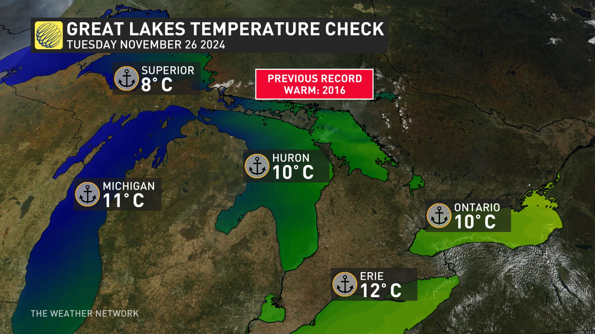
These record-breaking lake temperatures are driven by a combination of factors, including the warm fall air temperatures, and the less frequent storm patterns that normally stir up the water.
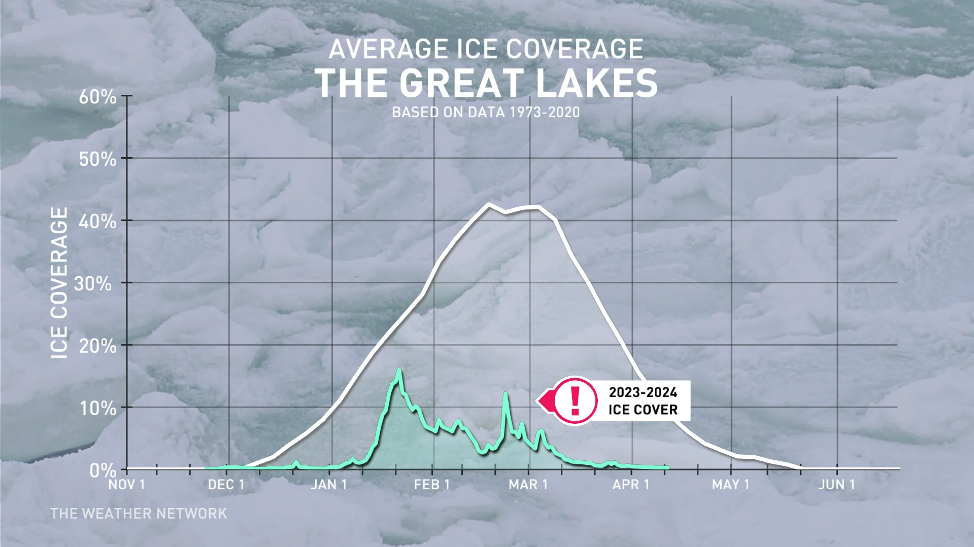
Without the typical cooling mechanisms, the lakes are starting the season much warmer than normal. Minimal ice cover from the previous winter played a role, meaning the lakes held more heat heading into this season.
Lakes are nature’s thermostat
The Great Lakes are more than massive bodies of water; they’re nature’s thermostat. Their ability to regulate temperatures comes down to the unique thermal properties of water.
Water’s specific heat is 4,186 J/(kg·°C), more than four times higher than air’s specific heat of 1,005 J/(kg·°C).
That means water can store immense amounts of heat, absorbing energy during the summer, and releasing it gradually in winter. The mild fall energy has been stored in the Great Lakes.
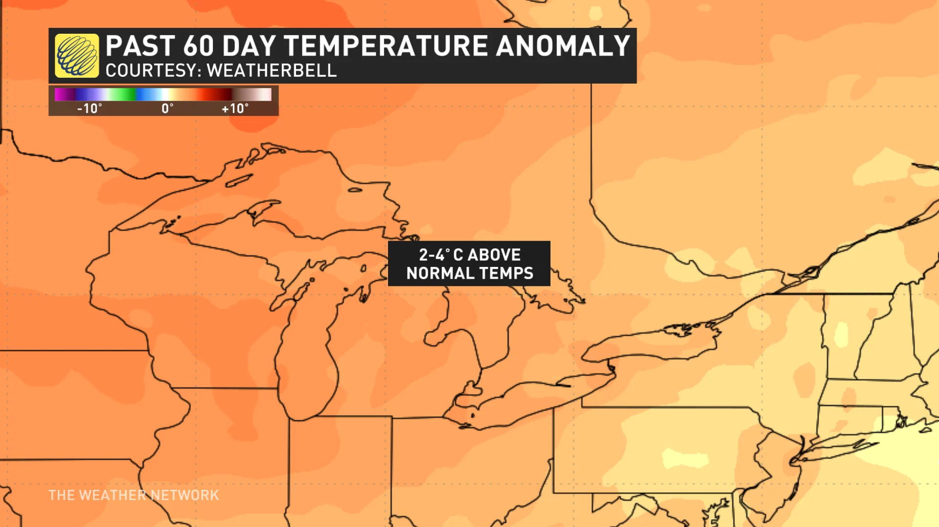
Check out the temperature anomaly over the past 60 days.
Did you know? This same effect keeps shoreline communities cooler in the summer and warmer in the winter. For example, areas along Lake Ontario tend to have a longer growing season than areas inland away from the water.
How lake temperatures influence winter weather
Record-high lake temperatures don’t guarantee a warmer winter, but they do stack the odds for hefty, lake-effect snow events when the aArctic air rolls into town.
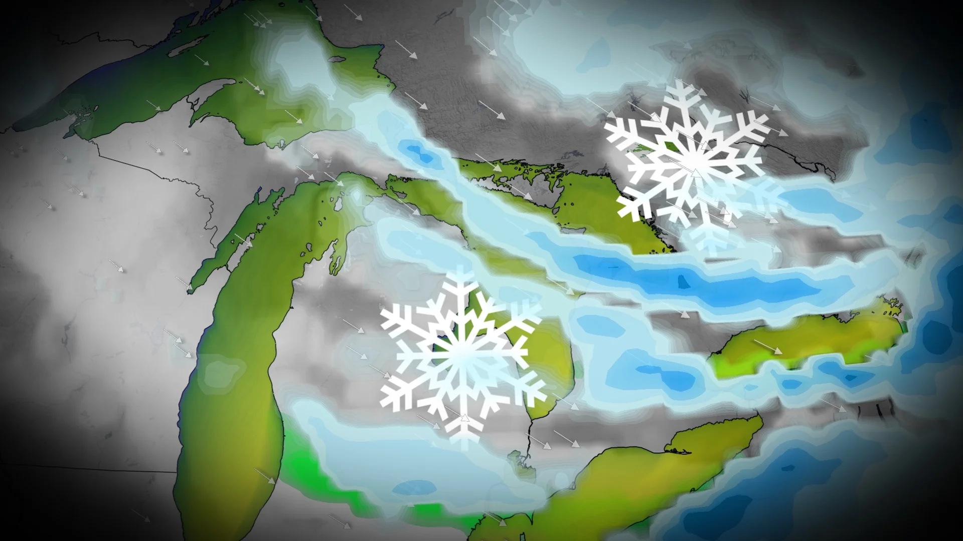
Lake-effect snow on steroids? Warm lake waters can enhance lake-effect snowbands by providing more instability and moisture to the cold air masses passing overhead. This can lead to heavier and more frequent snowfall events, especially during events that had marginal potential with normal lake temperatures.
The typical difference needed between the lake temperature and 1,500 metres above the surface needs to be 13°C, so with lake temperatures being a few degrees above normal, we’ve made it much easier to produce lake-effect snow.
Delayed freeze-up
Warmer waters delay ice formation on the lakes, prolonging the window for lake-effect snow. Ice typically acts as a cap, limiting evaporation and moisture transfer to the atmosphere.
What’s in store for this winter?
With the Great Lakes entering the season unusually warm, here’s what we’re watching for.
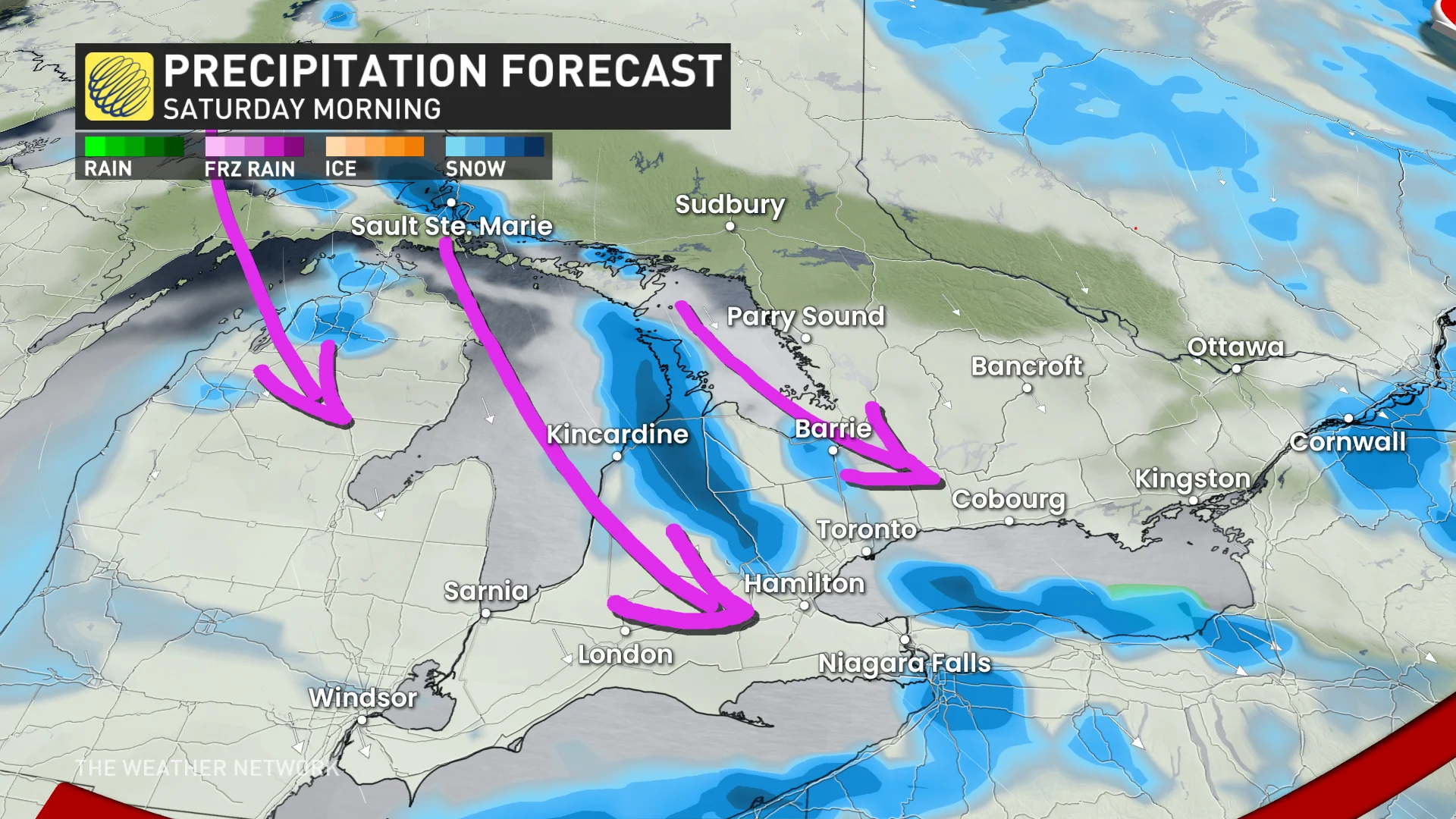
Lake-effect snow potential Communities downwind of the lakes will see significant snowfall events over the next couple of weeks.
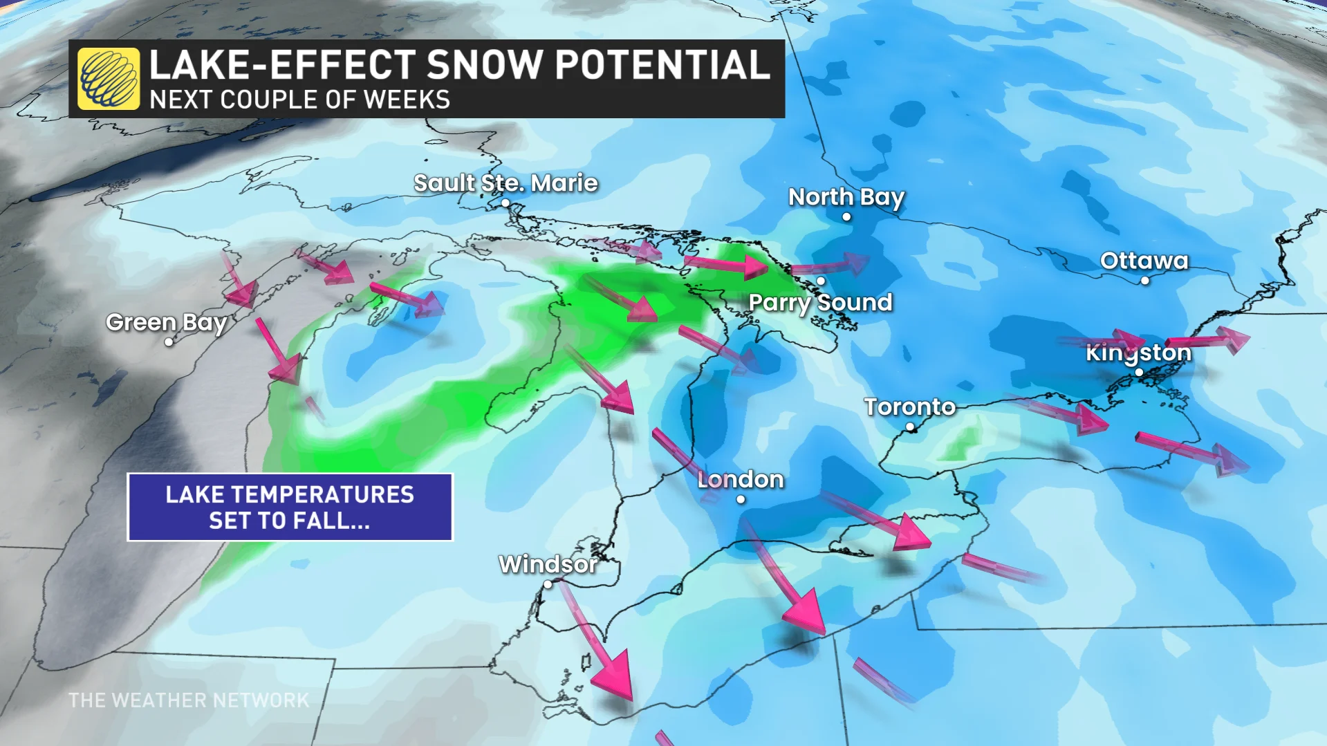
Although the warm lakes haven’t had much impact on your day-to-day activities, that’s about to change. They’re about to unleash some of the snowiest, and perhaps the most extreme, snow events of the season.


