Record summer fuels extreme water temperatures, tropical trouble brewing?
It takes much more energy to heat water than air, so meteorologists start to pay attention when an ocean temperature anomaly passes a couple of degrees Celsius.
Bathtub water enveloping Newfoundland? Hardly, but it's extreme relative to what waters you typically find sloshing around the shores of Atlantic Canada.
You're probably familiar with temperature anomalies on land. Often meteorologists reference how much the thermometer deviates from climate normals. Land temperature anomalies can reach 20°C above, like this week across portions of Coastal California.
Naturally, water has a very high heat capacity, and it's highly capable of absorbing energy. It takes much more energy to heat water than air, so meteorologists start to pay attention when an ocean temperature anomaly passes a couple of degrees Celsius.
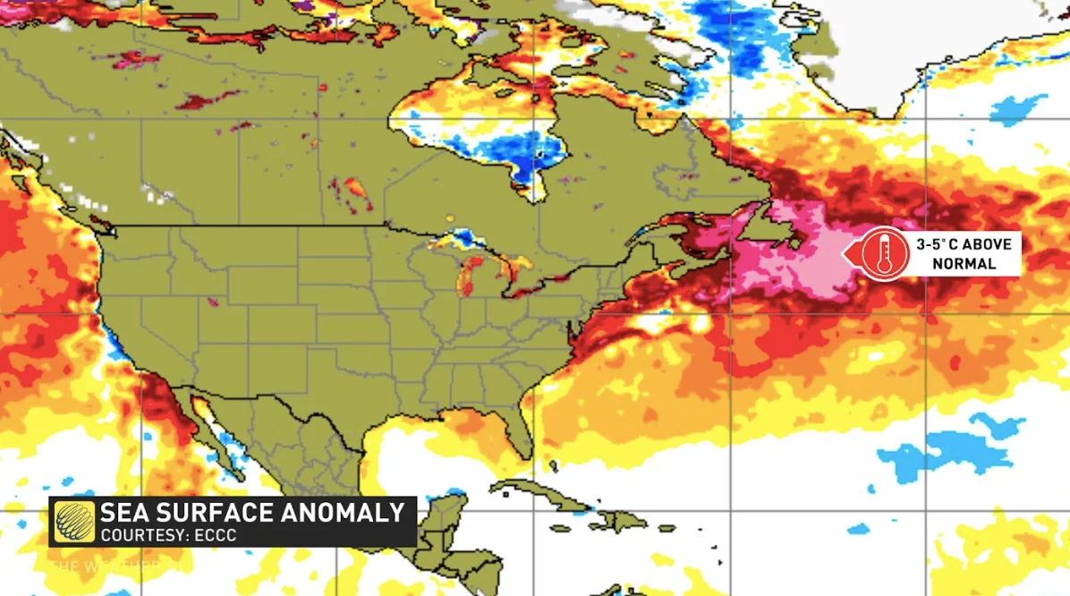
Here's the current water anomaly as of September 5th, 2022, for Atlantic Canada:

Some buoys just a few hundred kilometres away from Newfoundland are measuring water temperatures at 23°C (Buoy 44139)
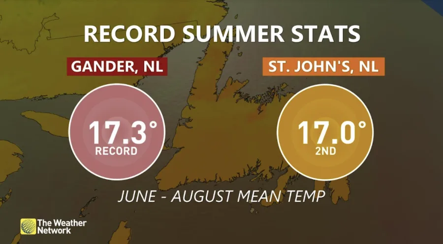
What's the primary reason we've seen this ocean temperature deviation from average? Here are the stats from meteorological summer, which spans June through August.
Unsurprisingly, it was one of the warmest summers on record for portions of Newfoundland.

Look at the average temperature for St. John's at 17°C. That's 2.5°C warmer than the 1990-2020 average, a finding consistent with climate change. A persistent, mild southwest flow dominated the summer months, with the primary trough anchored further northwest over Hudson Bay.
Potential for tropical impacts this weekend
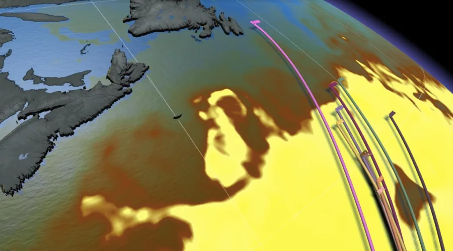
The first test of this blob could be as early as this upcoming weekend. Hurricane Earl will pass southeast of Bermuda late Thursday and eventually stall south of Atlantic Canada by next weekend.

Suppose tropical disturbances interact with the warmer waters south of Atlantic Canada. In that case, it could potentially delay the transition to extratropical systems. Warmer ocean temperatures mean the surrounding air can transport more moisture, producing more moisture-laden storms.
Systems tracking across the warm water also mix the surface water, which will likely locally suppress some of the extreme water temperatures recorded in recent weeks.


