Rex block pattern gives a 'second summer' to Ontario and Quebec
A blocking pattern known as a Rex block is setting up over Eastern North America, and is responsible for the revival of summer in Ontario and Quebec for the days to come
We're just over a week away from the official start to the fall season, but a blocking pattern setting up over Eastern North America will allow for quite the extended grand finale of summer.
This will be the longest stretch of warm and mostly dry weather of the year in parts of Ontario and Quebec, with one of the best weekends of the summer season expected for the region coming up! It doesn't end there, either. Much warmer than normal temperatures are forecast to dominate through the end of September, and even into the beginning of October, as well.
Visit our Complete Guide to Fall 2024 for an in-depth look at the Fall Forecast, tips to plan for it and much more!
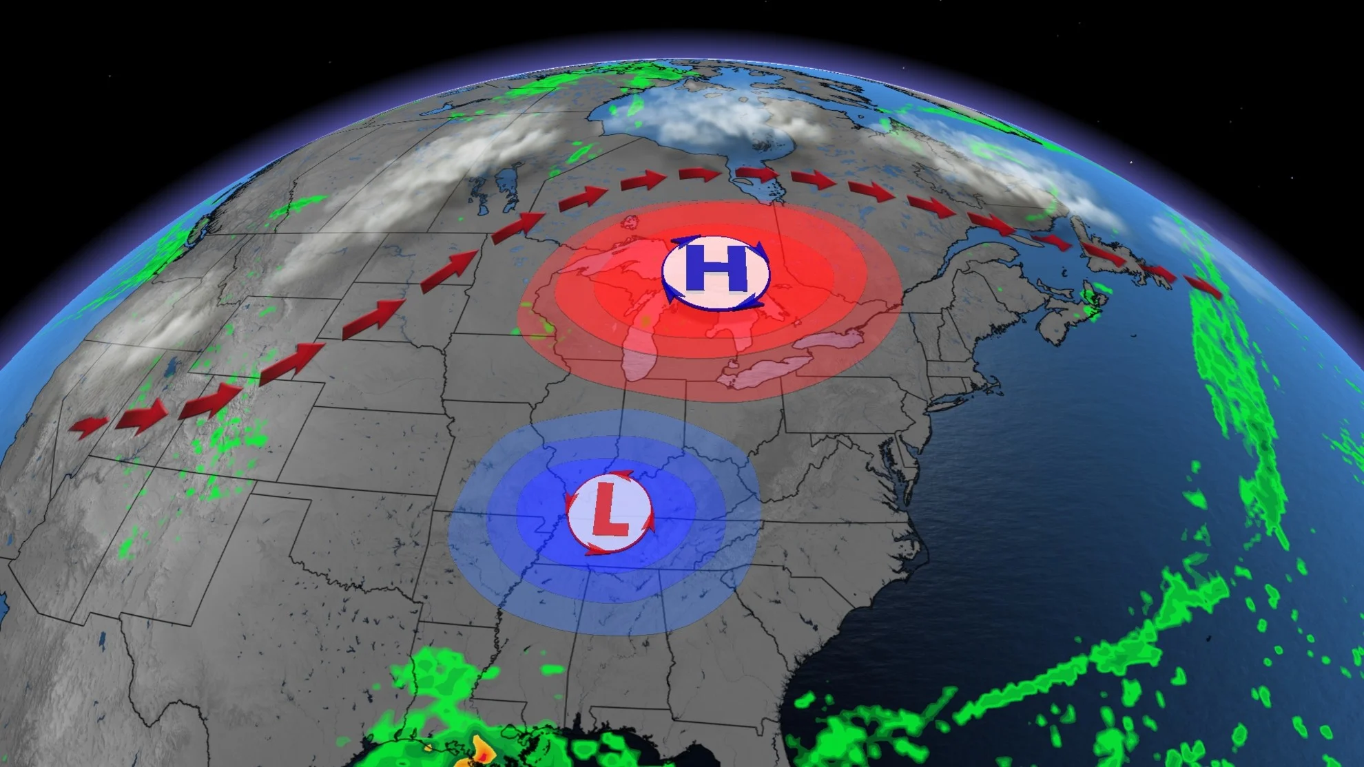
A Rex block occurs when an upper level high pressure ridge sits directly north of a low pressure system, blocking its movement. With upper-level winds contorted like a kink in a garden hose, Rex blocks can last for a week or longer in some extreme cases until another disturbance upwind forces the rigid pattern to finally break free.

LEARN MORE: How Omega blocks and Rex blocks can affect Canada's weather
A large high pressure ridge builds in on Thursday over the Great Lakes, as the approaching remnants of Hurricane Francine attempt to push northward. The ridge stops its movement, creating a stagnant flow and eventually the low becomes stationary.
The ridge will fend off any weather systems, keeping them south of the ridge, or deflecting the weather north of the ridge.
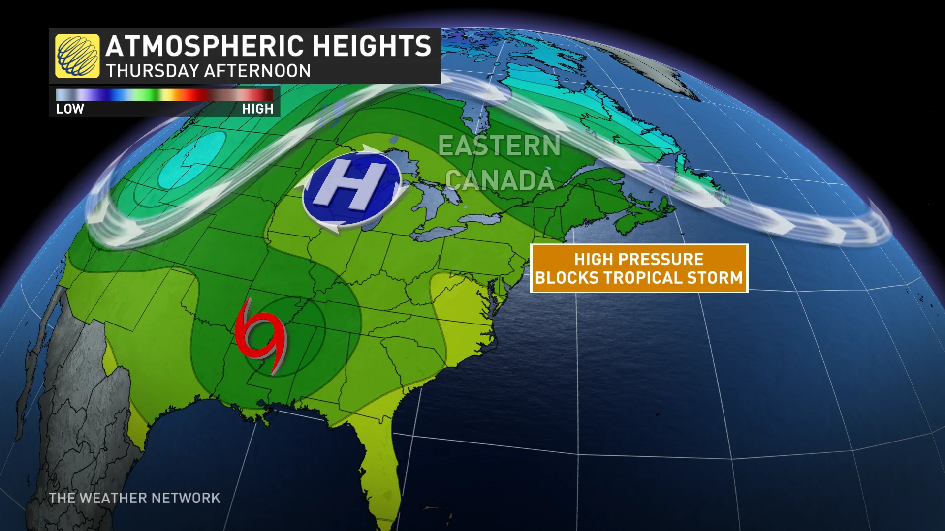
Very little precipitation will fall under the high pressure for an extended period of time. Confidence is high that the Rex block will set up and remain for several days, and possibly into next week and beyond.
Above seasonal temperatures will span much of Ontario and Quebec, specifically northern Ontario with temperature anomalies sitting 10-15°C above seasonal. High temperatures will reach the mid to upper 20s, and several places across Ontario and western Quebec could reach 30°C late this week and weekend, and likely next week, as well.
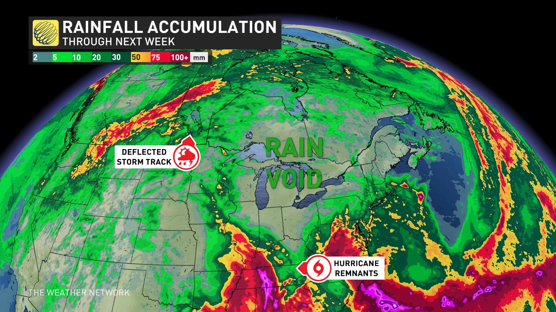
There will be a heightened storm risk across northwestern Ontario however, as the storm track deflects north of the ridge. Little accumulating precipitation is expected across southern Ontario and Quebec, possibly remaining mostly dry until the third week of September at least.
There will be no need to dig out the winter gear early this year, with warmer than normal temperatures expected to dominate through the end of September and into the beginning of October. Periods of pleasant weather will also allow for enjoying the fall colours from Kenora to Ottawa.
For more on when we expect the milder pattern to eventually break down, be sure to check out our official 2024 Fall Forecast.