Severe storm threat, damaging risks persists on the Prairies
Severe thunderstorm chances will build across the Prairies again on Friday and into the weekend, as a hot and muggy air mass continues to push humidex values well into the 30s and even 40s for some.
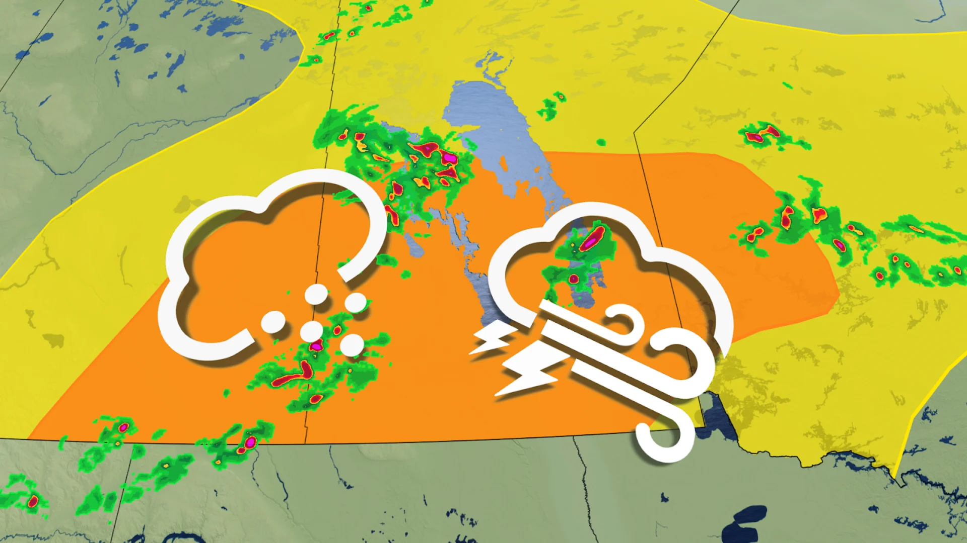
The hot and humid weather continues to fuel a multi-day severe weather risk across parts of the Prairies this week, with the threat for strong winds and very large hail on the table reappearing to close out the work week.
Storms on Thursday brought reports of funnel clouds and large hail from Saskatchewan -- a trend that will likely stick around into the weekend.
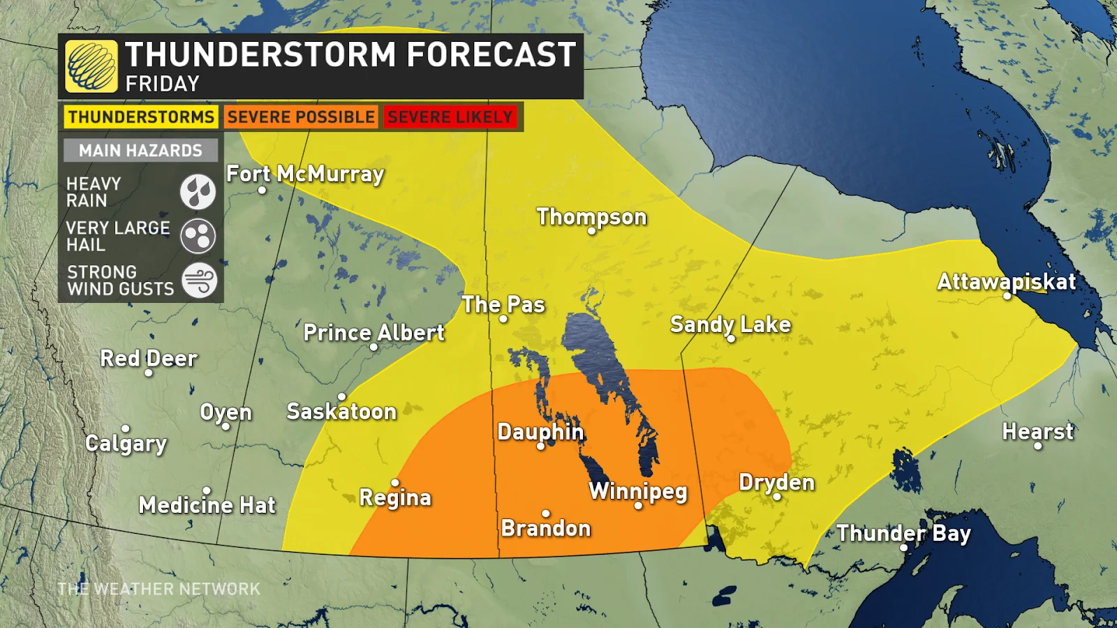
Friday's storm threat shifts eastwards, focusing primarily on southern Saskatchewan and Manitoba, and into parts of northwestern Ontario.
DON'T MISS: 10 ways The Weather Network app can help you plan for summer weather
Heat warnings continue to cover much of the region, as well, with Environment and Climate Change Canada advising folks to take precautions to protect themselves, their families and their neighbours.
RELATED: What is 'humidex' and how does it impact our bodies?
Severe thunderstorm chances on Friday and Saturday, heat breaks records in Alberta
The stretch of high heat has broken new records across parts of Alberta this week. Temperatures in Edmonton on Wednesday reached 36.2°C, tying for the fourth hottest day in recorded history, and second warmest July day since the city's records began in 1880!
Across central and southern Saskatchewan and Manitoba, the humidex will have things feeling closer to 40.

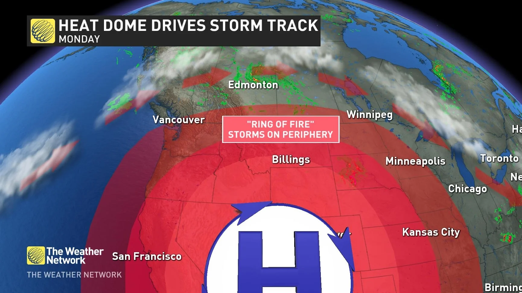
Ring of fire explainer (The Weather Network)
With the extreme heat comes the stubborn storm risk, as well. Thunderstorms will reappear in the forecast Friday and Saturday, as the "ring of fire," the northern edge of the heat dome, will set up in the area. Because of the excessive heat generated and radiated by the heat dome, storms along its boundary can be severe, as they tap into the extreme heat.

Thursday's storm risk will continue to linger and rebuild into Friday. It will be a repeat setup of impressive amounts of energy attempting to break through the cap being provided by the heat dome. Very large hail and damaging winds will be possible once again if the storms are able to develop on Friday.
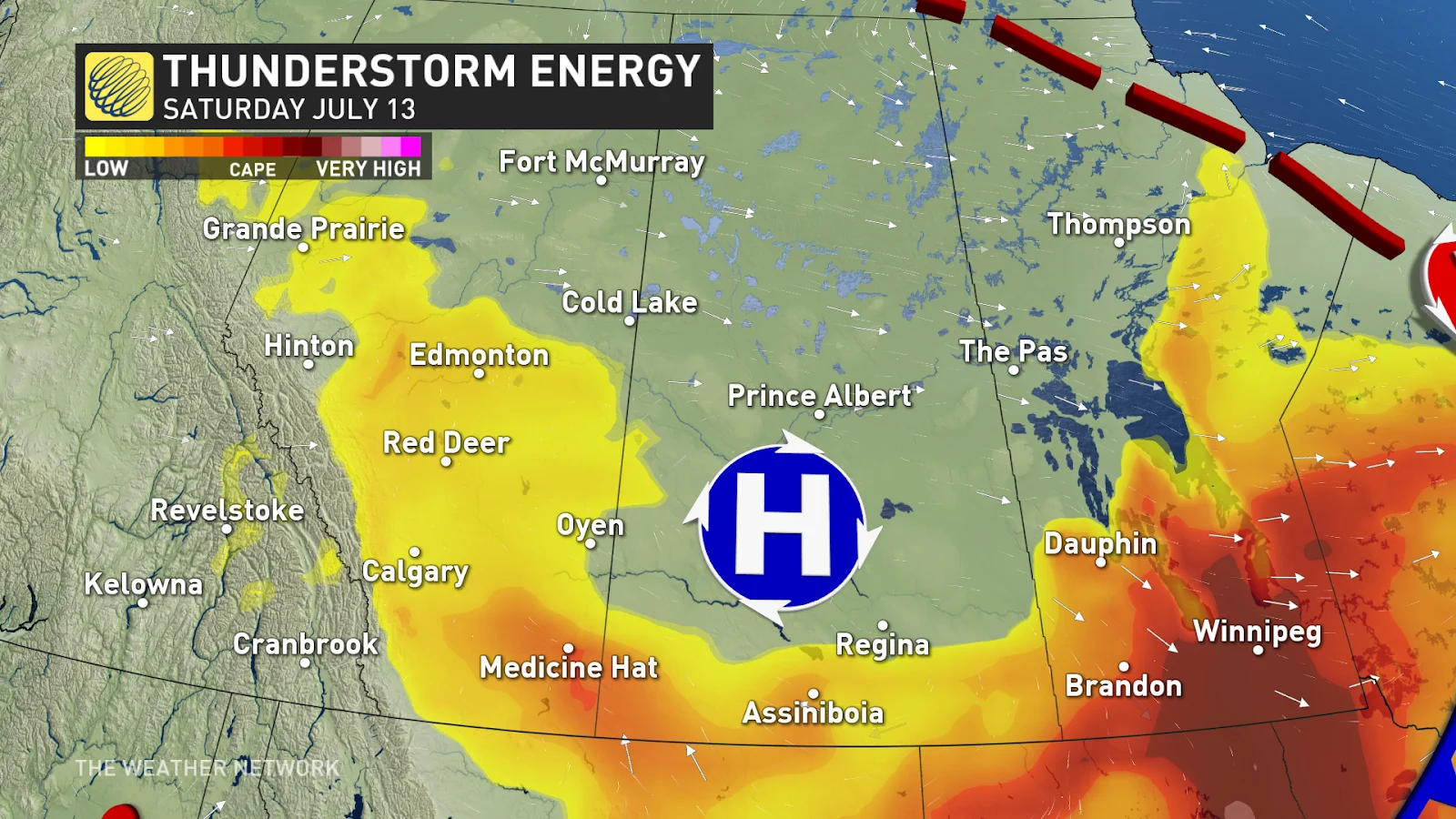
An area of high-pressure will sink over Saskatchewan on Saturday, giving folks some reprieve from the stormy weather that has plagued them all week.
The storm risk will shift eastward, towards northwestern Ontario, with a chance for severe thunderstorms in southeastern Manitoba.

Alberta won't be out of the woods, either, as a renewed storm risk makes its return for the start of the weekend.
Stay tuned to The Weather Network for the latest forecast updates across the Prairies.


